Sunday, July 22, 2012

Irchester - Nettles and Nasty Mosquitoes in the Nene Valley

The Irchester walk was our 13th 'Chester' and my first time walking in Northamptonshire.  It's one of those obscure counties, somewhere in the middle, that most Londoners would be hard pushed to pinpoint on a map. It only took us 50 minutes to get to Wellingborough from St Pancras, which is a reasonable commute for anyone who works in London, but lives elsewhere.

Lodgings


We decided not to stay in Wellingborough, but further out in the countryside, in a small village called Chelveston, so we could walk back towards 'civilisation' the following day.  Middle Farm Villa BnB was a lovely place to stay and we were given a nice welcome by the owners.

Middle Farm Villa BnB, Chelveston

After dropping our bags off, we headed across the road to the village pub, The Star and Garter, for a swift drink and a chance to sample local life!  The locals seemed really friendly and we got involved in a weekly draw, based on the 80's TV show, Play your cards right, where you have to guess whether or not the next card is going to be higher or lower than the one before.

The Star and Garter in Chelveston


Luckily for us, we didn't get chosen to participate - I think being thrust in the limelight, as complete strangers, would have been too much for BAM (Best Aussie Mate).  The three participants who were chosen failed to guess correctly, so the jackpot has rolled on until next week.

Walk disclaimer


This had to be one of the most difficult walks we've ever done and, unfortunately, I wouldn't really recommend it - at least not right now!  There has been a lot of rain in England this summer and the East Midlands are particularly susceptible to flooding, the Nene valley being no exception.  What's more, the 'Recreational Walk', the Nene Way, is badly maintained, being completely overgrown in some parts and blocked off on others.  Perhaps there will be in improvements in the future, but right now, it's not passable.

Chelveston to Stanwick Lakes (1.6 miles/2.6 km)


We set off early from Chelveston, walking along Water Lane, we discussed the passion and enthusiasm of Peter Garret from Midnight Oil before turning onto a small public footpath leading through a wheat field.  BAM told me about an incident involving her kayaking club in East London, due to current overcrowding on the Thames and we discussed the concept of 'Right of Way' - how it has more or less been protected on land, but is very difficult to enforce on water.

Path through wheat field leading off Water Lane, Chelveston

Field beside Chelveston Lodge


We continued following the path along the bottom of some fields, past a farm called Chelveston Lodge and, eventually, we came out onto Stanwick Road.  Another effect of the recent rains has been an explosion of plant growth - I've never seen the English countryside looking so green, it's almost as green as Ireland!  Also, the nettles and thistles are thriving, so we got stung and scratched a lot, as we climbed through hedgerows and walked along the field edges.  The weather was fantastic for a change and it was so lovely to be outdoors enjoying the sunshine, even if we were looking a little bit burnt at the end of the walk!

Hedgerow on Stanwick Road

Crossing Stanwick Road, we walked through a couple of fields, before crossing the A45 to reach Stanwick Lakes.

Stanwick Lakes to Irthlingborough (1.8 miles/2.9 km)


Stanwick Lakes is a lovely area full of fishing ponds.  The Nene valley had lots of ironstone and gravel deposits, so the river valley has been heavily quarried in the past and the former quarries have filled with water, creating a series of artificial lakes.  Stanwick Lakes has recently been designated a country park and I'm sure that it's normally a lovely place to visit but, because of the floods, we found that the paths we wanted to follow were completely inundated.  Unfortunately, after twenty minutes or so of wading knee-deep through water, we had to backtrack to the A45 and walk along the verge to a roundabout, where we picked up a smaller road leading to Irthlingborough.

BAM on path in Stanwick Lakes

It's a nice spot to do some fishing!


It's never pleasant walking on roadside verges and the A45 is quite a busy road, linking Northampton to the A14.  Turning down Station Road, we passed a Scrap merchant and a caravan park before picking up the Nene Way, just opposite the Nene park Industrial Estate.  Walking along the upper end of a field, we passed some beautiful old buildings at Nene View, then followed a back lane, which runs behind the village, until we came to St Peter's Church.


St Peter's Church in Irthlingborough
I really loved the design of St Peter's Church at Irthlingborough - it has a 'lantern tower', which looks out of place in the English countryside, making me think more of Tuscany or Andalusia!  From the church we made our way to the High Street, for a short break and the chance to stock up on water.


Irthlingborough High Street
Irthlingborough to Higham Ferrers (2.5 miles/4 km)


The next part of the walk was probably the most beautiful, heading downhill from St Peter's Church, through the water-meadows of the Nene Valley.  The path was completely water-logged in parts, but manageable.  The Nene Way follows a dismantled railway line at this point, which used to run trains between Northampton and Peterborough, but was closed down in 1964.  As the path hooks around Station Road, we lost it again, whether because it's overgrown or has disappeared under the water, so we made our way back up to Station Road, back to the roundabout at the A45!

Water-logged path

Dismantled railway line


We followed the A45 for a little bit, before picking up the Nene Way again at a pedestrian flyover leading to the village of Higham Ferrars.  The walk into Higham was lovely, along a back street, past the ruins of the castle and Chichele College.  Higham had a nice 'feel' about it and I'd imagine it's a lovely place to live.  BAM got momentarily fixated on the fact that the flat above the Sweet Shop was for rent, but I managed to snap her out of her reverie and remind her of London and responsibilities!

River Nene with sky reflected

Street corner in Higham Ferrers

Higham Ferrers to The Sewage Works (1 mile/1.6 km)


The next part of the walk was well sign-posted, from Higham Ferrers downhill, crossing a pedestrian bridge over the A45 to the Higham Ferrers nature reserve.  We continued following a clear foot path through the reserve until we came to the grounds of a local Sewage Works, where we came completely unstuck!  Whether the Nene Way had completely disappeared under the water at this point, or it had been blocked off, wasn't really clear, but we came to a dead end, as soon as we crossed a footbridge over a weir and ran into the Sewage Works fence.  Our problem-solving skills were called into action, so we studied the map and managed to find an alternative detour around the back of the Sewage Works and back on to the Nene Way at Ditchford Bridge.

River doesn't look very healthy?

River Nene with A45 running alongside

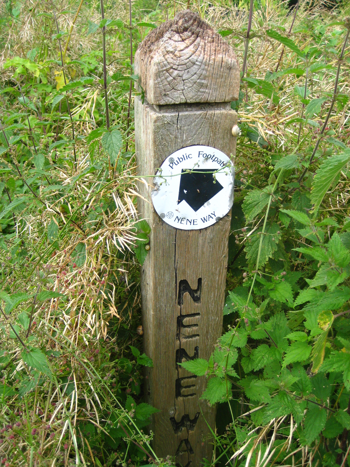
Sign post for Nene Way overgrown with nettles!

Detour: The Sewage Works to Ditchford Bridge (2.3 miles/3.7 km)


This was probably the hardest part of our walk, as we tiptoed across a dilapidated railway bridge and hacked our way through dense undergrowth beside a disused pit, whilst being dive-bombed by particularly nasty mosquitoes - it felt like we'd suddenly been transported to the Thai jungle!  There was no defined path, so it was quite a physical challenge to get out of the nature reserve and back towards civilisation.  By the time we stumbled onto the shockingly suburban Lodge Way, we looked like survivors of a jungle expedition gone wrong.  BAM noted that it's probably the closest we'll get to experiencing I'm a Celebrity . . . and I think that's a good thing too!

Dismantled railway bridge near Sewage works
Where we'd ended up was actually the far end of Irthlingborough and it was a little disheartening to feel like we'd spent the day going round in circles!  We walked along Lodge Way to Waterloo Way, then followed Thomas Flawn Road onto the main Wellingborough Road, at the end of Irthlingborough village.  Thomas Flawn was a soldier in the British army, born in Irthlingborough, who was awarded the Victoria Cross for bravery when he saved the life of his lieutenant during the Basuto Gun War (modern-day Lesotho) in the 1880's.

Walking along the Wellingborough Road was really unpleasant, with cars speeding past us recklessly, we stumbled along the verge, kicking up crushed beer cans and other random bits of rubbish.  Eventually, we came to a cross-roads and turned down the slightly less offensive Ditchford Road, until we rejoined the Nene Way at Ditchford Bridge.

Ditchford Bridge to Wellingborough Station (2.1 miles/3.4 km)


The next part of the walk was a pleasant stroll through water-meadows, under a lovely railway viaduct until we reached a footbridge leading to Irchester.  Unfortunately, this was to be our conclusive disappointment of the day, as the footbridge has been closed by the local authority, for Health and Safety reasons, which meant we had to miss Irchester altogether and find another way out of the water meadows, so we would get back to Wellingborough Station in time to catch our train back to London.  It was a shame to miss Irchester and walk through the country park but, as geography, time and the local authority were conspiring against us, we had to settle for a distant view of Irchester church and the site of the old Roman settlement on the other side of the river!

Railway viaduct with horses

Closed-off footbridge leading to Irchester

Access for Wheelchair Users


One of the many obstacles for Wheelchair Users
I was quite hopeful, when planning this walk, that there would be a certain amount of accessibility for Wheelchair users.  When it came to the reality of the walk, accessibility proved to be incredibly difficult, even for able-bodied walkers, with lots of fences, gates and other obstacles that needed to be climbed over.  The only bit I could recommend, although it's currently inundated, is the walk from Irthlingborough through the water meadow and along the dismantled railway track.  


Unfortunately, a metal kissing gate on the pedestrian flyover blocks access for wheelchair users hoping to go to Higham Ferrers, however, an alternative might be to follow a cycle path from the other side of Station Road which runs all the way to Thrapston.  We didn't follow this route though, so I can't really recommend it.  


Image credits:


All photos were taken by me, please feel free to reuse, under the Creative Commons license:

- Attribution (especially to this blog post)
- Share alike
- Non-commercial


Sunday, May 20, 2012

Ribchester - Weavers and Witches in Middle-Earth

Ribchester was our first foray into the wilds of Lancashire!  It's located between Preston and Blackburn, in the Ribble valley (hence the name), a beautiful spot that feels a million miles away from the big towns and cities that surround it.  I'd been in the Ribble valley before, having finished a walk of the Yorkshire Dales at Ribblehead, near the source of the Ribble river, but it was BAM's first time in Lancashire, so we were very excited to get out into the countryside and find out what the North West is all about!

Lodgings

As it's summer, accommodation options are much in demand and most places, including the Ribchester Arms (unfortunately) require a minimum two-night stay.  We were a bit pushed for time on this trip, so we could only stay one night and chose the Rose Cottage BnB in nearby Clayton-le-Dale instead.  It was a cosy place and we received a nice welcome after our long train journey from London and taxi ride from Preston station.  It was quite late when we arrived at Rose Cottage, so we didn't get to see much of Clayon-le-Dale. 

Longsight Road to Ribchester bridge (1.8 miles)

To get to the River Ribble we started by taking a bridleway opposite Rose Cottage, on the Longsight Road.  We passed a couple of gorgeous little lambs, who looked suspiciously well-fed and we wondered whether or not they were destined for one of the local restaurants!  Not far down the bridleway we turned left onto a small path past a pond with very serious looking fishermen, then climbed over a stile into a rather messy slurry pit, a not so great start to the day.  Trudging through slurry left us with a very pungent aroma of cow manure that I'm still struggling to forget! 

The slurry pit lay right on the path of an old Roman road, which we followed down to a ridge overlooking the Ribble valley.  At the ridge, we got our first real view of the valley, then turned right on a public footpath which brought us to a car park at Barker Brow and the B6245.  We followed the pedestrian footpath along the road downhill to Ribchester bridge. 

Lambs at Mire Fold, off the Longsight Road

View towards Ribchester and the Ribble Valley

Ribchester Bridge, taken from the Blackburn side


Ribchester Bridge to Haugh Wood (0.8 miles)

At Ribchester Bridge we turned right along the Ribble Way and headed north, in the opposite direction to Ribchester.  The Ribble Way is a long-distance footpath that runs for 65 miles (105km) from the Ribble estuary at Longton, just south of Preston, to Gayle Moor in North Yorkshire, where the source of the river can be found.  The Ribble seems like quite a placid river, meandering along as though it's in no great hurry, we also meandered along and stopped in Haugh Wood to soak up the atmosphere and have a small picnic. 

A Ribble Way signpost

River Ribble, taken from Ribchester bridge

Beautiful carpet of flowers at Haugh Wood


Haugh Wood to Hurst Green (1.9 miles)

Just after Haugh Wood, the Ribble Way diverts across a field, away from the river.  We didn't quite do this, but followed the tree line of Coppy Scar Wood, above a bend in the Ribble.  Our conversation turned to the recent controversial case in nearby Rochdale involving young girls being targeted by a gang of sex-traffickers.  Nine men have been convicted of trafficking young girls and the case has sent a shock wave across the country and caused heated debates, a lot of which, unfortunately, have focused on race (8 of the men were of Pakistani origin and most of the victims were young, white girls). 

People often talk about race, when they really mean culture and I can't help thinking that the real 'elephant in the room' is, in fact, social class.  Most of the victims were vulnerable working-class girls, some of whom came from dysfunctional families.  In a country where young, working-class girls are constantly portrayed as being promiscuous, benefit-scroungers who get pregnant so they can get a flat from the council, it's hardly surprising that some men, regardless of their ethnicity, have no respect for these young women and see them as fair game. 

Lopsided sign post near Coppy Scar Wood

Crossing the fields below Hey Hurst, we got our first views of Pendle Hill, a place steeped in mystery and the supernatural.  It's probably most famous as the place where the 17th century Pendle Witch trials took place.  Ten people, mostly women, were convicted of witchcraft and hanged to death.  It's obvious from a modern perspective that these women weren't really witches, but victims of a ruthless campaign to rid Lancashire of 'religious heresy'.  Pendle was a bastion of Catholicism and this might have contributed to the witch-hunt in this area. 

Pendle Hill, where the 17th century witch trials took place

We like to think that the days of witch-hunting are over, but I often wonder if this is true, when I see minority groups being demonised and pilloried in the modern press.  17th century Lancashire was considered to be a wild and lawless region, fabled for its theft, violence and sexual laxity.  It's obvious that Lancashire has suffered from a lot of bad press over the years and I wonder how much of this is down to its historical role in the power struggles that forged modern England. 

Hurst Green, just as the sun came out!


Hurst Green to Greengore (0.85 miles)

If Hurst Green is anything to go by, then I can gladly confirm that Lancashire is not as wild and lawless as they make it out to be!  Hurst Green seemed like a lovely place.  As we had a rest on the benches in the centre of the village, the sun came out and it finally started to feel like May, instead of December!  We followed the road through the village, which passes The Bayley Arms and the entrance to the Dene (which leads to Shire Lane).  Apparently, JRR Tolkien's Middle-Earth was inspired by the local landscape and Tolkien wrote part of The Lord of the Rings when he was staying at the local Jesuit college in Stoneyhurst.

Rock formations at Mill Wood, inspiration for Tolkien's The Shire?

Certainly, the landscape had a magical quality, as we took a path through Mill Wood, past weird rock formations and small glades dappled with sunshine.  Amongst other things, Lancashire was famous for its weavers and textile industry.  As we walked through the woods, it felt as though we'd been transported to a different era and we got a glimpse of what England must have been like in bygone days. 

A dappled light worthy of the best Impressionist painter

A magical path through the woods


Unfortunately a lot of the larch in this area has been felled because of an outbreak of Ramorum dieback.  A terrible disease that mostly affects oak trees (it's also known as Sudden Oak Death), it kills healthy trees in a very short space of time.  I think ramorus comes from the Latin word ramus meaning 'branch'.  There were certainly lots of stockpiles of timber around the area, as you can see in the photograph (below).

It couldn't be England in May without the bluebells

The path to Greengore

Stockpile of timber


Greengore to Intack (0.9 miles)

The Ribble valley is full of wonderfully interesting buildings like Greengore farm, a 15th century building which has some self-catering accommodation and (rather bizarrely) has flying buttresses on the main building!  From Greengore we walked towards Crowshaw House and briefly joined the Old Clitheroe Road, where there are spectacular views over the Ribble valley.  We then took a small path past a disused quarry and into the grounds of Intack, a traditional detached farmhouse. 

View of the Ribble Valley from the Old Clitheroe Road

Path leading to Intack

Intack to Duddel Wood (0.7 miles)

The next part of the walk was very short, but took us a long time, as it was difficult to navigate the public footpaths in the fields between Intack and Duddel Wood.  The first bit, to Huntingdon Hall, was fairly straight forward, but we got really confused after that, as it was difficult to find the entrance to the wood.  We eventually found a way, over a fallen fence, and scrambled through the trees along a ridge above Duddel Brook.  Luckily, we found a stone bridge that brought us across the brook and out onto a neglected lane way, leading to the 19th century Dutton Manor. 
Getting lost in Duddel Wood

Duddel Wood to Duddel Hill (0.6 miles)

The lane way from Dutton Manor to the B6243 at Dean Brow is a rather enchanting place and is lined with old-fashioned electric lamp-posts that have fallen into disrepair.  I don't know enough about architecture and design to say what style the lamp-posts were in, but it had a feeling of the 1920's and I could almost hear the echo of newfangled motor cars driving up to Dutton Manor in the late evening for a fabulous party! At the entrance to the lane is a small gatehouse, known as the Beech House.

Lamp-post on Dutton Manor lane way

 At the Beech House, we turned right onto Dean Brow and, before it came to Moor Cock farm, we crossed the road and took a footpath on the left leading to Duddle Hill.

Beech House on Dean Brow (Longridge Road)

Duddel Hill to Ribchester (1 mile)

By the time we got to Duddel Hill, it was already quite late, so we covered the last mile downhill to Ribchester quite quickly.  The fields had been sprayed with manure, so we finished our walk in a similar fashion to how we'd started it!  Following a fairly obvious path downhill, we eventually came out onto Stydd Lane.  Passing two small churches and an almshouse that has been converted into apartments, we followed the lane back to the B6245, which is the main Blackburn Road.  At the road we turned right towards the village and made our way to the Ribchester arms for a well-deserved drink and hearty meal!

Field sprayed with manure, near Stydd Manor


Ribchester was known as Bremetannacum during the Roman era and the village still has some Roman ruins.  Archaeological artifacts, like the Ribchester Helmet, were found in the village.  Unfortunately, we didn't have a lot of time to explore Ribchester itself, as we had booked a taxi back to Preston and our onward train to London. 

Ribchester, site of Roman Bremetannacum
Access for Wheelchair Users:

Unfortunately the first part of the walk we did would not be accessible for wheelchair users, however, an alternative walk from Clayton-le-Dale (or even Blackburn) would be possible, as there is a path for pedestrians along the B6245.

The Ribble Way was accessible from Ribchester Bridge to Dewhurst House - after this, the route we followed was not accessible again until the lane way leading from Trough House to Hurst Green.

The most beautiful part of the walk, from Hurst Green to Intack was mostly accessible, as the path seemed pretty smooth.  There were some gates that needed to be opened and closed along the path. 

The bit between Intack and Ribchester was inaccessible, as it crossed fields, however an alternative route might be along the Huntingdon Hall Road and Gallows Lane, if you feel comfortable wheelchairing on small country lanes with the risk of traffic.  I haven't been on these roads, but I'd imagine they are quite steep in parts.  Definitely one for more adventurous wheelchair users!

Image credits:

All photos were taken by me, please feel free to re-use them under the Creative Commons license:

Attribution (especially to this blog)
Share-Alike
Non-commercial

Wednesday, March 21, 2012

Worcester - Elgar, Swans and Daffodils

With a population of just over 94,000 people, Worcester is, by far, the biggest 'chester' we've visited during our series of 'Chester' walks.  Home of Lea and Perrins and the birthplace of the British Medical Association, Worcester has faded in and out of history, mostly on the periphery of events (a notable except being the English Civil War) despite its strategic location on the River Severn and its magnificent cathedral.

I must admit, I knew very little about Worcester before we went there, concerning myself more with the pronunciation of the name (it's wuster, right?  Or is it wooster?) than with the city's place in the wider world!  It seems like a pleasant enough place and, although the city is believed to have Roman origins (hence the -cester), this felt less obvious that at some of the other -cesters we've visited, like Wroxeter and Silchester.  I guess the smaller places have kept their more obvious connections to the Romans, whereas cities like Worcester have had many other layers of history added on top. 

Huntlands Farmhouse BnB
Lodging,  victuals and merriment

We decided to stay outside Worcester and walk towards the city, as we enjoy waking up to the sound of birds twittering (as opposed to the constant traffic of London) and it's very fulfilling to walk towards civilisation and the train that will take us back home.  We decided to stay in a wonderful rambling farmhouse with a duck pond called Huntlands Farm, just outside Knightwick in the Malvern Hills District of Worcestershire.  It's not the most obvious place to stay, but I think we're fated to stumble across the most interesting lodgings on these walks and the welcome we received at Huntlands was second-to-none. 

The BnB is provided by Lucy, who redesigned the interior of the main farmhouse building and is a professional upholsterer.  We also met her father, John, who is a charming man and has a wonderful collection of accordions and harmonikas.  We had a very tasty dinner, cooked by Lucy and then an evening of laughter and music - I used to play the accordion years ago, when I was in an accordion band in Ireland.  It was a wonderful feeling to play again and I realise how much I've missed it.  It's inspired me to think about taking up a musical instrument again - it's such a stress-relief and a lovely way to spend an evening!

Huntlands to Knightwick Manor (0.9 miles)
Cows near Knightwick Manor

Rather than walking directly to Knightwick, we decided to take a more circuitous route via Knightwick Manor, so we could avoid walking along the busy A44, which is the road that runs all the way from Oxford to Aberystwyth.  So we turned right, instead of left, at the bottom of Huntlands drive and made as though we were heading south towards Great Malvern.  After a very small settlement called Gaines we followed a local path to Knightwick Manor, a wonderful farm building on top of a small hill near the Suckley Road.

Knightwick Manor to Knightwick (1 mile)

Three Choirs Way signpost
From Knightwick Manor, we turned right onto the Suckley Road, then picked up the Three Choirs Way, a 100-mile long walking route that links the cities that host the Three Choirs Festival - one of the world's oldest classical choral music festivals.  Each year the festival alternates between the cathedrals of Worcester, Gloucester and Hereford and celebrates, amongst others, the music of English composers such as Elgar and Vaughan Williams.  This has definitely been the most musical of our walks so far! 

The Talbot, Knightwick
The symbol of the Three Choirs Way is a treble clef and the words of a local adage 'Blessed is the Eye between Severn and Wye'.  I've been puzzling over the meaning of this adage ever since, but I'm none the wiser, so if anyone knows what it means, please put me out of my misery!

Knightwick itself is very much a typical 'roadside' village and has a very attractive looking pub called The Talbot with an interesting signpost outside, pointing to faraway friends, rather than faraway places!

Knightwick to Ankerdine Hill (0.5 miles)

Daffodils
We don't get to do a lot of climbing on these Chester walks, so Ankerdine Hill was a chance to stretch our calf muscles and enjoy some forest walking as well.  Our conversation had turned to a recent TV documentary about the English Defence League.  BAM (Best Aussie Mate) doesn't have a television, so I was updating her on the themes of the documentary and the how it portrayed the EDL leader in a very positive light. Without addressing that organisation's extreme islamophobia, the documentary seemed to legitimise support of the EDL and justified xenophobia by distracting viewers away from the blatant issues around race.

Ankerdine Hill to Doddenham Hall (1.3 miles)

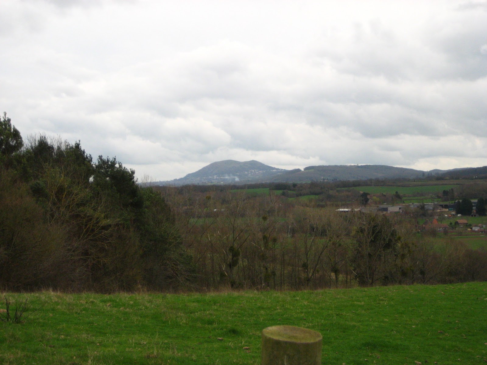
View of the distant Malverns
Leaving the summit of Ankerdine Hill, we got lost in a conversation about Sakura, the Japanese Cherry blossoms, then we wandered on to a discussion about the incredible optimism of Japanese people, despite last year's terrible earthquake and tsunami and we finished talking about the famous Japanese Shikoku pilgrimage route and how we would both love to do part of this (although the full thing can take sixty days!)

We also slightly lost the Three Choirs Way at this point and wandered on to the much shorter Worcestershire Way, which runs 31 miles from Bewdley to Great Malvern.  We soon realised our mistake and turned off the Worcestershire Way when it came to Easinghope Lane, following the lane downhill to Doddenhall Hall and the Three Choirs Way once more.

Doddenham Hall to Broad Green (1.1 miles)

Hmmm...everywhere but back then!
The stretch from Doddenham Hall to Broad Green was fairly typical of the rest of the day's walk - mostly along the edges of fields, with views of the Malverns off in the distance and the occasional foray on to quiet country lanes.  It was quite a peaceful walk and we didn't come across any other walkers apart from farmers in the distance, tending to their fields. 

Getting out of Doddenham Hall was probably the most complicated part of the whole walk, as the path was partly obstructed and signposts like the one in the picture were particularly open to interpretation!  I sometimes wonder at the value of sign posts like these, as it's plainly obvious that, at any given time, we mainly have four directions to choose from (right, left, back, forward)!

Broad Green to Elgar's Birthplace (2.3 miles)

Broad Green
Broad Green seemed like a fairly sedate place and reminded me of other 'commons' that we've seen on our various walking trips.  The rest of the path to Elgar's birthplace was through pastureland and made very pleasant walking.  I was a bit underwhelmed by the village at Elgar's birthplace.  I think at that point, I'd been hoping for some refreshments and a public toilet.  The birthplace museum building looked really nice and I'm sure it makes a good day trip from Worcester.

As BAM did an artistic re-enactment of Elgar's birth, I thought about his legacy and how Elgar has become a symbol of bombastic patriotism and flag-waving.  By all accounts, nothing could be further from the truth and Elgar was very much an outsider in late-19th century English society. 

Elgar's birthplace museum
He came from a relatively lowly background and languished in obscurity before the success of The Enigma Variations and the Pomp and Circumstance marchesOften considered to be one of the most 'English' of composers, Elgar took his musical inspiration from the Continent.  He was also an outsider because of his Catholic faith.  He loved walking in the countryside, no doubt around some of the fields myself and BAM were walking through. 

Elgar's birthplace to Worcester Cathedral (2.7 miles)

Descent into Worcester
Not long after Elgar's birthplace, we started our descent into the outer suburbs of Worcester.  At this point, the Three Choirs Way passes along the Oldbury Road, past the main campus of the University of Worcester and down the rather steep Hollywell Hill to meet the River Severn. 

The Hive, Worcester
It's a lovely walk along the Severn to reach Worcester Cathedral, past the railway and road bridges and the swan sanctuary.  The cathedral itself is magnificent - with an incredibly imposing exterior and breath-taking interior, it reminded me a little bit of Durham cathedral, which we visited on our Chester-le-Street trip. 

We were equally impressed by The Hive - a gold-plated library building, part of the University of Worcester, which is due to open in July 2012.  It's nice to see some economic growth in these times of doom and gloom!

Access for Wheelchair Users

Worcester Cathedral
As most of the walk was through fields, the only part I'd recommend for Wheelchair users is the 2.7 miles from Elgar's birthplace to Worcester Cathedral.  The first part of this is on a track which seemed fairly accessible.  As you come into Worcester itself, the paths are also accessible.  I wouldn't recommend wheelchairing down Holywell Hill, as it's a bit steep - it would be better to turn left on Henwick Road and then right on Hylton Road, which runs parallel to the River Severn. 

Swan sanctuary on the Severn
Image credits:

All images were taken by me - please feel free to reuse them under the Creative commons license:

Attribution (especially to this blog)
Share alike
Non-commercial