Showing posts with label canal. Show all posts

Sunday, February 18, 2018

Chichester - Maths, Misogyny and Musicals

I’ve wanted to visit Chichester for a very long time and, indeed, when myself and BAM (Best Aussie Mate) first conceived our Chester project, back in 2010, it was due a conversation which started with me saying I’d love to visit Chichester and BAM replying that she’d love to visit Winchester.


So, eight years and forty-nine Chesters later(!), we finally found ourselves on the train to a destination that has always felt somehow rather exotic to me.


I think the thing that intrigues me about this little corner of England, is that it's a bit off the beaten track and overshadowed by more glamorous neighbours such as Brighton and Portsmouth.


When you look at the area on a map, with the inlets around Chichester harbour and Hayling Island, it looks like an English equivalent of the Mekong Delta more so than other parts of south-east England’s calm and unbroken coastline.


Map of Chichester harbour


Anyway, Chichester isn’t exactly Saigon and we managed to get there from London in a respectable one hour and forty-five minute train ride.


Lodging and victuals


The weather forecast wasn’t great for the weekend we did this walk (end of January), so we were quite happy to get in out of the dark and rain, as we made our way into Trent’s pub, a convivial spot, where we’d pre-booked a table.


It was a nice place to spend a couple of hours and we were impressed to see so many young people out enjoying a meal with friends, not just getting hideously drunk, as is more usual behaviour on a Friday night.


Stained-glass window in Chichester cathedral


Of late, we’ve become quite attached to our Premier Inn experiences, so no other option seemed viable when we realised there was a Premier Inn in Chichester’s retail park and, as usual, we had a comfortable, cheap-and-cheerful stay.


Quite randomly, we ended up watching a programme about Mughal and Islamic gardens and I was transported briefly to Humayun’s Tomb, one of my favourite places to visit when I go to India.


West Wittering to West Itchenor (3.3 miles/5.3 kilometres)


As usual, we decided to start the walk outside our Chester, so we could have Chichester as our destination rather than our starting-point.  With this in mind, we caught the 53 bus from Chichester to West Wittering (via East Wittering), a 20 minute journey and, surprisingly frequent service, given the cut-backs we’ve seen on local bus services elsewhere in the country.


The Witterings are delightful villages and make me think of retirement homes and old people dithering and wittering away to their hearts' content. It was interesting being there in winter, as it’s more of a summer destination and, whilst the coastline in this part of England is no doubt stunningly beautiful anytime of the year, it was also quite bleak and a little bit forlorn, as the rain came on and we made our way along Roman Landing to the shoreline.


Shoreline near West Wittering


One thing that’s guaranteed at this time of the year is mud and the path from West Wittering to West Itchenor was pretty muddy. We had it mostly to ourselves and were able to lose ourselves in the abstract rumination of the landscape, with birds diving in the distance and the mist carrying our thoughts away, across to Bosham and West Thorney.


BAM walking on muddy path


Actually, the open physical space gave us a good chance to catch up and share our thoughts about the things that are happening in our world, namely the #metoo scandal and the exposure of Harvey Weinstein’s abuse of power, amongst other things.


We also ended up talking about gender, the next great revolution that’s changing the way we organise our societies and BAM filled me in on a radio programme she’d heard about Intersectionality and multidimensional oppression.


In exchange for this information, I updated BAM on some reading that I’ve been doing recently on Maths and how multidimensional abstract calculations can have a very practical use for areas like Economic forecasting, regardless of whether the 7th or 77th dimensions actually exist! 


Concrete blocks


We agreed that Maths hadn’t been our favourite subject at school, as we both had negative experiences with our Maths classes and, perhaps, Maths wasn’t taught in a way that made sense or engaged us. As an adult it’s much easier to see the point of abstract thinking.


Cottages at West Itchenor


Before long we reached a pretty harbour at West Itchenor, a part of England BAM is fairly familiar with, as it’s a place she’s been to on a kayaking trip.


West Itchenor to Salterns Lock (2.3 miles/3.7 kilometres)


From West Itchenor it was another couple of miles following the Chichester channel to Salterns Lock, where the path we were following The New Lipchis Way takes a sudden turn inland, to follow the Chichester Ship canal all the way back to Chichester.


Waymarker for the New Lipchis Way


The name Lipchis made me think of the song, Cellblock Tango from the musical, Chicago and I couldn't help humming, Lipchis, pop, six, squish, uh-oh, Cicero, as we trundled along!


Actually, this path was named after the two main towns that it links, Liphook and Chichester - somehow they put these two names together and came up with Lipchis.


Tide times at Itchenor


There are some very expensive-looking properties at Westlands and some very pretty boats in Chichester marina. The rain starting coming on more heavily, as we followed the canal and made our way back inland.


Salterns Lock to Poyntz Bridge (2.5 miles/4 kilometres)


It was another quiet, but muddy walk along the Chichester Ship canal, a well-looked after path with lots of information boards telling us about the history of the canal and the various historical features along the way.


We passed a miserable-looking Swan near Crosbie bridge and a few coots doing their best to find some shelter from the rain.


Muddy path along the Chichester Ship Canal


Poyntz Bridge made me think of the village Poyntzpass in Northern Ireland, where that horrible shooting occurred in 1998, when two best friends, a Catholic and a Protestant, were murdered by Loyalist paramilitaries.


The Poyntz family have their origins in Gloucestershire, where we’ve recently been walking and they seem to have a long history with Ireland, although I’m not quite sure why there is a Poyntz Bridge on the canal near Chichester.


Walking into Chichester


There is a lovely view of the spire of Chichester cathedral from Poyntz Bridge, as it rises above the trees in the distance, almost as though there were no town bustling around underneath it.


Poyntz Bridge to Chichester (1.4 miles/2.25 kilometres)


It’s a short walk from Poyntz Bridge into Chichester and we were lucky enough to get into the train station toilets, so we could change out of our muddy boots and trousers.


Chichester cathedral


Chichester was known as Noviomagus Reginorum in Roman times and, before we left for West Wittering in the morning, we’d had a chance to walk around the Cathedral and the town centre. It seemed like a very pleasant place and somewhere I’d definitely like to return to. Hopefully it won’t take another 8 years to get there next time!


Access for Wheelchair Users


I'm afraid not much of this walk would be accessible to wheelchair users, however, Chichester is a pleasant place to visit and part of the canal walk there seemed accessible - also the road between East and West Wittering was pretty quiet and I'm sure you can gain access to the shoreline just beyond the Roman Landing.  The route was pretty accessible between West Itchenor and Salterns Lock, so I think you could do that part of this walk without too many problems.    


Image credits:

All photos were taken by me - please feel free to reuse them under the following Creative Commons license:

Attribution (especially to this blog post)
Share-alike
Non-commercial

Sunday, December 24, 2017

Cirencester - Christmas Trees, Hope and Heavy Rain

Flag of GloucestershireThe fact that I’m writing this blog post on Christmas Eve shows how busy life has been since we did our last Chester walk, more than a month ago, up in the wilds of the Gloucestershire/Wiltshire border.

There’s no train station in Cirencester (pronounced Siren-sester) which seems like a bit of an oversight, so we found ourselves jumping off the train at Kemble, late on a Friday evening, then catching a taxi from Kemble to Cirencester, a mere 12 minutes by car.

Lodgings and victuals

Cirencester
We stayed in the delightful Ivy House BnB, which is on Victoria Road in Cirencester. The BnB owners are just about to retire, so they may not be running Ivy House by the time you read this blog post. It was a bitterly cold night, but we ventured out for a night cap and found a warm welcome at The Bear Inn on Dyer Street, a bar which has loads of books, which made me happy - even if I didn’t have time to read any of the books, I still liked the idea of being surrounded by them.

Church of St John the Baptist to Upper Siddington (2.2 miles/3.5 kilometres)

We really liked Cirencester and I could think of worse places to live, even if, what had been forecast to be a sunny winter’s day turned into a bit of a washout and the rain had come on before we’d properly set out on our walk. We’ve visited many beautiful churches during our series of Chester walks, but I really loved Cirencester’s main church, St John the Baptist. It’s an interesting building, architecturally, and there was a really lovely feeling inside and lots going on, including a display of Christmas trees and a bookshop selling cards, as well as books.

Inside St John the Baptist church in Cirencester

Detail of church organ in Cirencester

Unusual Christmas tree decoration

Hard to believe nowadays, but Cirencester was once one of the most important settlements in Britain, during Roman times, right up there with Colchester and St Alban’s and there is an area of the town, known as the Querns, where you can see the remains of Cirencester's Roman life in the Cirencester Amphitheatre.

We faffed around quite a bit, trying to find a way into the Amphitheatre, walking as far as the roundabout on the Bristol Road, then wandering around Waitrose car park, before we headed along Sheep Street and over the bridge to Cotswold Avenue. The Amphitheatre today is a covered mound of grass and reminded me of the Maumbury Rings in Dorchester, although on a much larger scale.

Roman Amphitheatre at the Querns in Cirencester
The rain started coming on quite heavily, as we made our way through the Love Lane industrial estate, on the edge of Cirencester, towards the suburban village of Siddington.

Upper Siddington to South Cerney (2.8 miles/4.5 kilometres)

We didn't actually pass through Siddington village, but we could see it on the other side of the canal, as we followed the Thames and Severn Way in the direction of South Cerney.  We saw the Thames and Severn Way very briefly, when we were in Stroud last year for the Frocester and Woodchester walk and this is a handy path that, quite literally, links the Thames to the Severn, the Thames side starting in Lechlade, finishing on the Severn at a little village called Upper Framilode. It's 43 miles (69km) in total and follows the old Thames and Severn canal, formerly an important transport route for produce and people across the Cotswolds area.

Canal bridge at Siddington
It took a while to figure out what the symbol of the Thames and Severn Way represents - at first, we thought it might be a train passing through a tunnel, until we realised, it represents a canal boat sailing under a bridge.  It made for pleasant walking and I was quite pleased to find that the ominously named Cowground Bridge didn't have any cows underneath it, just some dog-walkers, bravely bracing the elements.

Symbol of the Thames and Severn Way
We left the Thames and Severn Way just outside South Cerney, as we turned down Northmoor Lane, much to BAM's horror, as it meant walking on the roadside into oncoming traffic (BAM's idea of hell!) It didn't take very long though until we got to the end of Northmoor Lane and turned left into the village.

BAM walking towards South Cerney
South Cerney to Ashton Keynes (2.5 miles/4 kilometres)

We had a short break in South Cerney, sheltering from the rain in the porch of All Hallows church.  South Cerney gets its name, as Cirencester does, from the River Churn, a great name for a river if ever I heard one! It certainly felt like we were churning through the mud and rain on as wet a November day as one could hope to experience.

All Hallows church in South Cerney
Interestingly, the noticeboard at the church had the word Hope in different fonts and it got us thinking about the world we live in today and how important Hope is to people - hope that we won't completely destroy the environment, hope that we won't kill each other in a nuclear war, hope that the next US President might be someone to feel hopeful about!

Noticeboard at All Hallows Church, South Cerney
With hope in our hearts, we continued our walk, passing through beautiful old buildings in South Cerney, having a giggle at the curiously named Bow Wow Lane before turning onto Broadway Lane. Halfway down Broadway Lane, we turned onto a very narrow path between a residential area and an industrial estate, before coming out into the Cotswold Water park and making our way on to the village of Ashton Keynes.

Narrow path off Broadway Lane in South Cerney
Ashton Keynes to Kemble (5.9 miles/9.5 kilometres)

We've been in Ashton Keynes before and, actually, the rest of this walk we'd already done in the opposite direction, when we walked the Thames Path a few years ago. As we left Ashton Keynes, the rain got even heavier and the light was quite dim on this last part of our walk.


Ashton Keynes (Wiltshire)

There weren't many people around, so it felt like we had the countryside all to ourselves. It got dark just as we reached the road into Kemble and, by the time we got there, we were soaked through. We were pretty happy to reach The Tavern Inn near Kemble station, where we changed into our jeans and soft shoes, then dried off a bit, before getting the train back to London.

Thames path near Kemble


Access for Wheelchair Users

Unfortunately, not much of this walk would really be accessible to wheelchair users, although it would be possible to get to the Amphitheatre in Cirencester and wheelchair around there.  In our experience, the roads around this part of Gloucestershire are quite busy, with no footpaths and, therefore, dangerous for wheelchairing.  There's a nice path through the Cotswolds Water Park though that seemed pretty accessible.  

Image credits:

All photos were taken by me - please feel free to reuse them under the following Creative Commons license:

Attribution (especially to this blog post)
Share-alike

Non-commercial

Saturday, April 29, 2017

Cheshunt - Retail, Reservoirs and Regeneration

It would be a real shame to do this Chester series and not have an excuse to include the ancient capital of Britain, founded by the Romans after their invasion in 43 CE. It goes by the name of London these days - you might have heard of it?

Actually, the first real capital was at Colchester, also included in our series of walks and the capital even settled briefly on St Alban's, before permanently establishing itself at Londinium, the main Roman settlement on the River Thames.  By coincidence, we've also been in St Alban's this month, with our walking group, The Odd Weekenders, so we've now visited all three of Britain's Roman capitals!

Of course, Londinium is where we live and, indeed, BAM's lovely new apartment is within 15-miles walking distance from Cheshunt, our main destination for the day.  For once, there was no need for lodging and victuals and the journey to the start of walk at Mile End was quite easy this time for me and BRH (Best Russian Husband) and even easier for BAM (Best Aussie Mate).

Mile End to Hackney Wick (1.8 miles/2.9 kilometres)

Now in the beating heart of East London, Mile End was once at the very edge of a nascent city - a mile beyond the city's Aldgate to be precise, hence the name!  It's an area that BAM knows like the back of her hand, so we let her guide us through Mile End Park and along the Hertford Union canal at the southern end of Victoria Park.


For a big city, London has a surprising number of green spaces and we were really lucky with the weather that day, glorious spring sunshine, which brought out hordes of joggers, dog-walkers and cyclists.

It's really lovely along the canal and this whole area is undergoing yet another period of transformation, as snazzy apartment blocks are popping up like mushrooms along the canal side. In a nice contrast to our last Chester walk (Caerphilly/Cardiff), whereas we ended the last walk with the urban graffiti, joggers and city parks in the capital of Wales, we started this walk with pretty much the same ingredients, but this time in the capital of England!

The Hertford Union canal is a really short one, just about a mile in length and was opened in the 1830's as a link between the Regent's canal and the Lea Valley navigation.  It was the first time I'd ever walked there, but BAM quite often jogs that way, so she's seen this whole area go through various stages of development in the past few years.


Hackney Wick to Springfield Park (2.7 miles/4.3 kilometres)

There's a lot going on in Hackney Wick and, ever since the 2012 London Olympics, this whole area has been gentrifying at a tremendous pace.  At the end of the Hertford Union Canal, we turned north into the River Lea Navigation, past the Copper Box arena, which is where we went to see a couple of Handball matches during the Olympics.


We also walked past an interesting building which is now called Here East and was the media centre during the Olympic games - there are plans to turn this whole area into a high-tech IT hub, a kind of digital city and I have a feeling I'm going to get to know this area quite well in the future!

From Here East we followed the canal towpath along the edge of Hackney Marsh to Lea Bridge, where the (until now) straight canal, takes swings dramatically around an attractive bend surrounded by even more apartment blocks all the way to Springfield Park.


Springfield Park was once part of a private estate, but opened to the public in 1905.  Interestingly, the landscaping work that was done on the park in preparation for opening it to the public, uncovered some Roman artifacts, sarcophagi and shards of pottery, so it was reassuring to know that we were following a path that the Romans had carved out many centuries before us!

We had a nice picnic in the park and enjoyed the sunshine, as we sat at a park bench munching on some chocolate that BAM had brought back from Central America.

Springfield Park to Tottenham Hale (1.3 miles/2.1 kilometres)

As you walk from Hackney Wick, with all of its gentrification to Tottenham Hale, in the London Borough of Haringey, the symbols of economic regeneration and the building boom start disappearing, being replaced by much poorer social housing and signs of deprivation.


No doubt one day places like Upper and Lower Clapton, more famous in the 90's for drug and gun-related crimes will become as gentrified as other parts of London further south but, at least for now, the Boroughs of Hackney, Haringey and Enfield have some serious social issues to deal with.  Whilst researching for this blog post, I found a really interesting website called London's Poverty Profile, which outlines the levels of social deprivation across all London boroughs.


I really love London, having lived in this city for more than 8 years now, so I want to see the city prosper and I hope all Londoners will get a fair chance at life, with the same opportunities as their fellow citizens in more affluent parts of the country, many of which we've also visited during our Chester series of walks.

Tottenham Hale to Enfield Lock (6.4 miles/10.3 kilometres)

After Tottenham Hale the landscape gets noticeably more industrial, as it passes by some of London's biggest industrial estates and retail distribution centres.  We're quite familiar with this walk, as we've done it a couple of times before, namely when we walked the Lea Valley path, back in 2012.  Myself and BAM walked the entire 50-mile Lea Valley path, which starts in Leagrave, not far from Luton and ends at the River Thames in Limehouse Basin.


In this part of London, the path follows the River Lea Navigation past the Tottenham Marshes, alongside a series of reservoirs; Lockwood, Banbury, William Girling, King George, that supply us Londoners with our drinking water.  I've quite often seen these reservoirs from the air, as they stand out quite majestically from the surrounding urban sprawl, when you're coming in on flights from Europe or Asia.

The reservoirs are much more difficult to appreciate at ground level, as they're hemmed in by fences, probably a good thing really, as these protect London's water supply from contamination.

As we plodded along this fairly industrial stretch, BAM entertained us with tales from her most recent adventure diving off Utila, one of Honduras' Bay Islands.  I blogged quite a bit about Honduras, by the way, back in 2013, in case you fancy an armchair trip to this fascinating Central American country.

Enfield Lock to Cheshunt (3.1 miles/5 kilometres)

Enfield Lock definitely has an edgy feeling to it and I first came here in 2009, during my first year in London, when I was walking the 150-mile London Outer Orbital Path, a.k.a. The London Loop.


The Lea Valley path, rather dismissively, crosses the London Loop, obviously not that pleased about its more prominent rival, and heads north out of London towards the M25.  From the M25, it's a fairly short walk through Hertfordshire to the town of Cheshunt, not yet swallowed by the ever-expanding city, but feeling more and more like an outer suburb of London, as the Lea Valley towns get sucked into the excitement of life in the capital.


Despite having walked past Cheshunt twice in the past, I'd never actually walked into the town but, as we were in search of a hearty meal, to end our 15-mile walk, we passed the station and followed Windmill Lane to the town centre on Turner's Hill.


It didn't look too promising at first, but we were lucky to find a really nice restaurant called Fishy Delishy on Cheshunt's College Road.

Access for Wheelchair Users

Pretty much all of this walk would be accessible to wheelchair users, as it follows a very level canal towpath - the trickiest parts would be around the locks, like Enfield Lock, but this is a path that is used by all kinds of people and I would recommend it for wheelchair use. 

Image credits:

All photos were taken by me - please feel free to reuse them under the following Creative Commons license:

- Attribution (especially to this blog post)
- Share-alike
- Non-commercial

Saturday, March 12, 2016

Chesterfield - Crooked spires, Stud Farms and the Cuckoo Canal

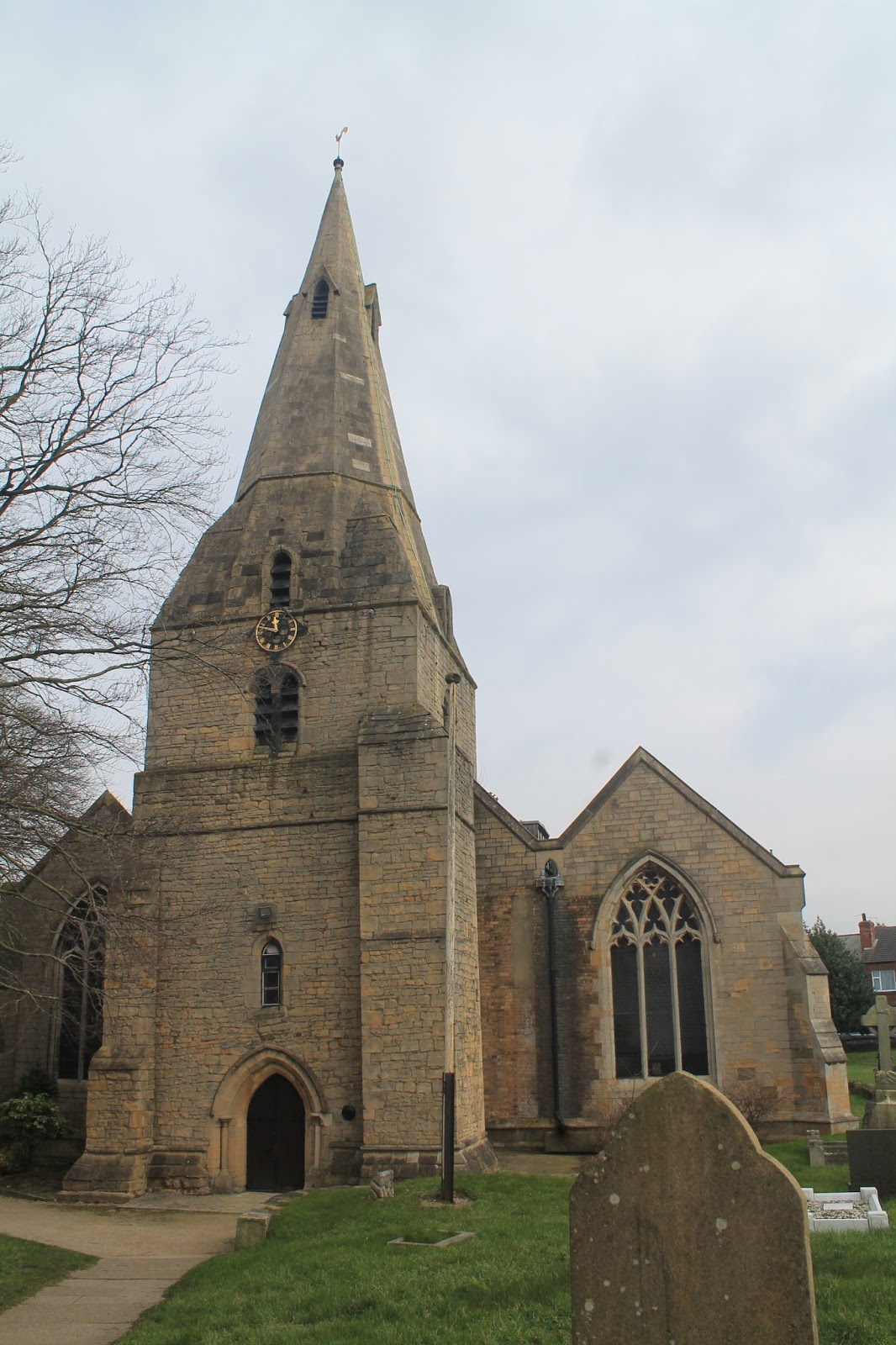
I'd really been looking forward to going to Chesterfield, having passed through the town once before, on my way to Sheffield and being intrigued by the curiously twisted spire of Chesterfield's parish church, the Church of St Mary and the All Saints (sounds a bit like a girl band, doesn't it!).

The church is Chesterfield's most interesting sight and it is truly remarkable to behold.  It caused quite a flurry of interest, when I posted some photographs of the crooked spire on Facebook!  There are different theories, as to why the spire is crooked, but my favourite explanation is that it's a result of bad craftsmanship because a plague killed off all the local builders!

Chesterfield's Crooked spire

This was to be our first and last foray into Derbyshire, which isn't particularly famous for its Roman settlements but has always been on the way to other places, being on the main road north from London to York.

Sign for Chesterfield College

Symbol of strong arm on Chesterfield's Knifesmithgate
Due to train times and Friday evening ticket prices, myself and BAM (Best Aussie Mate) had committed to leaving London early in the day, guiltily sloping out of our respective offices just after lunch and arriving in Chesterfield with a few hours to spare before the sun went down, which gave us a chance to walk around the town centre and check the place out.

Chesterfield Borough Council
Lodgings and victuals

We had a very comfortable stay in Chesterfield, at the ultra-modern Spire View @ the Galleon Steak House (so modern it even has an @ in its name!)  As our accommodation was above the steak house, we were quiet conveniently located for dinner and we would highly recommend the steaks at the Galleon, if you ever find yourself in Chesterfield.

We were quite impressed with Chesterfield itself.  It's a handsome town, with lots of Georgian architecture and a really pretty market place with an Italianate town hall.  Some of the black-and-white striped tudor-style buildings are in need of some TLC, but the town was prettier than I expected it to be and we enjoyed walking around Queen's Park, as the light began to fade.

Chesterfield Unitarian Chapel

The Boating Lake at Queen's Park

Chesterfield Market Place
Bolsover to Woodthorpe (3.2 miles)

Some of my colleagues from 'up north' looked a bit appalled when I said we were planning to start our walk in Bolsover, a small village about 5 miles to the east of Chesterfield. Apparently, Bowser doesn't have a great reputation and is looked down upon by neighbouring Chesterfield as being a bit rough.

Distant view of Bolsover Castle
We thought Bolsover was alright - jumping off the bus on Station Road, we made our way up to Bolsover's impressive castle and had a nosey around the castle gift shop. BAM caused a bit of consternation, knocking over a display of cards and then getting into a battle of hard stares with the shop assistant, who seemed to be very confused by the fact that we'd just come to see the gift shop and had no intention of visiting the castle!

Bolsover Castle - which we didn't visit!

Bolsover St Mary and St Lawrence
Bolsover has a lot of potential and there are some pretty, historical buildings around the village, although it is also surrounded by some grim-looking housing estates.

Housing estates surrounding Bolsover
We knew that the first part of our walk, from Bolsover to Woodthorpe would be the trickiest, as there is no waymarked trail through this part of the Derbyshire, but we were relying on a series of connecting public footpaths, which can be hard to find, especially in winter time, when they seem to disappear into the tilled fields.
We'd purposefully organised the walk in this way, so we could do the most challenging bit first and then have the easier way-marked trail into Chesterfield later in the day, when we would, inevitably, be feeling a little bit more tired.

Public footpath through Derbyshire countryside
From Bolsover we followed the Shuttlewood Road to the end of the village, with some fine views over the Derbyshire countryside, we followed a public footpath downhill towards the B6418 and Bolsover Woodhouse farm.

The hardest part of the walk was at the farm, which was a stud farm and where, unfortunately, the owners had blocked the public right of way and we found overselves floundering around in the mud, in an enclosed farmyard with some panicking horses.  It was a relief to get out onto the roadside again, where we picked up another public footpath, a more defined one this time, going in the direction of Woodside Farm.

We got a bit distracted at this point and waylaid by a rather big road that has been cut into the hillside and which took us away from Woodside Farm and straight over towards the M1.  The M1 is quite an impressive motorway and I've been on it quite a few times before, when I used to catch the bus up to Leeds to visit my sister.  It was built in the 1960's and cuts an impressive chunk out of the Derbyshire countryside.

Distant view of Woodside Farm

I thought of all those people in cars, lorries and buses. listening to music on the radio, as they made their long journeys north and I was extremely thankful, to be outside in the fresh air, enjoying the countryside.  We were as horrified by the sight of cars on the M1, as the drivers would have been of walkers in the fields nearby, if they'd been travelling slowly enough to see us!

M1 near Woodthorpe
We ended up crossing the motorway a bit further south than we'd intended but, yet again, another convenient road appeared on the far side of the M1, part of a new housing development, which led us straight to the village of Woodthorpe.

Building site just outside Woodthorpe
We sat on the public bench in the middle of Woodthorpe, at the top of Norbriggs Road, munching on fruit and nuts and talking about the difference between the Comoros Islands and the French overseas region of Mayotte.

BAM in Woodthorpe
Woodthorpe to Staveley (2.2 miles)

It's been quite cold this past few weeks, so we didn't hang around on the bench for long, as our hands were freezing and we soon set off down the Norbriggs Road toward the houses at Norbriggs.  We then followed another public path called the Norbriggs Cutting and eventually joined up with the Cuckoo Way, which soon joined the Chesterfield branch of the Trans-Pennine trail and took us to Staveley and the Chesterfield canal.

A Cuckoo waymarker
We've walked on the Trans-Pennine trail before, when we did our Doncaster walk almost three years ago.  The comedienne, Jo Brand, has just recently completed the Trans-Pennine trail and I was lucky enough to see her talking about it on the Jonathan Ross show, when I was in the audience for the live recording a few weeks ago.

We've done quite a bit of canal walking in our time and Chesterfield Canal was quite a pleasant canal to walk along.  It's one of the oldest canals in England and played a key role in the transport of coal from Staveley to Chesterfield.  I convinced BAM to stop and help me cut some rushes near the canal bank, as I wanted to make a St Brigid's day cross.

The Chesterfield Canal at Staveley
Staveley to Brimington (2.7 miles)

The day had brightened up quite a bit by the time we got to Staveley, so the canal walk was relatively busy with dog-walkers and couples with children. The countryside roundabout is unremarkable, but quite a pleasant and quiet place to let your thoughts wander, as you make your way back to the town. Interestingly, the Chesterfield canal is quite curvy and not set in a straight line, like most canals we've seen previously.  It meanders, much as a river would.

The canal near Brimington
Brimington to Chesterfield (1.5 miles)

The landscape becomes noticeably more urban, as you get closer to Chesterfield and this isn't the nicest part of the canal.  We had a few hours to spare, as we finished our walk quite early and our train wasn't due to leave until half past seven, so we took our time and had a nice meal in a restaurant called Ephesus, which is, no doubt, named in honour of the former Greek city in Anatolia (now Efes in modern-day Turkey).

Only 2,500 miles to Istanbul!
We also managed to squeeze in a quick drink at the White Swan, on Saint Mary's Gate, just opposite the church, before making our way back down to Chesterfield station and our train back to London.

Chesterfield Old Railway station building
Access for Wheelchair users:
The Canal tow path is pretty accessible

The walk described above would be completely inaccessible from Bolsover to Staveley, however, the paths alongside the Chesterfield canal appeared to be quite accessible and that would be the most logical local route for wheelchair users.  

Image credits:

All photos were taken by me - please feel free to reuse them under the following Creative Commons license:

Attribution (especially to this blog post)
Share-alike
Non-commercial