Sunday, February 16, 2014

Lancaster - Power, Pylons and Protest

Lancaster Castle
It was back up north again this month for the next walk in our 'Chester' series.  Lancaster is a small city in the north-west of England and, rather like Chester, it has a historical importance that overshadows its current small size.  In the 15th century, the House of Lancaster fought a series of wars with the House of York, known collectively as The War of the Roses, to gain the English throne.  In a subsequent history that is so dominated by London and the south, it's hard to gauge the power of these two northern cities and how they changed the course of English history.

We almost started our trip at a completely different northern city, when we mistakenly got off the train at Preston.  The train sat patiently at the platform, as we looked around Preston station and remarked on its familiarity, marvelling that many of those northern English stations look kind of the same.  It was just seconds before our train to Lancaster pulled out before we realised we'd got off at the wrong stop!  Perhaps we were drawn to Preston because of our last walk in that part of the world, when we visited Ribchester back in May 2012?

Lodgings and Victuals

We stayed in a hotel this time, the Penny Street Bridge, a nice enough place near the centre of town.  We arrived a lot earlier than we usually do, having taken a half day off work to make the long journey north, so it gave us a little bit of time to walk around the centre of town, before claiming our reserved table at The Borough on Dalton Square, a cosy bar/restaurant with great food.  As usual, BAM had done her research well, so we had a pleasant evening with good food, a couple of drinks and a short stroll back to the hotel in time for bed.

Lancaster to Cocker Bridge (on the 89 bus, destination: Knott End)

Lancaster on a Saturday morning is a busy place - despite the blustery weather, the town centre was full of shoppers and there was a thriving market taking place on Church Street.  As usual, we'd decided to start in the countryside and walk back towards the city, thereby giving us more control over our return train times, not to mention a sense of destination which would be hard to achieve if we were doing it the other way around.

Lancaster town centre

This meant figuring out the local buses, in this case the number 89 from Lancaster to Knott End.  It's funny getting on a bus to a destination you've never heard of and you have no intention of reaching.  I still don't know where Knott End is, but it sounds rather suspect as a destination, so we were happy to jump off at Cocker Bridge, where we'd decided to start our walk.

We had a pleasant bus driver who was happy to drop us off at this rather obscure starting point.  Being more used to how things work in London, we always find it a bit disconcerting when we go to other parts of England, where bus drivers are friendly and you're allowed to talk to them - you're even allowed to ask questions!  I did find it strange however when he asked us 'Is that the place at the bottom of the hill?'  It's a bit worrying that bus drivers often assume you know their bus route better than they do.  But, in fairness, it wouldn't be logical to assume the truth, ie. that we had made the journey all the way from London to get on a local bus to a place we'd never been to before!

Start of the walk at Cocker Bridge


Cocker Bridge to Bank End (1.5 miles/2.5 kilometres)

It was blowing a gale when we pitched out of the bus at the 'bottom of the hill', just after Cockerham village.  Despite the strong winds, we were lucky enough to be walking in one of the few parts of England where we wouldn't be up to our waists in water!  It's been an incredibly wet winter and many of the other 'Chesters' in the south of England are currently inundated.  Our path back to Lancaster was completely along the Lancashire Coastal Way which runs 66 miles from the curiously named village of Freckleton, to Silverdale which is on the border with Cumbria. 

Sign post for the Lancashire Coastal Way


We don't often get to do coastal walks during this Chester series, as the Romans tended to settle away from the coasts in heavily fortified river valleys, so it was a real treat to walk along the coast again and our first Chester walk on the Irish Sea.  We started by following a narrow trail along the dyke to Pattys Farm.  We passed the corpse of a rotting sheep, which was disturbing - we're used to dead moles, mice, rabbits and other small rodents, but it's the first time we've seen a dead sheep on our walk! 

Narrow path along a field/dyke


At Pattys Farm we took a turn on the swings, then followed a very accessible path to the caravan park at Bank End. 

Signpost for Pattys Barn and Bank End


Bank End to Cockersand Abbey (1 mile/1.7 kilometres)

The light along the coast at this time of the year is fantastic!  An ever-changing palette of blues and greys, with the stable sharpness of the green vegetation and the black earth, left behind by the retreating tide.  I took quite a few photos but struggled to capture the beauty of the area, as seen by the naked eye.  There are quite a few holiday homes along this part of the coast, but I couldn't imagine what this area looks like in summer - I guess, I'll have to go back there some time to find out!

Winter colours on the Irish Sea


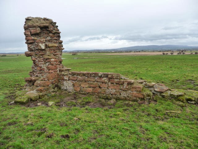
Cockersand Abbey is mostly a ruin, although the Chapter House still stands, the rest of the Abbey having fallen into wreck and ruin after the dissolution of the monasteries in the 16th century.  It's a pretty bleak location in winter and, with the howling wind and the onset of rain, it felt desolate, as we slid our way past through a muddy field.

The Chapter House of Cockersand Abbey

Cockersand Abbey ruins


Cockersand Abbey to Glasson Dock (2 miles/3.2 kilometres)

I got a bit fixated by Plover Scar lighthouse, which is not far from the shore and marks the point where the River Lune meets the Irish Sea.  We could also see the grim outline of Heysham Nuclear Power station on the far side of the Lune estuary.  This walk reminded me a bit of another coastal walk we did three years ago in Rochester, Kent. From Plover Scar it's a short walk to Crook Farm, where we left the coast, turning inland along a muddy trail that eventually took us to the small riverside port of Glasson Dock.

Plover Scar lighthouse

Crook Farm

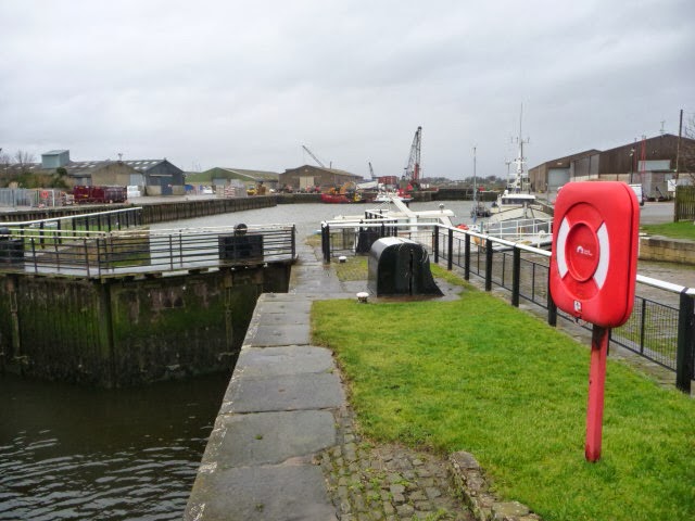
Glasson Dock


Glasson Dock to Aldcliffe Marsh (3.2 miles/5.2 kilometres)

We took a brief respite at Glasson Dock, sheltering behind the wall of the bowling green, as we nibbled on chocolate and listened to the wind whistling up the Lune estuary.  From Glasson Dock to Aldcliffe Marsh it was a very easy and unremarkable walk along a disused railway line which used to link Glasson Dock with Lancaster and was run by the London and North Western Railway company.  The remnants of the railway line are still visible.  You can tell where the former platforms used to stand and you can almost hear the whisperings of past trains trundling alongside the river. 

Disused railway line near Glasson Dock


You can't quite see the Gothic buildings of Ashton Hall from the path, but you can see the golf course, which is managed by Lancaster Golf Club.  After Ashton Hall the path passes under a line of electrical pylons, which run straight out of the nuclear facility.  It was an eerie place and the wind caused a booming sound, as it thrashed its way through the steel framework of the transmission towers. 

Transmission Towers from Heysham Banks

Aldcliffe Marsh to Freeman's Wood (0.9 miles/1.4 kilometres)

At the beginning of Aldcliffe Marsh, the coastal path turns left down through the marsh, but this path was flooded, so we continued to follow the disused railway line, along a ridge of higher ground to an industrial estate, just past Freeman's wood.

BAM on the railway path near Aldcliffe Marsh


We see a lot of curious things during our Chester walks, but the graffiti along the edge of Freeman's Wood was very curious indeed.  According to the campaign website Friends of Freeman's Wood this woodland areas belongs to the common people of Lancaster and should remain a place where the public can enjoy the outdoors and should not be concreted over or sold off to private developers, as is currently planned.  The struggle for Freeman's Wood is a very local one, but interesting and you can read a good summary of the issues on this blog post

Protest graffiti in Freeman's Wood

Sign with protest rhyme

What struck us most was the rather haunting sign quoting the words of a 17th-century protest rhyme:

They hang the man and flog the woman,
That steals the goose from off the common,
But let the greater villain loose,
That steals the common from the goose


English people are, quite rightly, proud of their common land and rights of way - conflict with private developers is centuries old and it's interesting to see this still being played out in the 21st century. 

Freeman's Wood to Lancaster Castle (1 mile/1.7 kilometres)

The industrial estate is mostly on the site of the abandoned Williamson's Factory - a major producer of linoleum in the late 19th century.  Lancashire was famous for its cotton mills and, I guess, linoleum was an offshoot of textile manufacturing.  Nowadays, this part of the city is full of new housing developments - these were partly constructed when we were there, but I'm pretty sure they will be completed and occupied by new house owners pretty soon.

Long Marsh Lane
From the river, it's an uphill climb along Long Marsh Lane to Lancaster Castle.  The castle was an impressive place to end our walk.  It was built on the site of a Roman fort and the Roman connection, along with the River Lune is what gives Lancaster its name, ie. 'Roman fort on the Lune'.  The castle has a rather grim history and was the scene of the 17th century Pendle witches trial, as well as many a sentence of 'transportation' in the 19th century, to the penal colonies in Australia.  The castle was a functioning prison until 2011 - it's now being redeveloped for tourism, which seem more in keeping with 21st century expectations!

View of Lancaster from the castle

Lancaster castle


We finished our walk with a hearty meal in The Water Witch - an award-winning pub on the Lancaster canal side - before jumping on the train back to London.

Access for wheelchair users:

Disused railway paths are usually good for wheelchairing
Large parts of this walk would be accessible to wheelchair users, namely the paths around Patty's Farm and Bank End, as well as the railway path from Glasson Dock to Lancaster.  The coastal path from Bank End to Crook Farm wasn't very accessible and I seem to remember some gates along this stretch of the coast.


Image credits:

All photos were taken by me - please feel free to reuse them, under the Creative Commons license, with Attribution/Share Alike

Saturday, January 11, 2014

Rochester, Northumberland - Reivers, New Year and Astrotourism

Rochester, Northumberland is the second 'Rochester' we've visited during our series of Chester walks, the other being Rochester in Kent, on the River Medway.  It was also our third visit to the North East of England, as we've previously been to Chesterwood and Rudchester - both of which are alongside Hadrian's wall. 

Lodgings and victuals

Rochester in Northumberland was pretty much the last outpost for the Romans in England and, being so far away from London, we found it impossible to do this trip in a single weekend. 

So, this walk was quite special, in the sense that we combined it with our New Year celebrations and stayed three nights in a gorgeous little cottage called Petty Knowes, which is owned by Gordon and Joanne Moore, who also own the village shop in Otterburn, The Border Reiver.  I'd heard about Border Reivers before this walk - the 15th and 16th century 'highwaymen' who owed no allegiance to either the English or Scottish crowns and terrorised both sides of the border.  

Petty Knowes farmhouse and cottage in Rochester
We'd highly recommend staying with Gordon and Joanne - not only are they incredibly welcoming, but theirs is a very interesting story, having ditched highly-paid jobs and city lives, they moved to the rural Northumberland around twelve years ago and have really made a success of their businesses.  Gordon is somewhat of a Roman history enthusiast and Joanne gave us a lot of useful information about access to the surrounding countryside. 

BAM and BRH

In a departure from tradition and because it was New Year, we had a special guest on our Chester walk this time - not just myself and BAM (Best Aussie Mate), but also BRH (Best Russian Husband), my long-suffering and patient partner who has closely followed our previous walks (online/virtually) and been incredibly supportive of our challenge to visit all of the Chesters. 

Petty Knowes cottage to Stewartshiels Plantation (1.4 miles/2.3 kilometres)

Joanne told us about the origin of the name 'Petty Knowes' which is connected to the small mounds/knolls or knowes near the cottage, which are believed to cover a Roman graveyard.  The cottage is situated very close to the remains of Dere Street, the road that led from York to the Antonine Wall near (what is now) Edinburgh. 

Northumberland countryside


Rochester was known as Bremenium in Roman times, a name connected to the local stream.  As we made our way along the small lane leading to Hillock, we passed through what would have been the original fort, but is now a farmyard, still visible in the landscape.  What's interesting is that many of the local buildings, including the cottage we stayed in, most likely contain stone that was originally part of the Roman fort.  It's amazing to see how the fort has been 'recycled' into the modern buildings. 

Signpost for Bremenium

Before reaching Hillock, there is a sign that points out a path running uphill, towards the distant trees of Stewartshiels Plantation.  This whole area is part of the Northumberland National Park, one of England's least populated areas and a place that very few people have been lucky enough to visit.  The Park was just recently awarded 'Dark Sky' status and is set to becoming Britain's leading 'hotspot' for astrotourism.  Unfortunately, being quite stormy around New Year, it was bitterly cold outside and the sky was too cloudy for us to engage in any nocturnal star-gazing!

BAM and BRH walking towards the plantation


Stewartshiels Plantation to Dudless Road (2 miles/3.2 kilometres)

We're not quite sure about the exact distance we covered in Stewartshiels plantation.  It's difficult to orientate yourself in a forest and we somehow ended up wandering around a bit and coming out onto the Dudless Road, about half a mile from where we'd intended to be! 

It was at the plantation that we saw our first signs of military activity, due to the proximity of the Otterburn Training Area, the UK's largest firing range and one of Europe's most important military training areas.  I still find it fascinating that so many of the 'chesters', which were identified as strategic areas by the Roman military are still somehow connected to the military in the 21st century. 

It's always a bit nerve-racking walking in or near MOD (Ministry of Defence) property, but it's something we've had to get used to, since our first 'chester' walk (Ancaster) in 2010.  Luckily, being New Year, there weren't any major training activities when we were there, so no red warning flags!

Danger: Military training zone!

Road through the plantation


I've rarely been to a place that is as deathly silent as Stewartshiels plantation - it felt as though we'd fallen into a post-apocalyptic novel and the views along the long plantation roads were beautiful and spooky in equal measure!  Eventually we stumbled out onto a main road again, between Stewartshiels and Tofthouse farms.

Road to Stewartshiels Farm


Dudless Road to Hopehead (2.5 miles/4.1 kilometres)

We've seen a lot on these Chester trips and walked in all kinds of strange places, but I think this was our first time to walk on a runway.  To be honest, we didn't initially realise it was a runway - it merely looked like a rather conveniently smooth short-cut to where we wanted to go.  It was only after consulting the map halfway along that we realised we were standing in the middle of an airstrip!

Walking on the airstrip


From the airstrip we walked uphill along a very empty road that runs along the edge of the Otterburn Training area.  The air was incredibly fresh and chill along the ridge and we had spectacular views of the Redesdale valley in the late afternoon winter light. Apart from grazing sheep and mysterious military-type buildings, this part of the walk was pretty uneventful, until we reached the junction at Hopehead, where we were able to turn downhill, towards Otterburn and the bottom of the valley. 

Rainbow

Hopehead to Hopefoot (1.6 miles/2.5 kilometres)

The Hopefoot road leading downhill came to a 'blind summit' which, I realise must have something to do with visibility for drivers but set us off on a mental tangent trying to imagine a summit for all of the world's most influential blind people, past and present!  The road passes Otterburn camp and leads all the way to a small farmstead at the bottom of the hill, where we then took a public footpath towards the river (Otter Burn). 

Lonely road alongside the Otterburn Training Area

Sign post for Otterburn

BRH walking towards the 'blind summit'

Hopefoot to Otterburn (1.4 miles/2.25 kilometres)

Apparently there are still otters in the Otter Burn, but we didn't see any, as we walked along the riverside footpath. The light began to fade, as we made our way to Otterburn village.  Otterburn is a quiet little village, somewhat dominated by the road to Scotland and the frequent traffic passing through.  Whilst Gordon and Joanne have managed to make the local shop work, it's clear that some of the other local businesses haven't fared so well and Otterburn is in danger of becoming just another commuter town or retirement village, without a real sense of community or an identity of its own.  It's a shame really, as there's something quite special about this remotest corner of England. 

Hopefoot
Otterburn Tower - now a hotel
Access for wheelchair users:

Actually, most of this route is accessible, except the first part which crosses fields to the Stewartshiels plantation.  The roads around the military area are good and were relatively traffic-free when we were there, although it was during the New Year holiday.  An alternative route, which would be wholly accessibly would be to follow the Yatesfield Road from Bennettsfield.  The A68 is much too busy and we wouldn't advise using any part of this road in a wheelchair, as it's dangerous.  The roads around Otterburn seem to be fairly accessible.  

Image credits:

All photos were taken by me - please feel free to reuse them under the following Creative Commons license:

Attribution (especially to this blog post)
Share-alike
Non-commercial 

Sunday, December 22, 2013

Chester - City Walls, the Dukes of Westminster and Christmas shopping!

Mosaic in Chester amphitheatre
When we first started planning these -chester walks, three and a half years ago, both myself and BAM (Best Aussie mate) had our sights set on visiting the 'original' Chester, not far from Liverpool and Manchester, in the north west of England.

I'd only ever been in Chester railway station - not the city itself - many moons ago when, as a student, I use to make the arduous journey by boat and rail, between Dublin and London.  This was in the days before budget airlines and, whilst it seems like an epic journey by 21st century standards, it was quite a common way to do things in the early 1990's.

Chester castle walls
Chester is one of those defining junctions between England, Wales and Ireland, that tourist brochures euphemistically call 'gateways', .  Although comfortably ensconced in the lush, green fields of England, the city still has a whiff of the frontier about it - with it's impressively intact city walls and its refusal to expand too far into the surrounding countryside, as the bigger cities of Lancashire have done. 

Lodging and victuals

We were incredibly lucky in our choice of accommodation in Chester, as we arrived quite late on a Friday evening, battling through the wind and rain to find ourselves at the Albion Inn on Park Street, just inside the city walls.  The innkeepers, Christina and Mike Mercer gave us a really warm welcome, as we dropped our bags in the room, had a drink at the bar and listened to the live music - they even played Waltzing Mathilda to welcome BAM, which was really sweet!

Chester city walls circuit (2 miles/3.2 kilometres)

As it's winter, we planned a shorter walk than usual, so we would have time to explore Chester a little bit and make the most of the limited hours of winter sunshine.  We had quite a late start and a leisurely breakfast, before setting off around the walls, a two-mile circuit around the city centre.  I must admit, I was pleasantly surprised by Chester - I'd heard about the city walls before, but I hadn't expected it to be so quaint.  The city was full of pre-Christmas shoppers, which added an extra buzz to the city's Saturday morning hustle and bustle.

Chester and the River Dee


Chester city walls

Christmas shoppers on Northgate Street


Aldford to the Iron Bridge (0.4 miles/0.6 kilometres)

We had a few different options for our Chester walk, including a path starting in Wales, which was tempting but, in the end, we decided to follow the path closest to Chester's Roman heritage - near the remains of Watling street, along the River Dee from Aldford to Chester.


This path is part of the Marches way, a 218-mile path through the Welsh 'marches', all the way from Chester to Cardiff.  It's hard to imagine Roman soldiers marching along in this, rather quiet, corner of West Cheshire!

Trees on Blobb Hill, Aldford

Christina Mercer, the landlady of the Albion Inn, very kindly offered us a lift to the start of our walk at St John's Church in Aldford.  Not only did she save us a lot of time, but she also personalised the whole experience by telling us about her father, who trained horses and worked for the Duke of Westminster at the nearby Grosvenor estate. 

From the village it's a short walk across Blobb Hill to reach the River Dee, which you can cross by way of Telford's Iron bridge.  We've come across Telford before, as he was an important engineer in the West Midlands and designed the main road linking London and Dublin, via Holyhead.  He also designed bridges and canals and you can read more about him in my blog post on Wroxeter, Shropshire.  There was a lot about this walk that reminded us of Shropshire and Shrewsbury.

The River Dee gets it's name from the Latin for Chester, Deva Victrix which means something like 'Victorious Goddess' - it flows all the way from Snowdonia to the Irish Sea at Liverpool bay.

Aldford Iron Bridge

Iron Bridge Lodge

Alford Iron Bridge to Eaton Stud (1 mile/1.6 kilometres)

These days, the path along the River Dee is a rather peaceful one - road, rail, the 21st century are all quite far away and we found ourselves getting lost in the splendour of the natural colours and a discussion on the Impressionist painters of the 19th century.  I've been to the Rijksmuseum in Amsterdam recently and I was surprised to find out that the invention of the 'paint tube' in the 1840's meant that artists could leave the studio more and paint en plein air.  This revolutionised art in the 19th century and enabled the Impressionists to create their masterpieces of speckled sunshine and mottled light.

The mid-winter light on the River Dee was certainly very inspiring and we were lucky to have great weather for walking - cold and sunny, as we made our way around the edge of the Grosvenor estate.


River Dee at Aldford Bridge

Suitably impressed by nature

Glimpse of the Grosvenor estate


Eaton stud to Eccleston (0.7 miles/1.2 kilometres)

We couldn't see much of Eaton Hall or the Duke of Westminster's estate, as we were passing by, until we came to the village of Eccleston, which lies on the estate grounds and has a really beautiful church, St. Mary's, where members of the Grosvenor family are traditionally buried.

The current Duke of Westminster, Gerald Cavendish Grosvenor, was born in Omagh, Country Tyrone, where my Mum used to live.  He spent most of his early childhood in County Fermanagh, Northern Ireland and he's the sixth person to hold the title Duke of Westminster.

View of Eccleston village, Cheshire

Gerald frequently appears in the top ten of the Sunday Times Rich list and has a fortune estimated at around £8 billion.  Ironically, he's one of the few British-born rich people on the UK's 'rich list' - the majority of the UK's top ten richest people are Russian/Indian/Uzbek oligarchs!

BAM walking to St Mary's Church, Eccleston

Grosvenor is a Norman name and comes from the French for 'big hunter', le gros veneur.  The Grosvenor family also own property in Mayfair - which is where Grosvenor Square, site of the US embassy in London, get its name.  I guess, in some esoteric way, the Grosvenor family have always managed the relationship between England and her neighbours to the west!

Generations of Grosvenors are buried at St Mary's Church in Eccleston

Eccleston to Heronbridge (1 mile/1.6 kilometres)

It's another uneventful mile from Eccleston to Heronbridge, which is on the boundary of Chester's Roman settlement.  The walking path passes under the A55, also known as 'the North Wales expressway' - a major road linking Chester to Holyhead (and onwards to Ireland).

Interesting rock walls near Heronbridge

Heronbridge to Chester (2 miles/3.2 kilometres)

From Heronbridge, the path follows a loop in the River Dee around Queen's Park and into the city of Chester.  There doesn't seem to be too much on the left-bank of the River Dee, so we concentrated on the ornate buildings on the other side of the river, in Boughton, Chester's eastern suburb.

View of Boughton from Queen's Park, Chester


We finished our walk by crossing the pedestrian bridge, which leads to the site of the Roman amphitheatre.  We were both very impressed with Chester and would like to go back again, to explore the city a little bit more.

Queen's Park pedestrian bridge in Chester
 Access for wheelchair users:

Path along muddy river bank

The path from Aldford to Heronbridge is along the riverside and completely inaccessible.  For wheelchair users, I would recommend Chester itself, as the city is small and easy to get around - some parts of the city walls seemed to be more-or-less accessible.  

Also, Queen's Park, which occupies a bend in the River Dee, had accessible paths, although one end was closed off by a gate when we were there.  
 
Image credits:

All photos were taken by me - please feel free to reuse them under the following Creative Commons license:

Attribution (especially to this blog post)
Share-alike
Non-commercial