Sunday, November 9, 2014

Tadcaster and Acaster Malbis - Brigands, Brewing and Bishops

This was our second foray into Yorkshire, having previously walked from Fishlake to Doncaster in April 2013.  When people think of walking in Yorkshire, they mostly think of the Dales or the North York moors - scrambling over mountain passes and descending spectacular valleys.  But both the Doncaster walk and our walk from Tadcaster to York, via Acaster Malbis were through a very flat and relatively mundane landscape.

There's a very good reason for that - i.e. we're walking the chesters of Britain and these mark Roman settlements.  The Romans, quite wisely, built their settlements in the lowlands and on Britain's major rivers, so they had no interest in the more mountainous areas, which were inhabited by unruly Celts and brigands!

View of York from the city walls
In the early days, the Celtic Brigantes tribe ruled most of (what is now) northern England.  When the Romans arrived on the scene and conquered the southern half of Britain, the Brigantes managed to retain their autonomy as a kind of client state of Rome, under the direction of the Celtic queen Cartimandua and her husband Venutius.  When Cartimandua ran off with one of Venutius' soldiers, it plunged the Celtic kingdom into civil war, which the Romans exploited, eventually establishing their rule in the north of England.

York (Eboracum) became the capital of the Roman province of Britannia Inferior (north of England) and London (Londinium) became the capital of Britannia Superior (the south of England and Wales). Tadcaster, where we started our walk, is about 10 miles from York and it was apt to finish our walk in York as it was such an important Roman settlement.  There are other 'chesters' in Yorkshire that are hidden to the modern age, as their names have changed or dropped the chester/caster prefix.

Lodging and victuals

The differences between the north and south of England are still evident today and it really felt as though we were setting off on a big adventure to a far-off land, as we boarded the Edinburgh-bound train at King's Cross and went hurtling north through the East Midlands and past the Humber estuary.  We travelled in the afternoon, so it was still light when we reached York and caught the 843 bus from York railway station to Tadcaster along the busy A64 road, which still follows the course of an old Roman road, which linked Chester and York.

The Ark in Tadcaster

Tadcaster is an unassuming little town and I'd imagine it's always lived in the shadow of York.  The Romans called it Calcaria because of the local lime deposits. The quality of the local water, which is rich in lime sulphates, led to Tadcaster becoming one of Britain's most important brewing centres. Tadcaster's brewing industry is still very much a presence, with John Smith's brewery dominating the town centre.

John Smith brewery in the centre of Tadcaster

There isn't a lot of accommodation in Tadcaster, but BAM (Best Aussie Mate) managed to secure a room for us in a residential hotel in Kirkgate, a few doors down from a historical tudor-style building called 'The Ark'.  We had a great dinner in Tadcaster, at a cafe/bistro called The Granary which is on the main street.

Tadcaster to Colton Lane (3.6 miles/5.8 kilometres)

The weather was crisp and bright, as we set out from St Mary's Church in Tadcaster and followed the main road out of town, across the River Wharfe and along the old Roman road, which eventually joins the A64, about a mile out of town.  At the first opportunity we turned left down a laneway which leads to the village of Catterton, then followed signs to the right, which brought us along The Old Street, route of the original Roman road, which follows a steep ditch, through some woodland and along the bottom of Catterton Moor.  This is also part of the Ebor Way, a 70-mile footpath which crosses Yorkshire.

St Mary's Tadcaster

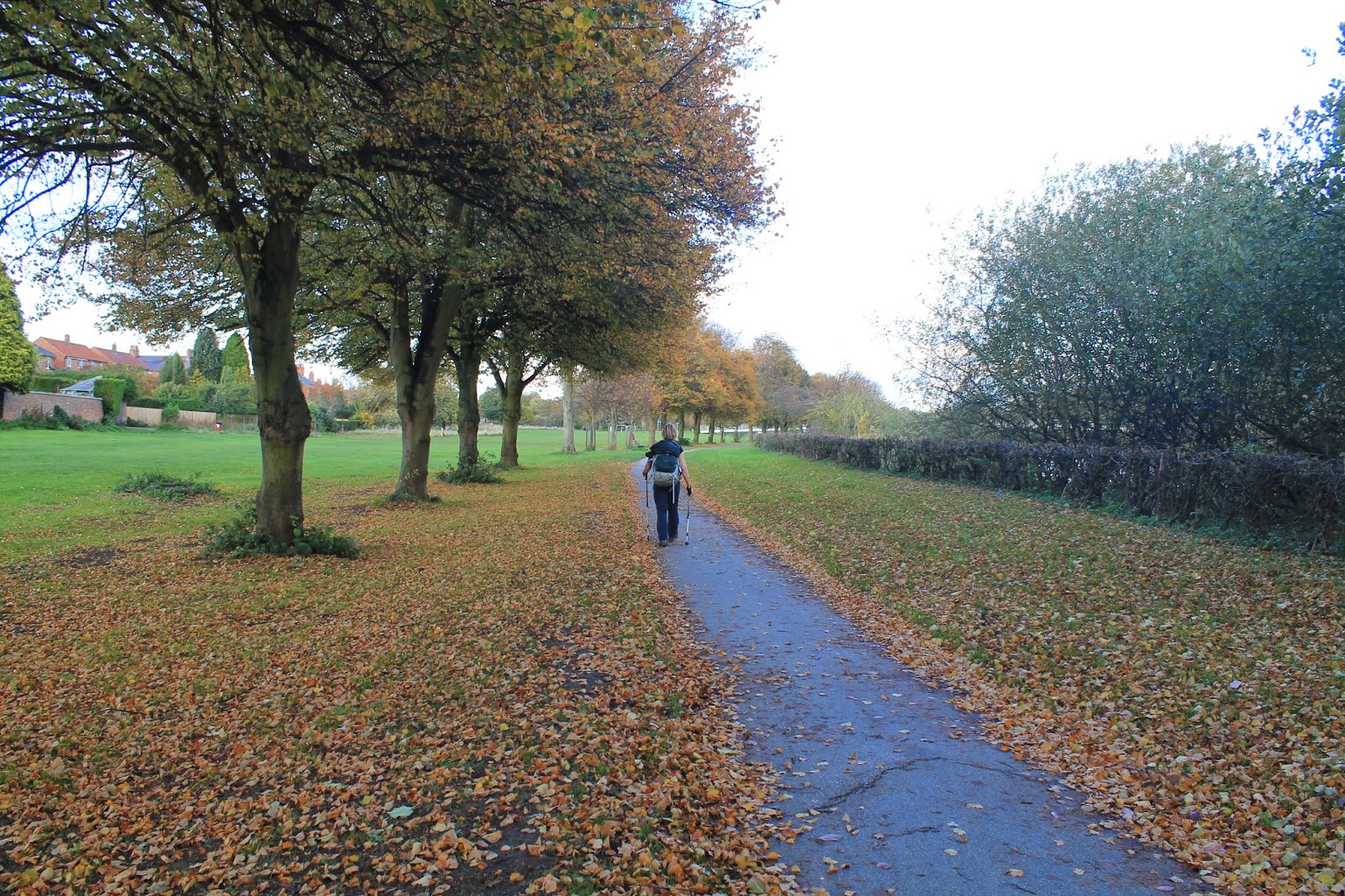
The autumnal colours on this walk were really fantastic, although I'm still recovering from a recent trip to Canada, where the vivid reds, oranges and yellows of the maple leaves have dazzled me and left me less impressed by the slightly understated tones of the English countryside in October.

Old Street ditch

Catterton Moor

Sign post for the Ebor Way

Rather typically of Roman roads, the Old Street was long and straight, pointing like an arrow towards the Vale of York and the ultimate objective of our walk.  After a couple of miles, we hit the A64 again, still busily trundling on in its never-ending journey to York, presenting us with fast food restaurants and hotel chains, as we negotiated the pedestrian by-pass near Colton lane, so we could rejoin the Roman road and make our way towards Copmanthorpe.

Fast food restaurants

The busy A64

Ironically, the by-pass over the A64 provided our highest 'viewpoint' of the day and we could see the power stations near Snaith in the distance and it was interesting to realise that our last Yorkshire walk had been on the far side of the power stations in an equally flat and industrial landscape!

Distant power station

Colton Lane to Copmanthorpe (1.75 miles/2.8 kilometres)

I've recently discovered an app for iPhone, which helps you identify wild flowers.  As myself and BAM are constantly coming across all kinds of wild flowers on our walks, we're interested in learning the names of these flowers/plants and what they can be used for (particularly the edible ones!).  At Colton Lane we came across some trifolium pratense a.k.a. red clover.

Red clover is the national flower of Denmark, which is interesting, as York/Jorvik was such an important Viking settlement.  Perhaps the clover we spotted on the side of road originally came from Scandinavia!

Red clover

From Colton Lane we followed the Ebor Way along the edge of some fields and then out onto a rather attractive country road, which connects Colton to Copmanthorpe.  We noticed a lot of cyclists on this walk and also posters advertising cycling events.  The first two stages of the 2014 Tour de France took place in Yorkshire back in July and it seems to have inspired a local resurgence of interest in cycling.

BAM on the Ebor Way

Country road to Colton

We had a chocolate break at Copmanthorpe, a quirky little village which was in the thralls of its first beer festival, the amusingly named Coptoberfest.  Thorpe is a Middle English word for 'village' and is common in place names in the north of England. Copmanthorpe means something like 'Trader's village' and it definitely had a lot more character than your average commuter village.

Poster advertising the Coptoberfest

Copmanthorpe to Acaster Malbis (2.2 miles/3.6 kilometres)

We left the Ebor Way at Copmanthorpe, as we wanted to detour via Acaster Malbis and cover two 'chesters' in one go.  Turning off the Main Street into Station Road, we soon crossed the East Coast railway line and came to Temple Lane, a rather long and eerie lane that connects Copmanthorpe and Acaster Malbis.  The lane is named after land granted to the Knights Templar, who led the medieval Crusades to the 'Holy Land'.  I'm currently blogging about Palestine, so this was a rather arcane connection to my other blog, Learning about the World.  

Sign post for Acaster Malbis

Acaster Malbis was most likely the site of a Roman military camp, no doubt protecting York from marauding native tribes.  It's got an air of abandonment about it these days and there was a stillness around the village 'centre' which we found lulling, but also somewhat spooky! Although it's situated on the River Ouse, one of Yorkshire's main rivers and, no doubt, a great thoroughfare in bygone days, Acaster Malbis is now very much cut off from the outside world and feels like the end of the road.

Acaster Malbis

When I bought the map for this walk we noticed that there is another Acaster in this area - Acaster Selby - but it was too far to walk in one day, so no doubt we'll be back in that part of the world at a future date!

Acaster Malbis to Bishopthorpe (1.9 miles/3.2 kilometres)

It was a pleasant walk along the River Ouse to Acaster Bridge, where we picked up a branch of the Trans-Pennine trail, a coast-to-coast long-distance footpath from Southport on the Irish Sea to Hornsea on the North Sea.  This is a fairly accessible route, which revitalises disused railway lines and we walked part of the Trans-Pennine trail when we did our Doncaster walk last year.

We only did about half a mile on this route to Bishopthorpe, but there was a lot to see in that short space, including an installation about the planets and a Halloween festival at the Brunswick Organic nursery.

Planets installation on the Trans-Pennine trail

We were really inspired by the Brunswick nursery, which is a charity that employs young people with learning disabilities.  The young people grow organic vegetables, run a canteen and produce all kinds of beautiful art work and handicrafts.  I left with a bag full of organic produce and Christmas cards!

Disabled scarecrow at Brunswick organic nursery

We left the Trans-Pennine trail at Bishopthorpe and made our way through some suburbia, then down the main street and past the Bishop's palace.  The current Archbishop of York is John Sentamu, who was born in Uganda and is, I think, the second-most important figure in the Church of England, the first being the Archbishop of Canterbury (again the North/South divide set up by the Romans!)

In olden times, the Archbishop of York would have sailed down the river to York Minster to conduct prayer services, otherwise retreating to the serenity of Bishopthorpe which sits at a respectable distance from the city.

The Bishop's Palace in Bishopthorpe

Bishopthorpe to York Minster (3.7 miles/6 kilometres)

We were back on the Ebor Way again at Bishopthorpe, although we missed a rather hidden turn and spent a bit of time wandering around the local Crematorium, before we got back on track and made our way towards the River Ouse.  

Walking around the Crematorium turned our thoughts towards will-making, as both myself and BAM have got to make wills soon and, as per usual, BAM is more organised than me and has done a lot of research on will-making and the best way to proceed.

With thoughts of our own mortality at the front of our minds, we passed under the A64 and wandered through the distinctly earthly delights of the Middlethorpe Ings, with a view of the imposing Rowntree Factory in the distance.  Ings are water meadows and I'm pretty sure that they're prone to flooding.  The Middlethorpe Ings are at a lovely bend in the River Ouse, just before it enters the city of York.

Under the A64

Path through Middlethorpe Ings

BAM walking towards York

The Rowntree chocolate works

As we passed the suburb of Nunthorpe and the York Millennium bridge, the sun came out and the late afternoon strollers, shoppers and tourists gave York a jaunty feel, as we enjoyed our last evening stroll of this year's summer time, before the clocks were put back later that night.

Rowers on the River Ouse

Nunthorpe, outskirts of York

I've been in York a few times before, but it's always such a pleasure to visit again and York Minster was a rather grand place to finish our Tadcaster/Acaster Malbis walk!

Busy riverside in York

St Wilfred's Catholic Church in York

View of York Minster from Duncombe Place

Access for wheelchair users:

Trans-Pennine Way seems fairly accessible
Unfortunately, much of the walk, as described above, wouldn't be particularly accessible to wheelchair users and it would certainly be difficult to follow this walk without interruptions.

The parts that were accessible included the Roman road from Tadcaster if you continued to Catterton, rather than turning off through the fields.  Also the country road from Colton to Copmanthorpe was accessible and seemed relatively free of traffic. Likewise, a walk from Copmanthorpe to Acaster Malbis would be accessible.  The Trans-Pennine trail is wonderful for wheelchair users and should be pretty easy to access - in fact you could follow it all the way from Bishopthorpe to York.  The riverside walking described above wasn't at all accessible, however, there are plenty of walks in and around York which would be satisfying for wheelchair users.  

Image credits:

All photos were taken by me - please feel free to reuse them under the following Creative Commons license:

Attribution (especially to this blog post)
Share-alike
Non-commercial 

Saturday, August 30, 2014

Uttoxeter and Rocester - Thrill-seekers, Tractors and being trampled by cows

This was our first walk in Staffordshire and we did something quite clever this time round, which was to arrive in Uttoxeter in the late afternoon on the Friday, so we could explore the local area a little bit and do a 'pre-amble' around Uttoxeter on the evening before our official 'chester' walk.

It was also a double whammy, as our walk took into two -chesters this time, instead of one.  Out of the two -chesters, it's actually Rocester which has most of the Roman heritage, however, in the 21st century Uttoxeter is the bigger Staffordshire -chester, with more amenities and a railway station.

Lodgings and Victuals

Uttoxeter and Rocester are a bit unusual in the sense that neither seem to lie on the path of any of Britain's major Roman roads.  The closest Roman road, the Icknield Way, is now the A38, which links Lichfield to Derby and passes (in a typically straight line) a few miles south-east of Uttoxeter.  We stayed in a nice BnB called Lanes Guest House, which is on the Derby Road, in a small residential area called St Catherine's Close.

Welcome to Uttoxeter sign

We found a nice pub-eatery called Dapple Grey, where we ate on both evenings and which does a mean oven-baked pizza.  I'd recommend it, if you happen to be in Uttoxeter for any reason!

Horse-racing and the Caravan club

Uttoxeter feels a little bit like it's slowly slipping into the more urban realities of the West Midlands, with nearby cities like Burton, Stoke and Lichfield, only a few miles down the road.  Nevertheless, it's managed to maintain a small town feel and the urban sprawl hasn't yet conquered this island of country life.

Uttoxeter Market Place
One of things Uttoxeter is most famous for is its race course, which hosts the Midlands Grand National in March every year.  Again, it's not the biggest racecourse in the country and its small-town status adds to Uttoxeter's air of modest occupation.

Entrance to Uttoxeter Race course
It's funny that we also walked past a racecourse in Stratford-upon-Avon, on our last Chester walk and we've realised that racecourses, when they're not in use, often double up as camping/caravanning sites.  Uttoxeter Racecourse also has camping facilities and it made us think that we might want to pitch a tent in a racecourse site, sometime in the future!

Pre-amble

For our Uttoxeter pre-amble, we walked past the race course and up Wood Lane to Toothill Road, which runs along a small ridge to the south-east of the town.  It was a nice walk, very quiet and atmospheric, as it had just rained.  From Toothill Road we got a view back towards Uttoxeter, which looked a bit sullen in the distant damp evening.

View of Uttoxeter from Toothill Road
It was in Uttoxeter that we first spotted the Staffordshire county symbol, the Stafford knot, a bloody reminder of Stafford's proximity to the rebellious Celtic folk of Wales!  To be honest, we thought it was a pretzel, rather than a hangman's noose, so we spent some time trying to conjure up a logical Uttoxeter-German connection.

The Staffordshire pretzel
The 32A to Oakamoor

We decided to start our walk in a village called Oakamoor, a respectable distance from Uttoxeter, and to work our way back to the town, so we could pass Rocester and still make it in time for our train back to London.  To get there we caught the 32A bus on Bradley Street and it was all very pleasant until 5 minutes later when we pulled in Uttoxeter Railway station and the bus was invaded with crowds of people headed for Alton Towers.

Detail on St Mary the Virgin Church
I don't begrudge people their day out of the city and, in fact, myself and BAM (Best Aussie Mate) are great believers in the need to get away from the maelstrom of urban life.  But to go to Alton Towers for the day!  With screaming kids and grumpy adults?  I couldn't think of anything worse.  The forty minutes or so that it took to get to Alton Towers on the bus was more time that I ever wish to spend with screaming kids and grumpy adults!

Countryside around Sedsall
It got us thinking about leisure, thrill-seeking and the mechanisation of modern life. The fact that people from Birmingham, Stoke and Wolverhampton would get their kids out of bed at the crack of dawn, drag them into the countryside on trains and buses, only to end up in another man-made environment, completely baffles me. Why not just bring them to the country and let them loose?  There are way more interesting things for kids to do running around in the forest or in the open-air, than standing in queues and fighting over ice-cream. 

A flower we spotted along the way
The only explanation can be the thrill of going on the rides and it begs that question as to why do we need that?  What is it about modern culture that demands more of everything and faster?  Is it because 'thrill' is a commodity and it's being constantly sold to us (and our kids) by clever advertisers?

It's a shame that people will spend around £160 for a day admission ticket to Alton Towers (2 adults + 2 kids) when the countryside is sitting there completely free of charge.  I can't help feeling that the kids would not only enjoy a day in the country more (fresh air, no queues, interesting plants and insects), but they would also be more likely to grow into adults who respect the countryside, as a result of spending time in a more natural environment.

Abandoned railway platform near Oakamoor
As the practically empty bus pulled out of Alton Towers, we breathed a joint sigh of relief and watched on in despair, as a group of kids with sticks bashed the bejaysus out of an inoffensive-looking bush near the ticket office.  

Oakamoor to Alton (1.7 miles/2.7 kilometres)

Oakamoor is a very pretty little village and it seems like it would be a nice place to spend a quiet weekend. We hopped off the bus at the Star Bank stop, then crossed the bridge to pick up a cycle path which runs along the route of a disused railway line.  The path follows the River Churnet through a very tranquil corner of Staffordshire, far away from the roaring of the Ripsaw and the screaming of the Sonic spinball!

Old railway building near Oakamoor
As we walked along we couldn't help but notice the posters proclaiming The Battle of the Balsam 2014.  First introduced to Britain in the 19th century, Himalayan Balsam has become an invasive plant which is now choking up many of Britain's waterways and blocking out light for native plants.


We've seen balsam a few times on our walks, but the prevalence of this plant along the River Churnet was worse than anything I've seen previously.  I thought about the kids at Alton Towers who'd been attacking a harmless bush with sticks and how their destructive skills might be put to good use along this stretch of the river!

The invasive Himalayan Balsam
We'd meant to cross the Churnet at Lord's bridge and pick up the Staffordshire way into Alton, but we missed our crossing and kept following the seductively linear railway track, until we found ourselves at Alton's former railway station, a building now owned by the Landmark Trust, who let it out to holiday-makers.  The reason we know all of this is because we stopped to chat to the resident holiday-makers, a lovely family who seemed to be enjoying their stay in this historic building.

Alton Station building, now owned by the Landmark Trust
Alton to Denstone (2.4 miles/3.9 kilometres)

We got a bit distracted at Alton station by three people walking with Llamas along the railway path.  What beautiful animals Llamas are - it's the first time I've seen them up-close (not behind a glass screen or iron bars).  It turns out that we'd met a Llama trek organised by Llama Adventures, a small company based in the West Midlands.  What a lovely way to spend the day and both the trekkers and their guide seemed to be having a lot of fun with the Llamas!

Walking with Llamas
As a result of this distraction, we completely missed Alton, although it looked like a pretty village when we passed through it on the bus.  The cycle path seduced us away from the path we'd originally intended to take and, before we knew it, we were already at the back of the churchyard in Denstone, a couple of miles past the bridge at Alton.

Denstone churchyard
Denstone to Rocester (1.5 miles/2.5 kilometres)

At Denstone, we crossed the Churnet again to a small hamlet called Quixhill.  From there, we struck out across the fields towards Rocester, our second -chester of the day.

Path to Rocester
Richard Arkwright, one of the world's first industrialists, chose Rocester as the location for one of his cotton mills, using water from the River Dove, to power the production of cotton at a mill on the river.  Although he was originally from Preston in Lancashire, Arkwright founded some of the world's first industrialised factories in Nottinghamshire and Derbyshire.

JCB Academy and former cotton mill, Rocester
The Rocester mill building has now been converted into the JCB academy and Rocester is, in fact, the headquarters for JCB, one of the world's biggest manufacturers of agricultural machinery and construction equipment.  We could see the HQ buildings as we walked into Rocester but, unfortunately, we didn't have time to pay a visit, although I'm sure the JCB plant has a fascinating history behind it.

JCB mural at Uttoxeter railway station
Rocester to Doveridge (3.2 miles/5.2 kilometres)

From Rocester to Doveridge we followed the Staffordshire Way, a long-distance path which runs for 92 miles from Mow Cop castle in Cheshire to Kinver Edge on the Staffs/Worcestershire border.  It's quite a challenging path and not that well sign-posted, so we ended up diverting to a smaller footpath near Sedsall which was overgrown with nettles and certainly exercised our rambling and orientation skills!

Staffordshire Way signpost
Having regained the correct path at Eaton Dovedale, our next challenge was to walk through the Doveridge Clay Pigeon shooting facilities at Eaton Hall farm.  It's quite frightening when you're approaching a shooting facility on foot and you don't know that that's what it is!  It wouldn't be the first time we've had to deal with gunfire on our -chester walks and I particularly remember the diversion we had to make in Chesteron in Shropshire, during the fowl-shooting season.

Red flag at Doveridge
Once we got to the farm and realised that the shooting was all controlled and not necessarily directed towards us, the walk became a lot more normal again, although we didn't hang around, as we followed a lane uphill, out of the farm and in the direction of Doveridge village.

Doveridge to Uttoxeter (1.7 miles/2.7 kilometres)

In our haste to escape the sound of shooting, we missed a turn-off, which would have taken us to Uttoxeter via Sidford Wood - instead we continued along the lane towards Doveridge, until we realised our mistake.

Trying to make up for lost ground, we decided to follow another public footpath through a field with cows in it.  I hate walking through fields of cows at the best of times, but at the end of the day, when you're in a hurry to get to the station and you've just been subject to gunfire, dealing with a field full of cows isn't really my idea of fun!

Doveridge Clay Pigeon shooting facility
Regular readers of this blog will remember the 'fun' experience we had with cows in Portchester in 2010 - both my sheer terror at being stuck in a pen with the 'beasts' and BAM's cool resolve to get us through the farm unscathed!  I've been a bit traumatised by cows ever since then so, as we got to the bottom of the field near Doveridge, with the cows running downhill after us and no exit in sight, I was beginning to think Alton Towers might have been a more sensible option for an unintentional thrill-seeker like myself!

Statue of a cow in Uttoxeter
Despite BAM's assurances that cows are harmless, docile beasts - I remain convinced that they are dangerous aggressors and being trampled to death by cows is a much more common fate for walkers than people realise.  Having got much closer to a herd of charging cows than I ever want to be again, I've realised several things:

1. If you run, cows will run after you
2. Cows are big and aggressive, especially when there's a whole herd of them
3. If you turn and chase them, cows will generally run away
4. I don't want to be chased by cows again . . . ever!

Our only option was to beat a hasty retreat, so we scaled a gate into another part of the field, where the cows couldn't see us and made our way dejectedly back to the safety of the lane.

It wasn't a massive detour via Doveridge to Uttoxeter and the rest of the walk was relatively uneventful.  We celebrated our cow-chasing experience with a couple of nice steaks at the Dapple Grey, before jumping on the train and heading back to the cow-free environs of London.

Rain clouds over Uttoxeter
Access for Wheelchair users


Disused railway line at Lord's Bridge
The first part of this walk from Oakamoor to Denstone along the former railway line was completely accessible and I would recommend this part of the walk to users.  The rest of the walk was relatively inaccessible, apart from the country lanes around Rocester and Doveridge.

We wouldn't recommend that wheelchair users engage in any cow chasing, but walking with the Llamas could be a lot of fun!

Image credits:  

All photos were taken by me - please feel free to reuse them under the following Creative Commons license:

Attribution (especially to this blog post)
Share-alike

Non-commercial

Monday, June 23, 2014

Alcester - Hairdos, D-Day and One Direction

I'd never been to Warwickshire before this series of walks brought us to Alcester (pronounced Alster), a pretty little town on the River Arrow, about 7 miles west of Stratford-upon-Avon.  As I'd also never been to Stratford-upon-Avon before, I thought it would be a good opportunity to explore Shakespeare's birthplace and be a proper tourist for once, strolling around eating ice-cream and taking photographs.

It was a glorious sunny morning, when myself and BAM (Best Aussie Mate) set off from Marylebone Station in London, taking the wonderfully quaint Chiltern railways train to Stratford-upon-Avon.  We'd been on this railway once before, when we did our walk in Bicester, back in September 2010.

Stratford is, not surprisingly, a really lovely place to spend a few hours.  We went on a very short boat trip on the River Avon, then did a walking tour of the town, which ended at the Holy Trinity Church, where Shakespeare is buried.  If you'd like to see some of the photos I took in Stratford, please feel free to have a look at these on my Flickr account.

Stratford-upon-Avon
Lodgings and Victuals

When possible we try to stay at the 'Chester' we're visiting, so we hopped on the number 26 bus from Stratford and travelled along the old Roman road to Alcester, where we'd booked accommodation at the Roebuck Inn on the Birmingham Road.

Alcester High Street
The Roebuck Inn was pleasant enough and we had a really lovely dinner there, as we caught up on our respective lives and talked about our future travel plans.  The Roebuck doesn't usually serve breakfast until 10am (I guess because it doubles up as the area's local pub), but we managed to convince them to serve us breakfast a bit earlier, so we would have enough time to do our walk.

Poster advertising Alcester 1940's weekend
It was the 70th anniversary of the D-Day landings, so Alcester's 1940's weekend was in full swing.  It was quite interesting seeing all the flags, banners, posters and Alcestrians dressed in 1940's outfits; we saw men in army uniforms, top hats and tails, women in war-time dresses and even one man wearing an old-fashioned aviator's uniform!  I'm posting a video from YouTube below, to help you get a sense of that 1940's feeling.


I've noticed that war-time hair-styles for women are coming back into fashion in England and I've recently seen quite a few young women with retro 'Victory roll' hairdos.  It's a really interesting fashion and I'm sure it's influenced by all of the World War commemorations that are going on at the minute.

Vintage WW2 poster in Alcester shop window
The Roebuck Inn to Oversley Green (1.4 miles/2.25 kilometres)

We were fated to a slow start to this walk and, as the weather had turned really wet over night, we soon found ourselves taking shelter in the lovely Fat Cat's cafe on Alcester High Street.  Alcester has lots of little shops and is an interesting alternative to the more touristy Stratford.

Sheltering from the rain in Fat Cat's cafe
We waited for the heaviest rain to pass, then ventured out along the High Street, back-tracking down Malt Mill Lane to join the Heart of England way, a 104-mile walking trail through the West Midlands.  It was a short walk along the Stratford Road to Mill Lane and the neighbouring village of Oversley Green.

Rainy morning on Malt Mill Lane
Oversley Green to Broom (3 miles/5 kilometres)

We followed Primrose Lane from Oversley Green, crossing a footbridge over the Alcester Road, then turning right along the edge of a field towards Lower Oversley Lodge.  The countryside in Warwickshire is different than other parts of England.  It's partly Thames valley but with a good deal of Dorset thrown in! We could see the Cotswolds in the distance south, as we followed the track towards Oversley Castle, now a private property.

The Heart of England way
We could also see the impressive, Palladian-style, Ragley Hall, the ancestral home of the Marquis of Hertford, on the far side of the Arrow Valley.  The path soon wound its way downhill again, past Oversley Farm to the village of Wixford.  From Wixford we followed a path along the fields below Crabtree Farm to Broom.

A Heart of England waymarker
Broom to Bidford-on-Avon (1 mile/1.8 kilometres)

Myself and BAM have been to another Broome recently, in Western Australia, but there was no comparison with this sleepy little Warwickshire village!  Crawling through the nettles and hedgerows of Broom, we got a bit lost and followed King's Lane to a dead end (but a very beautiful cottage). We quickly back-tracked and made our way to the Bidford Road.

Cottage in Broom
My abiding memory of the Broom to Bidford path was telling BAM all about my new favourite programme, an American show called My Cat from Hell, which gives interesting insights into cat behaviour and cat psychology!

The rain clouds had moved off to the east by this stage and the sun had come out in full force, making us feel uncomfortable in our rain coats and various layers. Arriving at Bidford, we crossed the bridge, took off some of our layers and had a break on a picnic bench by the River Avon.

Bidford-on-Avon
Bidford-on-Avon to Welford-on-Avon (3 miles/5.75 kilometres)

From Bidford, we crossed a muddy meadow and walked to a small village called Barton.  Passing a caravan-site at Barton, we fantasised about buying several caravans in England and establishing a little 'caravan Empire' that would fund our future walks and travels!

BAM by the River Avon
We'd left the Heart of England way behind at this stage and moved onto the less-established Shakespeare's Avon way, which promised to bring us all the way back to Stratford, along the River Avon.  The first part of this walk, along the relatively busy Welford Road, wasn't so pleasant, but we soon turned off on a small path towards the river and the rest of the walk was a really quiet path through an extremely verdant landscape.

Verdant Warwickshire countryside
The River Avon is around 85 miles in length and comes all the way from Naseby in the Northamptonshire uplands, to Tewkesbury in Gloucestershire, where it meets the River Severn.  The word 'Avon' is from the British/Celtic word for river, so the River Avon, literally means 'the river River'.  This reminded me of the way we mis-name the River Kong in south-east Asia, calling it the 'Mekong', when 'Me-' (or more precisely, mee-nam แม่น้ำ 'mother water') already means river!

The Avon isn't quite the Mekong, although the over-grown riverside flora we had to fight our way through did remind me of the Thai jungle and both myself and BAM were stung by nettles more than once during this part of the walk!

Sheep near Welford-on-Avon
Welford-on-Avon to Stratford-on-Avon (5 miles/8.2 kilometres)

We had a break just outside St Peter's church in Welford, then walked down to the cross roads before following a village path all the way to Weston-on-Avon.  From there we followed the river path again until we came to an old railway bridge and a cycle path which leads all the way into Stratford.  The cycle path follows a dismantled railway line called 'the Honeybourne Line' and used to be part of the Great Western railway's Warwickshire/Gloucestershire network.

Railway carriage-cum-cafe
We could have followed the cycle path all the way to Stratford station, but we decided to turn onto another walking path at Chamber's Crossing Halt (where an old railway carriage has been turned into a seasonal cafe).  Funnily enough, the final path we followed along the Avon to Stratford was the Monarch's Way - the same path we encountered all the way down in Somerset, during our Ilchester walk.  I have a feeling that it's not the last we've seen of the Monarch's way!

Walking into Stratford-upon-Avon
At 13.4 miles/21.5 kilometres, this was one of our longest Chester walks - but it was a beautiful one and I'd highly recommend it.  We got to Stratford in time for our train, which should have been an indirect train to London but was changed to a direct train, because the pop group One Direction were playing a concert in Wembley arena that evening - a rather random end to a very interesting trip!

Access for wheelchair users:
The accessible Greenway near Stratford

I would recommend first part of this walk, from Alcester to Wixford to wheelchair users.  This path is basically an accessible track all the way to Wixford village and the footbridge out of Oversley Green is also accessible.  After Wixford, it was a lot more complicated and the path between Wixford and Broom had lots of stiles, which you wouldn't be able to pass.  The riverside walk along the Avon is completely inaccessible, however, the cycle path/Greenway from Stratford to Long Marston would be doable, although the gate at Chamber's Crossing was closed when we passed (around 5.30 pm). 

Image credits:

All photos were taken by me - please feel free to reuse them under the following Creative Commons license:

Attribution (especially to this blog post)
Share-alike

Non-commercial