Showing posts with label cows. Show all posts

Saturday, August 11, 2018

Caistor - Civic pride, needy Cats and channelling your inner Cow

Purely by coincidence, our second-ever Lincolnshire walk happened almost eight years to the day after our first trip to Lincolnshire, which was also our first ever Chester walk, from Grantham to Sleaford via Ancaster, back in July 2010.  We have, quite literally, come a long way since then - in terms of the many miles we've walked, from places as far apart as Exeter in the South West of England to Chesterwood, Northumberland in the North East.  

Perhaps more importantly, we've also come quite a way through our respective lives - eight years is a long time to spend on any project and our Walking the Chesters project has now accompanied us through a period spanning almost a decade.  Caistor, Lincs was our 51st Chester, so we've made good progress and we estimate that there are only 15 Chesters left (although we keep finding new ones!), so we should be alright for another two or three years!

We've also come a long way in terms of our organisation and planning of these walks - as we reminisced about the first ever walk, we recognised how unprepared we were back then, to do such a long walk, on one of the hottest days in summer, not even having our usual pub meal at the end, but settling for a hastily consumed Indian take-away and a beer on the train on the way back!

The Journey Up North

Market Place in Caistor, Lincolnshire
Whilst we're certainly more organised these days, I can't say the same for the British Rail network.  The weather has been incredibly hot in recent weeks, including the day we were travelling Up North.  As a result of a delay in finding the train driver, health & safety concerns about overheated carriages and the wrong type of sun (well, that's what it basically boils down to!), our 18:03 service from King's Cross experienced a slight delay (driver's words, not mine) until we finally set off around 19:45.  

Considering the fact that our connecting train from Newark to Market Rasen had departed 10 minutes before we had even left London, we worked out that we might be in for a bit of an adventure in our quest to spend the night in Caistor - in itself a taxi journey from Market Rasen, the nearest big town with a station.  I'd flown into the UK overnight from Canada, so I was feeling quite zen (= jetlagged) whilst I calmly assured Best Aussie Mate (BAM) that all would be okay, before I sought out the train manager, who kindly organised an alternative route, which got us to Lincoln, then a taxi from Lincoln to Market Rasen.

We arrived at The White Hart in Caistor around 23:00 - so time enough for last orders at the bar, which was a blessing, considering it was Friday night and we'd had such a complicated journey.

Caistor to Nettleton Grange (1.4 miles/2.25 kilometres)

Having a stroll around Caistor the following morning, we were surprised to learn that it's quite a pleasant place - lots of beautiful old Georgian buildings and a very strong sense of civic pride.  Indeed, as we were standing on Market Place, an elderly man appeared out of nowhere and handed me a leaflet entitled Walkabout Caistor published by the Caistor Civic Society.  

Holly House, Caistor
This came in very handy, as we plotted an impromptu walking tour down the High Street to Holly House, then up Chapel Street past the Wesleyan School and Church Street, past the Grammar School and the St Peter and St Paul Church.  We then made our way past a very long and beautiful cottage on Fountain Street, before turning down Plough Hill, so we could pick up The Viking Way which would guide us through the Lincolnshire Wolds.


Pink cottage on Fountain Street, Caistor
We've been on The Viking Way once before, when we walked down in Rutland towards Great Casterton and this is a path that links Rutland with Hull - 147 miles in total and a nice contrast to another long distance path we're currently following, The Saxon Shore Way (currently walked as far as Sandwich!)

Sign post on The Viking Way
The path to Nettleton was, not surprisingly, quite nettly, but the weather on that Saturday was a lot cooler than it had been in previous weeks, so it turned out to be an ideal day for walking, with no rain, until we got to the very end of the walk at Market Rasen.

Nettleton Grange to Normanby-le-Wold (3.9 miles/6.3 kilometres)

We met a very friendly, but slightly needy, cat at Nettleton Grange - he seemed too happy to see us and we began to wonder about his life on the stud farm.  It seemed as though he'd had enough of horses and was desperate for contact with another species - even humans would do!  

Nettleton Grange in the Lincolnshire Wolds
You don't hear much about the Lincolnshire Wolds and they're certainly not as touristy (= a good thing) as e.g. the Cotswolds, but I have to say that they really are very beautiful and we had a real sense of adventure making our way from Nettleton Grange up into the Wolds.  

From Nettleton Grange, we walked through four large meadows, each one of which contained a herd of cows.  Ever since reading the Bhagavad Gita earlier this year, I'm trying to detach myself from my 'cow phobia' and be more understanding of cows and their existence, on the planet, but also frequently on my path through life!  I think I'm doing better than before and I even found time to admire the different breeds of cows we saw on this walk - the owners of Nettleton Grange have a really beautiful herd of Viking White cows and I believe the last herd we saw were a herd of the famous Lincoln Red beef cattle.  

Meadow with the White Viking herd

Lincolnshire Wolds
Having said that, given a choice, I would prefer not to go through a field of cows (see my Uttoxeter post from August 2014), especially a tiny field containing two cows and a bull, like the one The Viking Way crosses, just before Normanby-le-Wold.  Whilst BAM marched on through the field with her devil-may-care bravado, I meekly took a detour around the field, before we met up again and continued our walk into the village.  

Curiosity killed the Cow

The road to Normanby-le-Wold
Normanby-le-Wold to Walesby (2.1 miles/3.4 kilometres)

When I say village, I really mean a couple of houses, an impressive haystack and an old Norman church.  You can see a lot of place names in Lincolnshire with the suffix -by, which comes from the Old Norse word for a farmstead or village.  Normanby-le-Wold is definitely more of a farmstead than a village, and was a very peaceful place to have a little rest, which we did, scoffing Caramello Koalas on a bench just opposite St Peter's Church.

St Peter's Church at Normanby-le-Wold

We could see half of Lincolnshire and the distant chimneys of Sheffield, as we made our way along the ridge of the Wold, heading south from Normanby.  Just before Walesby, we came down off the Wolds and made a slight detour into Walesby (a village this time) as far as St Mary's Church, where a wedding was taking place.  

View across the East Midlands

BAM walking to Walesby

Walesby to Market Rasen (4.6 miles/7.4 kilometres)

Rather than walking directly from Walesby to Market Rasen, we did a slight detour down along Moor Road, then over the railway line and into the Middle Rasen plantation.  The plantation was very peaceful and nice place to walk, as we eventually came to a pretty-looking campsite at Walesby Grange, then rejoined the Rasen road, so we could finish our walk at Market Rasen.


The path through Middle Rasen plantation
We didn't find Market Rasen to be as pretty as Caistor and it started raining a little bit, which dampened our mood, so we retreated to the comfort of The Advocate Arms, a lovely 18th century building, where they serve up delicious food, although the portions were a bit on the small side for BAM's liking!

Our destination: Market Rasen
Luckily our journey back to London was a lot less complicated than our journey to Lincolnshire, so we had a successful end to our wonderful 51st walk!

Access for wheelchair users

Typical rough path on the Viking Way
As this walk follows a rough path along the Wolds, most of it was inaccessible for wheelchair users - however, there is a relatively quiet country lane from Nettleton all the way to Walesby (or Claxby, if you take a detour), which could be an alternative accessible route.  The paths through Middle Rasen plantation and Walesby Moor were also accessible.  

Image credits:  

All photos were taken by me - please feel free to reuse them under the following Creative Commons license:

Attribution (especially to this blog post)
Share-alike
Non-commercial

Sunday, July 9, 2017

Carmarthen - Cats, Cows and Castles

Carmarthen marked our second foray into Wales, as part of our series of 'Chester' walks and the weather couldn't have been more different on this walk (blazing hot sunshine) compared to our last Welsh walk, from Caerphilly to Cardiff, back in February (a lot less sunny!)

I'm very fond of Wales - there are more castles than you can shake a leek at, the countryside is beautiful and it reminds me a little bit of home (Ireland). I'd previously been to Swansea, many years ago, for a work conference and my memories of this part of Wales included the impressive steelworks at Port Talbot and the industrial slag heaps outside my hotel window!

BAM (Best Aussie Mate) knows South West Wales very well, due to her kayaking trips, but it was my first time west of Swansea and, with the glorious June weather and the unspoilt beaches along the Carmarthenshire coast, it certainly left a good impression on me!

Lodging and victuals

Carmarthen is believed to be the oldest town in Wales and was one of the most far-flung reaches of the Roman Empire.  It's also one the most far-flung Chesters on our list, so we both took the Friday off work, so we could enjoy the three and a half hour train journey from London to Cardiff to Swansea to Carmarthen and then back a little bit to Kidwelly, where we'd resolved to stay the night.

Kidwelly is a small town with a huge castle and a pleasant enough place to spend the evening.  We stayed at the lovely Kidwelly B&B on Causeway Street, where we were made very welcome by the proprietor, Gerri Tennant, who moved to Kidwelly from the West Midlands.

Kidwelly, Carmarthenshire

Kidwelly castle

There weren't too many options for dinner, apart from Chinese takeaways, so we booked into The White, which was so-so - not the best meal I've ever had, but enough to fill us up for the evening.  After dinner we took a walk around the village and visited the castle.  Like many castles in south Wales, it was built by the Normans, in their attempt to contain the rebellious native Celts and bring Wales under their control.

Interestingly, the name Kidwelly, which used to be spelt Cetgueli in English, led to a legend about a black cat, which people believed was the source of the town's name.  A black cat features on the town's coat of arms and, as if to prove its importance, we even met a black cat, who was sitting in the middle of the road, just outside the castle, licking himself, as cats know how to do best!


Kidwelly to Llansaint (2.2 miles/3.5 kilometres)

You can now walk the entire coast of Wales as, in 2012, Wales became the first country in the world to open a long-distance footpath (870 miles) that is on/near the country's coastline.  Our entire route was following the Wales Coast path, although we didn't actually spend a lot of time on the coast, as Kidwelly sits at a point where the River Towey flows into Carmarthen from the sea and this particular section of the coast path is mostly inland.

View towards the Gower peninsula


By Hogyn Lleol - Own work,
CC BY-SA 3.0,
We loved the coast path logo, a sort of hybrid between a dragon and a seashell and, as we set out along the path from Kidwelly, we had great views towards the Gower peninsula and the Irish Sea, in the distance.  The path leaves Kidwelly following the Gwendraeth river, where we saw the most athletic cow I've ever seen, jogging along the river bank!  The path soon led to a rather busy country road, which runs between Kidwelly and Penallt, then we turned uphill along a rough track towards a hilltop village called Llansaint.

Llan is a common prefix in Welsh place names and it means saint - so I was a bit surprised to find myself in Saint saint!  The village was previously called Halkenchurche, which means 'Church of Saints' - so the Welsh name continues that translation.  It's a pretty village and the only other living soul in Llansaint was the postman, who we bumped into several times, as he was making his rounds of the village.  I always wanted to be a postman, when I was a child, but I don't drive, so not sure I have the right skill-set for a change of career at this point in my life!  You could do worse though, than drive around Carmarthenshire delivering the mail?

The white church at Llansaint

Llansaint to Ferryside (2.3 miles/3.7 kilometres)

There are some nice little forested valleys on this route that make you feel as though you are miles from anywhere - it was also a bit of a relief to get out of the sun occasionally, although these little shaded valleys suddenly became quite jungle-like in their midday humidity!

Before long we came to a rather interesting collection of buildings at Pengay Farm, on a small hill overlooking the sea.  The farm was the seat of the Bevan family (relation of the famous Bevan brothers who set up the NHS?) and the family has a strong Methodist tradition, that is common in this part of Wales.  The farm buildings are from the 18th century and there was a rather welcome bench in the middle of the farm, which was in the shade of some trees, so we stopped for a water and chocolate break.

Pengay Farm, seat of the Bevan family
From the farm it's an easy mile or so downhill towards Ferryside, a holiday village dominated by the railway line that runs from Carmarthen to Llanelli.  On the way down, we had great views across to a ruined castle on the hill above the village of Llansteffan, on the other side of the Towey river.

View towards Ferryside and Llansteffan

Rocks at Ferryside


Ferryside to Bronyn Farm (1.4 miles/2.3 kilometres)

After a much needed refreshment in Ferryside, we set off along the Carmarthen Road, before turning into a laneway past the curiously-named hamlet of Rotten Pill, then we followed the railway line through a steep valley leading to Bronyn Farm.

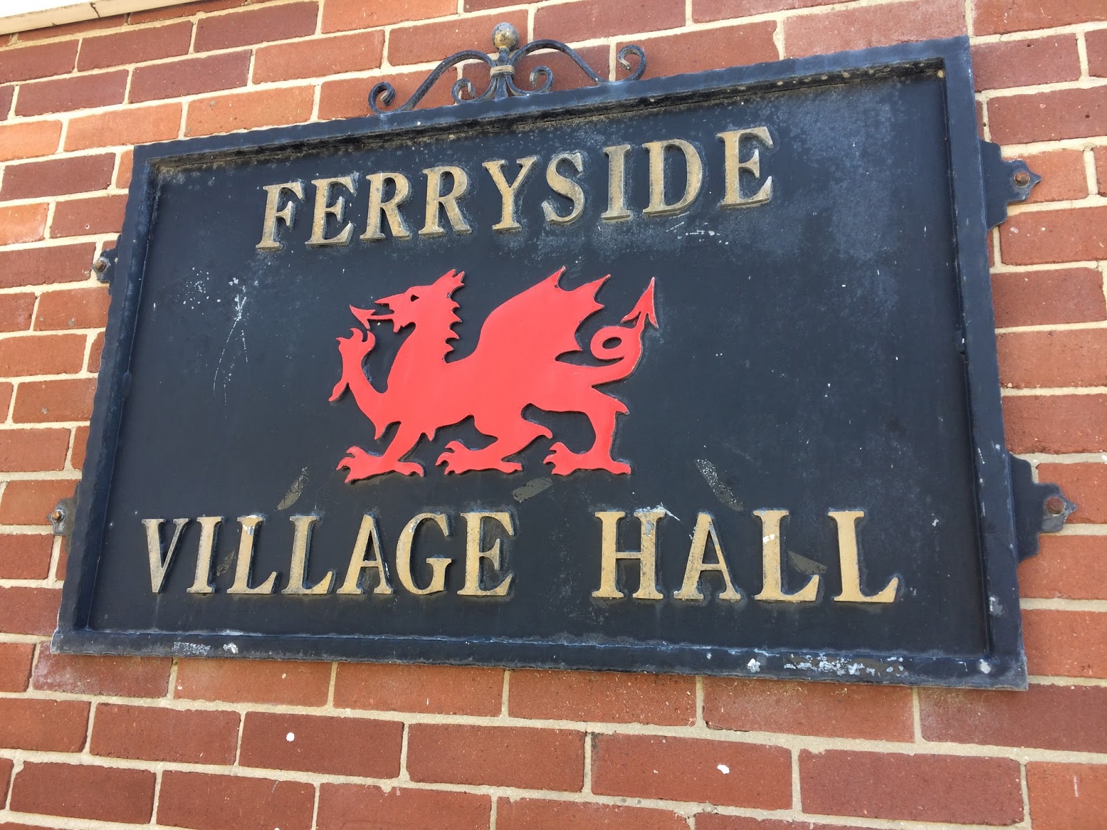
Ferryside Village Hall
Whilst a lot of farmers and land-owners have insisted that the coast path be routed away from their land, the couple who own Bronyn Farm seemed to have embraced the public right of way and gave us cheery waves, as we walked through their farm on the way to a small country lane on the far side of their land.

As we closed the gate to their farm, a train sped past and, as we knew that BRH (Best Russian Husband) was on his way to Carmarthen at some point that afternoon, we waved at the train in true-Railway children style, hoping he would look out of the window and see us (it turns out his train was arriving a few hours later than we thought, but it amuses me to think of passengers on the train seeing us and wondering who had let the lunatics out of the asylum for the day!)

Bronyn Farm to Gellylednais (2.6 miles/4.2 kilometres)

From Bronyn Farm we followed a series of country lanes, climbing uphill again until we got to the top of Trelymsi, where we were rewarded with lovely views towards Llansteffan and the outskirts of Carmarthen, barely visible in the far distance.

Country lane at Trelymsi

The hedgerows were absolutely full of verdant plant growth and flowers, lots of foxgloves on this walk, which really took me back to my childhood, when we use to pull the flowers off the foxgloves and wear them on our fingers!  BAM also identified red campion, crane's bill, dandelions, buttercups, dog rose, daisies, bramble, cow parsley, honeysuckle, knapweed, bindweed, red and white clover and even fuchsia, which lit up the roadside in a splendid roadside red.

We passed another farm at Pentrecwm, where a pack of dogs were rather excited by our arrival and barked furiously, whilst keeping their distance.  After the farm itself, we entered my worst nightmare - a field full of cows (or this time, young bullocks).  I feel I've come a long way, since my being-chased-by-cows experience in Uttoxeter in 2014 and, after a momentary panic where I thought 'I can't do this' - I quickly regained my composure and followed BAM, as she bravely struck out across the field.

We saw some more peaceful-looking cows later in the walk
There were cows running in every direction around us, some were quite panicked, others were trying to sneak up behind us, but BAM chased them off every time they got too close.  It was a relief to get through the field, although the far side was downhill, which meant that the cows were on higher ground than us, which also frightens me, but we eventually found a gate leading to another wooded valley.

Passing down and up the side of the valley, we came to another field, where a large white horse was blocking the kissing-gate we needed to pass through.  It was clear that the horse was very ill, as he was breathing heavily and had some foam in his mouth, as well as some half-chewed grass. I thought he might be dehydrated, as he seemed to be staring longingly at the small stream that was trickling past on the other side of the fence from him.

We managed to coax him away from the gate, eventually, and crossed the field quickly, to see if we could find a farmer, or someone who might be able to check that the horse was okay.  Unfortunately, the only people around were holiday-makers, but we passed on the information to anyone we could find within a mile radius, to see if they could get some help.

Gellylednais to Carmarthen (4.6 miles/7.4 kilometres)

After Gellylednais we came to Towey Castle Farm and Towey Castle, where there is a residential home, where a small dog accompanied us on part of the walk.  We bumped into the only other walkers we met that day in a field just outside Towey Castle and gave them an estimation of how much time it would take for them to walk to Ferryside.  I think they were originally planning to go to Kidwelly but, as it was already well into the afternoon and they looked quite tired, I doubt they made it all the way to Kidwelly.

Small town life in Croesyceiliog
Not long after that we came to a small road, which led to a bigger road that runs through Croesyceiliog and another few miles to Pen-sarn, then through some industrial estates and concrete underpasses until we emerged at Carmarthen train station and crossed the bridge to visit the town and the remains of the Carmarthen castle.

Carmarthen
Carmarthen castle
We thought it was quite amusing to see sheep grazing, a stone's throw from the town centre and we really liked Carmarthen - there was a nice atmosphere in town, although all the shops had closed, we grabbed a bit to eat at Pizza Express, overlooking a small square in the shopping district.

Access for Wheelchair users

A lot of this walk went through fields and along small walking paths, so the walk in its entirety wouldn't be suitable for wheelchair users, however, there were many parts of the walk that followed quiet country lanes and the sections around Llansaint and from Towey Castle into Carmarthen could be adapted to suit a wheelchair user.  

Of course, it's always dangerous to wheelchair on roads, so you should only do so, if you're willing to deal with oncoming traffic.  

Image credits:  

All photos were taken by me - please feel free to reuse them under the following Creative Commons license:

Attribution (especially to this blog post)

Share-alike

Non-commercial


Saturday, August 30, 2014

Uttoxeter and Rocester - Thrill-seekers, Tractors and being trampled by cows

This was our first walk in Staffordshire and we did something quite clever this time round, which was to arrive in Uttoxeter in the late afternoon on the Friday, so we could explore the local area a little bit and do a 'pre-amble' around Uttoxeter on the evening before our official 'chester' walk.

It was also a double whammy, as our walk took into two -chesters this time, instead of one.  Out of the two -chesters, it's actually Rocester which has most of the Roman heritage, however, in the 21st century Uttoxeter is the bigger Staffordshire -chester, with more amenities and a railway station.

Lodgings and Victuals

Uttoxeter and Rocester are a bit unusual in the sense that neither seem to lie on the path of any of Britain's major Roman roads.  The closest Roman road, the Icknield Way, is now the A38, which links Lichfield to Derby and passes (in a typically straight line) a few miles south-east of Uttoxeter.  We stayed in a nice BnB called Lanes Guest House, which is on the Derby Road, in a small residential area called St Catherine's Close.

Welcome to Uttoxeter sign

We found a nice pub-eatery called Dapple Grey, where we ate on both evenings and which does a mean oven-baked pizza.  I'd recommend it, if you happen to be in Uttoxeter for any reason!

Horse-racing and the Caravan club

Uttoxeter feels a little bit like it's slowly slipping into the more urban realities of the West Midlands, with nearby cities like Burton, Stoke and Lichfield, only a few miles down the road.  Nevertheless, it's managed to maintain a small town feel and the urban sprawl hasn't yet conquered this island of country life.

Uttoxeter Market Place
One of things Uttoxeter is most famous for is its race course, which hosts the Midlands Grand National in March every year.  Again, it's not the biggest racecourse in the country and its small-town status adds to Uttoxeter's air of modest occupation.

Entrance to Uttoxeter Race course
It's funny that we also walked past a racecourse in Stratford-upon-Avon, on our last Chester walk and we've realised that racecourses, when they're not in use, often double up as camping/caravanning sites.  Uttoxeter Racecourse also has camping facilities and it made us think that we might want to pitch a tent in a racecourse site, sometime in the future!

Pre-amble

For our Uttoxeter pre-amble, we walked past the race course and up Wood Lane to Toothill Road, which runs along a small ridge to the south-east of the town.  It was a nice walk, very quiet and atmospheric, as it had just rained.  From Toothill Road we got a view back towards Uttoxeter, which looked a bit sullen in the distant damp evening.

View of Uttoxeter from Toothill Road
It was in Uttoxeter that we first spotted the Staffordshire county symbol, the Stafford knot, a bloody reminder of Stafford's proximity to the rebellious Celtic folk of Wales!  To be honest, we thought it was a pretzel, rather than a hangman's noose, so we spent some time trying to conjure up a logical Uttoxeter-German connection.

The Staffordshire pretzel
The 32A to Oakamoor

We decided to start our walk in a village called Oakamoor, a respectable distance from Uttoxeter, and to work our way back to the town, so we could pass Rocester and still make it in time for our train back to London.  To get there we caught the 32A bus on Bradley Street and it was all very pleasant until 5 minutes later when we pulled in Uttoxeter Railway station and the bus was invaded with crowds of people headed for Alton Towers.

Detail on St Mary the Virgin Church
I don't begrudge people their day out of the city and, in fact, myself and BAM (Best Aussie Mate) are great believers in the need to get away from the maelstrom of urban life.  But to go to Alton Towers for the day!  With screaming kids and grumpy adults?  I couldn't think of anything worse.  The forty minutes or so that it took to get to Alton Towers on the bus was more time that I ever wish to spend with screaming kids and grumpy adults!

Countryside around Sedsall
It got us thinking about leisure, thrill-seeking and the mechanisation of modern life. The fact that people from Birmingham, Stoke and Wolverhampton would get their kids out of bed at the crack of dawn, drag them into the countryside on trains and buses, only to end up in another man-made environment, completely baffles me. Why not just bring them to the country and let them loose?  There are way more interesting things for kids to do running around in the forest or in the open-air, than standing in queues and fighting over ice-cream. 

A flower we spotted along the way
The only explanation can be the thrill of going on the rides and it begs that question as to why do we need that?  What is it about modern culture that demands more of everything and faster?  Is it because 'thrill' is a commodity and it's being constantly sold to us (and our kids) by clever advertisers?

It's a shame that people will spend around £160 for a day admission ticket to Alton Towers (2 adults + 2 kids) when the countryside is sitting there completely free of charge.  I can't help feeling that the kids would not only enjoy a day in the country more (fresh air, no queues, interesting plants and insects), but they would also be more likely to grow into adults who respect the countryside, as a result of spending time in a more natural environment.

Abandoned railway platform near Oakamoor
As the practically empty bus pulled out of Alton Towers, we breathed a joint sigh of relief and watched on in despair, as a group of kids with sticks bashed the bejaysus out of an inoffensive-looking bush near the ticket office.  

Oakamoor to Alton (1.7 miles/2.7 kilometres)

Oakamoor is a very pretty little village and it seems like it would be a nice place to spend a quiet weekend. We hopped off the bus at the Star Bank stop, then crossed the bridge to pick up a cycle path which runs along the route of a disused railway line.  The path follows the River Churnet through a very tranquil corner of Staffordshire, far away from the roaring of the Ripsaw and the screaming of the Sonic spinball!

Old railway building near Oakamoor
As we walked along we couldn't help but notice the posters proclaiming The Battle of the Balsam 2014.  First introduced to Britain in the 19th century, Himalayan Balsam has become an invasive plant which is now choking up many of Britain's waterways and blocking out light for native plants.


We've seen balsam a few times on our walks, but the prevalence of this plant along the River Churnet was worse than anything I've seen previously.  I thought about the kids at Alton Towers who'd been attacking a harmless bush with sticks and how their destructive skills might be put to good use along this stretch of the river!

The invasive Himalayan Balsam
We'd meant to cross the Churnet at Lord's bridge and pick up the Staffordshire way into Alton, but we missed our crossing and kept following the seductively linear railway track, until we found ourselves at Alton's former railway station, a building now owned by the Landmark Trust, who let it out to holiday-makers.  The reason we know all of this is because we stopped to chat to the resident holiday-makers, a lovely family who seemed to be enjoying their stay in this historic building.

Alton Station building, now owned by the Landmark Trust
Alton to Denstone (2.4 miles/3.9 kilometres)

We got a bit distracted at Alton station by three people walking with Llamas along the railway path.  What beautiful animals Llamas are - it's the first time I've seen them up-close (not behind a glass screen or iron bars).  It turns out that we'd met a Llama trek organised by Llama Adventures, a small company based in the West Midlands.  What a lovely way to spend the day and both the trekkers and their guide seemed to be having a lot of fun with the Llamas!

Walking with Llamas
As a result of this distraction, we completely missed Alton, although it looked like a pretty village when we passed through it on the bus.  The cycle path seduced us away from the path we'd originally intended to take and, before we knew it, we were already at the back of the churchyard in Denstone, a couple of miles past the bridge at Alton.

Denstone churchyard
Denstone to Rocester (1.5 miles/2.5 kilometres)

At Denstone, we crossed the Churnet again to a small hamlet called Quixhill.  From there, we struck out across the fields towards Rocester, our second -chester of the day.

Path to Rocester
Richard Arkwright, one of the world's first industrialists, chose Rocester as the location for one of his cotton mills, using water from the River Dove, to power the production of cotton at a mill on the river.  Although he was originally from Preston in Lancashire, Arkwright founded some of the world's first industrialised factories in Nottinghamshire and Derbyshire.

JCB Academy and former cotton mill, Rocester
The Rocester mill building has now been converted into the JCB academy and Rocester is, in fact, the headquarters for JCB, one of the world's biggest manufacturers of agricultural machinery and construction equipment.  We could see the HQ buildings as we walked into Rocester but, unfortunately, we didn't have time to pay a visit, although I'm sure the JCB plant has a fascinating history behind it.

JCB mural at Uttoxeter railway station
Rocester to Doveridge (3.2 miles/5.2 kilometres)

From Rocester to Doveridge we followed the Staffordshire Way, a long-distance path which runs for 92 miles from Mow Cop castle in Cheshire to Kinver Edge on the Staffs/Worcestershire border.  It's quite a challenging path and not that well sign-posted, so we ended up diverting to a smaller footpath near Sedsall which was overgrown with nettles and certainly exercised our rambling and orientation skills!

Staffordshire Way signpost
Having regained the correct path at Eaton Dovedale, our next challenge was to walk through the Doveridge Clay Pigeon shooting facilities at Eaton Hall farm.  It's quite frightening when you're approaching a shooting facility on foot and you don't know that that's what it is!  It wouldn't be the first time we've had to deal with gunfire on our -chester walks and I particularly remember the diversion we had to make in Chesteron in Shropshire, during the fowl-shooting season.

Red flag at Doveridge
Once we got to the farm and realised that the shooting was all controlled and not necessarily directed towards us, the walk became a lot more normal again, although we didn't hang around, as we followed a lane uphill, out of the farm and in the direction of Doveridge village.

Doveridge to Uttoxeter (1.7 miles/2.7 kilometres)

In our haste to escape the sound of shooting, we missed a turn-off, which would have taken us to Uttoxeter via Sidford Wood - instead we continued along the lane towards Doveridge, until we realised our mistake.

Trying to make up for lost ground, we decided to follow another public footpath through a field with cows in it.  I hate walking through fields of cows at the best of times, but at the end of the day, when you're in a hurry to get to the station and you've just been subject to gunfire, dealing with a field full of cows isn't really my idea of fun!

Doveridge Clay Pigeon shooting facility
Regular readers of this blog will remember the 'fun' experience we had with cows in Portchester in 2010 - both my sheer terror at being stuck in a pen with the 'beasts' and BAM's cool resolve to get us through the farm unscathed!  I've been a bit traumatised by cows ever since then so, as we got to the bottom of the field near Doveridge, with the cows running downhill after us and no exit in sight, I was beginning to think Alton Towers might have been a more sensible option for an unintentional thrill-seeker like myself!

Statue of a cow in Uttoxeter
Despite BAM's assurances that cows are harmless, docile beasts - I remain convinced that they are dangerous aggressors and being trampled to death by cows is a much more common fate for walkers than people realise.  Having got much closer to a herd of charging cows than I ever want to be again, I've realised several things:

1. If you run, cows will run after you
2. Cows are big and aggressive, especially when there's a whole herd of them
3. If you turn and chase them, cows will generally run away
4. I don't want to be chased by cows again . . . ever!

Our only option was to beat a hasty retreat, so we scaled a gate into another part of the field, where the cows couldn't see us and made our way dejectedly back to the safety of the lane.

It wasn't a massive detour via Doveridge to Uttoxeter and the rest of the walk was relatively uneventful.  We celebrated our cow-chasing experience with a couple of nice steaks at the Dapple Grey, before jumping on the train and heading back to the cow-free environs of London.

Rain clouds over Uttoxeter
Access for Wheelchair users


Disused railway line at Lord's Bridge
The first part of this walk from Oakamoor to Denstone along the former railway line was completely accessible and I would recommend this part of the walk to users.  The rest of the walk was relatively inaccessible, apart from the country lanes around Rocester and Doveridge.

We wouldn't recommend that wheelchair users engage in any cow chasing, but walking with the Llamas could be a lot of fun!

Image credits:  

All photos were taken by me - please feel free to reuse them under the following Creative Commons license:

Attribution (especially to this blog post)
Share-alike

Non-commercial