Showing posts with label Lincolnshire. Show all posts

Saturday, August 11, 2018

Caistor - Civic pride, needy Cats and channelling your inner Cow

Purely by coincidence, our second-ever Lincolnshire walk happened almost eight years to the day after our first trip to Lincolnshire, which was also our first ever Chester walk, from Grantham to Sleaford via Ancaster, back in July 2010.  We have, quite literally, come a long way since then - in terms of the many miles we've walked, from places as far apart as Exeter in the South West of England to Chesterwood, Northumberland in the North East.  

Perhaps more importantly, we've also come quite a way through our respective lives - eight years is a long time to spend on any project and our Walking the Chesters project has now accompanied us through a period spanning almost a decade.  Caistor, Lincs was our 51st Chester, so we've made good progress and we estimate that there are only 15 Chesters left (although we keep finding new ones!), so we should be alright for another two or three years!

We've also come a long way in terms of our organisation and planning of these walks - as we reminisced about the first ever walk, we recognised how unprepared we were back then, to do such a long walk, on one of the hottest days in summer, not even having our usual pub meal at the end, but settling for a hastily consumed Indian take-away and a beer on the train on the way back!

The Journey Up North

Market Place in Caistor, Lincolnshire
Whilst we're certainly more organised these days, I can't say the same for the British Rail network.  The weather has been incredibly hot in recent weeks, including the day we were travelling Up North.  As a result of a delay in finding the train driver, health & safety concerns about overheated carriages and the wrong type of sun (well, that's what it basically boils down to!), our 18:03 service from King's Cross experienced a slight delay (driver's words, not mine) until we finally set off around 19:45.  

Considering the fact that our connecting train from Newark to Market Rasen had departed 10 minutes before we had even left London, we worked out that we might be in for a bit of an adventure in our quest to spend the night in Caistor - in itself a taxi journey from Market Rasen, the nearest big town with a station.  I'd flown into the UK overnight from Canada, so I was feeling quite zen (= jetlagged) whilst I calmly assured Best Aussie Mate (BAM) that all would be okay, before I sought out the train manager, who kindly organised an alternative route, which got us to Lincoln, then a taxi from Lincoln to Market Rasen.

We arrived at The White Hart in Caistor around 23:00 - so time enough for last orders at the bar, which was a blessing, considering it was Friday night and we'd had such a complicated journey.

Caistor to Nettleton Grange (1.4 miles/2.25 kilometres)

Having a stroll around Caistor the following morning, we were surprised to learn that it's quite a pleasant place - lots of beautiful old Georgian buildings and a very strong sense of civic pride.  Indeed, as we were standing on Market Place, an elderly man appeared out of nowhere and handed me a leaflet entitled Walkabout Caistor published by the Caistor Civic Society.  

Holly House, Caistor
This came in very handy, as we plotted an impromptu walking tour down the High Street to Holly House, then up Chapel Street past the Wesleyan School and Church Street, past the Grammar School and the St Peter and St Paul Church.  We then made our way past a very long and beautiful cottage on Fountain Street, before turning down Plough Hill, so we could pick up The Viking Way which would guide us through the Lincolnshire Wolds.


Pink cottage on Fountain Street, Caistor
We've been on The Viking Way once before, when we walked down in Rutland towards Great Casterton and this is a path that links Rutland with Hull - 147 miles in total and a nice contrast to another long distance path we're currently following, The Saxon Shore Way (currently walked as far as Sandwich!)

Sign post on The Viking Way
The path to Nettleton was, not surprisingly, quite nettly, but the weather on that Saturday was a lot cooler than it had been in previous weeks, so it turned out to be an ideal day for walking, with no rain, until we got to the very end of the walk at Market Rasen.

Nettleton Grange to Normanby-le-Wold (3.9 miles/6.3 kilometres)

We met a very friendly, but slightly needy, cat at Nettleton Grange - he seemed too happy to see us and we began to wonder about his life on the stud farm.  It seemed as though he'd had enough of horses and was desperate for contact with another species - even humans would do!  

Nettleton Grange in the Lincolnshire Wolds
You don't hear much about the Lincolnshire Wolds and they're certainly not as touristy (= a good thing) as e.g. the Cotswolds, but I have to say that they really are very beautiful and we had a real sense of adventure making our way from Nettleton Grange up into the Wolds.  

From Nettleton Grange, we walked through four large meadows, each one of which contained a herd of cows.  Ever since reading the Bhagavad Gita earlier this year, I'm trying to detach myself from my 'cow phobia' and be more understanding of cows and their existence, on the planet, but also frequently on my path through life!  I think I'm doing better than before and I even found time to admire the different breeds of cows we saw on this walk - the owners of Nettleton Grange have a really beautiful herd of Viking White cows and I believe the last herd we saw were a herd of the famous Lincoln Red beef cattle.  

Meadow with the White Viking herd

Lincolnshire Wolds
Having said that, given a choice, I would prefer not to go through a field of cows (see my Uttoxeter post from August 2014), especially a tiny field containing two cows and a bull, like the one The Viking Way crosses, just before Normanby-le-Wold.  Whilst BAM marched on through the field with her devil-may-care bravado, I meekly took a detour around the field, before we met up again and continued our walk into the village.  

Curiosity killed the Cow

The road to Normanby-le-Wold
Normanby-le-Wold to Walesby (2.1 miles/3.4 kilometres)

When I say village, I really mean a couple of houses, an impressive haystack and an old Norman church.  You can see a lot of place names in Lincolnshire with the suffix -by, which comes from the Old Norse word for a farmstead or village.  Normanby-le-Wold is definitely more of a farmstead than a village, and was a very peaceful place to have a little rest, which we did, scoffing Caramello Koalas on a bench just opposite St Peter's Church.

St Peter's Church at Normanby-le-Wold

We could see half of Lincolnshire and the distant chimneys of Sheffield, as we made our way along the ridge of the Wold, heading south from Normanby.  Just before Walesby, we came down off the Wolds and made a slight detour into Walesby (a village this time) as far as St Mary's Church, where a wedding was taking place.  

View across the East Midlands

BAM walking to Walesby

Walesby to Market Rasen (4.6 miles/7.4 kilometres)

Rather than walking directly from Walesby to Market Rasen, we did a slight detour down along Moor Road, then over the railway line and into the Middle Rasen plantation.  The plantation was very peaceful and nice place to walk, as we eventually came to a pretty-looking campsite at Walesby Grange, then rejoined the Rasen road, so we could finish our walk at Market Rasen.


The path through Middle Rasen plantation
We didn't find Market Rasen to be as pretty as Caistor and it started raining a little bit, which dampened our mood, so we retreated to the comfort of The Advocate Arms, a lovely 18th century building, where they serve up delicious food, although the portions were a bit on the small side for BAM's liking!

Our destination: Market Rasen
Luckily our journey back to London was a lot less complicated than our journey to Lincolnshire, so we had a successful end to our wonderful 51st walk!

Access for wheelchair users

Typical rough path on the Viking Way
As this walk follows a rough path along the Wolds, most of it was inaccessible for wheelchair users - however, there is a relatively quiet country lane from Nettleton all the way to Walesby (or Claxby, if you take a detour), which could be an alternative accessible route.  The paths through Middle Rasen plantation and Walesby Moor were also accessible.  

Image credits:  

All photos were taken by me - please feel free to reuse them under the following Creative Commons license:

Attribution (especially to this blog post)
Share-alike
Non-commercial

Thursday, August 5, 2010

Ancaster - How I made Lincolnshire Haslet!

As part of my learning experience about Ancaster, I was interested in finding a traditional Lincolnshire dish that I could cook and after some research, I decided to make a (non-traditional) Lincolnshire Haslet, which is a type of pork meat loaf, traditionally made from innards and other icky bits of the pig, with stale bread and wrapped in caul, which is a sheet of fat.

My version was non-traditional, partly because I used regular pork mince, not innards, but also because, try as I might, I couldn't get my hands on caul fat and decided to wrap the meatloaf in less traditional, but infinitely tastier Parma ham!

Ingredients

For once, I didn't follow any specific recipe, but had a look at a few versions of Lincolnshire Haslet and came up with my own.  The ingredients I used included:

1/2 kilo of Pork mince
1 onion, which I chopped up very finely, although you could also mince this in the food processor
Three slices of slightly stale white bread
Garlic puree
Sage
Parma ham, to wrap the Haslet in before bunging it in the oven
Foccacia to accompany - I didn't make this, but bought it freshly baked from Marks and Spencers
Long-grain rice with peas, as a side
Gravy made from flour, red wine and vegetable stock

Process

I started by soaking the stale white bread in water for about 45 minutes, afterwards squeezing out as much of the water as possible and mixing the bread with the onion, garlic, sage and pork mince in a bowl.

Once this is mixed together, I gently kneaded it into a loaf shape, as you can see below. 

I then wrapped the Haslet in Parma ham, as you can see from these pictures.  I oiled an oven tray, having pre-heated the oven to 170 degrees and left the Haslet in there for about 50 minutes.  I must admit, I did have a moment of panic, when I thought that the Parma slices wouldn't be as durable as Caul fat and I really didn't know whether they were going to come out burnt after 50 minutes in the oven, but it turned out that I needn't have worried about the Parma ham, everything turned out just fine.


As I was waiting for the Haslet to bake in the oven, I prepared the rice, mixing in frozen peas at the end, as I love rice and peas together, with or without the Caribbean spices! 

Making the gravy was also quite simple.  I tossed some flour in a small pot for a minute or so, then adding half a glass of red wine, mixing the wine into the flour before pouring over 400ml of vegetable stock.  I let the gravy bubble away for a while, eventually turning down the heat, when the mixture had reduced a bit. There was no gravy in the original recipes I looked at, but I thought the Haslet might be a bit dry without it. 
In general, Haslet was a really easy dish to prepare and we'll definitely be having it again.  The pork was delicious and the Parma gave a nice salty taste to the Haslet that, otherwise, would have been missing.  I think next time round I would spice it up a bit, by adding chillies or spices like cinnamon to the meatloaf! 
Image Credits:

All photos were taken by me. 


Monday, July 26, 2010

Ancaster - The Walk

This weekend myself and Bam (Best Aussie Mate) did our first 'chester' walk, through Ancaster in Lincolnshire.  The weather was absolutely amazing, in fact, probably way too hot to be outdoors for seven and half hours!  But we had a great walk - the first one I've ever designed all by myself and I would recommend it to anyone who is living in or visiting the area.

Grantham to Belton Park Gates (2 miles/3.2 kilometres)


We arrived in Grantham on Friday night, after work and stayed at a lovely B&B called The Red House on North Parade, run by a couple of (Thai?) ladies.  We had dinner in the restaurant of The Angel and Royal, which was a really nice place to eat and gave myself and Bam a much needed opportunity to catch up on our respective lives, not having seen each other for about two months.  Bam told me about her favourite new song, Bang Bang Bang by Mark Ronson and the Business Intl, so that became our them song for the trip!

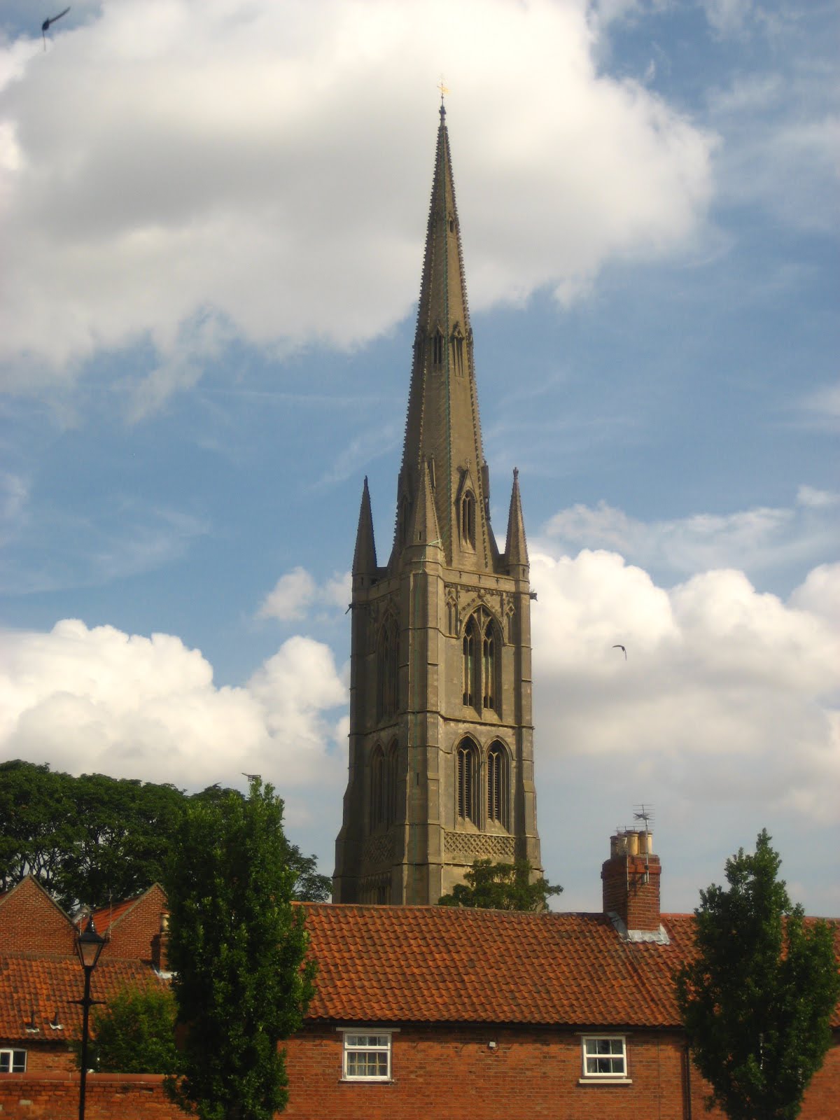
After a hearty breakfast, we set off to St Wulfram's Church at about ten the following morning.  The volunteers at St Wulfram's are incredibly friendly and we had an interesting time exploring the crypt and the exhibition room.  St Wulfram was a 7th-century Bishop of Sens, in France and is remembered for his missionary work in Friesland.  There are only two churches dedicated to him in England, the other one being in Sussex.  Grantham ended up with one of his arms, somehow, and St Wulfram's Church sheltered this relic for many years, although his arm seems to have been mislaid sometime during the Reformation.  I guess St Wulfram was the 7th century version of a celeb!  Perhaps this isn't such a modern phenomenon after all.  The church also has the sixth highest spire in England, which is surprising, as Grantham isn't exactly famous for it's landmarks or religion. 

Grantham is famous as the birthplace of Margaret Thatcher, who lived above her father's shop in the town.  It was also the place that Isaac Newton first studied mathematics and lived above an apothecary.  It's amazing that this, most unremarkable of English towns, should produce two such influential people.  I'm going to blog more about Isaac Newton later and I'm interested in the influence that his upbringing had on his genius.  Grantham was also the first town in Britain that had women police officers on the beat, Edith Smith and Mary Allen!  I found this plaque on a bench on the High Street and it struck me as being quite ahead of its day, having a Business and Professional Women's Club in the 1950's.  Perhaps not that remarkable after all for the town that produced Britain's first (and to date, only) female Prime Minister. 

Our walk really began in the centre of Grantham, just outside the Guildhall Arts Centre (pictured), we started by walking down Avenue Road, across the Stone bridge and then left alongside the River Witham on a path which is part of the National Cycle Route 1.  At Hill Avenue we turned right onto Belton Lane and followed this all the way down to the gates of Belton Park.  It's a pleasant suburban walk, but the array of signposts related to the cycle network and circular town walks can be confusing. 


Belton Park Gates to Belton House (1.5 miles/2.4 kilometres)

Belton Park is a really amazing place and I had planned my route through it, without expectations as to what the park might be like.  Arriving at the park gates, with that sweeping view of the park and Belton House at the end of it, I was immediately transported back several centuries and could almost hear the carriages rattling up the 1.5 mile drive to the house, amidst the grazing sheep and sunburnt landscape.  Belton House has a really lovely visitors centre, with giftshops, toilets, cafes and an exhibition of carriages.  We didn't have time to go inside and visit the house, which is a National Trust property, but I bought a book about the house and its history which, hopefully, I will be able to share with you at a later date. 


Belton House to Ancaster (5 miles/8 kilometres)

Belton village itself is an amazing little place.  When you come to the fork in the village, just after the telephone box, take the road to the right, which skirts the grounds of Belmont House and takes you through Barkston Heath, via Syston Grange, along a relatively quiet country lane with surprisingly hilly bits and fantastic views over the Lincolnshire countryside.  The only part of the walk that got 'hairy' was when we finally reached the B6403, a.k.a. the High Dyke or Ermine Street, the route of the Ancient Roman road from London to the Humber.  I don't know if it's legal, but you could possibly walk along the outside of the airfield which is on Barkston Heath and has a road running parallel to the B6403 and is certainly a less treacherous option.  My abiding memory of this part of the walk was Bam telling me about Alfred Hitchcock's The Birds and the novella it was based on by Daphne DuMaurier, which was more explicit in its references to the Cold War and fears of a Communist invasion.

To get off the B6403 we turned right down a country lane leading to the village of Wilsford, turning left about halfway down this lane to follow a bridleway along the top ridge of a small valley, eventually leading us to Ermine Street in Ancaster. 

Ancaster to South Rauceby (4 miles/6.4 kilometres)

Ancaster was the main focus of our walk and we stopped off on Ermine Street to have a banana and a soft drink.  I don't usually eat a lunch when I'm doing a full-day walk, but prefer to have a massive breakfast and then something substantial at dinner time.  I do however spend most of the day eating nuts and dried fruit (or Trail mix, as Bam likes to call it) and, with the high temperatures this weekend, I also drank three litres of water during the walk, which just about kept me hydrated.

The church at Ancaster is called St Martin's and it'll be interesting to see how many other casters/chesters have churches dedicated to St Martin, who is the patron saint of soldiers and an apt choice for what used to be a Roman camp.  It was also interesting to note the RAF presence around Ancaster and I find it intriguing to think that there has been a military presence in the area since Roman times!  Channel Four's Time Team visited Ancaster back in 2002 and found evidence of a Romano-celtic shrine to a God named Viridio.  This is thought to be an incorporation of Celtic animist beliefs, such as the Green Man and the Roman temple which stood on the site of today's church. 


We left Ancaster on a trail recommended by the Lincolnshire County Council, called the Ancaster to Sleaford Railway walk.  It wasn't really signposted, but I had marked the route out on our map and we improvised.  This was one of the most beautiful parts of the walk, skirting the higher end of Wilsford Warren, walking through fields abundant with wheat, passing haystacks like monuments abandoned by an extra-terrestrial life-force.  We did get a little bit lost during this part of the walk, but eventually found ourselves coming out onto Church Lane by Lodge Farm. 

It was then a short walk through some fields and sheep pens to the village of South Rauceby.

South Rauceby to Sleaford (3.5 miles/5.6 kilometres)

The last part of the walk is always the hardest, I find and we bombed along from South Rauceby to Sleaford, the evening heat beating down on our heads as we flew through chicken farms and over Bouncing Hill, along the sticky bank of the River Slea, under the railway bridge and finally getting our breathes back at King Edward Street in Sleaford, where we emerged, dazzled into the welcoming arms of civilisation.  The photo shows our route through a most beautiful cornfield outside Sleaford, almost at the end of our 16 mile (25km) journey.

I think 16 miles was quite a long day and, perhaps, next time we won't do quite as much.  Unfortunately we didn't see much of Sleaford, arriving just half an hour before our train was due to arrive, we were more concerned about getting dinner than seeing the sights of the town!  The Chilli Hut on Station Road is definitely to be recommended and, apart from the friendliness of the manager and his staff, who wanted to know all about our walk, Bam swears it's one of the best curries she's ever had (and she should know!). 

By all accounts Sleaford is an up-and-coming kind of place.  Jennifer Saunders grew up here and Emma Thompson's Dad, Eric, who did the Magic Roundabout (the English version) was a local.  I guess we've missed our chance to see what Sleaford has to offer but, you never know, fate may conspire to bring us Sleaford way again sometime!

Image credits:

All photos were taken by me on my (very basic) Canon Ixus 65.  Feel free to use the images under the Creative Commons License and don't forget to reference the source ie. this blog.

Wednesday, July 14, 2010

Ancaster - Welcome to Learning about Britain!

Welcome to this first posting on my new blog Learning about Britain.  This is a sister blog to http://www.learningabouttheworld.blogspot.com/ which is almost a year old.  The idea is to learn about Britain in greater depth than the countries in Learning about the World, because this is where I live and because the focus could be slightly different.

Me and my BAM (Best Aussie Mate) have come up with the crazy idea of getting to know Britain better by visiting every major town/city ending in -caster, -cester and -chester.  We thought that this might lead to some random trips to parts of Britain that we've never been to before and, what started off as a crazy idea, has now almost come to fruition in terms of our first trip which, alphabetically, will be to Ancaster in Lincolnshire. 

We're going to stay in nearby Grantham and do a walking trip through Ancaster, finishing in Sleaford.  I want to document our trip and blog about the learning experience along the way.  In true learningabout fashion, I want to also read a book related to that local area, watch a movie or TV programme inspired by the place we're walking through, listen to some music and, if at all possible, cook a local dish - oh, and I won't forget to sample the local brew! It should be a bit of fun really and I hope you'll join us virtually, by following this blog.  We've started alphabetically, so I guess that's how we'll continue.  We're also limiting ourselves to castercesterchesters that are on the National Rail network, otherwise it could end up being very random indeed! 

As I started researching this trip, the first thing that struck me was that our choice of placenames with the etymology 'castrum' is not that random after all and Ancaster, like most of the casters we'll be visiting, has remains of the Roman fort that once stood on this site.  Doh!  It seems so obvious now and it's a great thematic link for the places we're planning to visit.

Britain's history didn't start with the Romans, of course, but with the Celts.  Learning about Roman Britain is, by default, learning about Celtic Britain.  The celtic period of Britain's history is not really history at all, ie. documented and attested, but rather pre-history - that which exists mostly through archaeological guesswork and continues to haunt us through its unusual placenames and the names of long-forgotten kings.  In my brief dip into Celtic Britain this week, I've been amazed to learn about a whole country full of Celtic tribes - the Iceni of Norfolk, the Catuvellauni of Hertfordshire and Cambridgeshire, the Corieltauvi of the East Midlands and the Brigante of Yorkshire and the north.  I had no idea that these tribes had names and histories that could be made out, despite the obscurity of time.

Luckily, I've already read Robert Graves seminal history of Rome, I, Claudius, so I can place the Roman invasions of Britain between their first contact with the Trinovantes of Essex during Caeser's time and the full-scale, forty thousand man strong invasion during the time of Claudius in 43AD.  I think the Roman invasion of Britain had an impact on this country way beyond anything that happened later.  It was Britain's first real experience of aggressive colonisation, the first time Britain had belonged to a Europe united by the Roman Empire.  Before the Romans came along, even the word Britain didn't really exist.  They applied it to the islands of Great Britain, Ireland and (perhaps) Iceland, later restricting the use of the term to their subdued Roman province Britannia - corresponding, more or less and rather confusingly, to modern-day England and Wales. 

I realise that by visiting the chesters, we will be learning about England more than Britain.  But we're going to start with the Roman concept of Britannia and perhaps later, we can move on from that and visit other parts of the country as well.  In another, rather controversial way, the Roman invasion of Britain gave birth to a sense of national identity to those north of Hadrian's Wall (loosely called the Scots) and to a lesser extent, those to the west of the initial Roman border on the Trent (the Welsh).  The Roman tactic in colonising Britain was to build forts/castrums to secure its newfound territory, then employ local administrators from the friendlier Celtic tribes and have them run the colony on Rome's behalf.  Two thousand years later, it's a tactic that reminds me a lot of Western governments' plans for Iraq and Afghanistan. 

I'm looking forward to our first trip to Ancaster and hopefully I will have lots to report back on, not just about Ancaster, but also about Grantham and Sleaford.  Coming centuries after the Roman invasion, the Anglo-Saxons have formed the basis of English identity and I hope to combine our cester/caster/chester trips with many hams and fords and burys along the way!

Image credits:

The photo of the Green man (Banksia man) is by Graham Wilson, wikiuser Dgu56 and he has shared this with the world using the Creative Commons License.  Find out more information about re-use of this image here.

The image of Britannia on her plinth has been supplied by flickuser Tim Ellis and you can see more of Tim's photography on his blog http://tmellis.wordpress.com/

Thanks Graham and Tim for sharing your images with the rest of us!