Showing posts with label Walking. Show all posts

Sunday, July 15, 2018

Caerwent - Motorways and Monarchs in Monmouthshire

It's been many months since I've written a Chester blog post - probably the biggest gap I've had since this project began and this is due to the fact that we were prevented from doing a Chester walk in March, because of an unexpected snowfall - although we rescheduled our Caerwent walk and did it in May instead, I've been quite busy since then and, in fact, I've resorted to writing this blog post after a busy day at the office, on a work trip to India - a million miles away from rural Monmouthshire and far removed from the possibility of being snowed in!

Getting to Caerwent was always going to be a challenge, from a logistical point of view, but we managed quite well in the end, catching the 17:30 National Express service from Victoria Coach station, all the way to Chepstow, then jumping in a pre-ordered taxi, to take us the remaining miles to Caerwent itself.

Lodgings and Victuals

We had a really lovely stay in Northgate House BnB which, as the name suggests, is located on the site where the northern gate of Venta Silurum, the Roman settlement which gives Caerwent it's Chester credentials.  Actually, one advantage of Caerwent's relatively obscure location is the fact that the Roman town is rather well-preserved and quite a few sites have been excavated and made for an interesting visit when we arrived, although it was already after 9pm.

The church at Caerwent (sunset)
The light is good in May, so we had enough time to visit the Roman ruins and we even walked along the southern wall of the Roman settlement, which led us, handily enough, to the Coach and Horses Inn, where we settled in for a couple of drinks and a chance to have a proper catch up.

Y Deml Celtaidd-Rufeinig

Caerwent to Caldicot Castle (2.4 miles/3.9 kilometres)

Starting out bright and early the next morning, we retraced our steps through the Roman town, as far as the Church of St Stephen and St Tathan, then back along the southern wall and south along the Dewstow Road, crossing a bridge at Nedern Brook.  In case you're wondering, St Tathan was a Celtic saint, supposedly the son of an Irish king, who moved to Caerwent and set up the church there.  One thing about walking in Wales is that we're learning the names of saints we'd never heard of before, as they were local figures who, perhaps, didn't make much of an impression on the ecclesiastical world stage.

The Roman Wall in the southern part of Caerwent

After Nedern Brook, we turned left down the rather busy Church Road, in the direction of Caldicot, Caerwent's more ambitious neighbour, opting for a quieter cycle path which follows Sandy Lane under the busy M48, Monmouthshire's prime motorway and into some quiet suburbs on the edge of the town.

The cycle path led us to St Mary's Church in Caldicot, where we passed around the churchyard, then took a small path through the country park to Caldicot castle.  The castle was celebrating some kind of anniversary so, luckily for us, it was free entrance and we went into the castle grounds, where we stopped for some refreshments.  It was one of the first really nice summer days, so it felt good to sit in the castle grounds and drink lemonade, before we set off again in the direction of the Severn.

Caldicot Castle

Caldicot Castle to Sudbrook (1.9 miles/3.1 kilometres)

It was a short walk from Caldicot castle to the Severn, passing under the M4, which is the main motorway between London and South Wales and reaches across the river Severn in an impressive structure called the Second Severn Crossing, or the Prince of Wales bridge.  Most times I've been to Wales, I've travelled by train, which passes through the Severn Tunnel, under the river - so it was interesting to see the other option, which is the huge road bridge linking England and Wales.  We also saw the (old) Severn bridge, later in the day, which links Chepstow to South Gloucestershire.

BAM walking on the Wales Coast path near the Second Severn Crossing

It was the day of the Royal Wedding, so more Duke of Sussex than Prince of Wales and BAM (Best Aussie Mate) was quite excited to get an update, via Australia, on the dress that Meghan Markle had chosen to wear.  We stopped briefly at Sudbrook, an interesting little workers' village that sprang up in the 1870's, in response to engineering work on the Severn Tunnel, which passes under the cliff at this point.

The Prince of Wales bridge over the Severn
One of the locals tried to interest us in a series of chalk arrows, a bit of a Da Vinci code moment, that was completely lost on me, but apparently has some esoteric significance to the villagers of Sudbrook!

Weird chalk arrows at Sudbrook

Sudbrook to Mathern (3.2 miles/5.1 kilometres)

It was a nice walk along the Wales Coast path from Sudbrook to St Tewdric's church in Mathern (queue another obscure Welsh saint!) - there were some interesting rocks on the seafront and great views across the Severn to the lighthouse on Charston Rock.  We had a short break in the shade beside St Tewdric's church, as BAM went online to book a ticket for a music festival called The Mighty Hoopla, which we went to a couple of weekends later.

Lighthouse on Charston Rock
Sitting in the shade at St Tewdric's church in Mathern

Mathern to Thornwell (1.3 miles/2.1 kilometres)

From Mathern we walked past an industrial estate to reach Thornwell, an outer suburb of Chepstow, where I managed to convince BAM to stop at Tesco Express for a much-needed ice-cream!  Thornwell had a strange kind of vibe - someone shouted something unintelligible at us, as they were driving past on Denbigh Drive, then we passed Thornwell Football club, where there was a Royal Wedding party - lots of people getting drunk and wearing plastic Union Jack hats!

It's the oldest part of Chepstow, but not the nicest and we were glad to find that the path led us into a lovely wood, above the railway line and with great views towards the Army barracks at Beachley.

Thornwell to Chepstow Castle (2.2 miles/3.5 kilometres)

It was still quite a walk from Thornwell, over the ridge to Chepstow, past the remains of the city walls, then down past the train station to the town centre and the beautiful Chepstow castle.  I found Chepstow to be a slightly higgledy-piggledy place - medieval in its layout, which made it quite interesting.

Chepstow castle
Strangely, it reminded me a bit of Lifford/Strabane, where I grew up, there's a certain 'border' feeling I got in Chepstow - the river, the Army base, the frontier feeling - it all reminded me of home!  Although we don't have a fantastic castle in Lifford, as they do in Chepstow and I couldn't help but wonder if the castle was built to keep the English out, or to keep the Welsh in!

Cas-Gwent railway station
There's an award-winning pizza restaurant called Stone Rock pizza and we can certainly recommend it, as it was quite lovely sitting in the garden at the back of the restaurant, stuffing ourselves in the early evening sunshine. 

Access for Wheelchair users

Inaccessible path between Sudbrook and Mathern
The first part of the walk from Caerwent to Sudbrook was accessible, although you would need to be careful on the stretch of road between Nedern Brook and Sandy Lane.  The path was inaccessible from Sudbrook to Mathern, but Mathern to Chepstow was mostly on a cycle path and seemed fairly accessible, so this walk could form two distinct stages that would be accessible to wheelchair users. 

Image credits:

All photos were taken by me - please feel free to reuse them under the following Creative Commons license:

Attribution (especially to this blog post)
Share-alike
Non-commercial

Sunday, July 9, 2017

Carmarthen - Cats, Cows and Castles

Carmarthen marked our second foray into Wales, as part of our series of 'Chester' walks and the weather couldn't have been more different on this walk (blazing hot sunshine) compared to our last Welsh walk, from Caerphilly to Cardiff, back in February (a lot less sunny!)

I'm very fond of Wales - there are more castles than you can shake a leek at, the countryside is beautiful and it reminds me a little bit of home (Ireland). I'd previously been to Swansea, many years ago, for a work conference and my memories of this part of Wales included the impressive steelworks at Port Talbot and the industrial slag heaps outside my hotel window!

BAM (Best Aussie Mate) knows South West Wales very well, due to her kayaking trips, but it was my first time west of Swansea and, with the glorious June weather and the unspoilt beaches along the Carmarthenshire coast, it certainly left a good impression on me!

Lodging and victuals

Carmarthen is believed to be the oldest town in Wales and was one of the most far-flung reaches of the Roman Empire.  It's also one the most far-flung Chesters on our list, so we both took the Friday off work, so we could enjoy the three and a half hour train journey from London to Cardiff to Swansea to Carmarthen and then back a little bit to Kidwelly, where we'd resolved to stay the night.

Kidwelly is a small town with a huge castle and a pleasant enough place to spend the evening.  We stayed at the lovely Kidwelly B&B on Causeway Street, where we were made very welcome by the proprietor, Gerri Tennant, who moved to Kidwelly from the West Midlands.

Kidwelly, Carmarthenshire

Kidwelly castle

There weren't too many options for dinner, apart from Chinese takeaways, so we booked into The White, which was so-so - not the best meal I've ever had, but enough to fill us up for the evening.  After dinner we took a walk around the village and visited the castle.  Like many castles in south Wales, it was built by the Normans, in their attempt to contain the rebellious native Celts and bring Wales under their control.

Interestingly, the name Kidwelly, which used to be spelt Cetgueli in English, led to a legend about a black cat, which people believed was the source of the town's name.  A black cat features on the town's coat of arms and, as if to prove its importance, we even met a black cat, who was sitting in the middle of the road, just outside the castle, licking himself, as cats know how to do best!


Kidwelly to Llansaint (2.2 miles/3.5 kilometres)

You can now walk the entire coast of Wales as, in 2012, Wales became the first country in the world to open a long-distance footpath (870 miles) that is on/near the country's coastline.  Our entire route was following the Wales Coast path, although we didn't actually spend a lot of time on the coast, as Kidwelly sits at a point where the River Towey flows into Carmarthen from the sea and this particular section of the coast path is mostly inland.

View towards the Gower peninsula


By Hogyn Lleol - Own work,
CC BY-SA 3.0,
We loved the coast path logo, a sort of hybrid between a dragon and a seashell and, as we set out along the path from Kidwelly, we had great views towards the Gower peninsula and the Irish Sea, in the distance.  The path leaves Kidwelly following the Gwendraeth river, where we saw the most athletic cow I've ever seen, jogging along the river bank!  The path soon led to a rather busy country road, which runs between Kidwelly and Penallt, then we turned uphill along a rough track towards a hilltop village called Llansaint.

Llan is a common prefix in Welsh place names and it means saint - so I was a bit surprised to find myself in Saint saint!  The village was previously called Halkenchurche, which means 'Church of Saints' - so the Welsh name continues that translation.  It's a pretty village and the only other living soul in Llansaint was the postman, who we bumped into several times, as he was making his rounds of the village.  I always wanted to be a postman, when I was a child, but I don't drive, so not sure I have the right skill-set for a change of career at this point in my life!  You could do worse though, than drive around Carmarthenshire delivering the mail?

The white church at Llansaint

Llansaint to Ferryside (2.3 miles/3.7 kilometres)

There are some nice little forested valleys on this route that make you feel as though you are miles from anywhere - it was also a bit of a relief to get out of the sun occasionally, although these little shaded valleys suddenly became quite jungle-like in their midday humidity!

Before long we came to a rather interesting collection of buildings at Pengay Farm, on a small hill overlooking the sea.  The farm was the seat of the Bevan family (relation of the famous Bevan brothers who set up the NHS?) and the family has a strong Methodist tradition, that is common in this part of Wales.  The farm buildings are from the 18th century and there was a rather welcome bench in the middle of the farm, which was in the shade of some trees, so we stopped for a water and chocolate break.

Pengay Farm, seat of the Bevan family
From the farm it's an easy mile or so downhill towards Ferryside, a holiday village dominated by the railway line that runs from Carmarthen to Llanelli.  On the way down, we had great views across to a ruined castle on the hill above the village of Llansteffan, on the other side of the Towey river.

View towards Ferryside and Llansteffan

Rocks at Ferryside


Ferryside to Bronyn Farm (1.4 miles/2.3 kilometres)

After a much needed refreshment in Ferryside, we set off along the Carmarthen Road, before turning into a laneway past the curiously-named hamlet of Rotten Pill, then we followed the railway line through a steep valley leading to Bronyn Farm.

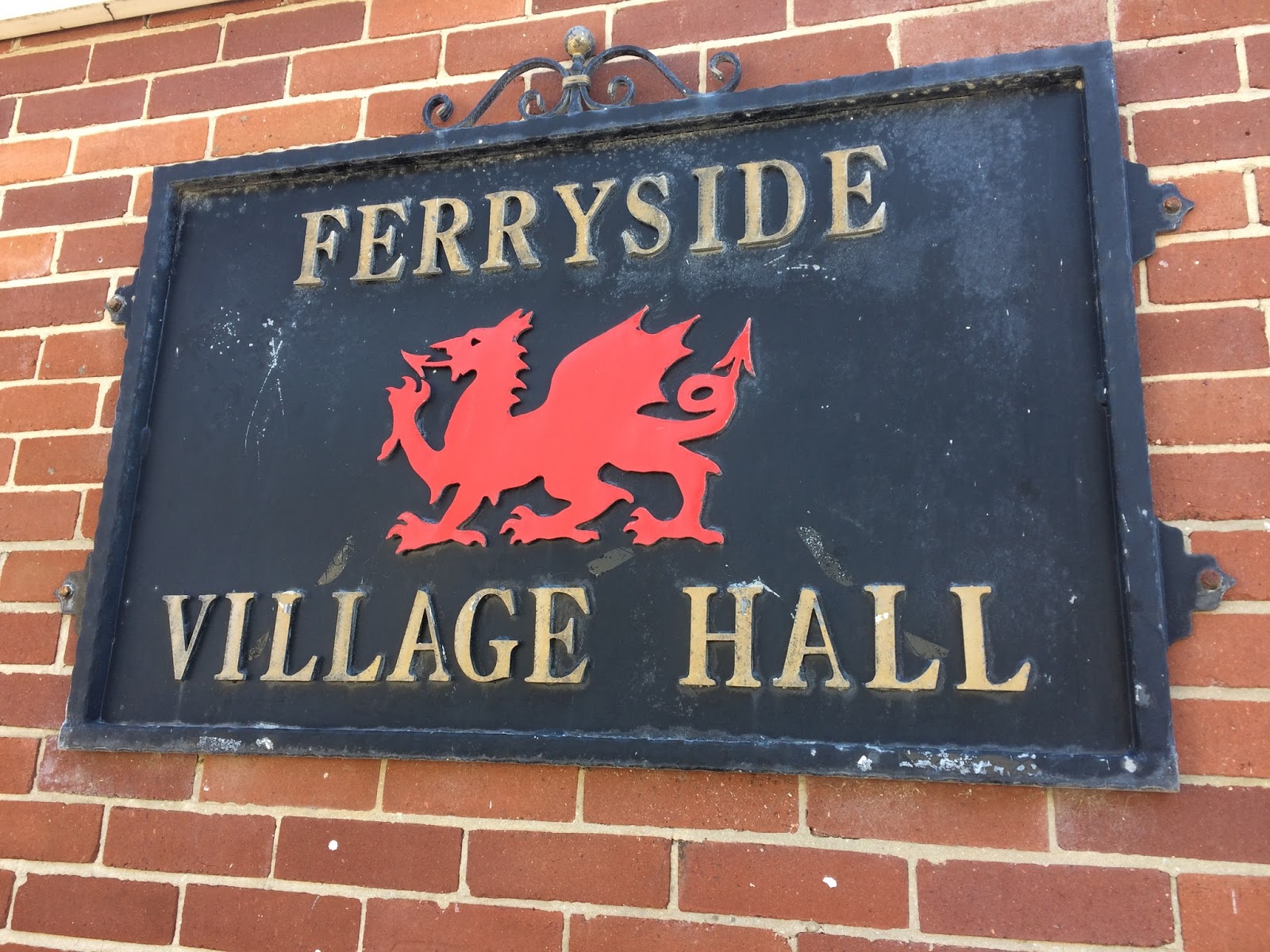
Ferryside Village Hall
Whilst a lot of farmers and land-owners have insisted that the coast path be routed away from their land, the couple who own Bronyn Farm seemed to have embraced the public right of way and gave us cheery waves, as we walked through their farm on the way to a small country lane on the far side of their land.

As we closed the gate to their farm, a train sped past and, as we knew that BRH (Best Russian Husband) was on his way to Carmarthen at some point that afternoon, we waved at the train in true-Railway children style, hoping he would look out of the window and see us (it turns out his train was arriving a few hours later than we thought, but it amuses me to think of passengers on the train seeing us and wondering who had let the lunatics out of the asylum for the day!)

Bronyn Farm to Gellylednais (2.6 miles/4.2 kilometres)

From Bronyn Farm we followed a series of country lanes, climbing uphill again until we got to the top of Trelymsi, where we were rewarded with lovely views towards Llansteffan and the outskirts of Carmarthen, barely visible in the far distance.

Country lane at Trelymsi

The hedgerows were absolutely full of verdant plant growth and flowers, lots of foxgloves on this walk, which really took me back to my childhood, when we use to pull the flowers off the foxgloves and wear them on our fingers!  BAM also identified red campion, crane's bill, dandelions, buttercups, dog rose, daisies, bramble, cow parsley, honeysuckle, knapweed, bindweed, red and white clover and even fuchsia, which lit up the roadside in a splendid roadside red.

We passed another farm at Pentrecwm, where a pack of dogs were rather excited by our arrival and barked furiously, whilst keeping their distance.  After the farm itself, we entered my worst nightmare - a field full of cows (or this time, young bullocks).  I feel I've come a long way, since my being-chased-by-cows experience in Uttoxeter in 2014 and, after a momentary panic where I thought 'I can't do this' - I quickly regained my composure and followed BAM, as she bravely struck out across the field.

We saw some more peaceful-looking cows later in the walk
There were cows running in every direction around us, some were quite panicked, others were trying to sneak up behind us, but BAM chased them off every time they got too close.  It was a relief to get through the field, although the far side was downhill, which meant that the cows were on higher ground than us, which also frightens me, but we eventually found a gate leading to another wooded valley.

Passing down and up the side of the valley, we came to another field, where a large white horse was blocking the kissing-gate we needed to pass through.  It was clear that the horse was very ill, as he was breathing heavily and had some foam in his mouth, as well as some half-chewed grass. I thought he might be dehydrated, as he seemed to be staring longingly at the small stream that was trickling past on the other side of the fence from him.

We managed to coax him away from the gate, eventually, and crossed the field quickly, to see if we could find a farmer, or someone who might be able to check that the horse was okay.  Unfortunately, the only people around were holiday-makers, but we passed on the information to anyone we could find within a mile radius, to see if they could get some help.

Gellylednais to Carmarthen (4.6 miles/7.4 kilometres)

After Gellylednais we came to Towey Castle Farm and Towey Castle, where there is a residential home, where a small dog accompanied us on part of the walk.  We bumped into the only other walkers we met that day in a field just outside Towey Castle and gave them an estimation of how much time it would take for them to walk to Ferryside.  I think they were originally planning to go to Kidwelly but, as it was already well into the afternoon and they looked quite tired, I doubt they made it all the way to Kidwelly.

Small town life in Croesyceiliog
Not long after that we came to a small road, which led to a bigger road that runs through Croesyceiliog and another few miles to Pen-sarn, then through some industrial estates and concrete underpasses until we emerged at Carmarthen train station and crossed the bridge to visit the town and the remains of the Carmarthen castle.

Carmarthen
Carmarthen castle
We thought it was quite amusing to see sheep grazing, a stone's throw from the town centre and we really liked Carmarthen - there was a nice atmosphere in town, although all the shops had closed, we grabbed a bit to eat at Pizza Express, overlooking a small square in the shopping district.

Access for Wheelchair users

A lot of this walk went through fields and along small walking paths, so the walk in its entirety wouldn't be suitable for wheelchair users, however, there were many parts of the walk that followed quiet country lanes and the sections around Llansaint and from Towey Castle into Carmarthen could be adapted to suit a wheelchair user.  

Of course, it's always dangerous to wheelchair on roads, so you should only do so, if you're willing to deal with oncoming traffic.  

Image credits:  

All photos were taken by me - please feel free to reuse them under the following Creative Commons license:

Attribution (especially to this blog post)

Share-alike

Non-commercial


Sunday, February 19, 2017

Caerphilly to Cardiff - Gwyddau a chestyll (digaffein)

It's now six and a half years since myself and BAM (Best Aussie Mate) started walking the Chesters of England and it took a long time for us to realise that there were any chesters in Wales at all, because the Welsh prefix Caer- wasn't immediately obvious to us!

Better late than never, I suppose - Caerphilly and Cardiff clocked up our 43rd and 44th Chesters, respectively and, with only 18 more Chesters to go (although we do keep finding new ones!), we're just over two-thirds of the way through our Chester walking project.

It's quite an adventure going to Wales, both because of the distance, but also because of the subtle cultural shift - we've often experienced the difference between regions in England, particularly when we head up north, but Wales is a different country and that, somehow, made it feeling like we were really travelling abroad!

Because of the nature of the journey (and the price of Friday night train tickets to Cardiff), we changed our usual routine of Friday/Saturday walking, leaving on Saturday instead and doing our Chester walk on the Sunday, which may be a first.

Lodging and victuals

It was pouring down with rain, when we arrived at Caerphilly station on a cold and dark Saturday night at the beginning of February.  Most of the local inhabitants were safely indoors, enjoying some Saturday night telly, or in the local pubs and restaurants, oblivious to our arrival, as we walked through the town, past the gloom of Caerphilly castle and the dark brickwork of the cottages on Bedwas Road.

At the end of Bedwas Road, the Premier Inn Caerphilly Crossways shone like a beacon, guiding us to our evening meal and a good night's sleep!  We were absolutely drenched by the time we got there, but the lady on reception was lovely, as the staff at Premier Inn always are and made no comment on our bedraggled state or the reasons we were abroad on such a dank and miserable evening.

The on-site restaurant at the Premier Inn is called Brewers Fayre and served up a passable evening meal, which saw us through until breakfast the following morning.

Caerphilly Crossways to Caerphilly Castle (1.2 miles/1.9 kilometres)

Luckily the weather improved a lot overnight and, although it was quite cold when we set out from the Premier Inn on Sunday morning, it was dry and the distant view of the mountains motivated us to make our way back along the Bedwas Road towards Caerphilly castle.

There was a local race going on, so the first part of our walk involved dodging some rather exhausted-looking men, women and children, who were doing some kind of circular run, involving the Bedwas Road.  BAM loves a good run, but I must admit that I can't think of anything less appealing that getting up early on a cold Sunday morning, to don the skimpy clothes that runners seem to favour and launch myself into the bracing, winter air for an activity that seems to involve a wholly unnatural challenge for the human physique!  Give me a 13-mile walk to Cardiff over that any day!

The castle in Caerphilly is impressive, although it looked very closed and we had it all to ourselves, apart from a couple of Malaysian tourists and a pack of geese, who were engaged in some kind of goosemageddon!  My abiding memory of Caerphilly is the huge goose-fight we witnessed outside the castle.

Caerphilly Castle

Caerphilly Castle and moat

Goosemageddon
I'm more than a little bit vague on the Romans in Wales, but perhaps my knowledge will increase, as we do more of the Welsh Caers?  I used to think the Romans never made it to Wales, as they never conquered Ireland, but Caerphilly Castle and many of the other castles in the Welsh Chesters we'll visit, is built on the site of a Roman fort, later taken over by the Normans and a succession of English and Welsh families.


Wales does have some spectacular castles and we saw three in total during this walk, which I also think is some kind of record for our Chester walking.

Caerphilly Castle to Craig yr Allt (3.4 miles/5.5 kilometres)

Caerphilly looked very closed on a Sunday morning and, as we made our way up the Mountain Road towards Caerphilly Common, I was getting a bit worried about BAM, as she hadn't yet had her morning coffee, which can be a rather dangerous situation!

Caerphilly Common
The lack of coffee was made up by the stupendous views from the top of Caerphilly Common - we got talking to a young Welsh couple who do lots of walking the in the local area and they were able to point out the Brecon Beacons at a distance to the north and the Welsh coast and Somerset, far way to the south.

Psalm in Welsh and English

View towards the Brecon Beacons
In my mission to find coffee for BAM, I got us a little bit lost, convincing myself that a distant roadside cafe was the direction we were meant to be going in, rather than completely the wrong direction.  As a result, we spent quite a bit more time wandering around the top of Caerphilly Common than we'd meant to, witnessed some dog-walker rage and eventually found our way onto the Glamorgan Ridgeway, which was the path we wanted to follow across to Craig yr Allt.

View from the top of Caerphilly Common

Countryside around Caerphilly
The views from the top of Craig yr Allt were equally stunning and, as we drifted along the ridge in contemplative (and decaffeinated) silence, I marvelled, not for the first time, at the fact that so few of our Chester walks have brought us anywhere near the mountains.  I can see how attractive the Rhymney Valley must have been to the Romans - close enough to the coast, but hidden behind hills like Craig yr Allt, that separate Cardiff from the Valleys.

BAM on Craig yr Allt

View towards the Bristol Channel and Somerset
Craig yr Allt to Castle Coch (4.8 miles/7.7 kilometres)

I felt quite sorry for the River Taff, squeezed in between industrial estates, as it made its way slowly south towards the sea.  From our vantage point at the top of Craig yr Allt, we also slowly made our way down into the Taff valley, following the river for most of the rest of our route all the way to Cardiff.

Bridge at Taff's Well

BAM revived somewhat, as we sat on a bench on the Taff trail, munching chocolate.  We were a bit behind schedule at this stage, so we resolved to bomb it along the trail, which was now quite clearly signposted and took us into the Fforest Fawr, through a gap in the hills and down to the wonderful Castell Coch. The well-maintained trail made it easy for us to regain some time.

BAM on the Taff Trail
Although the Normans were the first to build a castle on this site, just outside the (difficult to pronounce) village called Tongwynlais, the current castle is very much 19th century, in its Gothic revival style, reminiscent of something from a Hollywood movie.  We didn't go inside the castle, but walked around the grounds a bit, before making our way down to the village below.

Castell Coch front entrance

Castell Coch
Castle Coch to Gabalfa (4.4 miles/7.1 kilometres)

At Tongwynlais, we followed the Iron Bridge road down to the river and then the surprisingly busy path, alongside the river Taff, through Cardiff's outlying suburbs, Whitchurch and Llandaff, all the way to the high-rise apartments in working-class Gabalfa.

The Lewis Arms at Tongwynlais
The river looked like it was in more of a hurry at this point and we passed lots of families with kids, enjoying the late afternoon sunshine and a chance to take the dog for a walk.

The Taff Snail

Attractive building at Whitchurch
Gabalfa to Cardiff Castle (2.5 miles/4 kilometres)

By the time we got to the far end of Bute Park, we were completely mucked up to the eyeballs and in no fit state to stop in at a restaurant in Cardiff city centre.  So we made a pit-stop at the National Express bus station in Sophia Gardens where we got a code for the station toilets, so we could change out of our muddy boots and hiking trousers, into clean shoes and jeans.

High rise buildings at Gabalfa
Footbridge over the river Taff

Unfortunately the men's toilets were out of action, so BAM had to smuggle me into the ladies' loo, where the lights weren't working, so I found myself changing in the dark.  BAM being BAM was very organised and had a head torch to facilitate the transformation from muddy hill-walker to respectable citizen.

The River Taff at Taff Castle (aka Cardiff)
I'm very fond of Cardiff, having been there quite a few times before for work and as a tourist, so it's always lovely to go back and they've done a lot of work to the city centre, making it very attractive to visitors and residents alike.  I have a favourite restaurant there, Giovanni's, so I was able to introduce BAM to the Giovanni experience and their quatro staggioni pizza went down a treat after a cold day in the outdoors!

Cardiff Castle

Cardiff Church Street


Access for wheelchair users


The first part of this walk, on higher ground was pretty inaccessible for wheelchair users, however, the Taff trail looked fairly accessible and it runs all the way from Cardiff to Brecon which, at 55 miles, would make for good multi-day wheelchairing!

Image credits:

All photos were taken by me - please feel free to reuse them under the following Creative Commons license:

- Attribution (especially to this blog post)
- Share-alike
- Non-commercial