Showing posts with label the Severn. Show all posts

Sunday, July 15, 2018

Caerwent - Motorways and Monarchs in Monmouthshire

It's been many months since I've written a Chester blog post - probably the biggest gap I've had since this project began and this is due to the fact that we were prevented from doing a Chester walk in March, because of an unexpected snowfall - although we rescheduled our Caerwent walk and did it in May instead, I've been quite busy since then and, in fact, I've resorted to writing this blog post after a busy day at the office, on a work trip to India - a million miles away from rural Monmouthshire and far removed from the possibility of being snowed in!

Getting to Caerwent was always going to be a challenge, from a logistical point of view, but we managed quite well in the end, catching the 17:30 National Express service from Victoria Coach station, all the way to Chepstow, then jumping in a pre-ordered taxi, to take us the remaining miles to Caerwent itself.

Lodgings and Victuals

We had a really lovely stay in Northgate House BnB which, as the name suggests, is located on the site where the northern gate of Venta Silurum, the Roman settlement which gives Caerwent it's Chester credentials.  Actually, one advantage of Caerwent's relatively obscure location is the fact that the Roman town is rather well-preserved and quite a few sites have been excavated and made for an interesting visit when we arrived, although it was already after 9pm.

The church at Caerwent (sunset)
The light is good in May, so we had enough time to visit the Roman ruins and we even walked along the southern wall of the Roman settlement, which led us, handily enough, to the Coach and Horses Inn, where we settled in for a couple of drinks and a chance to have a proper catch up.

Y Deml Celtaidd-Rufeinig

Caerwent to Caldicot Castle (2.4 miles/3.9 kilometres)

Starting out bright and early the next morning, we retraced our steps through the Roman town, as far as the Church of St Stephen and St Tathan, then back along the southern wall and south along the Dewstow Road, crossing a bridge at Nedern Brook.  In case you're wondering, St Tathan was a Celtic saint, supposedly the son of an Irish king, who moved to Caerwent and set up the church there.  One thing about walking in Wales is that we're learning the names of saints we'd never heard of before, as they were local figures who, perhaps, didn't make much of an impression on the ecclesiastical world stage.

The Roman Wall in the southern part of Caerwent

After Nedern Brook, we turned left down the rather busy Church Road, in the direction of Caldicot, Caerwent's more ambitious neighbour, opting for a quieter cycle path which follows Sandy Lane under the busy M48, Monmouthshire's prime motorway and into some quiet suburbs on the edge of the town.

The cycle path led us to St Mary's Church in Caldicot, where we passed around the churchyard, then took a small path through the country park to Caldicot castle.  The castle was celebrating some kind of anniversary so, luckily for us, it was free entrance and we went into the castle grounds, where we stopped for some refreshments.  It was one of the first really nice summer days, so it felt good to sit in the castle grounds and drink lemonade, before we set off again in the direction of the Severn.

Caldicot Castle

Caldicot Castle to Sudbrook (1.9 miles/3.1 kilometres)

It was a short walk from Caldicot castle to the Severn, passing under the M4, which is the main motorway between London and South Wales and reaches across the river Severn in an impressive structure called the Second Severn Crossing, or the Prince of Wales bridge.  Most times I've been to Wales, I've travelled by train, which passes through the Severn Tunnel, under the river - so it was interesting to see the other option, which is the huge road bridge linking England and Wales.  We also saw the (old) Severn bridge, later in the day, which links Chepstow to South Gloucestershire.

BAM walking on the Wales Coast path near the Second Severn Crossing

It was the day of the Royal Wedding, so more Duke of Sussex than Prince of Wales and BAM (Best Aussie Mate) was quite excited to get an update, via Australia, on the dress that Meghan Markle had chosen to wear.  We stopped briefly at Sudbrook, an interesting little workers' village that sprang up in the 1870's, in response to engineering work on the Severn Tunnel, which passes under the cliff at this point.

The Prince of Wales bridge over the Severn
One of the locals tried to interest us in a series of chalk arrows, a bit of a Da Vinci code moment, that was completely lost on me, but apparently has some esoteric significance to the villagers of Sudbrook!

Weird chalk arrows at Sudbrook

Sudbrook to Mathern (3.2 miles/5.1 kilometres)

It was a nice walk along the Wales Coast path from Sudbrook to St Tewdric's church in Mathern (queue another obscure Welsh saint!) - there were some interesting rocks on the seafront and great views across the Severn to the lighthouse on Charston Rock.  We had a short break in the shade beside St Tewdric's church, as BAM went online to book a ticket for a music festival called The Mighty Hoopla, which we went to a couple of weekends later.

Lighthouse on Charston Rock
Sitting in the shade at St Tewdric's church in Mathern

Mathern to Thornwell (1.3 miles/2.1 kilometres)

From Mathern we walked past an industrial estate to reach Thornwell, an outer suburb of Chepstow, where I managed to convince BAM to stop at Tesco Express for a much-needed ice-cream!  Thornwell had a strange kind of vibe - someone shouted something unintelligible at us, as they were driving past on Denbigh Drive, then we passed Thornwell Football club, where there was a Royal Wedding party - lots of people getting drunk and wearing plastic Union Jack hats!

It's the oldest part of Chepstow, but not the nicest and we were glad to find that the path led us into a lovely wood, above the railway line and with great views towards the Army barracks at Beachley.

Thornwell to Chepstow Castle (2.2 miles/3.5 kilometres)

It was still quite a walk from Thornwell, over the ridge to Chepstow, past the remains of the city walls, then down past the train station to the town centre and the beautiful Chepstow castle.  I found Chepstow to be a slightly higgledy-piggledy place - medieval in its layout, which made it quite interesting.

Chepstow castle
Strangely, it reminded me a bit of Lifford/Strabane, where I grew up, there's a certain 'border' feeling I got in Chepstow - the river, the Army base, the frontier feeling - it all reminded me of home!  Although we don't have a fantastic castle in Lifford, as they do in Chepstow and I couldn't help but wonder if the castle was built to keep the English out, or to keep the Welsh in!

Cas-Gwent railway station
There's an award-winning pizza restaurant called Stone Rock pizza and we can certainly recommend it, as it was quite lovely sitting in the garden at the back of the restaurant, stuffing ourselves in the early evening sunshine. 

Access for Wheelchair users

Inaccessible path between Sudbrook and Mathern
The first part of the walk from Caerwent to Sudbrook was accessible, although you would need to be careful on the stretch of road between Nedern Brook and Sandy Lane.  The path was inaccessible from Sudbrook to Mathern, but Mathern to Chepstow was mostly on a cycle path and seemed fairly accessible, so this walk could form two distinct stages that would be accessible to wheelchair users. 

Image credits:

All photos were taken by me - please feel free to reuse them under the following Creative Commons license:

Attribution (especially to this blog post)
Share-alike
Non-commercial

Friday, September 29, 2017

Gloucester - Bus times, Broadband and the story of Bill's

It's been just over a year since we had our first foray into Gloucestershire, when we walked in the Cotswolds last June (visiting Frocester and Woodchester).  But this was our first visit ever to Gloucester city itself.

In Roman times, Gloucester was called Colonia Nervia Glevensium or Glevum for short.  The origin of this name is a bit obscure, but it might come from a Celtic word for 'bright place' (sounds suspiciously like the Germanic word glow - which makes me think there may have been some obfuscation of the meaning down through the years).

Glevum - the Roman name for Gloucester
Interestingly, the modern Welsh name for Gloucester is Caerloyw and the modern English name is what's left of Gleaw + chester.  It's one of the English place names I really struggled to pronounce, when I first visited this country - for anyone who's still a bit unsure, it's generally pronounced Gloster.

The Museum of Gloucester on Brunswick Road
Lodgings and victuals

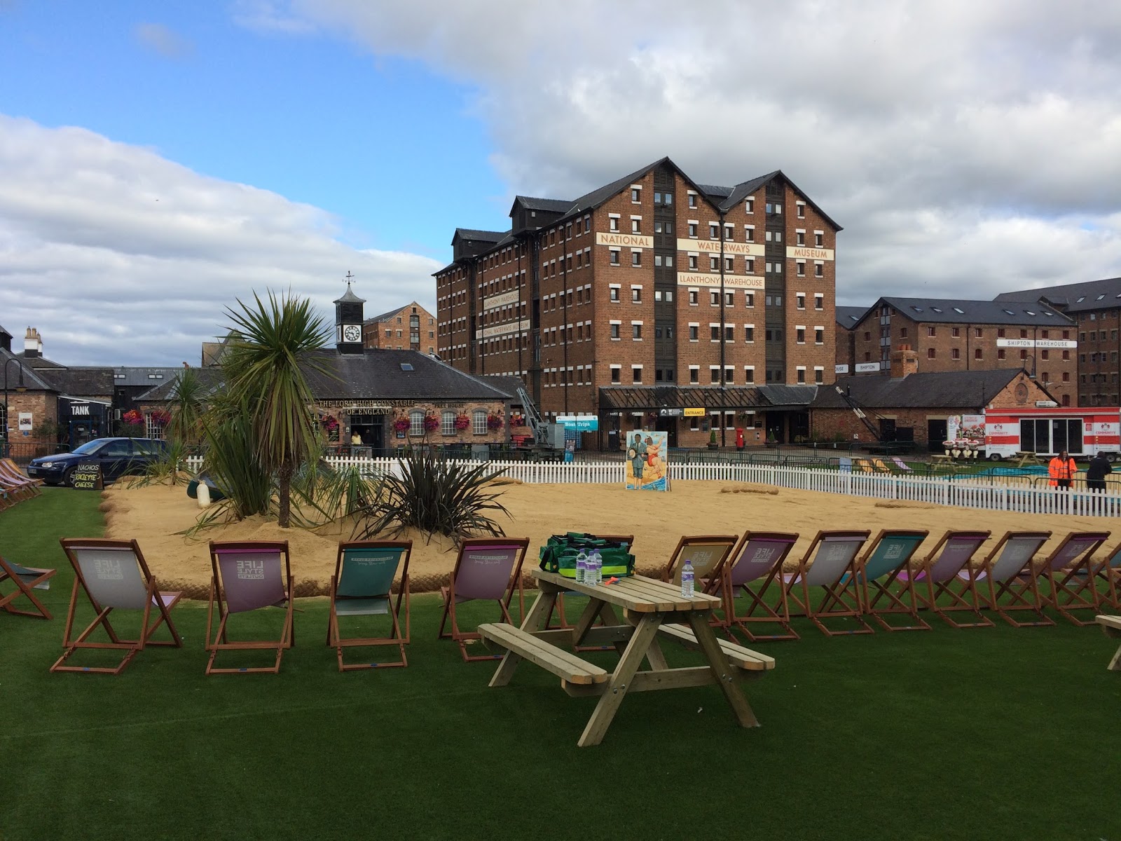
It wasn't very bright when we arrived off the train around 9pm on a Friday evening in August and it was difficult to get a sense of the place, as we made our way along Brunswick Road towards the Travelodge, our destination for the evening.  We managed to have a half-decent meal at The Lord High Constable of England in Gloucester Quays, run by the Wetherspoons chain and the pub was packed with the Friday night crowd - a friendly buzz of conversation, laughter and background music.

Gloucester Quays - the place to be on Friday nights!
Gloucester Quays is probably the most attractive part of town and there is a good selection of restaurants and bars in converted customs buildings near the River Severn.  Not to mention a Saturday morning market and an artificial beach beside the quays, which intended to save people the long journey to the coast!

The artificial beach on Gloucester Quays

We decided to have breakfast in Bill's Gloucester Quays, which was nothing less than sensational! Purely by coincidence, I had been in the original Bill's in Lewes the week before and I'm quite interested in Bill's story and how this restaurant chain has become so successful - not to mention the fact that their food is amazing!

Breakfast at Bill's in Gloucester Quays
BAM (Best Aussie Mate) was convinced that Bill's is, in fact, an Aussie chain, but a quick search on Google cleared up the confusion, as we learned that there is another chain of Bills, which has also has a story and started in Sydney, Australia.  By all accounts, the food there is also very good and I'm sure some of our Australian readers will be able to confirm this.

Mitcheldean to May Hill (3.3 miles/5.3 kilometres)

We decided to start in the country and walk back to Gloucester, both for the satisfaction of having a sense of destination, but also for the convenience of being able to jump on a train afterward, for the journey back to London.

Getting to Mitcheldean was a bit of an adventure though - unfortunately, the bus times from Gloucester to Mitcheldean have changed recently, but the website I was looking at hadn't been updated, so we missed our bus by about five minutes and ended up catching a taxi to Mitcheldean instead.

Mitcheldean in Gloucestershire
Thirty minutes and £27 later found us on Hawker Hill in Mitcheldean, looking for the Wysis Way, which is the path we followed for most of this walk.  Mitcheldean appealed to me, as Mitchel is another way of saying Michael and, indeed, the main church in the village is called St Michael's.
I don't think we'd walked on the Wysis Way before and it's a handy 55-mile link between the Offa's Dyke path and the Thames Way.

As we left Mitcheldean on a small road which passed the Business Village, we had an interesting debate on the responsibility of governments to provide decent broadband and I was trying to convince BAM that we're living in a first-world economy with third-world Internet connections.

View from May Hill Farm
I'd read recently that the UK's connectivity is worse than Romania's, but actually, researching this further, I've learned that this isn't true and, actually, both the UK and Romania have strong Internet connections - about 16.1 mbps in Romania and 16.3 in UK.  There is an organisation called Akamai that publishes quarterly reports on the State of the Internet - well worth a look, if you're interested.

The highlight of the walk was reaching the top of May Hill, not the biggest hill in the world, at 296 metres, but with fantastic views across to the Wye Valley and the distant hills of Wales to the West, as well as a stunning view of the River Severn, wending its way to the south.  I'd like to return to May Hill on May 1st, as apparently they have Morris dancing on top of the hill every year!

May Hill - view towards Wales

May Hill - old signpost

Trig on the top of May Hill
May Hill to Tibberton (4.8 miles/7.7 kilometres)

From May Hill, it was an easy path down towards May Hill village, then a very quiet path through Newent Woods, where we met a rather rugged man, who was carrying a sawn-off piece of tree.  We stopped to talk to him and he showed us the rings on the bark, which he was going to use to calculate the age of the tree.

There is a rather lovely-looking pub at Glasshouses called The Glasshouse Inn, after which we followed the least well-marked section of the entire walk, through Castle Hill Wood, past a small lake hidden in the depths of the Gloucestershire jungle!

The Glasshouse Inn
After Byford's Farm, I had to face my worst fear again with a field-full of young cows, who seemed rather panicky at the sight of us.  We passed through a total of four fields full of cows on this walk and I think I'm starting to come to terms with the fact that if I don't panic, they are also less likely to panic.  Animals can smell fear and stress and they don't respond well to that, so I kept my breath calm, as we slowly made our way past the various herds of cows we met on the Wysis Way.  Still not my favourite thing though and the thought of cows fills me with dread!

It's hard to write this in September and realise how hot the weather was, just over a month ago but, by the time we got to Tibberton, I was starting to feel a bit dehydrated, so it was lovely to sit in the churchyard at Tibberton Court and have a little rest , about halfway through the walk.

BAM negotiating the fields around Tibberton

Holy Trinity Church at Tibberton
Tibberton to Lassington (3 miles/4.8 kilometres)

I have to say, the people of Tibberton weren't particularly welcoming, especially when we missed the signpost for the Wysis Way in Orchard Rise and got told off by a rather obese lady, who had been enjoying the sunshine in her back garden, until we appeared on a lane between houses, trying to get back onto the path again.

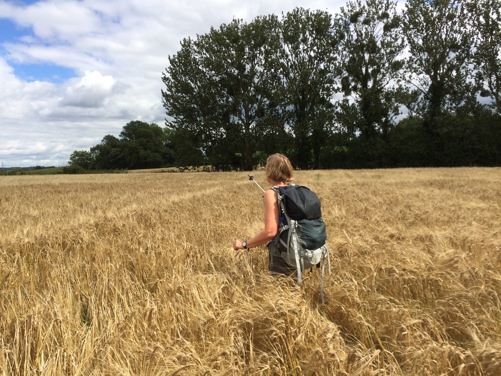
After Tibberton the path disappeared completely into a field of crop and we almost got scratched to death making our way to an eerie cluster of buildings called Bovone, the kind of place that looks like it could feature in an American movie about serial killers!

At Bridge Farm, we crossed the road and joined a disused railway track, which is now part of the Three Choirs Way - a path we walked on before, when we were visiting Worcester back in 2012.  It was an easy path and not too many cows between Bridge Farm and the medieval village of Lassington.

Disused railway line, now part of the Three Choirs Way
Lassington to Gloucester (3.5 miles/5.6 kilometres)

There is nice view of Gloucester and the Severn Valley from the north side of Lassington Hill, then a complicated route downhill through a small wood and out onto the main road at Over.  From Over, we followed local footpaths all the way the Gloucester.

Train near Over

By the time we got to Gloucester, my tongue was stuck to the roof of my mouth, so I was really happy to have a cold beer and some food in the garden of the lovely Fountain Inn just off Westgate Street.

Street Art in Gloucester
Access for Wheelchair Users
Field edge near Taynton

Very little of this walk would be recommended to wheelchair users - but there are plenty of interesting and accessible paths around Gloucester.  I would also recommend a return trip to May Hill from Glasshouses, all of which could be done by using small roads.  

There is a small road that runs from Glasshouses to Tibberton, pretty much parallel with the Wysis Way, but you should only use roads at your own risk and I couldn't really recommend this.  

Image credits:

All images were taken by me - please feel free to reuse them under the Creative commons license:

Attribution (especially to this blog)
Share alike
Non-commercial

Sunday, March 6, 2011

Wroxeter - Viroconium Cornoviorum

Our last -chester trip was to Rochester, which is at one end of Watling Street, the ancient Roman road running across the British mainland, from the coast at Kent to the Severn.  This time we found ourselves at the other end of Watling Street in Wroxeter, Shropshire.  Although these days it's barely even a village, in Roman times Wroxeter was the fourth largest settlement on the island of Britain, with an estimated 15,000 people and a Roman civitas that included public baths and a forum. 


Wroxeter Roman City, English Heritage site
 Last year Channel 4 made a programme called Rome wasn't built in a day which documents the reconstruction of a Roman-style villa at the site of Wroxeter Roman city.  I only managed to catch one episode before we did our Wroxeter walk but, now that I've been there, I'm definitely interested in watching the whole series!  This new feature of the English-heritage owned site was opened to the public last month but, unfortunately myself and BAM arrived in Wroxeter too late and left the next morning too early, to have to time to explore the site properly.

The West Midlands Cornovii


Roman villa at Wroxeter
 We like to stay in the -chester we visit, when that's possible and, although I'm sure there were lots of interesting accommodation options in nearby Shrewsbury, there is a lovely hotel in Wroxeter, which is reasonably priced and has a wonderful setting.  Trundling up from London on the train (via Birmingham, a sign of the times, there is no longer a direct rail service between Shropshire and the capital) and then catching a bus from Shrewsbury, followed by a short walk to the hotel, we went from one extreme to the other.  The hustle-bustle of one of the world's largest cities, to the tranquility of the Shropshire countryside. 

Our room had a view of the Wrekin, in the distance, Shropshire's iconic hill.  Indeed, the name Wroxeter, or as the Romans called it Vironconium Cornoviorum, was borrowed from the nearby hill fort on the Wrekin.  The origins of the name are obscure, but it might have something to do with the Celtic/Welsh word for werewolf


Snowdrops
 Before the Romans arrived on the scene, Shropshire was the territory of a Celtic tribe which the Romans called the Cornovii.  We don't know much about them, they produced no coins or other artifacts that might have preserved their culture, so the Roman records on the history of this tribe are our main source of information, apart from the hill forts and other archaeological evidence that they left behind.  There is a theory that the Cornovii of Shropshire and the West Midlands migrated south to Cornwall and gave that part of Britain its name, but this theory is controversial and the official story is still that Cornwall was so named because it resembled a 'horn'.  Another theory is that the Celts worshipped 'horned gods' (this may later have become our image of the devil) and there is a small village, called Abbot's Bromley, in neighbouring Staffordshire, where villagers still enact a 'horn dance', which has been around since time immemorial. 

Wroxeter to Atcham (1.8 miles)


The road out of Wroxeter
 The weather in Shropshire was rather strange yesterday.  A mist hung over the Severn valley for the whole day, that gave us the impression we were walking through someone else's dreams!  The path that we followed is part of the Severn Way, a 220-mile walking path that starts in mid-Wales and finishes somewhere near Bristol.  It's hard to imagine how much of a obstacle the Severn was, in Roman times - their great trans-Britannia road seems to have literally ground to a halt at Wroxeter, as they settled down and tried to figure out how to cross the river!  It practically separates England from Wales and, being the longest river in Britain, I think it has an iconic status, that is barely recognised, in our era of motorways and high-speed rail.  It was certainly the main focus of our walk yesterday and I think myself and BAM are confident that we now know this part of the Severn pretty well!


Old bridge at Atcham
 The first couple of miles from Wroxeter to Atcham were easy road-walking.  Atcham was a pretty place, with a wonderful old bridge, which has been superseded by a newer road bridge.  Atcham was the birth-place of Ordericus Vitalis (or as BAM so cruelly renamed him, Odorous Vitalis), the English chronicler who wrote one of the most famous histories of the Middle Ages, the Historia Ecclesiastica.  It also has a fine country house called Attingham Park, which is a National Trust property.

Something of a pattern on these walks is the mysterious links between places in Britain that are physically distant from each other.  Atcham/Attingham is named after Saint Eata, a 7th century bishop from Hexham in the North East of England.  It reminds me of the Hoo St Werburgh, the village in Kent, which is named after the patron saint of Chester.  It makes you wonder to what extent communication was possible between places that were really distant.  We tend to assume that there was little communication, because of the distances involved, but this obviously wasn't the case.  Nevertheless the connections are still somewhat obscure!


The Shropshire Loggerheads
 An interesting thing about Shropshire is that the county symbol is three loggerheads (which is the heraldic term for leopard's heads).  Again, it hints at something much more exotic and makes me more curious than ever, with conspiracy theories about werewolves running riot in my imagination!  The loggerheads in the picture are from a sign in Atcham.  BAM was terribly amused by the county motto, Floreat Salopia - Salopia being the Latin name for Shrewsbury.  As I also speak French, I can understand how that might sound a bit funny to a French-speaker!  I must admit, we did have a guilty giggle, as we walked past the Salopian Leisure Centre

Atcham to the A5 (approx 2 miles)


The Severn near Emstrey
 Shortly after leaving Atcham, we also left the road, continuing our walk much closer to the river, along one of the many bends that is characteristic of the Severn in this part of Shropshire.  The walking was pretty pleasant and, before long, we found ourselves at the modern bridge which carries the A5 over the river.  The A5 is an incredibly important road and was one of the earliest road building projects of modern Britain.  Although it more or less follows the route of the old Roman Watling Street, it's been altered and changed so many times that the original road no longer exists.  The bridge we were looking at was a pretty modern one and replaced an earlier version of the A5, which was the road we'd just walked on from Atcham. 


The A5 in the distance
 In 1800, an Act of Union was passed which united the Kingdom of Great Britain with the Kingdom of Ireland, effectively creating a new country, which we still call the UK!  Seeing the importance of establishing effective communication between London and Dublin, the government of the UK invested heavily in creating a unified road system, the A5, which would make travel between the British and Irish capitals relatively high-speed (by early 19th century terms!).  I guess, as an Irishman, the A5 is pretty important, as a symbol of Britain's relationship with Ireland and it's another iconic feature of the landscape, that I had no awareness of, before I started planning for this trip!  It runs all the way from the Marble Arch in London, to Holyhead, where you can connect by ferry to the Irish capital.  It used to run right through the centre of Shrewsbury, but now bypasses the town and the bridge in the picture is the point where it first crosses the Severn. 


The A5 near Shrewsbury
 Overall responsibility for building the A5 lay with the popular engineer, Thomas Telford.  I wish I'd had more time to read up on Thomas Telford, as he sounds like a fascinating person.  He was a self-made man, born into poverty and self-taught, he became one of the most prolific civil engineers of the late-18th and early-19th centuries.  He built numerous bridges in Shropshire and around Britain, he was famous for his canals and was even invited to Gothenburg by the King of Sweden to build the canal there.  The modern-day town of Telford, which has overtaken Shrewsbury in terms of population, was named after this Scottish engineer.  Another interesting thing I learned about Telford is that his mother's name was Janet Jackson! 

The A5 to Monksmoor (approx 2 miles)


A lonely tree on Monkmoor
 This part of the walk was incredibly quiet - passing under the railway bridge and another A-road, the A49 which was a 1920's project, built for motor-cars, rather than horse and carriage, linking Lancashire with South Wales.  The river meandered peacefully and we walked along, mostly in silence, lost in our own thoughts.  The river bends again, just opposite Uffington and the houses of Monkmoor are set back from the river.  Although you're incredibly close to Shrewsbury at this point, it feels as though you're in the middle of the countryside!  I was quite taken by this image of the tree on Monkmoor, which seemed incredibly forlorn by itself in the middle of the field!  I guess the area was called Monkmoor, as it's at the back end of Shrewsbury Abbey.  Shrewsbury is prone to flooding at several points along the Severn, some of the worst floods being at the other end of Shrewsbury, in Frankwell, which was flooded three times in 2000!  It would explain why some parts of Shrewsbury aren't particularly built up.

Monkmoor to the English Bridge (approx 3.5 miles)


The promenade at Ditherington
 We found Shrewsbury really interesting.  It's not a place you hear about much, in the news (which can only be a good thing!).  Although you have the feeling that you are in any typically English market town, you can sense the presence of Wales and, as I understand it, much of Shrewsbury's economy these days is focused on the many Welsh shoppers and visitors the town receives.  I was keeping an eye on the local news before going to Shropshire and it was interesting to see the reports of protests and campaigns by local people who are angry at the cuts to Shropshire Council's budget.  Whilst I'm used to protests, living in London, it surprised me to see this level of anti-cuts feeling in a part of England that traditionally votes Conservative. 


The walk into Shrewsbury
 The local Conservative MP, Daniel Kawczynski is 6 foot 8 1/2 inches tall (that's 2 metres four) and is believed to be one of the tallest MP's ever to sit in the UK parliament!  He belongs to a more right-wing grouping of conservatives, called 'the cornerstone group' and he is of Polish descent. 

This part of the walk took us through the suburb of Ditherington, where we crossed the road bridge and then walked on a really nice promenade all the way down to the centre of Shrewsbury.  We passed under another railway bridge, just below Shrewsbury Castle, then walked along the Gay Meadow to Shrewsbury's English bridge. 

The English bridge to the Welsh bridge (1.2 miles)


The Shrewsbury School
 We'd spent a couple of hours wandering around Shrewsbury when we arrived on Friday, but we hadn't done the riverside walk before yesterday and this was definitely the highlight of the day.  It says a lot that Shrewsbury's two main bridges are called the English Bridge and the Welsh Bridge and Shrewsbury itself acts as a kind of gateway between England and Wales.  Saturday seems to be a really popular time for the town's rowing clubs and, as we walked along Victoria Avenue, we saw lots of rowing teams zipping up and down the river, being shouted on by their coxswains and chased along the bank by friends videoing their performance. 


Statue of Hercules
 Some of the teams were from The Shrewsbury School, a well-known educational establishment founded in the 16th century.  Former pupils, known as Old Salopians (I can hear BAM giggling on the other side of London!), include Charles Darwin, Paul Foot, Michael Palin and Christopher Booker (the founder of Private Eye). 

Despite the bad weather, it seemed as though the whole of Shrewsbury had come out to jog, cycle or walk through Shrewsbury's main park, the Quarry.  The photo is a view of the Quarry with the statue of Hercules in the foreground.  Apparently, the statue used to face the other way, with its back to the park, as its front was deemed too shocking for the local womenfolk!  I'm also showing you the back, so as not to offend my more sensitive readers :-)

The Welsh Bridge to Shelton and back again (approx 4 miles)


Street Sign at the Welsh Bridge
 At the Welsh Bridge, the Severn Way joins up with part of a local walk called 'the Darwin town trail', which has interesting plaques telling different aspects of local history and highlights Shrewsbury's Darwin connection.  This side of the river is known as Frankwell and grew up as a separate place to Shrewsbury.  It's where Darwin lived, as a boy and some of the fields we were walking through, especially the Doctor's Field, are places that he would have known well as a child and are where he developed his interest in the natural world.  We followed the river for a couple of miles to the suburb of Shelton, then turned back onto the main road and made our way back to Frankwell and across the Welsh Bridge for some well-earned victuals in a very popular restaurant called The Armoury

Image specs:

All photos were taken by me.  Please feel free to reproduce them, using the Creative Commons License for non-commercial, attribution (especially this blog), share-alike and you can make derivative works.