This was the first time our Chester trip brought us to the North East of England. Chester-le-Street is a market town in County Durham, just to the south of Newcastle, it lies on the Roman road which ran up the east coast of England to Wallsend. This trip certainly had a very different feel to it and I think it's fair to say that myself and BAM are now thoroughly familiar with the east coast route, due to the delays and difficulties we had getting there and back!
Lodging and victuals
 |
| Tribley Farm near The Moorings |
We might have arrived in Chester-le-Street two hours later than we'd expected, but our accommodation at
the Moorings Hotel in Hett Hills, just outside the town, more than made up for the long journey to get there. Unfortunately, because of the delay, we didn't get a chance to eat at the hotel restaurant,
the Prime Rib, which has great reviews. Apparently, it's a really popular spot for Sunday lunch and people drive there from miles around to sample their famous Yorkshire pudding!
We'd found it hard to get accommodation in the town itself and we now know this was because of the one-day International between England and India at Chester-le-Street's
Emirates Durham International Cricket Ground. That would explain why every room in the town was booked out! By all accounts, tickets for the match had sold out in December of last year! We couldn't have ended up in a better place than
The Moorings and I'd recommend it, if you're ever up Durham-way.
The Moorings Hotel to Edmondsley (2 miles)
 |
| Horses at Tribley Farm |
 |
| Weird sculpture on the ground |
We didn't intend to visit Edmondsley on this walk! Whilst we have, on occasion, got
a little bit lost in previous Chester walks, this time we got
spectacularly lost
and somehow walked in completely the wrong direction,
away from Chester-le-Street rather than towards it! In our defense, I have to note that the landscape between the Moorings hotel and Congburn plantation looks completely different to what you see on the map. It feels as though they have been tearing chunks out of the surrounding fields and re-creating the landscape to turn it into something else. There were lots of eerie pieces of wooden sculpture, like the one in the photograph, which seemed to have been run over by a digger.
 |
| Congburn Plantation |
The myriad of paths through Congburn plantation are also partly to blame, as well as the interesting conversation we were having about hostage-taking, which led us to take that fateful right turn, when we should have gone left! In case you're not already aware of it, I have a sister blog to this one called
Learning about the World, which recounts my armchair travels to different parts of the world. I'm currently blogging about
Yemen, which is why we were talking about hostages in the first place! I guess the path to Edmondsley had taken
us hostage and, although it seemed like a nice enough place, we were keen to get to Chester-le-Street and back on the track of our intended walk.
Place of the horse people
I'd managed to convince myself, before this trip, that, in true English fashion, Chester-le-Street should be pronounced something like
Chester-l'Estrey or something equally pretentious, but no, in true North East fashion it's just
Chester-le-Street! The accent in this part of Durham is fascinating - not quite Geordie, definitely not Yorkshire, but somewhere in between.
 |
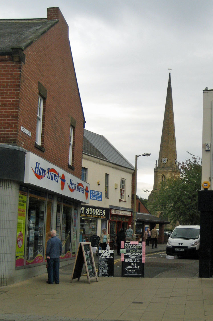
| Front Street, Chester-le-Street |
After all of our Chester walks in the south of England, the North East was suddenly very exotic, like being in a different country - the place names are very different -
Ouston, Birtley, Kibblesworth, Nettlesworth - definitely not southern English names. Then there were curious names, like
No Place and
Pity Me and North American names like
Washington, Canada, Philadelphia and
Quebec, as though the Americans had colonised England and not the other way about!
The Romans called Chester-le-Street
Concangis, which was their approximation of the original Celtic place name, which meant something like 'place of the horse people'. It's also the name of the small river
Cong which runs through Chester-le-Street and the plantation where we got lost! Interestingly, the Russian word for horse is also конь
kon'. The name Chester-le-Street was used to differentiate this Chester from all the other Chesters in England, ie. this was the one on the Roman road (or
street) to Wallsend. Chester-le-Street's Roman history isn't very visible these days, because the town was built on top of the Roman fort, so everything Roman is underground.
The Pilgrim's Way
 |
| St Mary and St Cuthbert's |
 |
| Signpost for Cuddy's Corse |
We restarted our walk on the main street, which is called Front Street, with a view of St Mary and St Cuthbert's, Chester-le-Street's main church. St Cuthbert seems to have been phenomenally popular in the north of England and his body rested in Chester-le-Street for 112 years in the 9th/10th century, before being moved further south to Durham cathedral. It turns out that the walk we did from Chester-le-Street is actually part of a pilgrim's route known as
Cuddy's Corse (ie. the path that they carried St Cuthbert (
Cuddy's) body (
corse). The route runs from the Farne Islands (north of Newcastle) to Durham, but it's not exactly a direct path, as it goes via Edinburgh and Carlisle in a highly circuitous loop.
Chester-le-Street seems to be a popular stopping off point on the way from North to South and it was also the first stop on the famous
Jarrow March of the 1930's, when 207 protestors marched from Jarrow in South Shields to Westminster Palace in London, to highlight the extreme poverty and unemployment faced by people in the North East at that time.
Chester-le-Street to Great Lumley (2 miles)
 |
| England v India at the Emirate Durham ICG |
The first two miles of our walk took us past the
Emirates Durham ICG where we could hear the cheers of 75,000 spectators and we could see the stadium draped in English and Indian flags. As we were passing, the weather was fine and everything was going well, but I heard on the news later that they had to call the match off because of the rain which fell at around 3pm. We crossed Lumley Bridge, then turned right onto
the Weardale Way, passing the magnificent
Lumley Castle Hotel (rooms starting at 185 GBP for a twin. Hmmm, maybe next time!)
The way followed the River Wear for a little bit, then turned left to pass Lumley Riding, skirting a hedgerow and wheat fields which brought us to Great Lumley.
 |
| Horse at Lumley Ridings |
 |
| Front Street, Great Lumley |
All of this land was once part of the Lumley estate, the Lumleys being a prestigious local family of Anglo-Saxon origin. Great Lumley was also known for its coal mines in the 19th century. Intriguingly, we spotted a pub on Great Lumley's
Front Street called
The Warriors Arms.
 |
| Fields outside Great Lumley |
We often hear the sound of gun shots on our walks through the country, usually a regular sound created by machines to scare away birds. This time we heard real gunshots, down towards the river and it reminded me of a great Spanish movie I've seen recently called
El rey de la montaña. If you've seen the movie, then you'll know why. If you haven't seen it (and you like thrillers) then it's well worth watching!
 |
| Inside Finchale Priory |
Great Lumley to Finchale Priory (1.4 miles)
 |
| The entrance to Finchale Priory |
We continued following the Weardale way, through some fields and onto a small country road called Cocken Lane, which brought us back to the river, crossing a pedestrian footbridge to reach the ruins of Finchale Priory. This one
is pronounced differently than it's spelled, so it's pronounced
Finkle not
Finchale. The priory is really beautiful and reminded me of
Bolton Abbey. Like
Bolton Abbey the priory was abandoned during the dissolution of the monasteries in the 16th century. Walking around the ruins, I couldn't help but feel appalled at the ruination of such a wonderful site. It's now managed by
English Heritage and maintains an atmosphere of dignified contemplation.
Finchale Priory to Brasside (1.1 miles)
 |
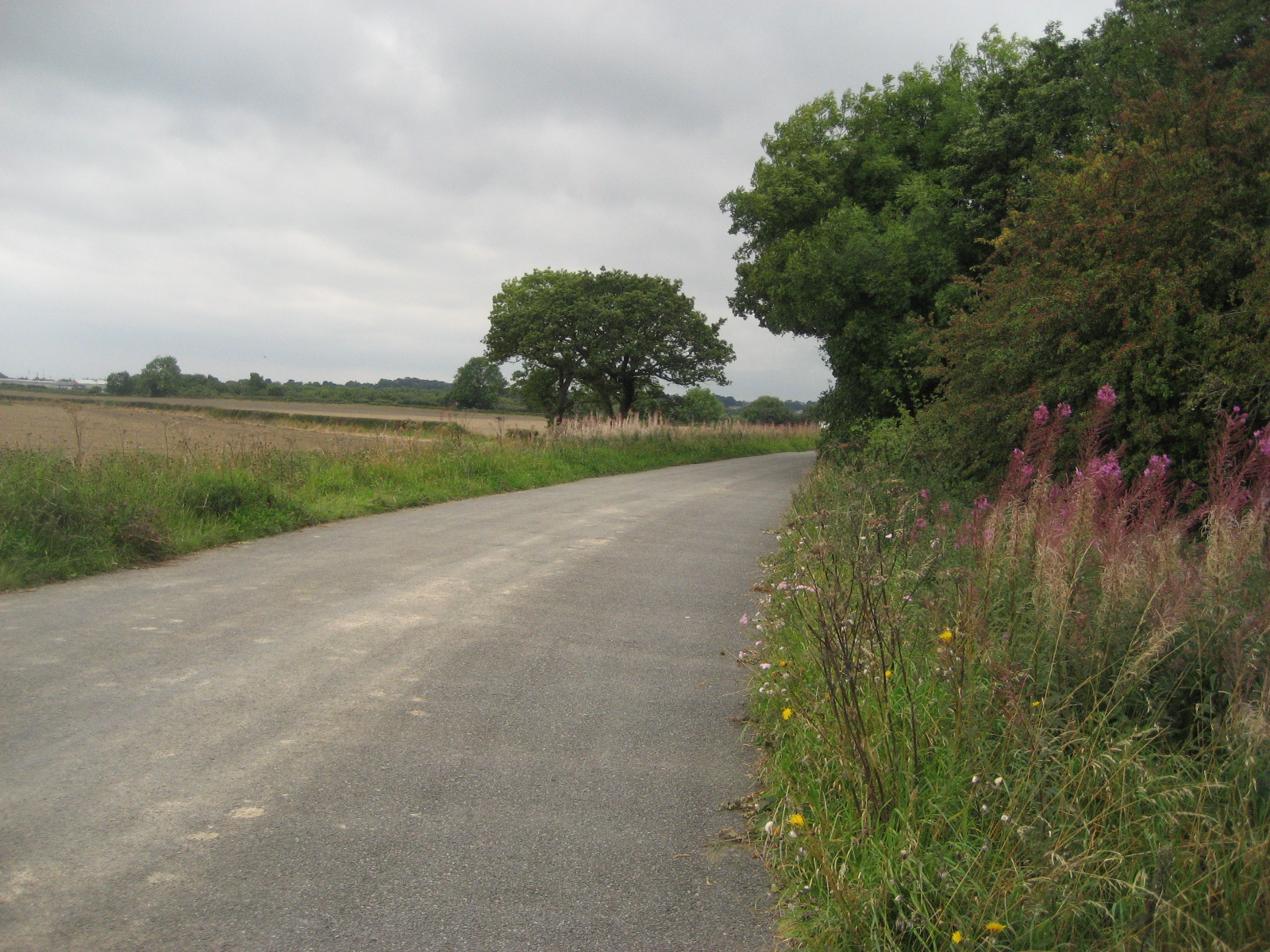
| The lonely road to Brasside |
Finchale Priory lies at the end of a very lonely road, which brings you down to the village of Brasside, the location of two Category A prisons, Low Newton womens' prison and Frankland mens' prison. We've seen a few fortified buildings on our walks, notably Fort Nelson in
Portchester, but nothing as frightening and impressive as the prisons at Brasside. The Weardale way, rather nonchalantly, goes right between the two prisons and we crept along, in awe of the prison walls, as the clouds burst suddenly and the rain pelted us angrily. I've found out since our walk that Rosemary West is currently being held at Low Newton and that Frankland holds the child-murderer, Ian Huntley. It makes me shiver just thinking about how close we were to such evil minds!
Brasside to Durham (2.3 miles)
 |
| View of Durham cathedral |
The rest of the walk to Durham was pleasant enough, despite the rain, and we could see Durham cathedral in the distance, romantically lounging in the mist on top of the hill. I'd never been to Durham before this walk, but I'd heard a lot about it and it certainly lived up to my expectations. We arrived with about an hour to spare before our train, so we walked around the city, through Market Place and up Saddler Street and Owengate to Durham Cathedral. The cathedral is a fantastic structure and we walked around inside, listening to the choir singing and reading about the history of the building. We also visited the shrine to St Cuthbert, thereby ending a pilgrimage that we didn't know we'd started!
Access for Wheelchairs users
 |
| Durham castle |
The part of this walk that I would recommend for wheelchair users is the Weardale way from Finchale Abbey to Durham. If you don't mind wheelchairing through a prison(!), this part of the route is fairly accessible, with a few bumpy bits coming down Frankland Lane and a slightly steep slope down from Frankland Farm. Durham has a new pedestrian bridge which is wheelchair-accessible and will bring you to Market Place via the Gala Theatre. Alternatively, you could get an elevator to street-level in the Gates Shopping Centre and cross the bridge at Leazes Road, just as we did.
Image credits:
All photos were taken by me - please feel free to use them under the Creative Commons license:
Attribution (especially to this blog)
Share alike
Non-commercial