Showing posts with label St Cuthbert. Show all posts

Sunday, April 7, 2013

Doncaster - Snow drops, Power stations and Level crossings!

St Cuthbert's church at Fishlake
I think it's fair to say that our Doncaster walk was not at all as we expected it to be.  First of all, the weather was really nice - a welcome break from the cold and miserable winter we've been experiencing in England this year.  Secondly, Doncaster has a reputation for being quite industrial, run-down and gritty - yet our walk took us through some of the most gorgeous countryside, along canals and across rural railway junctions, via a long green corridor that runs right through the city, so you can barely sense you are in the heartland of South Yorkshire's former mining area. 

Victuals and Lodging

Of course, it helps that we started our walk outside the city, in a small village called Fishlake, about 10 miles north-east of the city centre.  The name Fishlake particularly appealed to me, so poor BAM (Best Aussie Mate) was tasked with finding accommodation, in a part of England that doesn't see a lot of tourists.  There is a wonderful old mill in Fishlake, which has been converted into self-catering accommodation, but it was a bit extravagant for one night only, so BAM contacted the only other B&B in the village. 

Fishlake village
Unfortunately, the B&B wasn't available on the date we needed, however, the owner very kindly passed us on to one of her neighbours, who put us up in their 'granny flat' right beside St Cuthbert's Church.  We got a real feeling that the villagers were clubbing together to make sure we were looked after and felt welcome - a touching sense of community that most of us presume no longer exists in 21st century England, but that myself and BAM have experienced again and again.  A nightcap at the local pub, The Hare and Hounds, was just what we needed to settle us, after our travels!

Fishlake to Stainforth Bridge (1.2 miles/1.9 kilometres)

Thorne Round walk at Fishlake
We started off by passing alongside the churchyard to climb the river bank and then headed south on a local trail known as the Thorne Round walk.  Our walk didn't take us to Thorne, but we could feel the  presence of the village, both in the local signage and place names.  Instead, we walked towards Stainforth, following the path along the right bank of the River Don, which Doncaster is named after.  Like many Roman settlements, the name is a combination of a Celtic word Don (the name of a Goddess) and the Roman affix -caester


CO2 clouds from nearby Power station
At Stainforth Bridge, we nipped into the village to get some supplies in the local shop.  Stainforth looked much more run-down than Fishlake and it reminded us how much the area around Doncaster has suffered, as a result of the mines closing in the 1980's, amongst other things.  Doncaster and its surrounding areas has long been a staunch Labour-voting, working-class stronghold and Stainforth lies in the North Doncaster constituency, which is represented in parliament by the Labour leader, Ed Miliband. 

Stainforth Bridge to Kirk Bramwith (1.7 miles/2.7 kilometres)

St Mary's church with snowdrops, Kirk Bramwith
From Stainforth Bridge, we continued along the riverbank to a small hamlet called Kirk Bramwith.  Kirk Bramwith is home to a very pretty 12th century Norman church, called St Mary's, which is famous for its snowdrops, which flower in the churchyard every February.  The word kirk also reminded us how far from London we were, exactly 166 miles from Charing Cross!

From the path we could see the almost post-apocalyptic clouds of CO2 in the distance, hovering above the power stations that stand out against the flat landscape - I'm not sure which power stations they were, most likely the ones at Drax, by the River Ouse in North Yorkshire.  

Kirk Bramwith to Trumfleet Marsh (2.7 miles/4.3 kilometres)

From Kirk Bramwith, we followed the lane way to Braithwaite, crossing the New Junction Canal, the last canal built in England for commercial purposes (opened in 1905).  At Braithwaite, we picked up the Trans Pennine trail, which runs 215 miles from Hull, on the North Sea, to Southport, on the Irish Sea.  Although it's not yet recognised as a national trail, there has been a lot of investment in the Trans Pennine trail and it's very well sign-posted.  We were able to follow the trail all the way to Doncaster.

Braithwaite village on the Trans Pennine trail
The next part of the walk was along small country roads and wasn't the most enjoyable, as we had to keep our wits about us and keep an eye out for traffic.  We passed Willow Bridge farm, then turned south at Trumfleet, passing White House farm, before we came to Trumfleet Marsh and rejoined the River Don briefly. 

We climbed the river bank again and had a short lunch break, as we discussed our latest movie experiences, my recent obsession with the Austrian film director, Ulrich Seidl, as well as BAM's review of the Chilean movie, No starring Gael Garcia Bernal and directed by Pablo Larrain. 

Trumfleet Marsh to Joan Croft Junction (1.9 miles/3.1 kilometres)

Trumfleet Marsh, a good place to discuss movies!
From Trumfleet Marsh, we followed the road to a small commuter village called Thorpe in Balne.  Thorpe in Balne has unusually massive properties and is, no doubt, a convenient place for Doncaster's rich folk to live, being quite close to the city.  Our arrival was greeted by a chorus of barking dogs, who made sure we didn't hang around too long, gaping at the sudden display of prosperity!

As we walked along Joan Croft lane, our conversation turned towards another famous Joan - Joan Harris (or Holloway), the voluptuous secretary in Mad Men, played by Christina Hendricks.  We've both just recently seen Series 5 of Mad Men and Joan's dilemma, when she is pressurised into using her feminine charms to win the Jaguar account.  Our musings on the moral implications of Joan's actions came to an abrupt halt at Joan Croft Junction, where the manned level-crossing was shut, as we waited for a freight train to pass by.

This part of Yorkshire is criss-crossed with railways - some of them have become more or less obsolete - others, like the East Coast Main Line, are vital to the functioning of Britain's rail network.  The junction is a busy one, not to mention somewhat dangerous - the fact it's manned is testament to the recklessness of previous walkers and cyclists, who've ignored the signals and crossed the path of high-speed trains!  Normally, road tunnels would take traffic, cyclists and walkers under the railway, but this part of Yorkshire is so flat, that the only way to cross the railway is by building a bridge to go over it which, according to the man working at the level crossing, is what they intend to do. 

Joan Croft Junction to Tilts Bridge (1.6 miles/2.6 kilometres)

Owston Grange
Shortly after Joan Croft Junction, we crossed Thorpe Gates, an unmanned level crossing, then walked along Middle Lane as far as Owston Grange, following the Trans Pennine trail into the ancient Owston Wood.  On the other side of Owston Wood, we crossed yet another railway line, west-east this time, paying attention to the signals and carefully closing the gates on either side, as we crossed. 

It was then a short walk along a country lane to the village of Tilts and Tilts Bridge, which crosses the oddly named Old Ea Beck.  On the far side of a small lake, we could see what looked like a Traveller/Gypsy settlement - one of those places with empty dull brick houses with much more 'lived-in' caravans in each yard.  Apparently, Doncaster has England's largest Gypsy and Traveller population, outside London. The primary school in nearby Toll Bar has an intake of 20% of kids from a Gypsy/Traveller background

Tilts Bridge to Bentley Railway station (2.3 miles/3.7 kilometres)

The path to Bentley, with St Peter's Church in the background
From Tilts Bridge we followed Shaftholme Lane, then the A19, walking under a road bridge which brought us to the start of a long, green corridor that cuts right through the heart of Bentley, emerging again on the River Don, a few miles south of Doncaster city centre.  The trail goes on a bit of a detour through the suburbs of Bentley, passing the railway station and an intriguing 'black' church, St Peter's, which is run by the Franciscans. 

Bentley is considered to be one of the most deprived areas of England.  Although, it was certainly very different that some of the 'wealthier' places we've visited during our series of Chester walks, it didn't feel unsafe or extremely poor - I've certainly been to worse places!

Bentley Railway station to Warmsworth (2.4 miles/3.9 kilometres)

BAM walking into Warmsworth, South Doncaster
Once back on the 'green corridor' it was a very pleasant walk past the suburbs of Sunnyfields, Cusworth and Newton, before we met the River Don again at Warmsworth, crossing the river via a small pedestrian bridge near the village of Sprotbrough.  It all seemed very civilised, as we passed families taking their dogs for a walk, local teenagers playing football and joggers making the most of the early spring sunshine. 

The path got a lot lonelier towards the end, as we left the city behind us.


Warmsworth to Doncaster Railway station (2.3 miles/3.7 kilometres)

Welcome to Hexthorpe!
At Warmsworth, we doubled back on ourselves, following the Warmsworth Road and then the High Road, before turning left into Greenfield Lane and crossing the railway tracks to enter the suburb of Hexthorpe.  BAM had images of a Hexthorpe High Street filled with pretty boutique shops and cosy little restaurants, but all we could see were convenience stores and fast-food take-away joints, as we scuttled through the fading light and made our way to Doncaster city centre.

We didn't see a lot of Doncaster in the end, just the local Weatherspoons, where we had a quick bite to eat and a drink, before catching our trains to London (for BAM) and to Leeds (for me, a chance to visit my little sister!)

Access for Wheelchair Users

Don't forget to close the gate!
It's good news for wheelchair users this time, as the majority of this walk was accessible.  The Trans Pennine trail is designed for 'multi-users' and is generally accessible for all kinds of walkers, cyclists and wheelchair users.  I'd recommend the section from Braithwaite to Doncaster, although be mindful of the level crossings, which could be dangerous for wheelchair users, as the trains move pretty quickly!  The walk along the river bank outside Fishlake isn't really accessible for wheelchair users, however, the area around Fishlake is very flat and there are other options for wheelchair users which would be just as satisfying.  

Image credits:

The River Don, near Sprotbrough
All photos were taken by me - please feel free to reuse them under the following Creative Commons license:

Attribution (especially to this blog post)
Share-alike
Non-commercial 

Sunday, January 22, 2012

Chesterwood, Northumberland

This month’s Chester walk saw us travelling ‘up North’ again, to walk through Chesterwood in Northumberland, about 30 miles outside Newcastle.  When we first planned the walk a couple of months ago, I imagined we’d be walking through a winter wonderland of snow and ice, but this winter has been incredibly mild and the weekend’s weather was surprisingly sunny, although still incredibly windy.

Victuals and Lodging – Eve of the Walk

Chesterwood itself is merely a collection of farm buildings, so we found accommodation at Haydon Bridge, on the banks of the South Tyne.  Haydon Bridge is 254 miles (410 km) from London, which is the furthest we’ve travelled for a Chester walk, so we decided to make a weekend of it and stay two nights instead of our usual one.

The General Havelock, Haydon Bridge
We weren’t sure what to expect at Haydon Bridge, but it was a pleasant place, with a couple of pubs and churches.  We stayed at Shaftoe’s B&B, right beside the old bridge, where we had ‘well-appointed’ accommodation and a spacious room.  We decided to have dinner at The General Havelock Inn, a quaint village pub on Haydon Bridge’s main street.  General Havelock was an important player in 19th century British India and died at the Siege of Lucknow in 1857.  I must admit, I’d never heard of him before, despite walking past his statue on Trafalgar Square many times. 

Eat Drink Watch Movie

It just so happened that Friday night was cinema night at The General Havelock, which included some yummy Chinese food and Ang Lee’s movie, Eat Drink Man Woman.  It’s a wonderful movie about a father and his three daughters and, if you’ve not seen it before, I’d definitely recommend it.  The movie club is run by the Haltwhistle Film project (South Tyne Cinema Circuit), which moves around between Haltwhistle, Haydon Bridge, Slaggyford and other places.  Being a rural area, most people travel to the events by car, so they encourage car-sharing. The car with most people is rewarded with a nice bottle of wine.  It was a lovely evening and people were really friendly to us, as we were very obviously ‘outsiders’.  If you live in South Tyneside, or you’re visiting the area, you should look out for the cinema club! 

Haydon Bridge to Chesterwood – 1 mile

St Cuthbert's, Haydon Bridge
After a hearty breakfast on Saturday morning, we set off across the bridge to St Cuthbert’s church and the Tourist office, so we could stock up on information about the local area.  Haydon Bridge was the birthplace of the English Romantic painter, John Martin and they seem very proud of the connection. 

It was no surprise to see that the local church was named after St Cuthbert.  We last came across St Cuthbert on our Chester-le-Street walk, as we walked part of St Cuthbert’s way and his body rests at Durham Cathedral.  After the church, we crossed the Newcastle to Carlisle railway line and followed the North Road, out of the village.

About ¼ a mile out of the village, we turned off on a small country road to Chesterwood, starting an ascent up the South Tyneside Valley that would eventually take us to Hadrian’s Wall.

Dead mole
My abiding memory about Chesterwood is finding a dead mole lying in the middle of the road.  Neither of us had seen a mole before, which is hardly surprising as they mostly live underground.  We felt sorry for the mole and, not wanting it to become a squashed entity in the middle of the road, we used our walking sticks to move it to the verge.  I’ve since found out that the word ‘mole’ comes from the Early Modern English mouldywarp, which basically means ‘dirt thrower’ – mould being the word for dirt, related to our modern English word ‘mould’.

Chesterwood to the Byway – 1.4 miles

Tree with a rainbow
From Chesterwood we continued along the country lane towards Chesterfield, crossing the North road again and walking to the start of a public byway.  It’s a lovely stretch of country and as we ambled along, BAM (Best Aussie Mate) told me about some charity work she has been doing with homeless people in London.  Northumbria felt a million miles away from London and issues like homelessness.  I admire her compassion and it’s humbling to think that it’s only a veneer of luck, family support and employment that keeps any of us from a life on the streets.  Tramping around the countryside is incredibly liberating, but it helps when you know you’ll have some hot food and a warm bed waiting for you at the end of a winter’s day.

The Byway to Stonecroft – 1.7 miles

The Byway near Fell House
The Byway is one of those roads marked on the map with a thick green line that looks a bit like a bicycle chain, according to BAM.  I remember the byway on our Silchester walk which is, rather romantically, called ‘the Devil’s Highway’.  Byways are quite pleasant to walk on, being slightly dilapidated country roads with hardly any traffic.  This byway took us over a small hill, past Fell House and Cottage.  Eventually we came down to the main Newbrough road.  We crossed the road and went down through a steep field until our lunch stop at Stonecroft. 

Stonecroft to St Peter’s Church – 0.4 miles

Stonecroft
From Stonecroft it was a very short walk along a country lane to St Peter’s Church.  We talked about the prospect of Scottish independence and how much tension there seems to be in Westminster right now, at the thought of a Scottish referendum.  The future of Scotland has been on my mind a lot recently and this Chesterwood walk was an apt reminder of the troubled times of the past, when the English/Scottish border moved from North to South several times, before going North again. 

St Peter’s Church to High Teppermoor – 2.1 miles

Teppermoor
From St Peter’s Church we also headed north across some moorland, continuing uphill to reach the ridge that Hadrian’s wall runs along.  This was the most difficult part of the walk, as the path was less well-defined and the terrain was still quite wet from the rain of the past few weeks.  The weather also seemed to change, with the clouds darkening and the rain coming on.  I remembered crossing Rannoch Moor in Scotland and how dark and oppressive moorland can be.  But there’s also a silence in the moor, which is a relief after all the noise and stress of London. 

Perhaps, it’s no coincidence that, as we picked our way carefully through the moor, our thoughts turned to Charles Dickens and this year’s centenary.  This time last year, we walked across the Hundred of Hoo, just outside Rochester, at the heart of Dickens’ imagination; you could almost hear Pip cry out in terror at the groans of convicts being sent off to Australia. 

High Teppermoor to Black Carts – 1.4 miles

Tree with clouds
Coming out of the moor, the sun appeared once more and lit up the landscape around High Teppermoor, our first encounter with Hadrian’s Wall.  Parts of the original Roman wall are still intact and we were lucky enough to see these, especially around Black Carts.  When we first arrived at the road, we were struck by sight of the B6318, heading west in a series of dips and rises.  I guess, in some ways, the 2nd century wall became a 20th century road.  There is a path that runs the entire length of Hadrian’s wall, so we turned right on this path and headed back east, in the direction of Newcastle and Wallsend.

Black Carts to Walwick – 1.3 miles

Hadrian's Wall
It’s amazing really that the Romans invested in a building project as ambitious (and expensive?) as Hadrian’s Wall.  I guess it shows how threatened the Roman province of Britannia felt by their wild Celtic neighbours to the North.  It’s quite moving to see these ruins still standing there, all these centuries later, at a time when the idea of an international border in Scotland is again a possibility.  I also learned that there was another Roman wall, called the Antonine wall, further north, linking the Forth of Firth to the Firth of Clyde.  I guess the northerly extent of the Antonine border was too ambitious and the Roman Empire later retreated to Hadrian’s border, a much more realistic proposition!

I’ve always wanted to walk Offa’s Dyke, another national trail that follows the border between England and Wales. I’m sure Offa’s Dyke was constructed with the intention of keeping the Welsh at bay, but by the Saxons this time rather than the Romans.  In Roman times, the river Severn seemed to serve as a natural barrier between Roman settlements and Wales, as we discovered during our walk in Wroxeter.  There is no equivalent of Hadrian’s wall in Ireland (that I’m aware of), but I guess the Irish Sea was enough of a natural barrier. 

Walwick to Chollerford – 0.8 miles

Walwick
We’d arranged to spend our second night in Walwick, but decided to walk on to Chollerford, which is on the banks of the North Tyne river, so we could pass the Roman fortress at Chesters.  The weather had turned again by the time we got to Chollerford and, with darkness falling all around us, we turned at Chollerford and made our way back to the Walwick Farm B&B.

Lodging and Victuals – the Evening of the Walk

Walwick Farmhouse B&B
Walwick Farmhouse is a beautiful 200-year old building, which has been open as a B&B for less than year.  It’s run by a local woman called Maggie and her partner Paul, both of whom have worked for years in the catering industry.  I have to say I really enjoyed my stay at Walwick Farmhouse and I would highly recommend it.  The view from our bedroom window was entrancing and Maggie & Paul prepared a lovely evening meal for us, after which we read the I Ching and relaxed by the open fireplace. 

Access for Wheelchair Users

The first part of this walk, from Haydon Bridge to St Peter’s Church (on Newbrough Road) would be accessible for wheelchair users.  The hills are fairly steep and, although the country roads around Chesterwood are fairly quiet – I would advise caution at all times.  The Byway was a bit rough and tumble, but fairly accessible.  The main Newbrough Road was much busier so, again, I would advise caution when wheelchairing along this stretch.

The moor is inaccessible to wheelchair users, as is the part of Hadrian’s Wall path that we walked along (it has lots of stiles which walkers need to climb over).  There are parts of the wall, especially near Black Carts, that are accessible, even if only to have a quick look. 
Image credits:
BAM walking on the wall
All photos were taken by me - please feel free to reuse them using the Creative Commons license:
Attribution (especially to this blog)
Share Alike
Non-commercial

Sunday, September 4, 2011

Chester-le-Street - Concangis

This was the first time our Chester trip brought us to the North East of England.  Chester-le-Street is a market town in County Durham, just to the south of Newcastle, it lies on the Roman road which ran up the east coast of England to Wallsend.  This trip certainly had a very different feel to it and I think it's fair to say that myself and BAM are now thoroughly familiar with the east coast route, due to the delays and difficulties we had getting there and back! 

Lodging and victuals

Tribley Farm near The Moorings
We might have arrived in Chester-le-Street two hours later than we'd expected, but our accommodation at the Moorings Hotel in Hett Hills, just outside the town, more than made up for the long journey to get there.  Unfortunately, because of the delay, we didn't get a chance to eat at the hotel restaurant, the Prime Rib, which has great reviews.  Apparently, it's a really popular spot for Sunday lunch and people drive there from miles around to sample their famous Yorkshire pudding! 

We'd found it hard to get accommodation in the town itself and we now know this was because of the one-day International between England and India at Chester-le-Street's Emirates Durham International Cricket Ground.  That would explain why every room in the town was booked out!  By all accounts, tickets for the match had sold out in December of last year!  We couldn't have ended up in a better place than The Moorings and I'd recommend it, if you're ever up Durham-way. 

The Moorings Hotel to Edmondsley (2 miles)

Horses at Tribley Farm
Weird sculpture on the ground
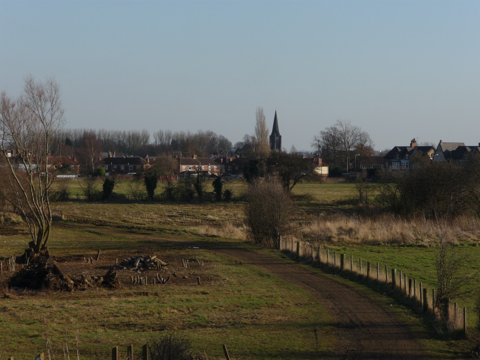
We didn't intend to visit Edmondsley on this walk!  Whilst we have, on occasion, got a little bit lost in previous Chester walks, this time we got spectacularly lost and somehow walked in completely the wrong direction, away from Chester-le-Street rather than towards it!  In our defense, I have to note that the landscape between the Moorings hotel and Congburn plantation looks completely different to what you see on the map.  It feels as though they have been tearing chunks out of the surrounding fields and re-creating the landscape to turn it into something else.  There were lots of eerie pieces of wooden sculpture, like the one in the photograph, which seemed to have been run over by a digger. 

Congburn Plantation
The myriad of paths through Congburn plantation are also partly to blame, as well as the interesting conversation we were having about hostage-taking, which led us to take that fateful right turn, when we should have gone left!  In case you're not already aware of it, I have a sister blog to this one called Learning about the World, which recounts my armchair travels to different parts of the world.  I'm currently blogging about Yemen, which is why we were talking about hostages in the first place!  I guess the path to Edmondsley had taken us hostage and, although it seemed like a nice enough place, we were keen to get to Chester-le-Street and back on the track of our intended walk. 

Place of the horse people

I'd managed to convince myself, before this trip, that, in true English fashion, Chester-le-Street should be pronounced something like Chester-l'Estrey or something equally pretentious, but no, in true North East fashion it's just Chester-le-Street!  The accent in this part of Durham is fascinating - not quite Geordie, definitely not Yorkshire, but somewhere in between. 
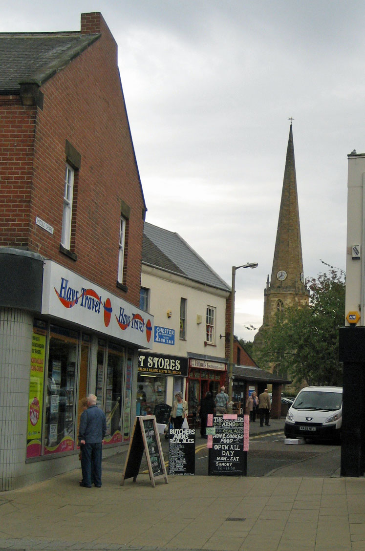
Front Street, Chester-le-Street

After all of our Chester walks in the south of England, the North East was suddenly very exotic, like being in a different country - the place names are very different - Ouston, Birtley, Kibblesworth, Nettlesworth - definitely not southern English names.  Then there were curious names, like No Place and Pity Me and North American names like Washington, Canada, Philadelphia and Quebec, as though the Americans had colonised England and not the other way about!

The Romans called Chester-le-Street Concangis, which was their approximation of the original Celtic place name, which meant something like 'place of the horse people'.  It's also the name of the small river Cong which runs through Chester-le-Street and the plantation where we got lost!  Interestingly, the Russian word for horse is also конь kon'.  The name Chester-le-Street was used to differentiate this Chester from all the other Chesters in England, ie. this was the one on the Roman road (or street) to Wallsend.  Chester-le-Street's Roman history isn't very visible these days, because the town was built on top of the Roman fort, so everything Roman is underground. 

The Pilgrim's Way

St Mary and St Cuthbert's
Signpost for Cuddy's Corse
We restarted our walk on the main street, which is called Front Street, with a view of St Mary and St Cuthbert's, Chester-le-Street's main church.  St Cuthbert seems to have been phenomenally popular in the north of England and his body rested in Chester-le-Street for 112 years in the 9th/10th century, before being moved further south to Durham cathedral.  It turns out that the walk we did from Chester-le-Street is actually part of a pilgrim's route known as Cuddy's Corse (ie. the path that they carried St Cuthbert (Cuddy's) body (corse).  The route runs from the Farne Islands (north of Newcastle) to Durham, but it's not exactly a direct path, as it goes via Edinburgh and Carlisle in a highly circuitous loop. 

Chester-le-Street seems to be a popular stopping off point on the way from North to South and it was also the first stop on the famous Jarrow March of the 1930's, when 207 protestors marched from Jarrow in South Shields to Westminster Palace in London, to highlight the extreme poverty and unemployment faced by people in the North East at that time. 

Chester-le-Street to Great Lumley (2 miles)

England v India at the Emirate Durham ICG
The first two miles of our walk took us past the Emirates Durham ICG where we could hear the cheers of 75,000 spectators and we could see the stadium draped in English and Indian flags.  As we were passing, the weather was fine and everything was going well, but I heard on the news later that they had to call the match off because of the rain which fell at around 3pm.  We crossed Lumley Bridge, then turned right onto the Weardale Way, passing the magnificent Lumley Castle Hotel (rooms starting at 185 GBP for a twin.  Hmmm, maybe next time!) The way followed the River Wear for a little bit, then turned left to pass Lumley Riding, skirting a hedgerow and wheat fields which brought us to Great Lumley. 
Horse at Lumley Ridings


Front Street, Great Lumley
All of this land was once part of the Lumley estate, the Lumleys being a prestigious local family of Anglo-Saxon origin.  Great Lumley was also known for its coal mines in the 19th century.  Intriguingly, we spotted a pub on Great Lumley's Front Street called The Warriors Arms

Fields outside Great Lumley
We often hear the sound of gun shots on our walks through the country, usually a regular sound created by machines to scare away birds.  This time we heard real gunshots, down towards the river and it reminded me of a great Spanish movie I've seen recently called El rey de la montaña. If you've seen the movie, then you'll know why. If you haven't seen it (and you like thrillers) then it's well worth watching!


Inside Finchale Priory
Great Lumley to Finchale Priory (1.4 miles)

The entrance to Finchale Priory
We continued following the Weardale way, through some fields and onto a small country road called Cocken Lane, which brought us back to the river, crossing a pedestrian footbridge to reach the ruins of Finchale Priory.  This one is pronounced differently than it's spelled, so it's pronounced Finkle not Finchale.  The priory is really beautiful and reminded me of Bolton Abbey.  Like Bolton Abbey the priory was abandoned during the dissolution of the monasteries in the 16th century.  Walking around the ruins, I couldn't help but feel appalled at the ruination of such a wonderful site.  It's now managed by English Heritage and maintains an atmosphere of dignified contemplation. 

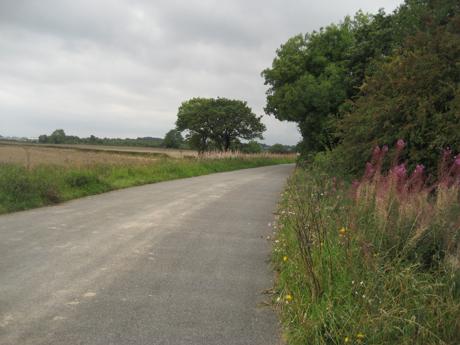
Finchale Priory to Brasside (1.1 miles)

The lonely road to Brasside
Finchale Priory lies at the end of a very lonely road, which brings you down to the village of Brasside, the location of two Category A prisons, Low Newton womens' prison and Frankland mens' prison.  We've seen a few fortified buildings on our walks, notably Fort Nelson in Portchester, but nothing as frightening and impressive as the prisons at Brasside.  The Weardale way, rather nonchalantly, goes right between the two prisons and we crept along, in awe of the prison walls, as the clouds burst suddenly and the rain pelted us angrily.  I've found out since our walk that Rosemary West is currently being held at Low Newton and that Frankland holds the child-murderer, Ian Huntley.  It makes me shiver just thinking about how close we were to such evil minds!

Brasside to Durham (2.3 miles)

View of Durham cathedral
The rest of the walk to Durham was pleasant enough, despite the rain, and we could see Durham cathedral in the distance, romantically lounging in the mist on top of the hill.  I'd never been to Durham before this walk, but I'd heard a lot about it and it certainly lived up to my expectations.  We arrived with about an hour to spare before our train, so we walked around the city, through Market Place and up Saddler Street and Owengate to Durham Cathedral.  The cathedral is a fantastic structure and we walked around inside, listening to the choir singing and reading about the history of the building.  We also visited the shrine to St Cuthbert, thereby ending a pilgrimage that we didn't know we'd started!  

Access for Wheelchairs users

Durham castle
The part of this walk that I would recommend for wheelchair users is the Weardale way from Finchale Abbey to Durham.  If you don't mind wheelchairing through a prison(!), this part of the route is fairly accessible, with a few bumpy bits coming down Frankland Lane and a slightly steep slope down from Frankland Farm.  Durham has a new pedestrian bridge which is wheelchair-accessible and will bring you to Market Place via the Gala Theatre.  Alternatively, you could get an elevator to street-level in the Gates Shopping Centre and cross the bridge at Leazes Road, just as we did. 

Image credits:

All photos were taken by me - please feel free to use them under the Creative Commons license:

Attribution (especially to this blog)
Share alike
Non-commercial