Showing posts with label wheelchair access walks. Show all posts

Sunday, March 8, 2015

Colchester - Clapboarding, creek-crossing and catcalls

We'd been in Essex once before, when we did the Great Chesterford walk back in August 2013, but Colchester is very much at the heart of Essex, a historical town that was one of the main Celtic population centres and the first real capital of Britain.

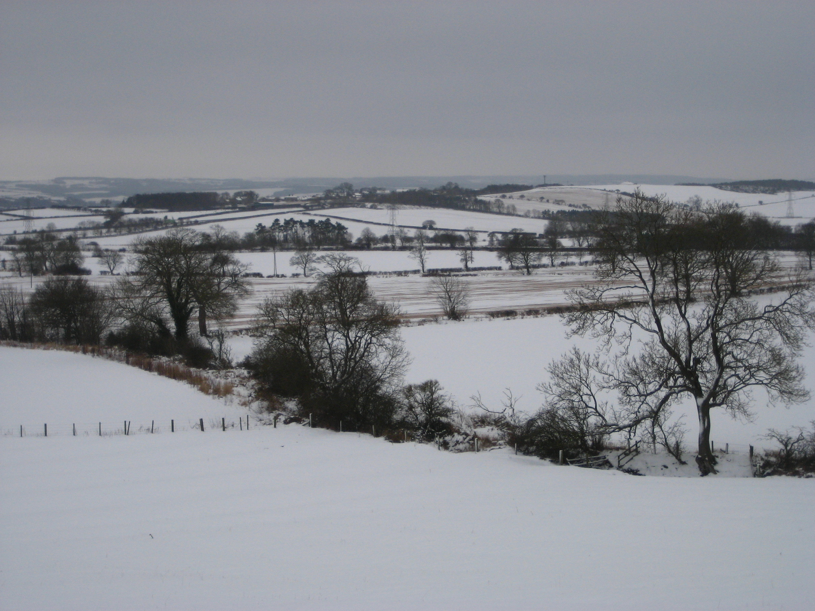
So it was with no small amount of excitement that we boarded our train at Liverpool Street station and set off with the Friday evening commuters into the wilds of a county which, despite being so close to London, manages to feel distant and even a little bit exotic for London-dwellers like ourselves.

Lodgings and victuals

Arriving in Colchester station on a cold and dark Friday evening in February is quite bewildering, but we eventually negotiated our way around the concrete pedestrian overpasses and, in no time at all, found ourselves in the welcoming warmth of the North Hill hotel.  The North Hill hotel was a lovely place to stay and they gave us a nice little cottage at the back of the main building. We had dinner, bed and breakfast, so it was a very welcome start to our Colchester trip.

Colchester Town Hall

Lion mosaic

Colchester to Brightlingsea (87 bus)

Having checked out the map, we decided to start our walk at Brightlingsea, on the coast, walking back towards Colchester and our connections home.  There are surprisingly few public rights of way in this part of Essex and hardly any way-marked trails, so the path along the River Colne was our only real option.

Beach huts at Brightlingsea
Brightlingsea to Alresford Creek (3.2 miles/5.1 kilometres)

Brightlingsea is a pleasant seaside resort with beach huts and an attractive camping site. We started our walk at Victoria Place, following Station Road past the outdoor swimming pool and onto the seafront.  Being February, it was pretty cold, but we were lucky enough to start with cloudy but dry weather and fantastic views across to Point Clear and Mersea Island.

View of Point Clear on the Essex coast
There's a really impressive folly at Brightlingsea, called Bateman's Tower, built by a local landowner for his sick daughter. The path from Bateman's Tower, follows the estuary of the River Colne (which gave Colchester its name) through a nature reserve which was teeming with bird life. The landscape along this path was fantastic, a combination of salt marshes, mud flats and shingle.

Bateman's Tower at Brightlingsea

Path through the Colne Estuary nature reserve

It was fairly easy walking along this 3-mile stretch to Alresford Creek and, despite the cold weather, there were quite a few families and dog walkers out and about, enjoying the bracing sea air!

BAM (Best Aussie Mate) at the Colne Estuary
Alresford Creek via Mill Dam (2.5 miles/4 kilometres)

According to the map, we could cross Alresford Creek on a public bridleway, but that's obviously in low tide and, by the time we arrived at the Creek it was very much high tide and the only way of crossing the creek would have been by boat!  We don't generally have to think about tidal times, so it came as a bit of s surprise to see our path disappearing under, what was effectively, a river.

Alresford Creek at high tide
Our only option was to go upstream around the creek to the crossing point at Mill Dam. Unfortunately, the path along the south side of the creek went through private land, which made us feel a bit uncomfortable, but we felt we had no other choice but to follow this path.  It's quite a peaceful part of the world and, as we made our way along the creek to Mill Dam, the sombre facade of Brightlingsea Allsaints Church, kept a close watch on our every move.

Private path to Thorrington Tide Mill
Getting off the private path involved a lot of climbing over ditches and scrambling through trees, until we emerged into a private garden leading to the Mill Dam.  Thorrington Tide Mill is an impressive, weatherboard building and one of Britain's few remaining tide mill structures.  There's something about the landscape of Essex and East Anglia that's reminiscent of neighbouring lands, such as Holland and Zeeland, on the other side of the North Sea.

Thorrington Tide Mill
As we sat on a log beside the mill pond, munching chocolate and watching the ducks feeding on pond plants, we contemplated the very Dutch-like architecture of Thorrington Tide Mill and the historic links between East Anglia and the Netherlands.

Alresford Creek at Thorrington Tidal Mill

We were able to follow a public path along a beautiful stretch of land on the north side of the creek, until we reached the landing stage on the opposite shore of the creek from where we'd stood about an hour before.

Public footpath on the north side of Alresford Creek

A rare Essex waymarker

Parking at high tide

Ever since our trip to Rochester, Kent in January 2011, we've been a bit obsessed by weatherboarding (also known as clapboarding).  It seems to be pretty prevalent in the east and south east of England, although I noticed an unusual form of weatherboarding in this part of Essex, where one half of the building is painted white and the other half is painted black.

Black and white weatherboarding at Alresford
Alresford Creek to Wivenhoe (2 miles/3.25 kilometres)

It was quite muddy as we made our way through the thicket of trees at Alresford Grange and along the Colne river to the pretty riverside port of Wivenhoe.  We were very enamoured by Wivenhoe and the riverside developments in the village reminded us a lot of places in London like Limehouse basin. Wivenhoe seems to be the place where anyone from Colchester with a bit of money moves to.  There was certainly a lovely feeling in the village and it left us wanting to know more and perhaps revisit Wivenhoe at a future date.

Wivenhoe

Wivenhoe to Hythe (2.7 miles/4.3 kilometres)

On the opposite side of the river from Wivenhoe, we could see another pretty-looking village called Rowhedge and an attractive riverside pub called The Anchor.  Rowhedge and Wivenhoe used to be linked by ferry, but I'm not sure if that's still the case.

Rowhedge
From Wivenhoe we followed an amenable cycle path between the river and the railway track.  The landscape north of Wivenhoe is dominated by the student residences and other buildings belonging to the University of Essex.  The university, which was founded in the 1960's had quite a reputation as a hotbed of radical politics, but these days it's better known for its social sciences and high intake of overseas students.


Student residence buildings at the University of Essex
Hythe to Colchester Castle (1.4 miles/2.2 kilometres)

After our lovely day in the country, it was quite a shock to be back in the 'big city' again and Hythe, an outlying suburb of Colchester, looked a bit run-down compared to the prettier villages we'd seen earlier in the day.  We don't often get jeered at on our Chester walks, but something about our walking gear, sticks and ruddy faces excited the people of Colchester, so we had a few catcalls on our way into the town and one group of teenage boys even offered to point us in the direction of the nearest mountain (for non-UK readers, there are no mountains in Essex!).

Derelict building in Hythe
My abiding memories of Colchester were a police appeal on a poster for a young man who'd been murdered and a thicket of trees where a group of homeless people seemed to have set up camp.  As we reached Colchester town centre, the rain came on and Colchester castle looked squat and sullen at our arrival.

Colchester castle
Luckily we found a nice brasserie on North Hill, where we changed into clean clothes and celebrated our walk with a well-earned steak and glass of red wine.

Access for Wheelchair users

Path into Wivenhoe
The path from Brightlingsea through the Colne Estuary nature reserve was pretty accessible, although one-way only, so a good walk would be to go as far as Alresford Creek and then return to Brightlingsea.  

The footpaths around Alresford creek were completely inaccessible, however, the cycle path from Wivenhoe to Colchester was also pretty accessible for wheelchair users. 

Image credits:

All photos were taken by me - please feel free to reuse them under the following Creative Commons license:

Attribution (especially to this blog post)
Share-alike
Non-commercial

Sunday, February 3, 2013

Rudchester - Snow, Godheads and a new Millennium

Signpost for Rudchester
It's almost a year since we last visited Hadrian's Wall in Northumberland (see the blog post on Chesterwood), as part of our series of Chester walks.

Rudchester is not much more than a couple of farm buildings and was an important fort in Roman times, known as Vindobala from the local Celtic dialect meaning 'white strength'.  The 'white' theme was certainly appropriate as, unlike our previous visit to Northumberland in January 2012 - this year we were rewarded with a spectacular snow fall. 

Lodgings and victuals

We had a very beautiful train journey from London King's Cross to Newcastle-upon-Tyne, through the snowy landscape of the East Midlands and Yorkshire.  Luckily, the snow didn't delay us too much and we made it to Newcastle just in time to catch our connecting train to Wylam, where we spent the night. 

Getting a train to Wylam on a Saturday night, after Newcastle United has lost 2-1 to Reading, isn't the most pleasant experience and it was with a palpable sense of relief that myself and BAM (Best Aussie Mate) disembarked at Wylam station, letting our boisterous fellow-passengers travel onwards to far-flung places like Hexham and Haltwhistle, further up the Tyne Valley!

The proprietor of the lovely Wormald House, on Wylam High Street, kindly picked us up at the station and took us to our accommodation.  We had dinner at the Fox and Hounds, just across the road, before turning in for the night.

Wylam High Street, covered in snow
Community noticeboard in Wylam


Wylam to Rudchester (2.8 miles/4.5 km)

Wylam seemed to be a pretty village - it's most famous for being the birth place of George Stephenson, the 'father of the railways'.  We headed up the Main Street from Wormald House, into Church Road and Holeyn Hall Road towards the B6318 and Rudchester.  The church in Wylam is dedicated to a rather obscure Anglian king, Oswin, who ruled a 7th century kingdom called Deira, which had its capital at York. 

St Oswin's Church in Wylam


It's a gentle climb uphill from Wylam to the Victorian-era Holeyn Hall, designed by John Dobson, the well-known architect of the North, who designed many of Newcastle's Georgian buildings, as well the neo-classical Newcastle Railway station.  Passing Holeyn Hall, we crossed the B6528 to reach a roundabout, just beyond the A69, a major road which runs between Newcastle and Carlisle. 

Tree on Holeyn Hall Road

Small country road leading to the Wall

We continued uphill to the B6318, where we joined the Hadrian's Wall Path.  Also known as the 'Military Way', the B6318 is the road which most closely follows Hadrian's Wall, along a ridge with views over the Tyne Valley to the south and towards Scotland in the north.

A frozen hedgerow

Sheep enjoying the snow!


Perhaps because of the snow, or because we were walking on a Sunday this time (not Saturday, as we usually do) - the road up to Hadrian's Wall felt quite remote.  Several orange-coloured airplanes passed overhead, no doubt Easyjet flights and we wondered what it would have been like for the Roman soldiers huddling in the freezing snow of Milecastle 14 if they had suddenly seen an Easyjet plane passing overhead.  No doubt it would have been extremely frightening, as their minds tried to rationalise the experience.

View over the Tyne Valley

Excavations at Rudchester have uncovered altars to a Roman cult, popular amongst soldiers which, quite unusually, worshipped the Persian God Mithras.  I can't help thinking that, had Easyjet flights suddenly appeared in the skies of Roman Britain, they would have thought it was some kind of Godhead - perhaps a visitation from Mithras himself!

Rudchester to Heddon-on-the-Wall (1.2 miles/1.9 km)

Hadrian's Wall Path runs for 83 miles (134 km) from Bowness-on-Solway, in Cumbria, to Wallsend, just beyond Newcastle city centre.  We'd walked on Hadrian's Wall path, when we visited Chesterwood,  but we could see much more of the wall there than around Rudchester and Heddon.  I suspect this was because, the few parts of the wall that are normally visible at this point, were covered in snow. 

Heddon-on-the-Wall


We were surprised to see people jogging on the path (even in the snow!) and, if local signs are anything to go by, joggers and large groups of people walking in single-file are causing lots of damage to the area around the wall.  By all accounts, Hadrian's Wall path has become very popular with 'charity walkers', in recent years. 

BAM at Heddon-on-the-Wall

Whilst the Hadrian's Wall trust are keen to encourage people to come and see the wall, they want to ensure that the increasing popularity of the Hadrian's Wall path is sustainable.  They're currently running a very interesting campaign called Every Step Counts, which provides guidance and advice on how to walk along the route 'responsibly'.  

Heddon-on-the-Wall to Newburn (3.4 miles/5.5 km)

It was a steep downhill from Heddon-on-the-Wall back to the River Tyne.  Back at the river we joined a very accessible track (popular with local walkers) which follows a former loop on the Newcastle-Carlisle railway line, once known as the Scotswood, Newburn and Wylam Railway.  The line was gradually closed down in the late 50's and early 60's, as part of Dr Beeching's recommendations for the reform of Britain's rail network.  It's great that a lot of these former railway lines have found new lives as cycle and walking paths - also they're usually quite accessible for wheelchair users. 

Path from Heddon-on-the-Wall to the Tyne

Former railway track that runs to Newcastle/Gateshead

Distance view of the Holy Cross Church in Ryton, with green meadow

Newburn to Scotswood (2.4 miles/3.9 km)


Fellow walkers had previously told me that the last part of the walk, from Newburn to Newcastle, wasn't very pleasant - mostly going through council estates and industrial parks.   I was glad to find out that they were wrong and that the walk from Newburn to Newcastle was very pleasant indeed.  Having said that, the heavy snow meant that most people were indoors, so we had, what is presumably a busy urban area, all to ourselves.  Also, I'm sure that the snow was covering all manner of evils, giving the outer suburbs of Newcastle a pristine look akin to an idyllic Scandinavian village.

First signs of the city

The Boathouse Inn at Newburn
Houses at Newburn
 
Newburn and Scotswood are at the heart of Newcastle's former coal-mining areas.  I find the history of this area of Newcastle fascinating and the local council has done a great job at bringing the history to life with statues, art work and information boards.  I was particularly impressed by the statue at Scotswood called Yesterday, Today, Forever which pays tribute to the areas miners.  Scotswood was the scene of a terrible pit flooding in 1925, where 38 men and boys lost their lives. 

Yesterday, Today, Forever statue at Scotswood

Scotswood to the Millennium Bridge (3.8 miles/6.1 km)

I'm a big fan of Newcastle/Gateshead and I've visited several times before, although it was BAM's first visit to the city.  I like what they've done with the city, reconceptualising the 19th-century industrial city and turning it into a 21st century one with inspiring architecture, such as the Millennium Bridge and Norman Foster's The Sage Gateshead.  The last few miles from Scotswood to Newcastle/Gateshead city centre was an easy walk, full of history, great views across the Tyne, passing under the city's famous bridges that are like a lesson in the history of bridge architecture!

The Tyne, low-tide

Sculptures in Elswick

The Millennium Bridge and Baltic Centre for Contemporary Arts


We really enjoyed our walk from Roman Britain, through the Industrial revolution to the 21st century capital of the North-East!

Access for Wheelchair Users

Accessible cycle path, Scotswood
It's great to give some good news for once and I'd highly recommend the path from Wylam to Newcastle/Gateshead, which is wholly accessible and follows the former Wylam, Newburn and Scotswood railway track - it's around 10 miles in total and could be covered by a wheelchair user in 2/3 days, using Wylam and Newcastle/Gateshead as walking bases.  There's a nice pub called The Boathouse Inn near Newburn which, although it doesn't look accessible, has outside seating for summer months.  
 

Sunday, September 16, 2012

Exeter - Canals, Castles and a round of mini-golf

After our last 'Chester' walk through the flooded Nene Valley - it was a relief to have our feet on solid ground again, as we walked down the Exe Valley to Dawlish Warren, on the south coast. 

War memorial in Northernhay Gardens
This was our first Chester walk in Devon and is as far west as we're going to go in this walking series. Exeter was also at the limits of Roman influence in the south west of England.  There are remains of the Roman wall in the city and Roman baths were excavated in the 1970's.  Exeter was also the starting point for one of the most famous Roman roads, the Fosse Way which runs all the way to Lincoln, passing a few other 'chesters' (Ilchester and Leicester) on the way! 

Known as Isca Dumnoniorum in Roman times, it's quite likely that Exeter was the site of a substantial Celtic settlement - the word isca could be related to the Celtic word for 'water' (if you compare modern Irish - uisce, pronounced ish-ka, also the basis for the word whiskey).  When the Saxons arrived, they called it Eascanceaster which became Exeter in modern English). 

Part of Exeter Castle

It's interesting how our walks in modern 'chesters' often involve three aspects of British history; a Celtic root word, somehow incorporated into the placename - evidence of a Roman settlement - the addition of the word ceaster by the Saxons.  There were other important Roman settlements in England like Bath and St Alban's but, for whatever reason, they didn't inherit the Saxon ceaster and, therefore, won't feature in our 'Chester' walks!

Lodgings and Victuals

My Best Aussie Mate (BAM) had spent a few days in Exeter before and is somewhat enamoured with the place, so she acted as my guide for this walk - showing me interesting corners of Exeter, like the Victorian-era catacombs of St Bartholomew's Cemetery or the gorgeous Georgian buildings on Northernhay Street.  We stayed in a grand old building on Blackall Road, which is now Raffles B&B and we had dinner at the wonderful Fat Pig Freehouse on John Street.  I'd recommend the Fat Pig - not only for its delicious, locally sourced menu, but also for their home-made cider!

Cider at The Fat Pig, Exeter
Part of Exeter's Roman wall


Exeter Quayside to Double Locks (1.6 miles)

We started our walk at Exeter's historic quayside - a photogenic place that attracts a lot of tourists.  Exeter has had a quayside since Roman times and this is also the location of a Canal basin for the Exeter Ship Canal that was started in the 1560's - one of England's oldest man-made waterways.  We were following the Exe Valley Way, a 45-mile walk from Starcross (Devon) to Hawkridge (Somerset).  Quite bizarrely, the path crosses the Piazza Terracina with its Italian-style restaurants - the square is named after Exeter's twin-town in Lazio.  Both Exeter and Terracina suffered heavy destruction during World War Two, so I guess the town-twinning was recognition of this common experience.

Exter Historic Quayside


The path from Exeter Quayside to the Double Locks is a pleasant one, although quite busy with other walkers, families and cyclists.  The Double Locks is so-called, because it can accommodate two ships at once.  The lock-keepers cottage is now a popular canal-side bar and restaurant.  I was quite fascinated by the 'snail wall' which you can see in the photo. 

The Snail Wall

The Double Locks


Double Locks to Turf Lock (3.7 miles)

This part of England has strong historical connections with Holland and the canal locks on the Exe show some Dutch influence.  Exeter was once an important centre in England's wool trade and, as we were walking along the path to Turf Lock, you could almost picture the ships laden with cargo, making their way to continental Europe, or returning to Exeter after a long sea passage. 


The path gets further from civilisation, finally leaving the city behind, as you pass under the M5 road bridge.  The first section of the M5 was opened in the 1960's and it runs all the way to West Bromwich, just outside Birmingham.  Myself and BAM were glad to see it go, carrying all of those noisy cars with it, as we passed underneath and strode out into the proper countryside.

Open countryside near the Double Locks
 In the 19th century, a decision was made to extend the Exeter Ship Canal an extra two miles to Turf Lock, where the Exe estuary carries a distinctly sea-perfumed breeze.  On the other side of the river lie the lands of Countess Wear and a village called Topsham, with its Dutch gable houses.  An erstwhile rival of Exeter, Countess Wear is named after a real countess, Isabella de Fortibus, who tried to sabotage Exeter's influence in the 13th century by building a weir that would divert trade to Topsham.  Vivien Leigh had local connections to Topsham and, although we could only see it at a distance, I'd love to visit the village properly, including the local museum, which holds a collection of Leigh memorabilia.

Swan at the Topsham Ferry lock
View of Topsham, across the river


Like the Double Locks, Turf Lock was once a lock keeper's cottage, but is now a very pleasant pub and restaurant.  They also offer accommodation and have a campsite, which seemed really busy with late-summer holiday-makers. 

The Turf Lock Hotel


Turf Lock to Powderham Castle (1.8 miles)

Passing Turf Lock, the Exe river begins to take on some of the grandeur of the open sea and is fully navigable, evidenced by the local ferries that criss-cross the river at this point.  This area is great for spotting migrating birds and waders and we saw a few 'twitchers' along this stretch, excitedly clutching their cameras and binoculars. 

As the Exe opens out to the sea

The path continued, with some disruption because of repair work, now paralleled by the inland railway line, which runs along the coast from Exeter to Plymouth.  We eventually crossed the railway line and found ourselves on Church Road, named after Powederham Church, the so-called 'church without a village'.  The road was relatively busy with cyclists and cars, so perhaps not the most pleasant part of the walk. 

Last view of the coast before turning inland


We could see the stately Powderham Castle in the distance, home to the de Courtenay (short-nosed?) family, the Earls of Devon.  It's not often that the Norman history intrudes on our Celtic-Roman-Saxon walks and Powderham Castle is a good reminder of the inherited privilege and wealth that still exists in England, having been handed down from generation to generation.  It looks like a stunning building and the interior has been used for filming movies like Remains of the Day

Powderham Castle hidden amongst the trees

The current (18th) Earl of Devon is the Oxford-educated British peer, Hugh Courtney.  He got into trouble in 2009, when he refused to let Powederham Castle be used for civil partnerships (state-recognised union of same-sex couples), citing religious objections.  This incident led to Powderham Castle losing its license to hold both marriages and civil partnerships.  Needless to say, BAM and I strongly disapprove of Lord Devon's narrow-mindedness and we believe in a world where people are shown respect, regardless of their sexual orientation. 

Powderham Castle to Starcross (1.2 miles)

Just before Starcross, we joined the even busier A379 - the railway line commands the coastal route at this point and I tried not to feel envious of the railway passengers enjoying the view of the Exe estuary, as we trudged along the inland roadside.  I had extremely high hopes for Starcross - not only, did I envisage comely villagers doing star-jumps on the village green to welcome us, but I also imagined balconies full of Shakespearian teenagers, declaring their eternal love.  Unfortunately, the reality was a lot shabbier and it seemed as though the most exciting thing happening in Starcross involved mini-golf (although, admittedly, at quite a reasonable rate!). 

But not a whisper of star cross'd lovers!


Starcross to Dawlish Warren (2.4 miles)

Starcross is the official starting (or ending) point of the Exe Valley Way but, as we'd made it in good time, we decided to extend our walk further south to the next railway station at Dawlish Warren, just opposite Exmouth.  Despite it's slightly embarrassing name, Cockwood was a much more picturesque place than Starcross and, as we walked by, we watched holiday-makers enjoying sundowners in the Anchor Inn, beside a small river estuary flowing into the Exe. 

Cockwood village
We followed a path that runs for another couple of miles alongside the Dawlish Warren road and, even sooner than expected, we were in Dawlish Warren itself, a not-unpleasant seaside resort full of caravan sites and bucket-and-spade shops.  As we caught the last rays of summer sunshine, we had time for a leisurely late-afternoon meal, before hopping on the train back to Exeter and on to London. 

The beach at Dawlish Warren


Access for Wheelchair Users

Anyone for mini-golf?
I'm pleased to say that most of this route was accessible for wheelchair users.  Certainly, I'd recommend the first few stages from the Exeter quayside to Turf Lock.  There are several parallel paths, but a great cycle path which is accessible for wheelchair users or others with limited mobility.  As far as I can remember, the bridge that crosses to the Double Locks pub is inaccessible, however, there seemed to be an accessible bridge crossing the canal at the Turf Lock, which would make a sensible end-point for a wheelchair user.

Beyond Turf Lock, the path was obstructed by repair work and inaccessible, but I presume this is a temporary situation.  The rest of the walk to Dawlish Warren was accessible, but with lots of road walking/wheelchairing, so watch out for traffic and cyclists!


Image credits:

All photos were taken by me, please feel free to reuse, under the Creative Commons license:

- Attribution (especially to this blog post)
- Share alike
- Non-commercial