Sunday, August 11, 2013

Great Chesterford - Pink houses, Pargeting and Kebapche at the Plough

Little did we know, as we were doing the Brancaster walk in Norfolk at the end of May, that we would be in for such a glorious summer in the south of England.  In stark contrast to last year, with all its rain and flooding (see the account of our Irchester walk in July 2012), this summer's walking has been incredibly easy-going, with our main concerns being our supply of water and sun-cream! 

So, it was with no small amount of excitement, that we found ourselves on a bright Friday evening, trundling along the West Anglia main line, which runs from London's Liverpool Street station, all the way to Cambridge.  We seem to be on a bit of a roll this summer, as far as East Anglia is concerned, and this was our second walk in the East, although our first Chester walk in the counties of Essex and Cambridgeshire.

Second walk in East Anglia

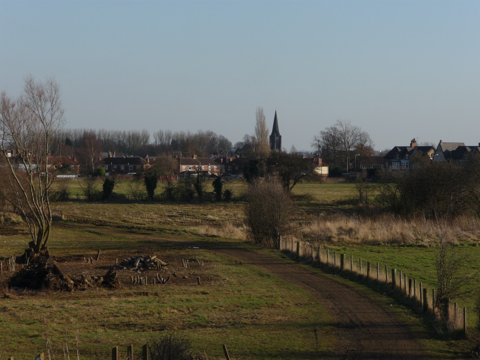
If Great Chesterford is really in Essex, then it's most certainly in the posh part of Essex and a million miles away from Essex's more famous metropolises, like Basildon, Tilbury and Harlow.  Great Chesterford is a pretty village but has the feeling of being a commuter or 'sleeper' town - there isn't much in the village in the way of shops and I doubt that a lot happens in Great Chesterford, although it does have a couple of nice pubs.

The Crown House Hotel, Great Chesterford
We stayed at the Crown House Hotel, which was quite pleasant and a lot quieter than in erstwhile years, when it was a major drinking den for those involved in the Newmarket races - apparently, previous crowds at the Crown House in Great Chesterford were so rowdy that a law was brought in to stop Sunday drinking at the Newmarket races.  We were much better behaved and had a very quiet and uneventful stay.

Germaine Greer lives in Great Chesterford, which is a bit of a coincidence - not only because I have mentioned her in a previous Chester blog, but also because I wanted to see her at Latitude Festival in Suffolk, only a week before, but missed her because she was delayed in traffic.  Seems like we're fated to keep missing each other!

Essex Village signs

Great Chesterford village sign
We really loved the village signs in Great Chesterford and Hadstock, which was later on our route.  It's the first time we've really noticed village signs on our Chester walks and, apparently, the tradition originated in Norfolk and then became popular all over the country - especially when the Daily Mail ran a competition for the 'best village sign' in 1920 and the winning designs were exhibited in Australia House in London! 

The signs depict elements of local life and are very beautiful to look at.  There is a Village Sign society which has its own website.   We'll certainly keep an eye out for more of these on future Chester walks!

Great Chesterton to Burtonwood Farm (1.75 miles/2.8 kilometres)

Still being in 'London' mode when we left for the walk, I'd assumed that I would be able to pick up essential supplies, including bottled water, in the village shop in Great Chesterford.  Unfortunately, there was nowhere to buy water, so I found myself setting out on, possibly the hottest walk we've done so far, rather poorly equipped to deal with the rising temperatures!  Luckily BAM (Best Aussie Mate) is much more organised than I am and had an extra bottle of water that she could lend me, until we got to a more shopper-friendly place!

Pink cottage, Great Chesterford
Leaving the hotel, we walked down Church Street, past All Saints church, then followed South Street onto the High Street until it met with the B184 road. Another interesting thing we've noticed in East Anglia is that many of the houses are 'whitewashed' in pink - it's a tradition which originates in Suffolk and, originally, pig's blood was mixed with the lime whitewash, to give houses in East Anglia their lovely pink colour.  We saw quite a few pink buildings on our Great Chesterford walk.

Click on the following link to read an interesting article about a woman in Suffolk who was forced to 'pinkwash' her house!

Once we'd crossed the main road, we followed Cow Lane, past Little Paddocks Kennels and Cattery, then turned right on the lane which runs past Burton Wood towards Burtonwood Farm.

Burtonwood Farm to Hadstock (2.4 miles/3.9 kilometres)

Countryside Essex/Cambridgeshire border
The path we followed on this walk is called the Icknield Way and forms part of the longer Ridgeway that runs across England, from Exeter (where we have also been, as part of our Chester walks) to the Wash, where it joins the coastal path we walked on in Norfolk! 

It's believed to be the oldest path in England and was of strategic importance, as a walking and transport route, when the Romans arrived in Britain, in the first century of our Common Era (CE).  It's also the reason why Great Chesterford was founded, as a staging post on this route and an important Roman town. 

Path through Paddock Wood
At Burtonwood Farm, the Icknield Way divides in two sections, which we decided we would do as a loop - eventually returning to the farm and back to Great Chesterford, where we started.  We walked the loop anti-clockwise, which meant that we would soon pass through the village of Hadstock, hoping to top up our dwindling water supply.  The countryside is pleasant in this part of England, but unremarkable and we marvelled, yet again, at how quiet and empty East Anglia seems to be, in contrast to other parts of England that we have walked in. 

Hadstock to Linton (1.6 miles/2.6 kilometres)


Hadstock Village sign
Our hopes of finding a shop in Hadstock were quickly dashed, but luckily the kind owner of The King's Head let us fill up our water bottles in his pub.  We had a rest on a well-placed bench on Back Hill and talked about the relationship between humans and dogs, as we watched some dog-owners arriving in their cars for a meet-up on the village green.  It was a very pleasant walk along Bartlow Road and Chalky Road, which is just a track really, leading us across the Essex/Cambridgeshire border to the nearby village of Linton. 

Linton to Burtonwood Farm (2.9 miles/4.6 kilometres)

Linton is another pretty little village, although this time well-supplied with shops, restaurants and other facilities.  We noticed lots of interesting designs on the buildings in Linton - a kind of etching or relief-decoration in the plasterwork, which is known as pargeting.  Again, this seems to be an East Anglian tradition and, with the pink houses and village signs, added to a very educational day in terms of architectural traditions in this part of England!


Pargeting on a building in Linton, Cambs
We stocked up on water again and made our way down to St Mary's Church, where we had a rest and some lunch in the churchyard.  Unfortunately, on opening my walking pack, I realised that an open bar of chocolate had melted all over the interior, leaving quite a sticky, yummy mess that BAM did her best to clean off, with hand wipes and pieces of tissue!  Once we'd recovered from 'Chocolategate', we set off again, crossing the River Granta on Horn Lane. 

We then walked along the High Street and crossed the main Cambridge road, before leaving the village along a small lane, interestingly named, The Grip.  For such a small place, we were surprised to find out that Linton has its own Zoo, run by the Simmons family from Hertfordshire!

Not long after the Zoo, the Icknield Way heads off through the countryside again, a rather pleasant walk along hedgerows and the edge of wheatfields, until you find yourself back at Burtonwood Farm. 

Burtonwood Farm to Great Chesterton (1.75 miles/2.8 kilometres)

Icknield Way, oldest path in England
We don't often retrace our steps on these Chester walks, so it was interesting to see how different the path from Burtonwood Farm to Great Chesterton looked like, with a reverse view and at a different time of day.  We were very lucky to stumble upon The Plough public house, where we had a really tasty evening meal, before catching our train back to London.  We highly recommend their Bulgarian kyufte and kebapche!


Access for Wheelchair Users


Relatively traffic-free Bartlow Road
Unfortunately, this walk is only partly accessible for wheelchair users.  It's fully accessible from Great Chesterford to Burtonwood Farm (but not beyond that).  I would also recommend the accessible part from Hadstock to Linton, perhaps doing a loop and returning along the Linton Road, although this might be fairly busy with traffic.  Certainly the Bartlow Road and Chalky Road sections are fairly quiet.  All three villages are relatively accessible and interesting to explore, because of the range of architectural features mentioned above. 

Image credits:  All photos were taken by me - please feel free to reuse them under the following Creative Commons license:

Attribution (especially to this blog post)
Share-alike
Non-commercial

Sunday, June 9, 2013

Brancaster - Marshes, Motivation and Martyrdom

Norfolk isn't known for its Roman heritage, so it was with a certain sense of occasion that myself and BAM (Best Aussie mate) set out early on a Friday evening for Branodunum a.k.a. Brancaster, on the North Norfolk coast. 

I've noticed the affix -dun in many place names that have Roman connections and I'm guessing it has something to do with the Celtic word dĂșn meaning 'fort'.  Indeed, Brancaster was one of the nine Saxon shore forts built by the Romans to secure Britain's coastline.  We visited another of the Saxon Shore forts during our walk in Portchester, on the south coast of England.

Lodgings and victuals

To get there, we trundled along on the London to Cambridge train, joining the front carriages at Ely, which continued to King's Lynn.   At King's Lynn we jumped on the Coasthopper which travels along the North Norfolk coast, to Brancaster Staithe, where we had booked B and B accommodation in a reassuringly suburban-looking house.  We ate dinner at The Jolly Sailors  - a lovely pub that was full of cheerful weekenders, enjoying the local ale. 

Burnham Deepdale to Brancaster (1.9 miles/3.1 kilometres)

We decided to start our walk at Burnham Deepdale, which is at eastern end of North Norfolk's three-village conurbation.  This area is well-known to walkers, as the path we followed to Hunstanton, is part of the Peddar's Way and North Norfolk Coast path - one of the UK's national trails, running 93 miles from Knettishall Heath in Suffolk to Cromer in Norfolk.  Burnham Deepdale is a well-known stopover on this route, famous for its tipi accommodation

St Mary's round-tower church, Burnham Deepdale

Books for sale at the church entrance

Starting at St. Mary's round tower church, we turned down a narrow public footpath to join the coastal path, turning left to head west, in the direction of Brancaster and the opposite direction to how the coastal path is usually walked!  The coast around Brancaster is ambiguous and the land barely sees to be at peace with the encroaching advances of the sea.  It's a very beautiful part of the world and we were lucky with the weather, which remained sunny for the duration of our walk.

Boat on Brancaster Marsh

A confusion of land and sea

The coastal marsh at Brancaster is teeming with bird-life and we saw a few 'twitchers' with their binoculars, as we walked along the board-walks and negotiated the thin path that clings to the coast.  I've done a lot of coastal walking before, mostly in Cornwall and Devon, but this was quite different, as Norfolk has no cliffs, making the walk much easier to what I'm used to. 

Lobster pots at Brancaster Staithe

There are lots of interesting buildings along the coast

A boat named Jessica

It didn't take long to reach Brancaster Staithe again and the site of the Roman fort at Branodunum.  We then followed the path to Brancaster, a pretty little village with an impressive church and a suspiciously 'continental' feeling about it!

Cottage in the marsh

Brancaster to Thornham (3.6 miles/5.8 kilometres)

At Brancaster the path turned inland for a few miles, taking us towards Norfolk's incomprehensible interior.  We've walked in many parts of England, especially in the south, and few places feel as 'empty' as Norfolk.  Once away from the coast, it's field upon field and not a settlement visible for miles around.  It's amazing that somewhere that feels so remote is, actually, not that far from London and the cities of the East Midlands. 

The church at Brancaster

Hedgerow flowers

We enjoyed our jaunt inland, admiring the hedgerow flowers, as our thoughts turned to the subject of 'motivation' and a recent course I've been on at work.  As we crossed the Chalkpit Road and passed two rather large, eerie looking barns, on the top of a kind of ridge - the coast looked ever so far away, with shimmering boats visible in the distant reaches of the Wash. 

The turn-off for Chalkpit Lane
Mudpath to barns

Norfolk country lanes devoid of traffic

 
Thornham to Gore Point (2.2 miles/3.5 kilometres)

At Thornham we were back in civilisation, celebrating our return from the interior with a chocolate break and a friendly chat with a local man, who was walking his, rather elderly, dog.  Beyond Thornham, we joined the sea again and the landscape really became spectacular, as we entered the Holme Dunes National Nature reserve. 

Sign post in Thornham
Village life in Thornham
There were a surprising amount of people around, walking, bird-watching, enjoying the weekend sunshine - our conversation turned to research that I've been doing on the work of Dr Kinsey, for my partner-blog, Learning about the World - BAM told me about an interesting radio documentary she'd listened to, about religious sects in New Zealand, who are advocating the return to a more traditional role for women.  It seems the world goes around in circles sometimes! 

Boat house near Holme Dunes

Path along the top of a dyke

Gore Point to Old Hunstanton (2.1 miles/3.4 kilometres)

The walk became more desolate again, as we passed Gore Point and made our way to the beach huts at Old Hunstanton.  It got rather hot in the dunes, as we dodged golf balls and marvelled at the view of the beach posts, installed to prevent coastal erosion.  There is a beautiful lighthouse in Old Hunstanton which is available as a holiday rental cottage

Beach posts preventing erosion

Holme Dunes nature reserve

Lighthouse at Old Hunstanton
We also came across a signpost for the Hunstanton Wolf Trail, with a picture of Saint Edmund (the Martyr) looking rather displeased at the fact that his body is full of arrows!  Legend has it that Edmund's decapitated head was thrown into the forest, where it remained lost, until a wolf cried out 'Here! Here! Here!' revealing its location!

Edmund and the Wolf


Old Hunstanton to Hunstanton (1.4 miles/2.2 kilometres)

It was a pleasant last mile or so, along the coastal road to Hunstanton, a seaside town that was abuzz with Saturday strollers, enjoying the first signs of (what promises to be) a short summer!  We indulged in some pub grub and beer before catching the Coasthopper back to King's Lynn, making our London-train with only a minute or two to spare!

Interestingly, our bus back to the station was named in honour of Margaret Read, a local woman who was burnt at the stake in King's Lynn in 1590, accused of witchcraft.  Legend has it that her heart burst out of her body and left an imprint in a local building, which can still be seen today! It was an interesting end to a very interesting day!

Access for Wheelchair users:

Unfortunately, not much of this walk would be accessible for Wheelchair users- the coastal path is narrow and on bumpy ground, sometimes following board walks through the marshes or travelling through sand dunes and other physical obstacles.

Probably the best part of the walk, which is accessible, would be from Brancaster going inland on the country lanes - we did come across a rather big gate at Chalkpit Road, which seemed inaccessible, but I'm sure that alternative routes and lanes could be used and it seemed as though the path from Thornham to the sea was pretty accessible, at least, until the stile which marks the boundary to Holme Dunes.

There is some nice coastal walking around Hunstanton and this might be another doable option for Wheelchair users.  Norfolk itself is quite flat and many of the country lanes are almost traffic-free.

Image credits: 

All photos were taken by me - please feel free to reuse them under the following Creative Commons license:

Attribution (especially to this blog post)
Share-alike
Non-commercial

Sunday, April 7, 2013

Doncaster - Snow drops, Power stations and Level crossings!

St Cuthbert's church at Fishlake
I think it's fair to say that our Doncaster walk was not at all as we expected it to be.  First of all, the weather was really nice - a welcome break from the cold and miserable winter we've been experiencing in England this year.  Secondly, Doncaster has a reputation for being quite industrial, run-down and gritty - yet our walk took us through some of the most gorgeous countryside, along canals and across rural railway junctions, via a long green corridor that runs right through the city, so you can barely sense you are in the heartland of South Yorkshire's former mining area. 

Victuals and Lodging

Of course, it helps that we started our walk outside the city, in a small village called Fishlake, about 10 miles north-east of the city centre.  The name Fishlake particularly appealed to me, so poor BAM (Best Aussie Mate) was tasked with finding accommodation, in a part of England that doesn't see a lot of tourists.  There is a wonderful old mill in Fishlake, which has been converted into self-catering accommodation, but it was a bit extravagant for one night only, so BAM contacted the only other B&B in the village. 

Fishlake village
Unfortunately, the B&B wasn't available on the date we needed, however, the owner very kindly passed us on to one of her neighbours, who put us up in their 'granny flat' right beside St Cuthbert's Church.  We got a real feeling that the villagers were clubbing together to make sure we were looked after and felt welcome - a touching sense of community that most of us presume no longer exists in 21st century England, but that myself and BAM have experienced again and again.  A nightcap at the local pub, The Hare and Hounds, was just what we needed to settle us, after our travels!

Fishlake to Stainforth Bridge (1.2 miles/1.9 kilometres)

Thorne Round walk at Fishlake
We started off by passing alongside the churchyard to climb the river bank and then headed south on a local trail known as the Thorne Round walk.  Our walk didn't take us to Thorne, but we could feel the  presence of the village, both in the local signage and place names.  Instead, we walked towards Stainforth, following the path along the right bank of the River Don, which Doncaster is named after.  Like many Roman settlements, the name is a combination of a Celtic word Don (the name of a Goddess) and the Roman affix -caester


CO2 clouds from nearby Power station
At Stainforth Bridge, we nipped into the village to get some supplies in the local shop.  Stainforth looked much more run-down than Fishlake and it reminded us how much the area around Doncaster has suffered, as a result of the mines closing in the 1980's, amongst other things.  Doncaster and its surrounding areas has long been a staunch Labour-voting, working-class stronghold and Stainforth lies in the North Doncaster constituency, which is represented in parliament by the Labour leader, Ed Miliband. 

Stainforth Bridge to Kirk Bramwith (1.7 miles/2.7 kilometres)

St Mary's church with snowdrops, Kirk Bramwith
From Stainforth Bridge, we continued along the riverbank to a small hamlet called Kirk Bramwith.  Kirk Bramwith is home to a very pretty 12th century Norman church, called St Mary's, which is famous for its snowdrops, which flower in the churchyard every February.  The word kirk also reminded us how far from London we were, exactly 166 miles from Charing Cross!

From the path we could see the almost post-apocalyptic clouds of CO2 in the distance, hovering above the power stations that stand out against the flat landscape - I'm not sure which power stations they were, most likely the ones at Drax, by the River Ouse in North Yorkshire.  

Kirk Bramwith to Trumfleet Marsh (2.7 miles/4.3 kilometres)

From Kirk Bramwith, we followed the lane way to Braithwaite, crossing the New Junction Canal, the last canal built in England for commercial purposes (opened in 1905).  At Braithwaite, we picked up the Trans Pennine trail, which runs 215 miles from Hull, on the North Sea, to Southport, on the Irish Sea.  Although it's not yet recognised as a national trail, there has been a lot of investment in the Trans Pennine trail and it's very well sign-posted.  We were able to follow the trail all the way to Doncaster.

Braithwaite village on the Trans Pennine trail
The next part of the walk was along small country roads and wasn't the most enjoyable, as we had to keep our wits about us and keep an eye out for traffic.  We passed Willow Bridge farm, then turned south at Trumfleet, passing White House farm, before we came to Trumfleet Marsh and rejoined the River Don briefly. 

We climbed the river bank again and had a short lunch break, as we discussed our latest movie experiences, my recent obsession with the Austrian film director, Ulrich Seidl, as well as BAM's review of the Chilean movie, No starring Gael Garcia Bernal and directed by Pablo Larrain. 

Trumfleet Marsh to Joan Croft Junction (1.9 miles/3.1 kilometres)

Trumfleet Marsh, a good place to discuss movies!
From Trumfleet Marsh, we followed the road to a small commuter village called Thorpe in Balne.  Thorpe in Balne has unusually massive properties and is, no doubt, a convenient place for Doncaster's rich folk to live, being quite close to the city.  Our arrival was greeted by a chorus of barking dogs, who made sure we didn't hang around too long, gaping at the sudden display of prosperity!

As we walked along Joan Croft lane, our conversation turned towards another famous Joan - Joan Harris (or Holloway), the voluptuous secretary in Mad Men, played by Christina Hendricks.  We've both just recently seen Series 5 of Mad Men and Joan's dilemma, when she is pressurised into using her feminine charms to win the Jaguar account.  Our musings on the moral implications of Joan's actions came to an abrupt halt at Joan Croft Junction, where the manned level-crossing was shut, as we waited for a freight train to pass by.

This part of Yorkshire is criss-crossed with railways - some of them have become more or less obsolete - others, like the East Coast Main Line, are vital to the functioning of Britain's rail network.  The junction is a busy one, not to mention somewhat dangerous - the fact it's manned is testament to the recklessness of previous walkers and cyclists, who've ignored the signals and crossed the path of high-speed trains!  Normally, road tunnels would take traffic, cyclists and walkers under the railway, but this part of Yorkshire is so flat, that the only way to cross the railway is by building a bridge to go over it which, according to the man working at the level crossing, is what they intend to do. 

Joan Croft Junction to Tilts Bridge (1.6 miles/2.6 kilometres)

Owston Grange
Shortly after Joan Croft Junction, we crossed Thorpe Gates, an unmanned level crossing, then walked along Middle Lane as far as Owston Grange, following the Trans Pennine trail into the ancient Owston Wood.  On the other side of Owston Wood, we crossed yet another railway line, west-east this time, paying attention to the signals and carefully closing the gates on either side, as we crossed. 

It was then a short walk along a country lane to the village of Tilts and Tilts Bridge, which crosses the oddly named Old Ea Beck.  On the far side of a small lake, we could see what looked like a Traveller/Gypsy settlement - one of those places with empty dull brick houses with much more 'lived-in' caravans in each yard.  Apparently, Doncaster has England's largest Gypsy and Traveller population, outside London. The primary school in nearby Toll Bar has an intake of 20% of kids from a Gypsy/Traveller background

Tilts Bridge to Bentley Railway station (2.3 miles/3.7 kilometres)

The path to Bentley, with St Peter's Church in the background
From Tilts Bridge we followed Shaftholme Lane, then the A19, walking under a road bridge which brought us to the start of a long, green corridor that cuts right through the heart of Bentley, emerging again on the River Don, a few miles south of Doncaster city centre.  The trail goes on a bit of a detour through the suburbs of Bentley, passing the railway station and an intriguing 'black' church, St Peter's, which is run by the Franciscans. 

Bentley is considered to be one of the most deprived areas of England.  Although, it was certainly very different that some of the 'wealthier' places we've visited during our series of Chester walks, it didn't feel unsafe or extremely poor - I've certainly been to worse places!

Bentley Railway station to Warmsworth (2.4 miles/3.9 kilometres)

BAM walking into Warmsworth, South Doncaster
Once back on the 'green corridor' it was a very pleasant walk past the suburbs of Sunnyfields, Cusworth and Newton, before we met the River Don again at Warmsworth, crossing the river via a small pedestrian bridge near the village of Sprotbrough.  It all seemed very civilised, as we passed families taking their dogs for a walk, local teenagers playing football and joggers making the most of the early spring sunshine. 

The path got a lot lonelier towards the end, as we left the city behind us.


Warmsworth to Doncaster Railway station (2.3 miles/3.7 kilometres)

Welcome to Hexthorpe!
At Warmsworth, we doubled back on ourselves, following the Warmsworth Road and then the High Road, before turning left into Greenfield Lane and crossing the railway tracks to enter the suburb of Hexthorpe.  BAM had images of a Hexthorpe High Street filled with pretty boutique shops and cosy little restaurants, but all we could see were convenience stores and fast-food take-away joints, as we scuttled through the fading light and made our way to Doncaster city centre.

We didn't see a lot of Doncaster in the end, just the local Weatherspoons, where we had a quick bite to eat and a drink, before catching our trains to London (for BAM) and to Leeds (for me, a chance to visit my little sister!)

Access for Wheelchair Users

Don't forget to close the gate!
It's good news for wheelchair users this time, as the majority of this walk was accessible.  The Trans Pennine trail is designed for 'multi-users' and is generally accessible for all kinds of walkers, cyclists and wheelchair users.  I'd recommend the section from Braithwaite to Doncaster, although be mindful of the level crossings, which could be dangerous for wheelchair users, as the trains move pretty quickly!  The walk along the river bank outside Fishlake isn't really accessible for wheelchair users, however, the area around Fishlake is very flat and there are other options for wheelchair users which would be just as satisfying.  

Image credits:

The River Don, near Sprotbrough
All photos were taken by me - please feel free to reuse them under the following Creative Commons license:

Attribution (especially to this blog post)
Share-alike
Non-commercial 

Sunday, February 3, 2013

Rudchester - Snow, Godheads and a new Millennium

Signpost for Rudchester
It's almost a year since we last visited Hadrian's Wall in Northumberland (see the blog post on Chesterwood), as part of our series of Chester walks.

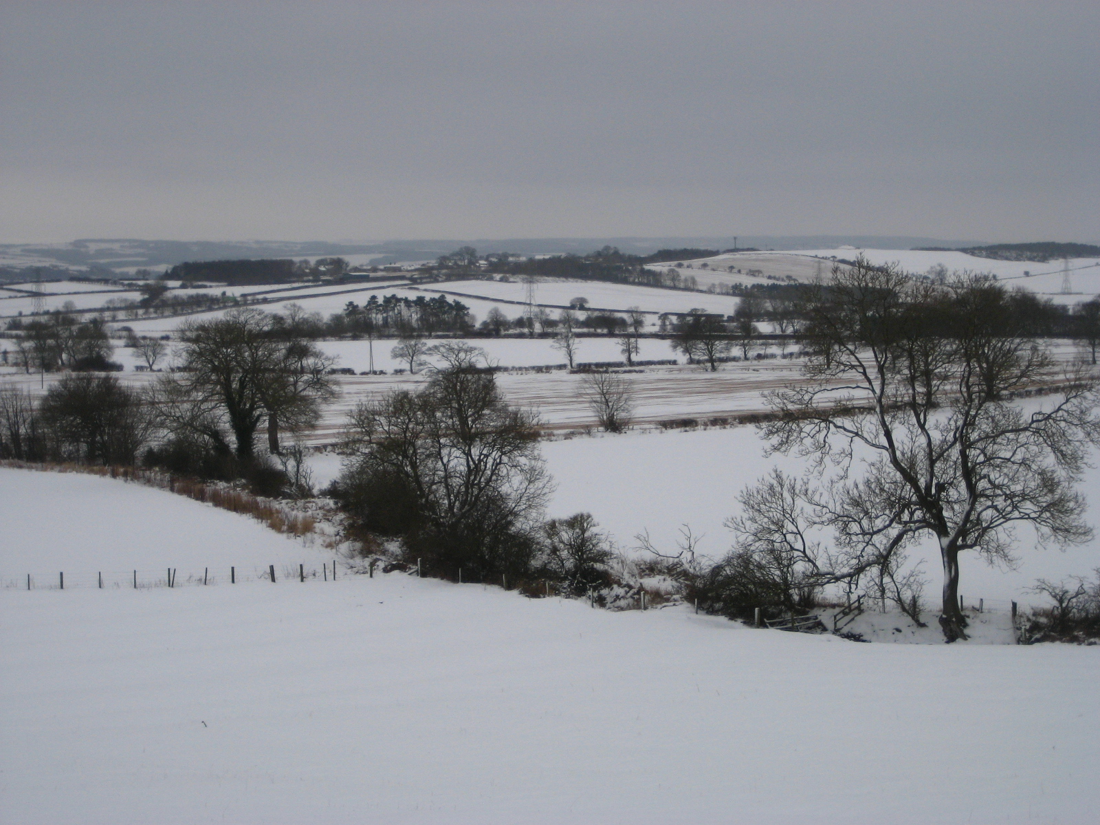
Rudchester is not much more than a couple of farm buildings and was an important fort in Roman times, known as Vindobala from the local Celtic dialect meaning 'white strength'.  The 'white' theme was certainly appropriate as, unlike our previous visit to Northumberland in January 2012 - this year we were rewarded with a spectacular snow fall. 

Lodgings and victuals

We had a very beautiful train journey from London King's Cross to Newcastle-upon-Tyne, through the snowy landscape of the East Midlands and Yorkshire.  Luckily, the snow didn't delay us too much and we made it to Newcastle just in time to catch our connecting train to Wylam, where we spent the night. 

Getting a train to Wylam on a Saturday night, after Newcastle United has lost 2-1 to Reading, isn't the most pleasant experience and it was with a palpable sense of relief that myself and BAM (Best Aussie Mate) disembarked at Wylam station, letting our boisterous fellow-passengers travel onwards to far-flung places like Hexham and Haltwhistle, further up the Tyne Valley!

The proprietor of the lovely Wormald House, on Wylam High Street, kindly picked us up at the station and took us to our accommodation.  We had dinner at the Fox and Hounds, just across the road, before turning in for the night.

Wylam High Street, covered in snow
Community noticeboard in Wylam


Wylam to Rudchester (2.8 miles/4.5 km)

Wylam seemed to be a pretty village - it's most famous for being the birth place of George Stephenson, the 'father of the railways'.  We headed up the Main Street from Wormald House, into Church Road and Holeyn Hall Road towards the B6318 and Rudchester.  The church in Wylam is dedicated to a rather obscure Anglian king, Oswin, who ruled a 7th century kingdom called Deira, which had its capital at York. 

St Oswin's Church in Wylam


It's a gentle climb uphill from Wylam to the Victorian-era Holeyn Hall, designed by John Dobson, the well-known architect of the North, who designed many of Newcastle's Georgian buildings, as well the neo-classical Newcastle Railway station.  Passing Holeyn Hall, we crossed the B6528 to reach a roundabout, just beyond the A69, a major road which runs between Newcastle and Carlisle. 

Tree on Holeyn Hall Road

Small country road leading to the Wall

We continued uphill to the B6318, where we joined the Hadrian's Wall Path.  Also known as the 'Military Way', the B6318 is the road which most closely follows Hadrian's Wall, along a ridge with views over the Tyne Valley to the south and towards Scotland in the north.

A frozen hedgerow

Sheep enjoying the snow!


Perhaps because of the snow, or because we were walking on a Sunday this time (not Saturday, as we usually do) - the road up to Hadrian's Wall felt quite remote.  Several orange-coloured airplanes passed overhead, no doubt Easyjet flights and we wondered what it would have been like for the Roman soldiers huddling in the freezing snow of Milecastle 14 if they had suddenly seen an Easyjet plane passing overhead.  No doubt it would have been extremely frightening, as their minds tried to rationalise the experience.

View over the Tyne Valley

Excavations at Rudchester have uncovered altars to a Roman cult, popular amongst soldiers which, quite unusually, worshipped the Persian God Mithras.  I can't help thinking that, had Easyjet flights suddenly appeared in the skies of Roman Britain, they would have thought it was some kind of Godhead - perhaps a visitation from Mithras himself!

Rudchester to Heddon-on-the-Wall (1.2 miles/1.9 km)

Hadrian's Wall Path runs for 83 miles (134 km) from Bowness-on-Solway, in Cumbria, to Wallsend, just beyond Newcastle city centre.  We'd walked on Hadrian's Wall path, when we visited Chesterwood,  but we could see much more of the wall there than around Rudchester and Heddon.  I suspect this was because, the few parts of the wall that are normally visible at this point, were covered in snow. 

Heddon-on-the-Wall


We were surprised to see people jogging on the path (even in the snow!) and, if local signs are anything to go by, joggers and large groups of people walking in single-file are causing lots of damage to the area around the wall.  By all accounts, Hadrian's Wall path has become very popular with 'charity walkers', in recent years. 

BAM at Heddon-on-the-Wall

Whilst the Hadrian's Wall trust are keen to encourage people to come and see the wall, they want to ensure that the increasing popularity of the Hadrian's Wall path is sustainable.  They're currently running a very interesting campaign called Every Step Counts, which provides guidance and advice on how to walk along the route 'responsibly'.  

Heddon-on-the-Wall to Newburn (3.4 miles/5.5 km)

It was a steep downhill from Heddon-on-the-Wall back to the River Tyne.  Back at the river we joined a very accessible track (popular with local walkers) which follows a former loop on the Newcastle-Carlisle railway line, once known as the Scotswood, Newburn and Wylam Railway.  The line was gradually closed down in the late 50's and early 60's, as part of Dr Beeching's recommendations for the reform of Britain's rail network.  It's great that a lot of these former railway lines have found new lives as cycle and walking paths - also they're usually quite accessible for wheelchair users. 

Path from Heddon-on-the-Wall to the Tyne

Former railway track that runs to Newcastle/Gateshead

Distance view of the Holy Cross Church in Ryton, with green meadow

Newburn to Scotswood (2.4 miles/3.9 km)


Fellow walkers had previously told me that the last part of the walk, from Newburn to Newcastle, wasn't very pleasant - mostly going through council estates and industrial parks.   I was glad to find out that they were wrong and that the walk from Newburn to Newcastle was very pleasant indeed.  Having said that, the heavy snow meant that most people were indoors, so we had, what is presumably a busy urban area, all to ourselves.  Also, I'm sure that the snow was covering all manner of evils, giving the outer suburbs of Newcastle a pristine look akin to an idyllic Scandinavian village.

First signs of the city

The Boathouse Inn at Newburn
Houses at Newburn
 
Newburn and Scotswood are at the heart of Newcastle's former coal-mining areas.  I find the history of this area of Newcastle fascinating and the local council has done a great job at bringing the history to life with statues, art work and information boards.  I was particularly impressed by the statue at Scotswood called Yesterday, Today, Forever which pays tribute to the areas miners.  Scotswood was the scene of a terrible pit flooding in 1925, where 38 men and boys lost their lives. 

Yesterday, Today, Forever statue at Scotswood

Scotswood to the Millennium Bridge (3.8 miles/6.1 km)

I'm a big fan of Newcastle/Gateshead and I've visited several times before, although it was BAM's first visit to the city.  I like what they've done with the city, reconceptualising the 19th-century industrial city and turning it into a 21st century one with inspiring architecture, such as the Millennium Bridge and Norman Foster's The Sage Gateshead.  The last few miles from Scotswood to Newcastle/Gateshead city centre was an easy walk, full of history, great views across the Tyne, passing under the city's famous bridges that are like a lesson in the history of bridge architecture!

The Tyne, low-tide

Sculptures in Elswick

The Millennium Bridge and Baltic Centre for Contemporary Arts


We really enjoyed our walk from Roman Britain, through the Industrial revolution to the 21st century capital of the North-East!

Access for Wheelchair Users

Accessible cycle path, Scotswood
It's great to give some good news for once and I'd highly recommend the path from Wylam to Newcastle/Gateshead, which is wholly accessible and follows the former Wylam, Newburn and Scotswood railway track - it's around 10 miles in total and could be covered by a wheelchair user in 2/3 days, using Wylam and Newcastle/Gateshead as walking bases.  There's a nice pub called The Boathouse Inn near Newburn which, although it doesn't look accessible, has outside seating for summer months.