Sunday, September 4, 2011

Chester-le-Street - Concangis

This was the first time our Chester trip brought us to the North East of England.  Chester-le-Street is a market town in County Durham, just to the south of Newcastle, it lies on the Roman road which ran up the east coast of England to Wallsend.  This trip certainly had a very different feel to it and I think it's fair to say that myself and BAM are now thoroughly familiar with the east coast route, due to the delays and difficulties we had getting there and back! 

Lodging and victuals

Tribley Farm near The Moorings
We might have arrived in Chester-le-Street two hours later than we'd expected, but our accommodation at the Moorings Hotel in Hett Hills, just outside the town, more than made up for the long journey to get there.  Unfortunately, because of the delay, we didn't get a chance to eat at the hotel restaurant, the Prime Rib, which has great reviews.  Apparently, it's a really popular spot for Sunday lunch and people drive there from miles around to sample their famous Yorkshire pudding! 

We'd found it hard to get accommodation in the town itself and we now know this was because of the one-day International between England and India at Chester-le-Street's Emirates Durham International Cricket Ground.  That would explain why every room in the town was booked out!  By all accounts, tickets for the match had sold out in December of last year!  We couldn't have ended up in a better place than The Moorings and I'd recommend it, if you're ever up Durham-way. 

The Moorings Hotel to Edmondsley (2 miles)

Horses at Tribley Farm
Weird sculpture on the ground
We didn't intend to visit Edmondsley on this walk!  Whilst we have, on occasion, got a little bit lost in previous Chester walks, this time we got spectacularly lost and somehow walked in completely the wrong direction, away from Chester-le-Street rather than towards it!  In our defense, I have to note that the landscape between the Moorings hotel and Congburn plantation looks completely different to what you see on the map.  It feels as though they have been tearing chunks out of the surrounding fields and re-creating the landscape to turn it into something else.  There were lots of eerie pieces of wooden sculpture, like the one in the photograph, which seemed to have been run over by a digger. 

Congburn Plantation
The myriad of paths through Congburn plantation are also partly to blame, as well as the interesting conversation we were having about hostage-taking, which led us to take that fateful right turn, when we should have gone left!  In case you're not already aware of it, I have a sister blog to this one called Learning about the World, which recounts my armchair travels to different parts of the world.  I'm currently blogging about Yemen, which is why we were talking about hostages in the first place!  I guess the path to Edmondsley had taken us hostage and, although it seemed like a nice enough place, we were keen to get to Chester-le-Street and back on the track of our intended walk. 

Place of the horse people

I'd managed to convince myself, before this trip, that, in true English fashion, Chester-le-Street should be pronounced something like Chester-l'Estrey or something equally pretentious, but no, in true North East fashion it's just Chester-le-Street!  The accent in this part of Durham is fascinating - not quite Geordie, definitely not Yorkshire, but somewhere in between. 
Front Street, Chester-le-Street

After all of our Chester walks in the south of England, the North East was suddenly very exotic, like being in a different country - the place names are very different - Ouston, Birtley, Kibblesworth, Nettlesworth - definitely not southern English names.  Then there were curious names, like No Place and Pity Me and North American names like Washington, Canada, Philadelphia and Quebec, as though the Americans had colonised England and not the other way about!

The Romans called Chester-le-Street Concangis, which was their approximation of the original Celtic place name, which meant something like 'place of the horse people'.  It's also the name of the small river Cong which runs through Chester-le-Street and the plantation where we got lost!  Interestingly, the Russian word for horse is also конь kon'.  The name Chester-le-Street was used to differentiate this Chester from all the other Chesters in England, ie. this was the one on the Roman road (or street) to Wallsend.  Chester-le-Street's Roman history isn't very visible these days, because the town was built on top of the Roman fort, so everything Roman is underground. 

The Pilgrim's Way

St Mary and St Cuthbert's
Signpost for Cuddy's Corse
We restarted our walk on the main street, which is called Front Street, with a view of St Mary and St Cuthbert's, Chester-le-Street's main church.  St Cuthbert seems to have been phenomenally popular in the north of England and his body rested in Chester-le-Street for 112 years in the 9th/10th century, before being moved further south to Durham cathedral.  It turns out that the walk we did from Chester-le-Street is actually part of a pilgrim's route known as Cuddy's Corse (ie. the path that they carried St Cuthbert (Cuddy's) body (corse).  The route runs from the Farne Islands (north of Newcastle) to Durham, but it's not exactly a direct path, as it goes via Edinburgh and Carlisle in a highly circuitous loop. 

Chester-le-Street seems to be a popular stopping off point on the way from North to South and it was also the first stop on the famous Jarrow March of the 1930's, when 207 protestors marched from Jarrow in South Shields to Westminster Palace in London, to highlight the extreme poverty and unemployment faced by people in the North East at that time. 

Chester-le-Street to Great Lumley (2 miles)

England v India at the Emirate Durham ICG
The first two miles of our walk took us past the Emirates Durham ICG where we could hear the cheers of 75,000 spectators and we could see the stadium draped in English and Indian flags.  As we were passing, the weather was fine and everything was going well, but I heard on the news later that they had to call the match off because of the rain which fell at around 3pm.  We crossed Lumley Bridge, then turned right onto the Weardale Way, passing the magnificent Lumley Castle Hotel (rooms starting at 185 GBP for a twin.  Hmmm, maybe next time!) The way followed the River Wear for a little bit, then turned left to pass Lumley Riding, skirting a hedgerow and wheat fields which brought us to Great Lumley. 
Horse at Lumley Ridings


Front Street, Great Lumley
All of this land was once part of the Lumley estate, the Lumleys being a prestigious local family of Anglo-Saxon origin.  Great Lumley was also known for its coal mines in the 19th century.  Intriguingly, we spotted a pub on Great Lumley's Front Street called The Warriors Arms

Fields outside Great Lumley
We often hear the sound of gun shots on our walks through the country, usually a regular sound created by machines to scare away birds.  This time we heard real gunshots, down towards the river and it reminded me of a great Spanish movie I've seen recently called El rey de la montaña. If you've seen the movie, then you'll know why. If you haven't seen it (and you like thrillers) then it's well worth watching!


Inside Finchale Priory
Great Lumley to Finchale Priory (1.4 miles)

The entrance to Finchale Priory
We continued following the Weardale way, through some fields and onto a small country road called Cocken Lane, which brought us back to the river, crossing a pedestrian footbridge to reach the ruins of Finchale Priory.  This one is pronounced differently than it's spelled, so it's pronounced Finkle not Finchale.  The priory is really beautiful and reminded me of Bolton Abbey.  Like Bolton Abbey the priory was abandoned during the dissolution of the monasteries in the 16th century.  Walking around the ruins, I couldn't help but feel appalled at the ruination of such a wonderful site.  It's now managed by English Heritage and maintains an atmosphere of dignified contemplation. 

Finchale Priory to Brasside (1.1 miles)

The lonely road to Brasside
Finchale Priory lies at the end of a very lonely road, which brings you down to the village of Brasside, the location of two Category A prisons, Low Newton womens' prison and Frankland mens' prison.  We've seen a few fortified buildings on our walks, notably Fort Nelson in Portchester, but nothing as frightening and impressive as the prisons at Brasside.  The Weardale way, rather nonchalantly, goes right between the two prisons and we crept along, in awe of the prison walls, as the clouds burst suddenly and the rain pelted us angrily.  I've found out since our walk that Rosemary West is currently being held at Low Newton and that Frankland holds the child-murderer, Ian Huntley.  It makes me shiver just thinking about how close we were to such evil minds!

Brasside to Durham (2.3 miles)

View of Durham cathedral
The rest of the walk to Durham was pleasant enough, despite the rain, and we could see Durham cathedral in the distance, romantically lounging in the mist on top of the hill.  I'd never been to Durham before this walk, but I'd heard a lot about it and it certainly lived up to my expectations.  We arrived with about an hour to spare before our train, so we walked around the city, through Market Place and up Saddler Street and Owengate to Durham Cathedral.  The cathedral is a fantastic structure and we walked around inside, listening to the choir singing and reading about the history of the building.  We also visited the shrine to St Cuthbert, thereby ending a pilgrimage that we didn't know we'd started!  

Access for Wheelchairs users

Durham castle
The part of this walk that I would recommend for wheelchair users is the Weardale way from Finchale Abbey to Durham.  If you don't mind wheelchairing through a prison(!), this part of the route is fairly accessible, with a few bumpy bits coming down Frankland Lane and a slightly steep slope down from Frankland Farm.  Durham has a new pedestrian bridge which is wheelchair-accessible and will bring you to Market Place via the Gala Theatre.  Alternatively, you could get an elevator to street-level in the Gates Shopping Centre and cross the bridge at Leazes Road, just as we did. 

Image credits:

All photos were taken by me - please feel free to use them under the Creative Commons license:

Attribution (especially to this blog)
Share alike
Non-commercial

Sunday, July 10, 2011

Silchester - Calleva Atrebatum

Signpost for Roman Silchester
Like Wroxeter, which we visited in March of this year, Silchester - known to the Romans as Calleva Atrebatum - didn't really take off as a settlement in modern times.  Most people would be hard pushed to pinpoint Silchester on a map and myself and BAM (Best Aussie Mate) were no exceptions, before we did this walking trip!

The modern-day village of Silchester is located in the north of Hampshire, in the countryside between Basingstoke and Reading, just outside a town called Tadley.  Although there is a hotel in Silchester, the reviews were off-putting, so we did some research and decided to start our walk in Stratfield Mortimer in Berkshire.  Mortimer station is located, quite handily, on a small branch line that runs between Reading and Basingstoke.  Although it's a small line, it dates back to the early days of rail travel and the station and line has been in operation since 1848!
Reading to Basingstoke line

Like a lot of railway stations around Berkshire and Oxfordshire, Mortimer station is quite far from the main village of Mortimer Common.  It might seem a bit incongruous to 21st century travellers, but I believe this is evidence of a stubborn compromise for 19th century villagers who weren't all that interested in having steam-driven technology ploughing through their idyllic lives.

Victuals and lodging

We travelled down from London Waterloo, via Basingstoke, arriving at Mortimer just in time for a delicious curry at a popular local restaurant called The Cinnamon Tree.  Time-travelling 19th century Mortimerians might well be bewildered by a restaurant in their village specialising in Bangladeshi and Indian cuisine, but we were well-pleased, feasting on Misty Lau and Murgh Jalfrazi.

Our room at the B&B
Little Park Farm B&B


BAM had booked us in to a lovely B&B called Little Park Farm, which is in a 19th-century farmhouse, a short distance from Mortimer station.  We stayed in a Twin room in the loft, with lovely views over the surrounding countryside.  For city-dwellers like us, it's great to wake up in the countryside, with the smell of bacon being fried in the kitchen and the sound of birds twittering in the garden.  Once we'd had our fill of food and coffee, we ventured out into the countryside and set off in the direction of Silchester.

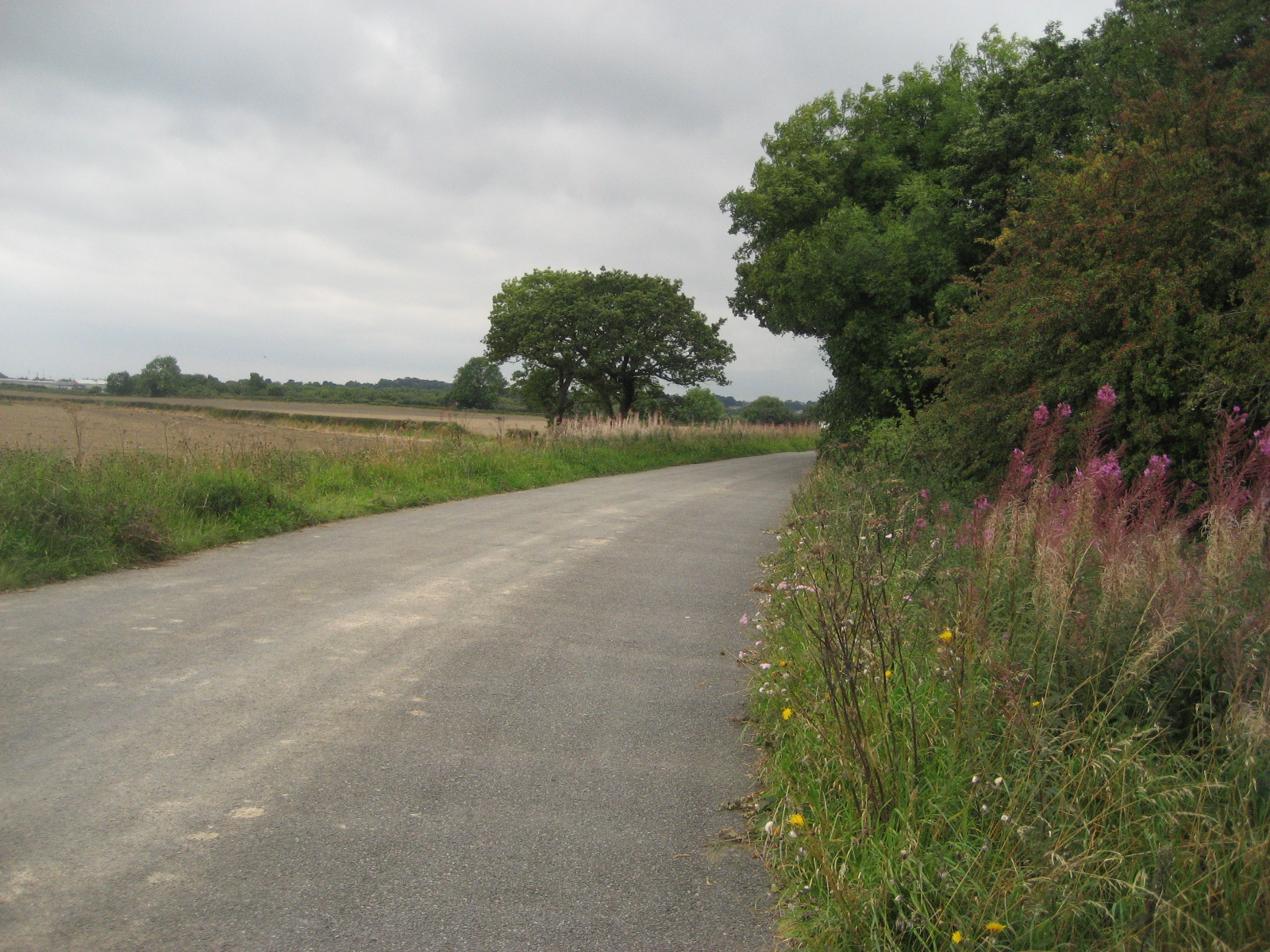
Little Park Farm to the Devil's Highway (1.2 miles)

BAM walking through a field of wheat
Like most Roman settlements, Calleva Atrebatum had a Roman road, which ran from modern-day Silchester all the way to London.  As it passes through this part of Berkshire, the Roman road is known as the Devil's Highway, although I couldn't quite find out why it's called this.  Perhaps, it was related to the fact that the road brought Roman invaders to what was a regional Celtic capital?  Perhaps, the name comes from a later time, when weary travellers along this road would have journeyed in fear of footpads and highwaymen?  Whatever the reason, the name in itself was enough to attract our attention, so our first 1.2 miles involved a loop from Little Park farm, walking down the farm driveway to the main Beech Hill road (known, oddly, as The Forehead).  Opposite Perrins Farm, we turned onto a public footpath leading through some beautiful wheatfields, which eventually brought us onto the Devil's Highway at the Home Farm, just outside Fair Cross.

The Devil's Highway
Yesterday's weather was a bit unsure of itself and our arrival at the Devil's Highway was greeted with a shower of rain which, in the nature of English showers, decided to finish, as soon as we'd got our raincoats out of our bags.  We noticed a group of young people with maps standing at the junction to Fair Cross, looking a bit uncertain as to whether or not the Devil's Highway was the right option for them.

The Devil's Highway to Calleva Atrebatum (3 miles)


Roman roads are very easy to walk on!  They're straight, for a start, so no chance of getting lost and, unlike most of the main Roman roads, which have been superseded by national highways and motorways, the Devil's Highway to Calleva Atrebatum is, blissfully, devoid of modern phenomena such as trains, planes or automobiles!  We passed south of Little Park Farm again, then through Butler's Land, where we passed another group of young people with maps and then crossed onto a small country road leading to a railway bridge.

Field full of cornflowers
We were quite startled when a silver-haired lady called Ann suddenly appeared from a gap in the hedge.  As it turned out, she is a local leader for the Duke of Edinburgh awards and had been looking for some of the same young people we'd seen wandering around the area with maps! We had a quick chat, then crossed the railway bridge, coming to a T-junction, where we left the road and crossed a hilly field full of the most amazing cornflowers, daisies and poppies.  The end of the field brought us onto the road again and the amphitheatre of Calleva Atrebatum.

Calleva Atrebatum to Silchester (0.8 miles)

The Amphitheatre at Calleva Atrebatum
The Roman name for the settle Calleva Atrebatum could possibly have been adapted from a local Celtic name that translates something like, 'wooded place where the Atrebates tribe live'.  Calleva sounds like a Romanisation of the Celtic word for wood/forest, if you compare the Irish word coillte or the Welsh coedwig.  I wonder if the origin of the name Silchester, also has its roots in the Latin word for wood/forest Silva? The Atrebates occupied most of modern-day Berkshire and they were unusual in that their culture seems to have more in common with Belgic tribes living in (modern-day) France, than the other Celtic tribes that were living around them in Britain.

The churchyard at St Mary's
Wedding guests
One mystery surrounding the Celtic settlement at Calleva Atrebatum was the fact that a stone with Ogham script was found on the site.  Ogham is mostly associated with Ireland and there are very few examples of Ogham script in England, the others being found exclusively in Cornwall in Devon.  The presence of Ogham in Silchester is attributed to a lone Irish settler, so perhaps, with its Belgic and Irish connections, Calleva Atrebatum was an ancient melting-pot of Celtic cultures?

Another mystery surrounding the site is the reason for its having been abandoned.  During the Roman times, it's believed that several thousand people lived in Calleva Atrebatum.  The site not only contained an amphitheatre, which you can still see today, but also Roman baths, temples, a mansion and a Forum Basilica.  According to The Guardian's Heritage writer, Maev Kennedy, in her article from 1999, the site might have been cursed by the Anglo-Saxons, evidenced by ritualistic remains involving a dog's bones!

Silchester Town Life Project
Excavation at Silchester Roman site
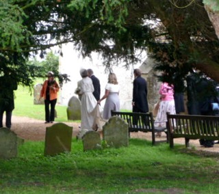
Whatever the reason for its abandonment, Calleva Atrebatum has an air of otherworldiness about it.  Just inside the walls of the site is a beautiful church called St Mary the Virgin.  We stopped for lunch in the churchyard and watched wedding guests milling around the church, congratulating a newly-married couple.  We then continued our walk through the heart of the ancient settlement, passing a group of young excavators from the Department of Archaeology at the University of Reading, who are currently working on the Silchester Town Life Project.  Eventually we came to a road at the edge of Silchester, where we turned around again in the direction of Mortimer.

Silchester to Mortimer (1.4 miles)

Sign post for Wall Lane
We had to walk along a fairly busy road, past Catthawlands Farm, before turning onto a quieter road called Wall Lane and back-tracking past the Roman walls and onto a public bridleway that took us all the way to Mortimer.  We had intended to take a smaller public footpath to Mortimer, rather than the bridleway, but I'm glad we went the way we did, as the bridleway passed through some lovely countryside, full of sheep and horses, past the Nine Acre copse and Simms Stud Farm, which is on the outskirts of Mortimer village.

Horses at Simm's stud farm
The wedding at St Mary's and the bridleway passing a stud farm has us thinking about all kinds of horsey-matrimonial connections we'd never thought of before.  It's interesting that the word groom is used mainly in two contexts, ie. a man who is getting married (or has just got married) and the person who looks after a horse.  It's also interesting that the word bride is very similar to the word bridle, ie. the idea that young, free women are bridled by marriage and reigned in by their new husbands, who are, by definition 'house bound'.  Horses were incredibly important to the development of modern technologies and societies, but it's not very flattering for a young woman to be described in language usually reserved for horses! 

Boundary marker
Another thing that caught our eyes on the way into Mortimer was an old boundary post, which marked the border between Hampshire and Berkshire.  I'd seen references to these on my Ordnance Survey map, but this is the first one we've spotted!

Mortimer to Wokefield Common (2.3 miles)

Wood for the signs?
The rain came on again as we sat at the church in Mortimer.  Mortimer seems like a nice place - quiet Berkshire village life went on all around us, as we sat munching our chocolate Koala bears!  Passing a playing field, we skirted around the north of the village and then took a path through Starvale Woods, eventually leading us to Wokefield Common on the edge of a village called Burghfield Common.  The woods were really beautiful, but it's always harder to orientate yourself in woodland and the bewildering array of signs for public footpaths and bridleways meant we couldn't see the wood for the signs! 

We got a little bit lost, but eventually made it to a crossroads, where DoE Ann spotted us and stopped her car to give us an update on her groups and an interesting history lesson about Mortimer Common and the Silchester Roman site.  We would loved to have spent more time talking to her, as she seems to know her local history really well, but time was pushing on and we had a train to catch.

Wokefield Common to Mortimer Station (2 miles)

Wheat fields
The last two miles brought us down Lockram Lane, then through some amazing wheatfields and hilly country, passing over Lockram Brook, we took a wrong turning and detoured down to Mann's Farm, then walked along the road to Wheat's Farm where we joined our original path, going downhill to Mortimer Station, just in time for our connection to Basingstoke and back to London.   

Access for Wheelchair Users

Wokefield Common
Again, I'm basing this on someone using a heavy, electric wheelchair.  I would start this walk at Beech Hill, rather than Little Park Farm or Mortimer Station.  The second part of the walk I've described above, along the Devil's Highway, is completely accessible and relatively smooth-going, until you get to the T-junction before Calleva Atrebatum.  At the T-junction you could turn left along a small country lane, then right to the gates of St Mary's Church.  The Roman site seems to be, for the most part, wheelchair accessible.  We didn't walk on the walls of the site but, from a distance, they looked really inaccessible to wheelchair users.  

Church at Stratfield Mortimer
I wouldn't recommend wheelchairing along the roads around Silchester and the bridleway to Mortimer was also not accessible.  Some of the paths in Wokefield Common seemed accessible, but the rest of the route described above, especially the last two miles, would not be accessible, unfortunately.  


Image credits:

All images were taken by myself or BAM, please feel free to use these images under the following Creative Commons license:

Attribution (especially to this blog)
Share-alike
Non-commercial 

Sunday, May 22, 2011

Dorchester - Durnovaria

Sign at South Dorchester Rail

Thomas Hardy statue in Dorchester
 The walk we did yesterday in Dorchester was our first foray into the Chesters of South West England.  I've been a big fan of Thomas Hardy since my teenage years and I've read almost all of his novels, including Tess of the D'Urbervilles and The Mayor of Casterbridge, both of which are set in Dorchester, fictionalised by Hardy as Casterbridge.


The Military Keep Museum

I'd been in Weymouth and Portland before, but this was only my second trip to Dorset and the walk we did was one of the most beautiful walks of the Chester series thus far.  Dorchester is an interesting enough town to spend a day.  Whilst BAM couldn't make it down from London until the evening, I arrived in the late afternoon and took a walk around the town, browsing in the shops of South Street and exploring the sights of the High Street, made famous by Hardy's novels.  I also walked around the old Roman fortifications and walked as far as The Keep Military Museum.  Dorchester seems to have a lot of museums - as well as the Keep, there was a Teddy Bear Museum, the Dorset County Museum, a Tutankhamun Exhibition, a Dinosaur Museum and an exhibition on the Terracotta Warriors (one of the few permanent exhibitions outside China which is devoted to the Terracotta Army!)

I overheard two ladies on South Street talking about an upcoming dramatisation of Tess and local posters informed me about Friday night's ceilidh, although we missed the Ghost Tour which took place on Thursday!  It's always a bit of a culture shock coming from London and dipping suddenly into the life of a rural town, like many of the Chesters we've been visiting.  By the time BAM arrived at Dorchester South Railway station, it felt as though I were one of the locals and as though I'd been in Dorchester for years, rather than hours!

 Lodging and Victuals

Visiting the Chesters isn't just about walking, of course - food and accommodation play an important part as well and we were really lucky to stumble upon a lovely little restaurant off Trinity Street which was called Billy's Fish Restaurant.  It has a very unassuming entrance and could be easily missed, but once you get inside, the decor is great and the food was absolutely amazing!  I had King Prawns with potatoes and I'd highly recommend Billy's place, if you ever find yourself in the locale.


King Prawn's at Billy's

We stayed at a B&B called The White House on Queen's Avenue, which was very good value for money, incredibly clean, with a spacious room and lovely red tiles in the bathroom.  Queen's Avenue is rather a grand driveway, planted with lime trees, leading up to The Thomas Hardye School.  I've learned this weekend that there was more than one Thomas Hardy, this one being a 16th-century merchant who founded the school to educate local boys. 

The B&B owners, Mr and Mrs Lees were very welcoming and have been running the B&B for 26 years!  We met an interesting older couple at breakfast who moved from England to Adelaide more than fifty years ago and had come back to meet some old friends their daughter had managed to contact through the Internet.  We got a bit distracted listening to their story and set out on the walk later than expected. 

In previous walks, I had been using pen and paper to try to measure the distances between one point on the map and the other.  However, it always seem to be longer than we'd expected and most of our previous Chester walks were around 12-16 miles, rather than 8-12, which is more comfortable (especially when you get chatting over breakfast and set out late!)  Not to be outdone by my erratic cartography, BAM invested in a small piece of technology, a kind of map measurer, which made planning this walk much more straightforward (and accurate) than previously.  It definitely made a big difference and we felt less rushed towards the end, which was a contrast to past walks when we were racing along the countryside outside Sleaford so we would be on time for our train, scrambling up over the Portchester downs in the failing light and finding ourselves plunged into the darkness of muddy fields in the Hundred of Hoo!

Dorchester to Maiden Castle (1.7 miles/2.7 kilometres)


A sheep at Maiden Castle
 After stocking up on water and chocolate on Maud Road, we made our way down to the Maiden Castle Road and a very pleasant walk out of Dorchester to the site of this Iron Age Fort.  The area that is now Dorset, Somerset and south Wiltshire was originally inhabited by a Celtic tribe called the Durotriges - it's from this tribe that we get the Roman name for Dorchester, Durnovaria and the Saxon name for the county of Dorset.  It's one of the best preserved Iron Age forts in Britain and I thought it was fantastic, especially the steep ramparts, which still look incredibly formidable.  It's mostly inhabited by sheep these days, but the view from the top is wonderful and it was a great start to our day's walking.  It's the kind of landscape you could imagine Thomas Hardy's characters to be roaming around in and I think this part of England is very beautiful, with its roly-poly hills and views down to the sea. 


BAM walking through Maiden Castle


Maiden Castle ramparts
 Maiden Castle to the South Dorset Ridgeway signpost (1.6 miles/2.6 kilometres)


Bridleway to Higher Ashton Farm
 When I'm planning these walks, I usually 'cheat' a little bit, by getting us on to one of the National Trails - partly because it's easier to follow a way-marked trail, but mostly because the way-marked trails go through some of Britain's most spectacular scenery.  Dorchester doesn't lie on any of the way-marked trails, so I improvised the 1.6 miles from Maiden Castle to the South Dorset Ridgeway, using a combination of public bridleways to make sure we didn't stray onto private land. 


South Dorset Ridgeway signpost
 There's a bridleway that runs to the west of Maiden Castle and it was really easy to follow this until it came out onto a small country lane and then a slightly bigger road (the B3159) which runs between Broadwey and Winterbourne Abbas.  We crossed the B3159 at Higher Ashton Farm and took another bridleway running diagonally uphill through two fields and then along the eastern side of another field until it meets the South Dorset Ridgeway with a handy signpost outlining your options!  The options at this point are east to Bincombe or west to the Hardy Monument, so we turned west, as planned and in keeping with our general direction. 


South Dorset Ridgeway
 I've done quite a bit of walking in England and have walked more than half of the South West Coastal path, which also runs along the Dorset coast not far from our Dorchester walk.  The Ridgeway is an interesting alternative to the coastal path and one that I'm getting very interested in.  There are quite a few ridgeway walks in the south of England, the most famous one being in Oxfordshire/Berkshire (reputedly Britain's oldest path).  The South Dorset Ridgeway is a 17-mile walk from Osmington Mills to West Bexington and can be walked as an additional stage or an alternative loop in the South West Coastal route.  It was certainly a very pleasant walk and the views over Portland and Chesil Beach were second-to-none!

The South Dorset Ridgeway signpost to the Hardy Monument (2.3 miles/3.7 kilometres)

It's quite windy on top of the Ridgeway and the shadows over the landscape added a dramatic tone to early afternoon light.  You can see the Hardy Monument in the distance, as you're walking and, at 239 metres (784 feet) above sea level, it was the highest point of the day for us. 


The Hardy Monument, Portesham

Blackthorn
 The monument was built in honour of yet another Thomas Hardy, the Vice Admiral Hardy who was a commander in the Battle of Trafalgar, famously close to Admiral Nelson and remembered in (one of) Nelson's dying phrases Kiss me, Hardy! Myself and BAM had a discussion about the significance of Nelson's words and how they could be interpreted so differently in the modern era of gay rights and recognised relationships between men.  We concluded that it was a very different time and that, perhaps, it would be a little bit unfair to apply a modern interpretation to Nelson's words.  It's an interesting thought, all the same and no-one seems to know whether or not Hardy kissed Nelson on the head, the cheek or gave him a good old-fashioned snog!  I guess we'll never know . . .

Unfortunately for us, the Monument is undergoing repairs and the bottom half is currently covered in scaffolding.  Nevertheless, it was an apt compliment to our Portchester walk, when we rested in the shadow of the Nelson Monument on Portsdown Hill. 

The Hardy Monument to Abbotsbury (2.9 miles/4.7 kilometres)


Benecke Wood
 From the Hardy Monument we went downhill through Benecke Wood, then followed a stone wall running along the bottom of three fields until we reached another small road at Portesham Hill.  We crossed the road and passed Hampton Barn, sticking to the top of the Ridgeway with sweeping views over Abbotsbury Plains we could see parts of Chesil Beach, in the gaps between the low-lying hills of the coast.  Eventually we crossed Bishop's Road, which links Abbotsbury to the Hardy Monument and then we turned downhill again, leaving the South Dorset Ridgeway to follow a small valley down through fields full of sheep, until we reached the road again and continued into Abbotsbury.  


Abbotsbury
 The weather was glorious with a late-afternoon sunshine and Abbotsbury was full of daytrippers, eating ice-creams, walking their dogs and shopping in the local gift shop.  It was a nice way to end the trip and Abbotsbury has a lot of quaint thatched cottages, as well as a famous swannery and tropical gardens, just behind Chapel Hill. 


View of Chapel Hill and Abbotsbury Plains


Gable-end cottage in Abbotsbury
 Disabled/Wheelchair Access


Bluebells near Abbotsbury
 As my sister is disabled and has one of those clunky motorised wheelchairs, I've promised to include information about wheelchair access (if any) in our Chester walks.  Unfortunately, most of this route was completely inaccessible to wheelchair users, the only exception being the walks around Dorchester and the road leading to Maiden Castle (although wheelchair users would find it difficult to get into the fort itself). 


View of Portland Bill
 It's always dangerous walking or wheelchairing along country roads, even quiet ones like Maiden Castle Road, but an alternative to this walk might have been to continue along the cycle path from Maiden Castle to Martinstown (although I'm not sure if the cycle path is completely accessible) and then along Bishop's Road from Martinstown to the Hardy Monument and down in Abbotsbury.  Maybe some day, wheelchair users will have access to routes like this one, without too much interference from drivers (who, let's face it, have lots of other options!). 


Thatched cottage in Abbotsbury
 The landscape is the same as the one we passed through, although I imagine that wheelchair users, especially people in motorised wheelchairs like my sister's, which are dependent on electric batteries, might want to limit their journeys to shorter stages such as Dorchester-Martinstown, Martinstown-the Hardy Monument or the Hardy Monument-Abbotsbury. 

Image credits:

All images were taken either by me or my Best Aussie Mate (BAM).  Please feel free to re-use these under the Creative Commons license for Non-Commercial, Share Alike and Attribution (especially to this blog).