
Lodgings
As it's summer, accommodation options are much in demand and most places, including the Ribchester Arms (unfortunately) require a minimum two-night stay. We were a bit pushed for time on this trip, so we could only stay one night and chose the Rose Cottage BnB in nearby Clayton-le-Dale instead. It was a cosy place and we received a nice welcome after our long train journey from London and taxi ride from Preston station. It was quite late when we arrived at Rose Cottage, so we didn't get to see much of Clayon-le-Dale.
Longsight Road to Ribchester bridge (1.8 miles)
To get to the River Ribble we started by taking a bridleway opposite Rose Cottage, on the Longsight Road. We passed a couple of gorgeous little lambs, who looked suspiciously well-fed and we wondered whether or not they were destined for one of the local restaurants! Not far down the bridleway we turned left onto a small path past a pond with very serious looking fishermen, then climbed over a stile into a rather messy slurry pit, a not so great start to the day. Trudging through slurry left us with a very pungent aroma of cow manure that I'm still struggling to forget!
The slurry pit lay right on the path of an old Roman road, which we followed down to a ridge overlooking the Ribble valley. At the ridge, we got our first real view of the valley, then turned right on a public footpath which brought us to a car park at Barker Brow and the B6245. We followed the pedestrian footpath along the road downhill to Ribchester bridge.
 |
| Lambs at Mire Fold, off the Longsight Road |
 |
| View towards Ribchester and the Ribble Valley |
 |
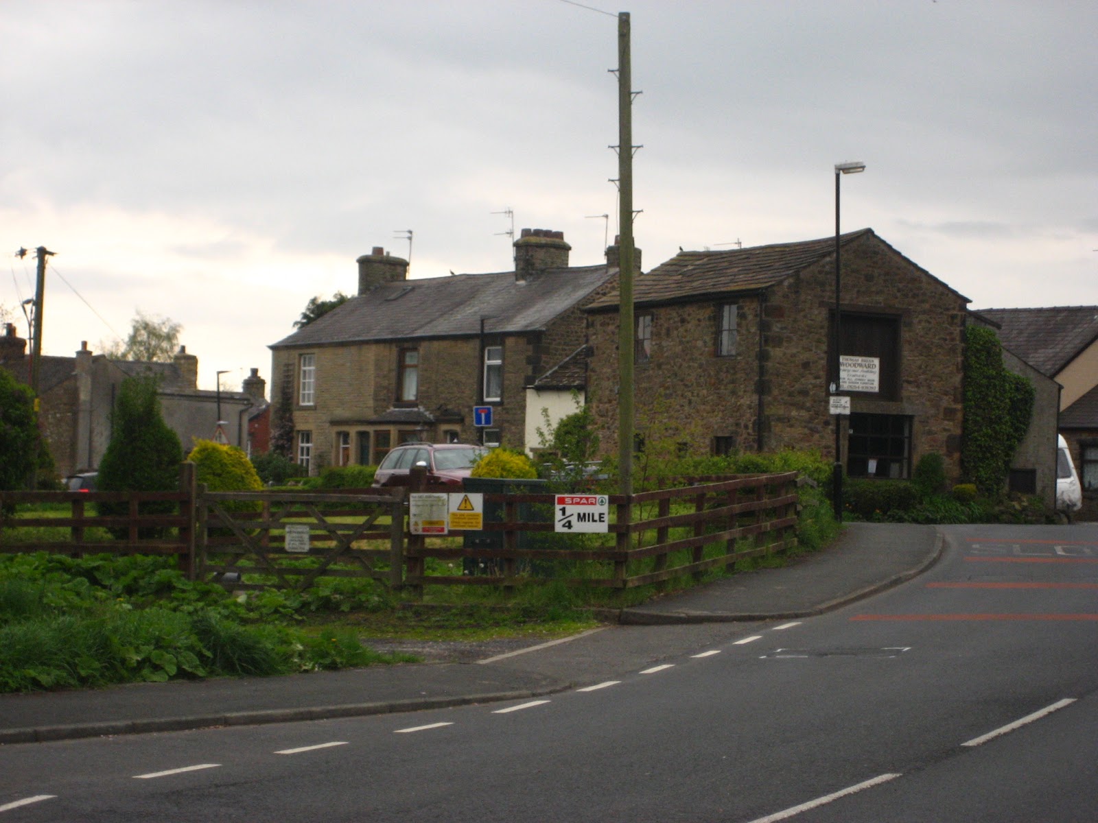
| Ribchester Bridge, taken from the Blackburn side |
Ribchester Bridge to Haugh Wood (0.8 miles)
At Ribchester Bridge we turned right along the Ribble Way and headed north, in the opposite direction to Ribchester. The Ribble Way is a long-distance footpath that runs for 65 miles (105km) from the Ribble estuary at Longton, just south of Preston, to Gayle Moor in North Yorkshire, where the source of the river can be found. The Ribble seems like quite a placid river, meandering along as though it's in no great hurry, we also meandered along and stopped in Haugh Wood to soak up the atmosphere and have a small picnic.
 |
| A Ribble Way signpost |
 |
| River Ribble, taken from Ribchester bridge |
 |
| Beautiful carpet of flowers at Haugh Wood |
Haugh Wood to Hurst Green (1.9 miles)
Just after Haugh Wood, the Ribble Way diverts across a field, away from the river. We didn't quite do this, but followed the tree line of Coppy Scar Wood, above a bend in the Ribble. Our conversation turned to the recent controversial case in nearby Rochdale involving young girls being targeted by a gang of sex-traffickers. Nine men have been convicted of trafficking young girls and the case has sent a shock wave across the country and caused heated debates, a lot of which, unfortunately, have focused on race (8 of the men were of Pakistani origin and most of the victims were young, white girls).
People often talk about race, when they really mean culture and I can't help thinking that the real 'elephant in the room' is, in fact, social class. Most of the victims were vulnerable working-class girls, some of whom came from dysfunctional families. In a country where young, working-class girls are constantly portrayed as being promiscuous, benefit-scroungers who get pregnant so they can get a flat from the council, it's hardly surprising that some men, regardless of their ethnicity, have no respect for these young women and see them as fair game.
 |
| Lopsided sign post near Coppy Scar Wood |
Crossing the fields below Hey Hurst, we got our first views of Pendle Hill, a place steeped in mystery and the supernatural. It's probably most famous as the place where the 17th century Pendle Witch trials took place. Ten people, mostly women, were convicted of witchcraft and hanged to death. It's obvious from a modern perspective that these women weren't really witches, but victims of a ruthless campaign to rid Lancashire of 'religious heresy'. Pendle was a bastion of Catholicism and this might have contributed to the witch-hunt in this area.
 |
| Pendle Hill, where the 17th century witch trials took place |
We like to think that the days of witch-hunting are over, but I often wonder if this is true, when I see minority groups being demonised and pilloried in the modern press. 17th century Lancashire was considered to be a wild and lawless region, fabled for its theft, violence and sexual laxity. It's obvious that Lancashire has suffered from a lot of bad press over the years and I wonder how much of this is down to its historical role in the power struggles that forged modern England.
 |
| Hurst Green, just as the sun came out! |
Hurst Green to Greengore (0.85 miles)
If Hurst Green is anything to go by, then I can gladly confirm that Lancashire is not as wild and lawless as they make it out to be! Hurst Green seemed like a lovely place. As we had a rest on the benches in the centre of the village, the sun came out and it finally started to feel like May, instead of December! We followed the road through the village, which passes The Bayley Arms and the entrance to the Dene (which leads to Shire Lane). Apparently, JRR Tolkien's Middle-Earth was inspired by the local landscape and Tolkien wrote part of The Lord of the Rings when he was staying at the local Jesuit college in Stoneyhurst.
 |
| Rock formations at Mill Wood, inspiration for Tolkien's The Shire? |
Certainly, the landscape had a magical quality, as we took a path through Mill Wood, past weird rock formations and small glades dappled with sunshine. Amongst other things, Lancashire was famous for its weavers and textile industry. As we walked through the woods, it felt as though we'd been transported to a different era and we got a glimpse of what England must have been like in bygone days.
 |
| A dappled light worthy of the best Impressionist painter |
 |
| A magical path through the woods |
Unfortunately a lot of the larch in this area has been felled because of an outbreak of Ramorum dieback. A terrible disease that mostly affects oak trees (it's also known as Sudden Oak Death), it kills healthy trees in a very short space of time. I think ramorus comes from the Latin word ramus meaning 'branch'. There were certainly lots of stockpiles of timber around the area, as you can see in the photograph (below).
 |
| It couldn't be England in May without the bluebells |
 |
| The path to Greengore |
 |
| Stockpile of timber |
Greengore to Intack (0.9 miles)
The Ribble valley is full of wonderfully interesting buildings like Greengore farm, a 15th century building which has some self-catering accommodation and (rather bizarrely) has flying buttresses on the main building! From Greengore we walked towards Crowshaw House and briefly joined the Old Clitheroe Road, where there are spectacular views over the Ribble valley. We then took a small path past a disused quarry and into the grounds of Intack, a traditional detached farmhouse.
 |
| View of the Ribble Valley from the Old Clitheroe Road |
 |
| Path leading to Intack |
Intack to Duddel Wood (0.7 miles)
The next part of the walk was very short, but took us a long time, as it was difficult to navigate the public footpaths in the fields between Intack and Duddel Wood. The first bit, to Huntingdon Hall, was fairly straight forward, but we got really confused after that, as it was difficult to find the entrance to the wood. We eventually found a way, over a fallen fence, and scrambled through the trees along a ridge above Duddel Brook. Luckily, we found a stone bridge that brought us across the brook and out onto a neglected lane way, leading to the 19th century Dutton Manor.
 |
| Getting lost in Duddel Wood |
Duddel Wood to Duddel Hill (0.6 miles)
The lane way from Dutton Manor to the B6243 at Dean Brow is a rather enchanting place and is lined with old-fashioned electric lamp-posts that have fallen into disrepair. I don't know enough about architecture and design to say what style the lamp-posts were in, but it had a feeling of the 1920's and I could almost hear the echo of newfangled motor cars driving up to Dutton Manor in the late evening for a fabulous party! At the entrance to the lane is a small gatehouse, known as the Beech House.
 |
| Lamp-post on Dutton Manor lane way |
At the Beech House, we turned right onto Dean Brow and, before it came to Moor Cock farm, we crossed the road and took a footpath on the left leading to Duddle Hill.
 |
| Beech House on Dean Brow (Longridge Road) |
Duddel Hill to Ribchester (1 mile)
By the time we got to Duddel Hill, it was already quite late, so we covered the last mile downhill to Ribchester quite quickly. The fields had been sprayed with manure, so we finished our walk in a similar fashion to how we'd started it! Following a fairly obvious path downhill, we eventually came out onto Stydd Lane. Passing two small churches and an almshouse that has been converted into apartments, we followed the lane back to the B6245, which is the main Blackburn Road. At the road we turned right towards the village and made our way to the Ribchester arms for a well-deserved drink and hearty meal!
 |
| Field sprayed with manure, near Stydd Manor |
Ribchester was known as Bremetannacum during the Roman era and the village still has some Roman ruins. Archaeological artifacts, like the Ribchester Helmet, were found in the village. Unfortunately, we didn't have a lot of time to explore Ribchester itself, as we had booked a taxi back to Preston and our onward train to London.
 |
| Ribchester, site of Roman Bremetannacum |
Unfortunately the first part of the walk we did would not be accessible for wheelchair users, however, an alternative walk from Clayton-le-Dale (or even Blackburn) would be possible, as there is a path for pedestrians along the B6245.
The Ribble Way was accessible from Ribchester Bridge to Dewhurst House - after this, the route we followed was not accessible again until the lane way leading from Trough House to Hurst Green.
The most beautiful part of the walk, from Hurst Green to Intack was mostly accessible, as the path seemed pretty smooth. There were some gates that needed to be opened and closed along the path.
The bit between Intack and Ribchester was inaccessible, as it crossed fields, however an alternative route might be along the Huntingdon Hall Road and Gallows Lane, if you feel comfortable wheelchairing on small country lanes with the risk of traffic. I haven't been on these roads, but I'd imagine they are quite steep in parts. Definitely one for more adventurous wheelchair users!
Image credits:
All photos were taken by me, please feel free to re-use them under the Creative Commons license:
Attribution (especially to this blog)
Share-Alike
Non-commercial