
There's a very good reason for that - i.e. we're walking the chesters of Britain and these mark Roman settlements. The Romans, quite wisely, built their settlements in the lowlands and on Britain's major rivers, so they had no interest in the more mountainous areas, which were inhabited by unruly Celts and brigands!
 |
| View of York from the city walls |
York (Eboracum) became the capital of the Roman province of Britannia Inferior (north of England) and London (Londinium) became the capital of Britannia Superior (the south of England and Wales). Tadcaster, where we started our walk, is about 10 miles from York and it was apt to finish our walk in York as it was such an important Roman settlement. There are other 'chesters' in Yorkshire that are hidden to the modern age, as their names have changed or dropped the chester/caster prefix.
Lodging and victuals
The differences between the north and south of England are still evident today and it really felt as though we were setting off on a big adventure to a far-off land, as we boarded the Edinburgh-bound train at King's Cross and went hurtling north through the East Midlands and past the Humber estuary. We travelled in the afternoon, so it was still light when we reached York and caught the 843 bus from York railway station to Tadcaster along the busy A64 road, which still follows the course of an old Roman road, which linked Chester and York.
 |
| The Ark in Tadcaster |
Tadcaster is an unassuming little town and I'd imagine it's always lived in the shadow of York. The Romans called it Calcaria because of the local lime deposits. The quality of the local water, which is rich in lime sulphates, led to Tadcaster becoming one of Britain's most important brewing centres. Tadcaster's brewing industry is still very much a presence, with John Smith's brewery dominating the town centre.
 |
| John Smith brewery in the centre of Tadcaster |
There isn't a lot of accommodation in Tadcaster, but BAM (Best Aussie Mate) managed to secure a room for us in a residential hotel in Kirkgate, a few doors down from a historical tudor-style building called 'The Ark'. We had a great dinner in Tadcaster, at a cafe/bistro called The Granary which is on the main street.
Tadcaster to Colton Lane (3.6 miles/5.8 kilometres)
The weather was crisp and bright, as we set out from St Mary's Church in Tadcaster and followed the main road out of town, across the River Wharfe and along the old Roman road, which eventually joins the A64, about a mile out of town. At the first opportunity we turned left down a laneway which leads to the village of Catterton, then followed signs to the right, which brought us along The Old Street, route of the original Roman road, which follows a steep ditch, through some woodland and along the bottom of Catterton Moor. This is also part of the Ebor Way, a 70-mile footpath which crosses Yorkshire.
 |
| St Mary's Tadcaster |
The autumnal colours on this walk were really fantastic, although I'm still recovering from a recent trip to Canada, where the vivid reds, oranges and yellows of the maple leaves have dazzled me and left me less impressed by the slightly understated tones of the English countryside in October.
 |
| Old Street ditch |
 |
| Catterton Moor |
 |
| Sign post for the Ebor Way |
Rather typically of Roman roads, the Old Street was long and straight, pointing like an arrow towards the Vale of York and the ultimate objective of our walk. After a couple of miles, we hit the A64 again, still busily trundling on in its never-ending journey to York, presenting us with fast food restaurants and hotel chains, as we negotiated the pedestrian by-pass near Colton lane, so we could rejoin the Roman road and make our way towards Copmanthorpe.
 |
| Fast food restaurants |
 |
| The busy A64 |
Ironically, the by-pass over the A64 provided our highest 'viewpoint' of the day and we could see the power stations near Snaith in the distance and it was interesting to realise that our last Yorkshire walk had been on the far side of the power stations in an equally flat and industrial landscape!
 |
| Distant power station |
Colton Lane to Copmanthorpe (1.75 miles/2.8 kilometres)
I've recently discovered an app for iPhone, which helps you identify wild flowers. As myself and BAM are constantly coming across all kinds of wild flowers on our walks, we're interested in learning the names of these flowers/plants and what they can be used for (particularly the edible ones!). At Colton Lane we came across some trifolium pratense a.k.a. red clover.
Red clover is the national flower of Denmark, which is interesting, as York/Jorvik was such an important Viking settlement. Perhaps the clover we spotted on the side of road originally came from Scandinavia!
 |
| Red clover |
From Colton Lane we followed the Ebor Way along the edge of some fields and then out onto a rather attractive country road, which connects Colton to Copmanthorpe. We noticed a lot of cyclists on this walk and also posters advertising cycling events. The first two stages of the 2014 Tour de France took place in Yorkshire back in July and it seems to have inspired a local resurgence of interest in cycling.
 |
| BAM on the Ebor Way |
 |
| Country road to Colton |
We had a chocolate break at Copmanthorpe, a quirky little village which was in the thralls of its first beer festival, the amusingly named Coptoberfest. Thorpe is a Middle English word for 'village' and is common in place names in the north of England. Copmanthorpe means something like 'Trader's village' and it definitely had a lot more character than your average commuter village.
 |
| Poster advertising the Coptoberfest |
Copmanthorpe to Acaster Malbis (2.2 miles/3.6 kilometres)
We left the Ebor Way at Copmanthorpe, as we wanted to detour via Acaster Malbis and cover two 'chesters' in one go. Turning off the Main Street into Station Road, we soon crossed the East Coast railway line and came to Temple Lane, a rather long and eerie lane that connects Copmanthorpe and Acaster Malbis. The lane is named after land granted to the Knights Templar, who led the medieval Crusades to the 'Holy Land'. I'm currently blogging about Palestine, so this was a rather arcane connection to my other blog, Learning about the World.
 |
| Sign post for Acaster Malbis |
Acaster Malbis was most likely the site of a Roman military camp, no doubt protecting York from marauding native tribes. It's got an air of abandonment about it these days and there was a stillness around the village 'centre' which we found lulling, but also somewhat spooky! Although it's situated on the River Ouse, one of Yorkshire's main rivers and, no doubt, a great thoroughfare in bygone days, Acaster Malbis is now very much cut off from the outside world and feels like the end of the road.
 |
| Acaster Malbis |
When I bought the map for this walk we noticed that there is another Acaster in this area - Acaster Selby - but it was too far to walk in one day, so no doubt we'll be back in that part of the world at a future date!
Acaster Malbis to Bishopthorpe (1.9 miles/3.2 kilometres)
It was a pleasant walk along the River Ouse to Acaster Bridge, where we picked up a branch of the Trans-Pennine trail, a coast-to-coast long-distance footpath from Southport on the Irish Sea to Hornsea on the North Sea. This is a fairly accessible route, which revitalises disused railway lines and we walked part of the Trans-Pennine trail when we did our Doncaster walk last year.
We only did about half a mile on this route to Bishopthorpe, but there was a lot to see in that short space, including an installation about the planets and a Halloween festival at the Brunswick Organic nursery.
 |
| Planets installation on the Trans-Pennine trail |
We were really inspired by the Brunswick nursery, which is a charity that employs young people with learning disabilities. The young people grow organic vegetables, run a canteen and produce all kinds of beautiful art work and handicrafts. I left with a bag full of organic produce and Christmas cards!
 |
| Disabled scarecrow at Brunswick organic nursery |
We left the Trans-Pennine trail at Bishopthorpe and made our way through some suburbia, then down the main street and past the Bishop's palace. The current Archbishop of York is John Sentamu, who was born in Uganda and is, I think, the second-most important figure in the Church of England, the first being the Archbishop of Canterbury (again the North/South divide set up by the Romans!)
In olden times, the Archbishop of York would have sailed down the river to York Minster to conduct prayer services, otherwise retreating to the serenity of Bishopthorpe which sits at a respectable distance from the city.
 |
| The Bishop's Palace in Bishopthorpe |
Bishopthorpe to York Minster (3.7 miles/6 kilometres)
We were back on the Ebor Way again at Bishopthorpe, although we missed a rather hidden turn and spent a bit of time wandering around the local Crematorium, before we got back on track and made our way towards the River Ouse.
Walking around the Crematorium turned our thoughts towards will-making, as both myself and BAM have got to make wills soon and, as per usual, BAM is more organised than me and has done a lot of research on will-making and the best way to proceed.
With thoughts of our own mortality at the front of our minds, we passed under the A64 and wandered through the distinctly earthly delights of the Middlethorpe Ings, with a view of the imposing Rowntree Factory in the distance. Ings are water meadows and I'm pretty sure that they're prone to flooding. The Middlethorpe Ings are at a lovely bend in the River Ouse, just before it enters the city of York.
 |
| Under the A64 |
 |
| Path through Middlethorpe Ings |
 |
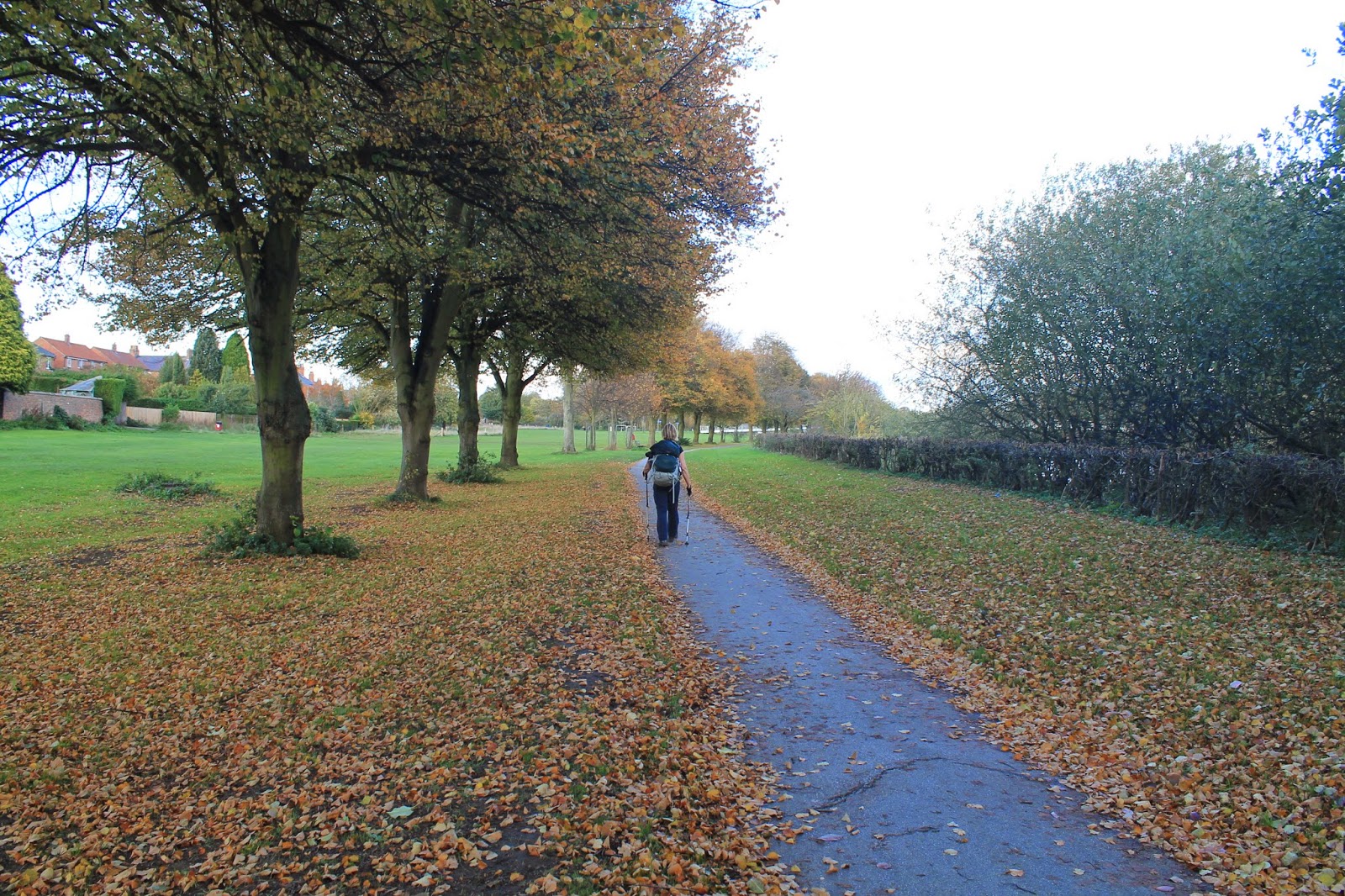
| BAM walking towards York |
 |
| The Rowntree chocolate works |
As we passed the suburb of Nunthorpe and the York Millennium bridge, the sun came out and the late afternoon strollers, shoppers and tourists gave York a jaunty feel, as we enjoyed our last evening stroll of this year's summer time, before the clocks were put back later that night.
 |
| Rowers on the River Ouse |
 |
| Nunthorpe, outskirts of York |
I've been in York a few times before, but it's always such a pleasure to visit again and York Minster was a rather grand place to finish our Tadcaster/Acaster Malbis walk!
 |
| Busy riverside in York |
 |
| St Wilfred's Catholic Church in York |
 |
| View of York Minster from Duncombe Place |
Access for wheelchair users:
 |
| Trans-Pennine Way seems fairly accessible |
The parts that were accessible included the Roman road from Tadcaster if you continued to Catterton, rather than turning off through the fields. Also the country road from Colton to Copmanthorpe was accessible and seemed relatively free of traffic. Likewise, a walk from Copmanthorpe to Acaster Malbis would be accessible. The Trans-Pennine trail is wonderful for wheelchair users and should be pretty easy to access - in fact you could follow it all the way from Bishopthorpe to York. The riverside walking described above wasn't at all accessible, however, there are plenty of walks in and around York which would be satisfying for wheelchair users.
Image credits:
All photos were taken by me - please feel free to reuse them under the following Creative Commons license:
Attribution (especially to this blog post)
Share-alike
Non-commercial