 |
| Signpost for Rudchester |
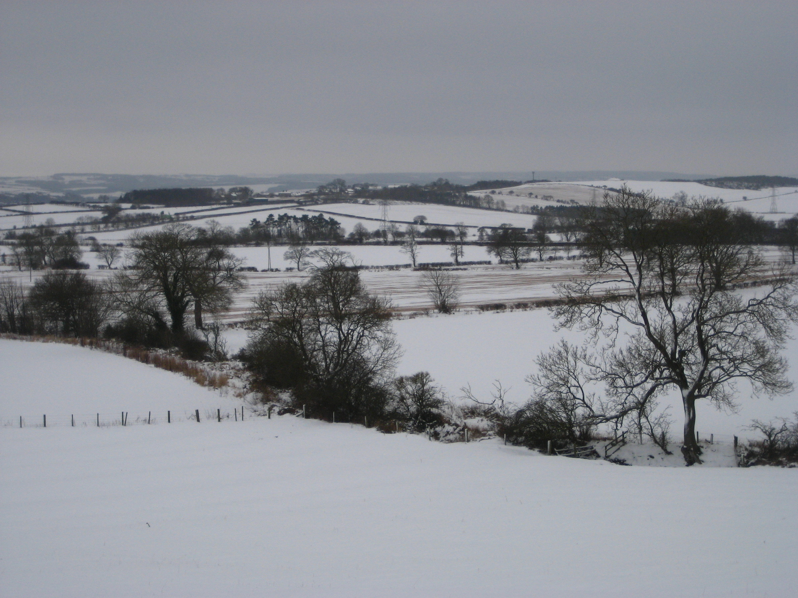
Rudchester is not much more than a couple of farm buildings and was an important fort in Roman times, known as Vindobala from the local Celtic dialect meaning 'white strength'. The 'white' theme was certainly appropriate as, unlike our previous visit to Northumberland in January 2012 - this year we were rewarded with a spectacular snow fall.
Lodgings and victuals
We had a very beautiful train journey from London King's Cross to Newcastle-upon-Tyne, through the snowy landscape of the East Midlands and Yorkshire. Luckily, the snow didn't delay us too much and we made it to Newcastle just in time to catch our connecting train to Wylam, where we spent the night.
Getting a train to Wylam on a Saturday night, after Newcastle United has lost 2-1 to Reading, isn't the most pleasant experience and it was with a palpable sense of relief that myself and BAM (Best Aussie Mate) disembarked at Wylam station, letting our boisterous fellow-passengers travel onwards to far-flung places like Hexham and Haltwhistle, further up the Tyne Valley!
The proprietor of the lovely Wormald House, on Wylam High Street, kindly picked us up at the station and took us to our accommodation. We had dinner at the Fox and Hounds, just across the road, before turning in for the night.
 |
| Wylam High Street, covered in snow |
 |
| Community noticeboard in Wylam |
Wylam to Rudchester (2.8 miles/4.5 km)
Wylam seemed to be a pretty village - it's most famous for being the birth place of George Stephenson, the 'father of the railways'. We headed up the Main Street from Wormald House, into Church Road and Holeyn Hall Road towards the B6318 and Rudchester. The church in Wylam is dedicated to a rather obscure Anglian king, Oswin, who ruled a 7th century kingdom called Deira, which had its capital at York.
 |
| St Oswin's Church in Wylam |
It's a gentle climb uphill from Wylam to the Victorian-era Holeyn Hall, designed by John Dobson, the well-known architect of the North, who designed many of Newcastle's Georgian buildings, as well the neo-classical Newcastle Railway station. Passing Holeyn Hall, we crossed the B6528 to reach a roundabout, just beyond the A69, a major road which runs between Newcastle and Carlisle.
 |
| Tree on Holeyn Hall Road |
 |
| Small country road leading to the Wall |
We continued uphill to the B6318, where we joined the Hadrian's Wall Path. Also known as the 'Military Way', the B6318 is the road which most closely follows Hadrian's Wall, along a ridge with views over the Tyne Valley to the south and towards Scotland in the north.
 |
| A frozen hedgerow |
 |
| Sheep enjoying the snow! |
Perhaps because of the snow, or because we were walking on a Sunday this time (not Saturday, as we usually do) - the road up to Hadrian's Wall felt quite remote. Several orange-coloured airplanes passed overhead, no doubt Easyjet flights and we wondered what it would have been like for the Roman soldiers huddling in the freezing snow of Milecastle 14 if they had suddenly seen an Easyjet plane passing overhead. No doubt it would have been extremely frightening, as their minds tried to rationalise the experience.
 |
| View over the Tyne Valley |
Excavations at Rudchester have uncovered altars to a Roman cult, popular amongst soldiers which, quite unusually, worshipped the Persian God Mithras. I can't help thinking that, had Easyjet flights suddenly appeared in the skies of Roman Britain, they would have thought it was some kind of Godhead - perhaps a visitation from Mithras himself!
Rudchester to Heddon-on-the-Wall (1.2 miles/1.9 km)
Hadrian's Wall Path runs for 83 miles (134 km) from Bowness-on-Solway, in Cumbria, to Wallsend, just beyond Newcastle city centre. We'd walked on Hadrian's Wall path, when we visited Chesterwood, but we could see much more of the wall there than around Rudchester and Heddon. I suspect this was because, the few parts of the wall that are normally visible at this point, were covered in snow.
 |
| Heddon-on-the-Wall |
We were surprised to see people jogging on the path (even in the snow!) and, if local signs are anything to go by, joggers and large groups of people walking in single-file are causing lots of damage to the area around the wall. By all accounts, Hadrian's Wall path has become very popular with 'charity walkers', in recent years.
 |
| BAM at Heddon-on-the-Wall |
Whilst the Hadrian's Wall trust are keen to encourage people to come and see the wall, they want to ensure that the increasing popularity of the Hadrian's Wall path is sustainable. They're currently running a very interesting campaign called Every Step Counts, which provides guidance and advice on how to walk along the route 'responsibly'.
Heddon-on-the-Wall to Newburn (3.4 miles/5.5 km)
It was a steep downhill from Heddon-on-the-Wall back to the River Tyne. Back at the river we joined a very accessible track (popular with local walkers) which follows a former loop on the Newcastle-Carlisle railway line, once known as the Scotswood, Newburn and Wylam Railway. The line was gradually closed down in the late 50's and early 60's, as part of Dr Beeching's recommendations for the reform of Britain's rail network. It's great that a lot of these former railway lines have found new lives as cycle and walking paths - also they're usually quite accessible for wheelchair users.
 |
| Path from Heddon-on-the-Wall to the Tyne |
 |
| Former railway track that runs to Newcastle/Gateshead |
 |
| Distance view of the Holy Cross Church in Ryton, with green meadow |
Newburn to Scotswood (2.4 miles/3.9 km)
Fellow walkers had previously told me that the last part of the walk, from Newburn to Newcastle, wasn't very pleasant - mostly going through council estates and industrial parks. I was glad to find out that they were wrong and that the walk from Newburn to Newcastle was very pleasant indeed. Having said that, the heavy snow meant that most people were indoors, so we had, what is presumably a busy urban area, all to ourselves. Also, I'm sure that the snow was covering all manner of evils, giving the outer suburbs of Newcastle a pristine look akin to an idyllic Scandinavian village.
 |
| First signs of the city |
 |
| The Boathouse Inn at Newburn |
 |
| Houses at Newburn |
Newburn and Scotswood are at the heart of Newcastle's former coal-mining areas. I find the history of this area of Newcastle fascinating and the local council has done a great job at bringing the history to life with statues, art work and information boards. I was particularly impressed by the statue at Scotswood called Yesterday, Today, Forever which pays tribute to the areas miners. Scotswood was the scene of a terrible pit flooding in 1925, where 38 men and boys lost their lives.
 |
| Yesterday, Today, Forever statue at Scotswood |
Scotswood to the Millennium Bridge (3.8 miles/6.1 km)
I'm a big fan of Newcastle/Gateshead and I've visited several times before, although it was BAM's first visit to the city. I like what they've done with the city, reconceptualising the 19th-century industrial city and turning it into a 21st century one with inspiring architecture, such as the Millennium Bridge and Norman Foster's The Sage Gateshead. The last few miles from Scotswood to Newcastle/Gateshead city centre was an easy walk, full of history, great views across the Tyne, passing under the city's famous bridges that are like a lesson in the history of bridge architecture!
 |
| The Tyne, low-tide |
 |
| Sculptures in Elswick |
 |
| The Millennium Bridge and Baltic Centre for Contemporary Arts |
We really enjoyed our walk from Roman Britain, through the Industrial revolution to the 21st century capital of the North-East!
Access for Wheelchair Users
 |
| Accessible cycle path, Scotswood |