|
| St Cuthbert's church at Fishlake |
I think it's fair to say that our Doncaster walk was not at all as we expected it to be. First of all, the weather was really nice - a welcome break from the cold and miserable winter we've been experiencing in England this year. Secondly, Doncaster has a reputation for being quite industrial, run-down and gritty - yet our walk took us through some of the most gorgeous countryside, along canals and across rural railway junctions, via a long green corridor that runs right through the city, so you can barely sense you are in the heartland of South Yorkshire's former mining area.
Victuals and Lodging
Of course, it helps that we started our walk outside the city, in a small village called Fishlake, about 10 miles north-east of the city centre. The name Fishlake particularly appealed to me, so poor BAM (Best Aussie Mate) was tasked with finding accommodation, in a part of England that doesn't see a lot of tourists. There is a wonderful old mill in Fishlake, which has been converted into self-catering accommodation, but it was a bit extravagant for one night only, so BAM contacted the only other B&B in the village.
 |
| Fishlake village |
Unfortunately, the B&B wasn't available on the date we needed, however, the owner very kindly passed us on to one of her neighbours, who put us up in their 'granny flat' right beside St Cuthbert's Church. We got a real feeling that the villagers were clubbing together to make sure we were looked after and felt welcome - a touching sense of community that most of us presume no longer exists in 21st century England, but that myself and BAM have experienced again and again. A nightcap at the local pub,
The Hare and Hounds, was just what we needed to settle us, after our travels!
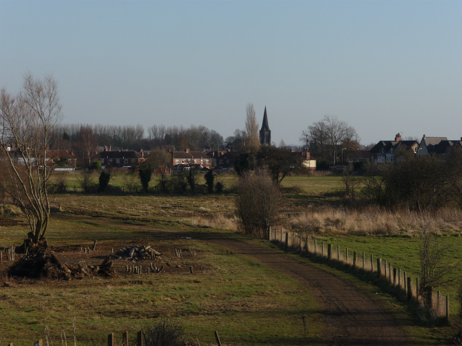
Fishlake to Stainforth Bridge (1.2 miles/1.9 kilometres)
 |
| Thorne Round walk at Fishlake |
We started off by passing alongside the churchyard to climb the river bank and then headed south on a local trail known as the Thorne Round walk. Our walk didn't take us to Thorne, but we could feel the presence of the village, both in the local signage and place names. Instead, we walked towards Stainforth, following the path along the right bank of the River Don, which
Doncaster is named after. Like many Roman settlements, the name is a combination of a Celtic word
Don (the name of a Goddess) and the Roman affix
-caester.
 |
| CO2 clouds from nearby Power station |
At Stainforth Bridge, we nipped into the village to get some supplies in the local shop. Stainforth looked much more run-down than Fishlake and it reminded us how much the area around Doncaster has suffered, as a result of the mines closing in the 1980's, amongst other things. Doncaster and its surrounding areas has long been a staunch Labour-voting, working-class stronghold and Stainforth lies in the North Doncaster constituency, which is represented in parliament by the Labour leader, Ed Miliband.
Stainforth Bridge to Kirk Bramwith (1.7 miles/2.7 kilometres)
 |
| St Mary's church with snowdrops, Kirk Bramwith |
From Stainforth Bridge, we continued along the riverbank to a small hamlet called Kirk Bramwith. Kirk Bramwith is home to a very pretty 12th century Norman church, called St Mary's, which is famous for its snowdrops, which flower in the churchyard every February. The word
kirk also reminded us how far from London we were, exactly 166 miles from Charing Cross!
From the path we could see the almost post-apocalyptic clouds of CO2 in the distance, hovering above the power stations that stand out against the flat landscape - I'm not sure which power stations they were, most likely the ones at Drax, by the River Ouse in North Yorkshire.
Kirk Bramwith to Trumfleet Marsh (2.7 miles/4.3 kilometres)
From Kirk Bramwith, we followed the lane way to Braithwaite, crossing the
New Junction Canal, the last canal built in England for commercial purposes (opened in 1905). At Braithwaite, we picked up the
Trans Pennine trail, which runs 215 miles from Hull, on the North Sea, to Southport, on the Irish Sea. Although it's not yet recognised as a national trail, there has been a lot of investment in the Trans Pennine trail and it's very well sign-posted. We were able to follow the trail all the way to Doncaster.
 |
| Braithwaite village on the Trans Pennine trail |
The next part of the walk was along small country roads and wasn't the most enjoyable, as we had to keep our wits about us and keep an eye out for traffic. We passed Willow Bridge farm, then turned south at Trumfleet, passing White House farm, before we came to Trumfleet Marsh and rejoined the River Don briefly.
We climbed the river bank again and had a short lunch break, as we discussed our latest movie experiences, my recent obsession with the Austrian film director, Ulrich Seidl, as well as BAM's review of the Chilean movie,
No starring Gael Garcia Bernal and directed by Pablo Larrain.
Trumfleet Marsh to Joan Croft Junction (1.9 miles/3.1 kilometres)
 |
| Trumfleet Marsh, a good place to discuss movies! |
From Trumfleet Marsh, we followed the road to a small commuter village called Thorpe in Balne. Thorpe in Balne has unusually massive properties and is, no doubt, a convenient place for Doncaster's rich folk to live, being quite close to the city. Our arrival was greeted by a chorus of barking dogs, who made sure we didn't hang around too long, gaping at the sudden display of prosperity!
As we walked along Joan Croft lane, our conversation turned towards another famous Joan - Joan Harris (or Holloway), the voluptuous secretary in
Mad Men, played by Christina Hendricks. We've both just recently seen
Series 5 of
Mad Men and Joan's dilemma, when she is pressurised into using her feminine charms to win the Jaguar account. Our musings on the moral implications of Joan's actions came to an abrupt halt at Joan Croft Junction, where the manned level-crossing was shut, as we waited for a freight train to pass by.
This part of Yorkshire is criss-crossed with railways - some of them have become more or less obsolete - others, like the East Coast Main Line, are vital to the functioning of Britain's rail network. The junction is a busy one, not to mention somewhat dangerous - the fact it's manned is testament to the recklessness of previous walkers and cyclists, who've ignored the signals and crossed the path of high-speed trains! Normally, road tunnels would take traffic, cyclists and walkers under the railway, but this part of Yorkshire is so flat, that the only way to cross the railway is by building a bridge to go over it which, according to the man working at the level crossing, is what they intend to do.
Joan Croft Junction to Tilts Bridge (1.6 miles/2.6 kilometres)
 |
| Owston Grange |
Shortly after Joan Croft Junction, we crossed Thorpe Gates, an unmanned level crossing, then walked along Middle Lane as far as Owston Grange, following the Trans Pennine trail into the ancient Owston Wood. On the other side of Owston Wood, we crossed yet another railway line, west-east this time, paying attention to the signals and carefully closing the gates on either side, as we crossed.
It was then a short walk along a country lane to the village of Tilts and Tilts Bridge, which crosses the oddly named
Old Ea Beck. On the far side of a small lake, we could see what looked like a Traveller/Gypsy settlement - one of those places with empty dull brick houses with much more 'lived-in' caravans in each yard. Apparently, Doncaster has England's
largest Gypsy and Traveller population, outside London. The primary school in nearby Toll Bar has an intake of 20% of kids from a Gypsy/Traveller background
Tilts Bridge to Bentley Railway station (2.3 miles/3.7 kilometres)
 |
| The path to Bentley, with St Peter's Church in the background |
From Tilts Bridge we followed Shaftholme Lane, then the A19, walking under a road bridge which brought us to the start of a long, green corridor that cuts right through the heart of Bentley, emerging again on the River Don, a few miles south of Doncaster city centre. The trail goes on a bit of a detour through the suburbs of Bentley, passing the railway station and an intriguing 'black' church, St Peter's, which is run by the Franciscans.
Bentley is considered to be one of the most deprived areas of England. Although, it was certainly very different that some of the 'wealthier' places we've visited during our series of Chester walks, it didn't feel unsafe or extremely poor - I've certainly been to worse places!
Bentley Railway station to Warmsworth (2.4 miles/3.9 kilometres)
 |
| BAM walking into Warmsworth, South Doncaster |
Once back on the 'green corridor' it was a very pleasant walk past the suburbs of Sunnyfields, Cusworth and Newton, before we met the River Don again at Warmsworth, crossing the river via a small pedestrian bridge near
the village of Sprotbrough. It all seemed very civilised, as we passed families taking their dogs for a walk, local teenagers playing football and joggers making the most of the early spring sunshine.
The path got a lot lonelier towards the end, as we left the city behind us.
Warmsworth to Doncaster Railway station (2.3 miles/3.7 kilometres)
 |
| Welcome to Hexthorpe! |
At Warmsworth, we doubled back on ourselves, following the Warmsworth Road and then the High Road, before turning left into Greenfield Lane and crossing the railway tracks to enter the suburb of Hexthorpe. BAM had images of a Hexthorpe High Street filled with pretty boutique shops and cosy little restaurants, but all we could see were convenience stores and fast-food take-away joints, as we scuttled through the fading light and made our way to Doncaster city centre.
We didn't see a lot of Doncaster in the end, just the local
Weatherspoons, where we had a quick bite to eat and a drink, before catching our trains to London (for BAM) and to Leeds (for me, a chance to visit my little sister!)
Access for Wheelchair Users
 |
| Don't forget to close the gate! |
It's good news for wheelchair users this time, as the majority of this walk was accessible. The Trans Pennine trail is designed for 'multi-users' and is generally accessible for all kinds of walkers, cyclists and wheelchair users. I'd recommend the section from Braithwaite to Doncaster, although be mindful of the level crossings, which could be dangerous for wheelchair users, as the trains move pretty quickly! The walk along the river bank outside Fishlake isn't really accessible for wheelchair users, however, the area around Fishlake is very flat and there are other options for wheelchair users which would be just as satisfying.
Image credits:
 |
The River Don, near Sprotbrough
|
All photos were taken by me - please feel free to reuse them under the following Creative Commons license:
Attribution (especially to this blog post)
Share-alike
Non-commercial