Saturday, December 13, 2014

Great Casterton - Christmas trees, lake towers and troll bars

Both myself and BAM (Best Aussie Mate) were very excited at the prospect of visiting Rutland - England's smallest (mainland) county.  The fact that Rutland has managed to survive until the 21st century is pretty amazing, as it has less than 40,000 people and the next biggest county, Herefordshire is almost six times bigger than Rutland and has almost five times the number of people than Rutland has!

Indeed, Rutland was merged into neighbouring Leicestershire in 1974, but became a county in its own right again in 1997 and I'm kind of glad that it did! There's something different about Rutland and it felt a little bit like a world unto itself, keeping its distance from the noise and bustle of nearby Leicester and Peterborough.

We managed to walk almost the entire length of the county, which has to be a first, although we did end our walk in Stamford, which is in Lincolnshire.

Lodgings and Victuals

The best accommodation options in Rutland were in Oakham, the county town, so we decided to stay there and walk from Oakham to Great Casterton. We were lucky enough to find a lovely BnB in a traditional thatched cottage on Northgate with a friendly and informative host, Dane Gould.  We had a lovely meal in a 17th century pub called the Wheatsheaf, also on Northgate.

As we're currently planning a trip to Tbilisi/Georgia, the Wheatsheaf was a good location to go through the maps and guidebooks and talk about far-off destinations such as Borjomi, Mtshketa and Akhaltsikhe.  I think Georgia will be a little bit more exotic than Rutland, but only marginally so!

Whilst we were expanding our horizons beyond the EU borders, we were joined, in our corner of the pub, by a table full of men who seemed to be celebrating the local UKIP Christmas party.  Not that we were listening, but we couldn't help overhearing talk of UKIP leadership, Romanians and how cheap Ryanair flights might help to rid the country of undesirables!

Whilst these Chester walks have deepened my understanding and love of England - I find myself despairing at some of the things that are happening in English politics right now!  I have a real fear that England will become isolationist and an economic and cultural backwater.  Whilst I love ye olde worlde of the English countryside, it's good to balance that with an outward world view and cosmopolitanism - you can have the best of both worlds, believe it or not!

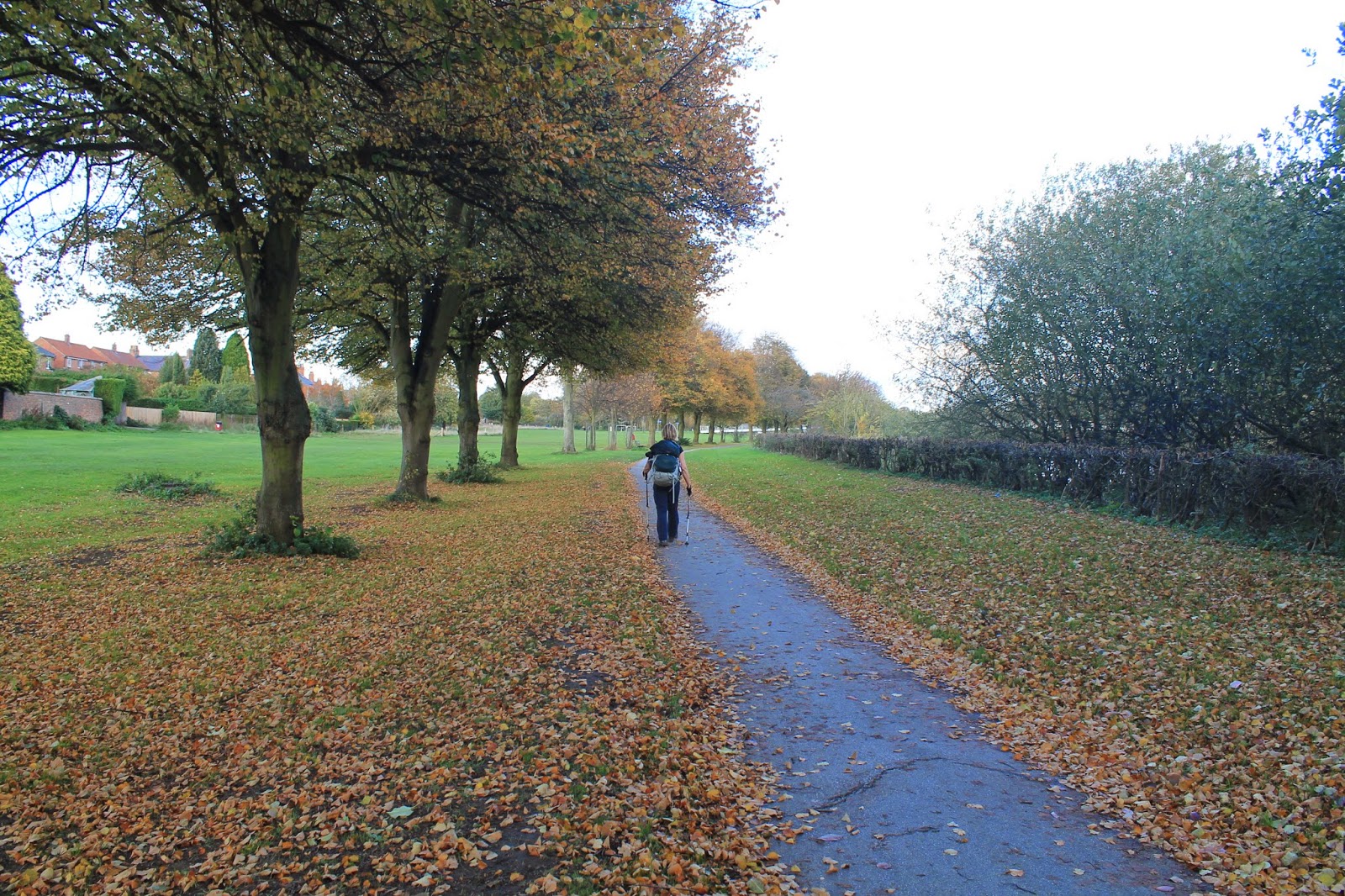
Oakham to Barnsdale Wood (3 miles/4.9 kilometres)

Despite the fact that it's December and rather cold outside, I managed to get sunburnt on our walk from Oakham to Stamford! It was a fantastic feeling walking around Oakham on a busy Saturday morning in the run up to Christmas, the bustling market and High Street, the beautiful remains of Oakham castle and the Butter Cross, blue skies and an energising chill in the air!

Oakham Saturday market

Bizarrely, Oakham is twinned with a town called Dodgeville, which is Wisconsin, a place I've blogged about in my other blog, Learning about the World. Or perhaps not that bizarre, as Dodgeville is the global headquarters of the US clothing retailer, Land's End and Oakham is the Land's End UK headquarters.

We didn't notice any Land's End retailers in Oakham, however, we did stop at a shop on the High Street to buy some water, which involved a lot of comedy as BAM tried to wrestle my wallet from a tight pocket in my backpack and then I knocked over a cardboard Christmas tree on the way out - I'm sure the residents of Oakham were wondering who these mad people were, with their funny sticks, boots and layers of winter clothing.

Oakham castle with All Saints Church
Frost on the ground at the remains of Oakham castle
Perhaps we were experiencing an episode of bad luck, due to the horseshoe, which is a symbol of Rutland (it's upside down). To this day, any royals or peers of the realm who pass through Rutland, must stop at Oakham castle and present their horseshoe to the local people.  We didn't bring our horseshoes with us, unfortunately, so I hope we didn't breach protocol!

Horseshoe on the gate of Oakham Castle
I was really impressed by the Butter Cross in Oakham's Market Place, as I've never seen a butter cross before, although there are others in England and in two other 'chesters', Chichester and Winchester, which we haven't yet visited.

Oakham Butter Cross

From the Butter Cross, we followed the Market Place lane around to All Saints Church, walking along the back of the church and through the park until we reached Burley Road. Crossing Vicarage Lane, we continued along Burley Road before turning right onto Woodland View, a cul-de-sac for drivers, but a handy escape route for walkers, as it takes you out of Oakham in the direction of Dog Kennel cottage and a small stream that leads to Rutland Water.

Rutland Water
Rutland Water looks pretty impressive on the map and takes up a substantial part of Rutland county. It's a man-made lake, being completed in the mid-70's and it's one of the biggest artificial lakes in Europe. It looks pretty impressive in real life too and I'm still trying to get my head around the engineering that's involved in creating an artificial lake.

In the case of Rutland Water, it was created by damming the River Gwash, so it flooded the Gwash Valley, submerging the villages of Nether and Middle Hambleton, but leaving Upper Hambleton intact, on top of a low ridge, which is now a peninsula. As we followed the main road out of Oakham, along the lake side, the only evidence of the lake's artificiality was the draw-off tower, in the middle of the water, visible from the beginning of Barnsdale Wood.

Winter canopy in Barnsdale Wood

Sailing boat on Rutland Water

Barnsdale Wood to Sykes Spinney (2.3 miles/3.7 kilometres)

It was a very pleasant walk along the north side of Rutland Water through Barnsdale Wood and around by Whitwell Creek.  It was surprisingly peaceful as well, although Rutland has a reputation for outdoor sports and I'd imagine that, in summer, Rutland Water and the surrounding paths must be teeming with people.

Whitwell Creek
The path we were following for this stage of the walk forms part of both the Hereward and Viking ways. Hereward sounded like an obscure English county to me, but I've since discovered that Hereward was a person, Hereward the Wake, who fought against William the Conqueror and was based on the Isle of Ely in nearby Cambridgeshire.

The Hereward Way links the Viking Way to the Peddars Way and the Peddars Way follows an old Roman road to join the Norfolk coast, continuing to Brancaster, one of our previous Chesters.  It's funny how all these ancient ways link up and I feel as though we could just keep walking around England following paths that have been in use for many centuries!

Hereward and Viking Ways
We hardly saw anyone, until we got to Whitwell Creek, which is near Whitwell village, therefore more accessible by road.  From Whitwell Creek, we could see another tower in the middle of the lake and this was the Limnological Tower, limnology or freshwater science being the study of lakes and inland waters.  There was also a very interesting sculpture on the shoreline, which was ablaze with light in the late afternoon sun.

Limnological Tower in Rutland Water
The Great Tower at Sykes Spinney
A spinney is a small wood or copse and Sykes Spinney had a lovely picnic area and some benches, which came in quite handy for our well-needed chocolate break!

Cow at Sykes Spinney

Sykes Spinney to Empingham (1.3 miles/2.1 kilometres)

Just after Sykes Spinney we came to the dam, then continued on a footpath called the Rutland Round, which took us through a small wood and into the village of Empingham. Whilst we were in Oakham, we'd heard that there had been a tragic car accident in Empingham the previous evening, involving two schoolgirls and it really struck me how these local tragedies happen all the time, but you wouldn't really be aware of them, if you live in London or other parts of England.

Stone marker near Empingham

Dam at Rutland Water

View of Empingham in the distance
Empingham was a pretty village, with lots of thatched cottages along the High Street, which looked magnificent in the waning light. We always have to plan very carefully around this time of the year, as we have the minimum amount of light. By the time we got to Empingham, around 3 in the afternoon, the sun was already making its descent towards the horizon behind us.

Empingham High Street
Empingham to Great Casterton (2.9 miles/4.6 kilometres)

From Empingham we followed the Rutland Round out of the village and up Chapel Hill, where we walked along a ridge at the top of some fields in a relatively logical direction with the village of Great Casterton barely visible in the distance.  We got slightly lost once, missing out turn off near the Tickencote Lodge farm, but we quickly figured out what we'd done wrong and caught up with our path again, crossing a field of very fat-looking, black sheep, before reaching the village of Tickencote.

Country lane near Tickencote

Fat, black sheep near Tickencote

Although they're barely a mile apart, Tickencote and Great Casterton are separated by the Great North road which, for centuries, was the main coaching road between London, York and Edinburgh and was frequented by Dick Turpin and many other highwaymen and women throughout its illustrious history!

The Great North road, in turn, follows the route of the ancient Roman Ermine Street which linked Londinium (London) with Lindum Colonia (Lincoln) and Eboracum (York).

Welcome to Great Casterton/Great North road/Ermine Street

Roadside building in Great Casterton
I must say that Great Casterford was a very congested place and, unfortunately, what had been quite a pleasant walk turned into a precarious adventure with racing cars, exhaust fumes and frantic 'drive slowly' signs!  Needless to say, we didn't hang around, but made our way through the village as quickly as possible in the direction of Stamford.

Great Casterton to Little Casterton (1 mile/1.6 kilometres)

Although the sun was setting fast, we decided to risk it and take a detour via Little Casterton, so we could tick another 'chester' off our list.  I was fascinated by the Toll Bar sign that we encountered on our way out of Great Casterton.  Obviously, this was once an actual bar, that blocked entry to the coaching inns of Great Casterton, until you paid a toll, for anyone travelling to the north of England.

Perhaps more interesting, in a way, was the fact that someone had scribbled a small letter 'r' on the sign, so it became Troll Bar - an amusing concept, as I'm not sure how many trolls make the long journey from London to Edinburgh these days.  Most modern trolls seem to spend most of their time on Twitter!

The Troll Bar

Little Casterton

After the toll bar we turned left onto a very busy country lane that hurtles towards Ryhall and Greatford. Walking on the verge of a busy road has never been our favourite thing, so we picked up our pace until we made it to Little Casterton and could turn off onto a much quieter road, the Little Casterton Road, which took us straight into Stamford.

Sundown, road to Stamford
Little Casterton to Stamford (2 miles/3.3 kilometres)

By the time we reached Little Casterton the sun had set already (around 4pm) and we suddenly found ourselves on an obscure country lane in that magical winter twilight that is both exciting and a little bit frightening.  Although a few cars passed us on the road to Stamford, it was a relatively peaceful walk and the distant lights of Stamford kept our spirits up, until we'd made it back to civilisation just before the light completely disappeared from the sky.

Stamford Scotgate, early evening
The Little Casterton Road very carefully guided us into Stamford, until we met with the curiously-named Scotgate.  I must admit, I was quite impressed with Stamford.  It seemed like a busy little town, with lots of Christmas cheer, shoppers, cosy pubs and a good choice of restaurants.

We had a fantastic meal at the Mad Turk on St Paul's Street, then we starting planning a future Chester walk over a much-appreciated pint of Czech beer (and glass of wine, in BAM's case) in the King's Head on Maiden Lane.

Stamford High Street

Access for Wheelchair users

Path along Rutland Water
The first part of this walk from Oakham to the dam near Empingham was very accessible for wheelchair users.  The Rutland Round mostly follows tracks through fields, so wouldn't be accessible.  We wouldn't recommend the country lanes between Great Casterton and Stamford, as they're quite busy with traffic. Stamford is a nice place to visit and I'd imagine there are some accessible footpaths around the town.  

Image credits:

All photos were taken by me - please feel free to reuse them under the following Creative Commons license:

Attribution (especially to this blog post)
Share-alike
Non-commercial

Sunday, November 9, 2014

Tadcaster and Acaster Malbis - Brigands, Brewing and Bishops

This was our second foray into Yorkshire, having previously walked from Fishlake to Doncaster in April 2013.  When people think of walking in Yorkshire, they mostly think of the Dales or the North York moors - scrambling over mountain passes and descending spectacular valleys.  But both the Doncaster walk and our walk from Tadcaster to York, via Acaster Malbis were through a very flat and relatively mundane landscape.

There's a very good reason for that - i.e. we're walking the chesters of Britain and these mark Roman settlements.  The Romans, quite wisely, built their settlements in the lowlands and on Britain's major rivers, so they had no interest in the more mountainous areas, which were inhabited by unruly Celts and brigands!

View of York from the city walls
In the early days, the Celtic Brigantes tribe ruled most of (what is now) northern England.  When the Romans arrived on the scene and conquered the southern half of Britain, the Brigantes managed to retain their autonomy as a kind of client state of Rome, under the direction of the Celtic queen Cartimandua and her husband Venutius.  When Cartimandua ran off with one of Venutius' soldiers, it plunged the Celtic kingdom into civil war, which the Romans exploited, eventually establishing their rule in the north of England.

York (Eboracum) became the capital of the Roman province of Britannia Inferior (north of England) and London (Londinium) became the capital of Britannia Superior (the south of England and Wales). Tadcaster, where we started our walk, is about 10 miles from York and it was apt to finish our walk in York as it was such an important Roman settlement.  There are other 'chesters' in Yorkshire that are hidden to the modern age, as their names have changed or dropped the chester/caster prefix.

Lodging and victuals

The differences between the north and south of England are still evident today and it really felt as though we were setting off on a big adventure to a far-off land, as we boarded the Edinburgh-bound train at King's Cross and went hurtling north through the East Midlands and past the Humber estuary.  We travelled in the afternoon, so it was still light when we reached York and caught the 843 bus from York railway station to Tadcaster along the busy A64 road, which still follows the course of an old Roman road, which linked Chester and York.

The Ark in Tadcaster

Tadcaster is an unassuming little town and I'd imagine it's always lived in the shadow of York.  The Romans called it Calcaria because of the local lime deposits. The quality of the local water, which is rich in lime sulphates, led to Tadcaster becoming one of Britain's most important brewing centres. Tadcaster's brewing industry is still very much a presence, with John Smith's brewery dominating the town centre.

John Smith brewery in the centre of Tadcaster

There isn't a lot of accommodation in Tadcaster, but BAM (Best Aussie Mate) managed to secure a room for us in a residential hotel in Kirkgate, a few doors down from a historical tudor-style building called 'The Ark'.  We had a great dinner in Tadcaster, at a cafe/bistro called The Granary which is on the main street.

Tadcaster to Colton Lane (3.6 miles/5.8 kilometres)

The weather was crisp and bright, as we set out from St Mary's Church in Tadcaster and followed the main road out of town, across the River Wharfe and along the old Roman road, which eventually joins the A64, about a mile out of town.  At the first opportunity we turned left down a laneway which leads to the village of Catterton, then followed signs to the right, which brought us along The Old Street, route of the original Roman road, which follows a steep ditch, through some woodland and along the bottom of Catterton Moor.  This is also part of the Ebor Way, a 70-mile footpath which crosses Yorkshire.

St Mary's Tadcaster

The autumnal colours on this walk were really fantastic, although I'm still recovering from a recent trip to Canada, where the vivid reds, oranges and yellows of the maple leaves have dazzled me and left me less impressed by the slightly understated tones of the English countryside in October.

Old Street ditch

Catterton Moor

Sign post for the Ebor Way

Rather typically of Roman roads, the Old Street was long and straight, pointing like an arrow towards the Vale of York and the ultimate objective of our walk.  After a couple of miles, we hit the A64 again, still busily trundling on in its never-ending journey to York, presenting us with fast food restaurants and hotel chains, as we negotiated the pedestrian by-pass near Colton lane, so we could rejoin the Roman road and make our way towards Copmanthorpe.

Fast food restaurants

The busy A64

Ironically, the by-pass over the A64 provided our highest 'viewpoint' of the day and we could see the power stations near Snaith in the distance and it was interesting to realise that our last Yorkshire walk had been on the far side of the power stations in an equally flat and industrial landscape!

Distant power station

Colton Lane to Copmanthorpe (1.75 miles/2.8 kilometres)

I've recently discovered an app for iPhone, which helps you identify wild flowers.  As myself and BAM are constantly coming across all kinds of wild flowers on our walks, we're interested in learning the names of these flowers/plants and what they can be used for (particularly the edible ones!).  At Colton Lane we came across some trifolium pratense a.k.a. red clover.

Red clover is the national flower of Denmark, which is interesting, as York/Jorvik was such an important Viking settlement.  Perhaps the clover we spotted on the side of road originally came from Scandinavia!

Red clover

From Colton Lane we followed the Ebor Way along the edge of some fields and then out onto a rather attractive country road, which connects Colton to Copmanthorpe.  We noticed a lot of cyclists on this walk and also posters advertising cycling events.  The first two stages of the 2014 Tour de France took place in Yorkshire back in July and it seems to have inspired a local resurgence of interest in cycling.

BAM on the Ebor Way

Country road to Colton

We had a chocolate break at Copmanthorpe, a quirky little village which was in the thralls of its first beer festival, the amusingly named Coptoberfest.  Thorpe is a Middle English word for 'village' and is common in place names in the north of England. Copmanthorpe means something like 'Trader's village' and it definitely had a lot more character than your average commuter village.

Poster advertising the Coptoberfest

Copmanthorpe to Acaster Malbis (2.2 miles/3.6 kilometres)

We left the Ebor Way at Copmanthorpe, as we wanted to detour via Acaster Malbis and cover two 'chesters' in one go.  Turning off the Main Street into Station Road, we soon crossed the East Coast railway line and came to Temple Lane, a rather long and eerie lane that connects Copmanthorpe and Acaster Malbis.  The lane is named after land granted to the Knights Templar, who led the medieval Crusades to the 'Holy Land'.  I'm currently blogging about Palestine, so this was a rather arcane connection to my other blog, Learning about the World.  

Sign post for Acaster Malbis

Acaster Malbis was most likely the site of a Roman military camp, no doubt protecting York from marauding native tribes.  It's got an air of abandonment about it these days and there was a stillness around the village 'centre' which we found lulling, but also somewhat spooky! Although it's situated on the River Ouse, one of Yorkshire's main rivers and, no doubt, a great thoroughfare in bygone days, Acaster Malbis is now very much cut off from the outside world and feels like the end of the road.

Acaster Malbis

When I bought the map for this walk we noticed that there is another Acaster in this area - Acaster Selby - but it was too far to walk in one day, so no doubt we'll be back in that part of the world at a future date!

Acaster Malbis to Bishopthorpe (1.9 miles/3.2 kilometres)

It was a pleasant walk along the River Ouse to Acaster Bridge, where we picked up a branch of the Trans-Pennine trail, a coast-to-coast long-distance footpath from Southport on the Irish Sea to Hornsea on the North Sea.  This is a fairly accessible route, which revitalises disused railway lines and we walked part of the Trans-Pennine trail when we did our Doncaster walk last year.

We only did about half a mile on this route to Bishopthorpe, but there was a lot to see in that short space, including an installation about the planets and a Halloween festival at the Brunswick Organic nursery.

Planets installation on the Trans-Pennine trail

We were really inspired by the Brunswick nursery, which is a charity that employs young people with learning disabilities.  The young people grow organic vegetables, run a canteen and produce all kinds of beautiful art work and handicrafts.  I left with a bag full of organic produce and Christmas cards!

Disabled scarecrow at Brunswick organic nursery

We left the Trans-Pennine trail at Bishopthorpe and made our way through some suburbia, then down the main street and past the Bishop's palace.  The current Archbishop of York is John Sentamu, who was born in Uganda and is, I think, the second-most important figure in the Church of England, the first being the Archbishop of Canterbury (again the North/South divide set up by the Romans!)

In olden times, the Archbishop of York would have sailed down the river to York Minster to conduct prayer services, otherwise retreating to the serenity of Bishopthorpe which sits at a respectable distance from the city.

The Bishop's Palace in Bishopthorpe

Bishopthorpe to York Minster (3.7 miles/6 kilometres)

We were back on the Ebor Way again at Bishopthorpe, although we missed a rather hidden turn and spent a bit of time wandering around the local Crematorium, before we got back on track and made our way towards the River Ouse.  

Walking around the Crematorium turned our thoughts towards will-making, as both myself and BAM have got to make wills soon and, as per usual, BAM is more organised than me and has done a lot of research on will-making and the best way to proceed.

With thoughts of our own mortality at the front of our minds, we passed under the A64 and wandered through the distinctly earthly delights of the Middlethorpe Ings, with a view of the imposing Rowntree Factory in the distance.  Ings are water meadows and I'm pretty sure that they're prone to flooding.  The Middlethorpe Ings are at a lovely bend in the River Ouse, just before it enters the city of York.

Under the A64

Path through Middlethorpe Ings

BAM walking towards York

The Rowntree chocolate works

As we passed the suburb of Nunthorpe and the York Millennium bridge, the sun came out and the late afternoon strollers, shoppers and tourists gave York a jaunty feel, as we enjoyed our last evening stroll of this year's summer time, before the clocks were put back later that night.

Rowers on the River Ouse

Nunthorpe, outskirts of York

I've been in York a few times before, but it's always such a pleasure to visit again and York Minster was a rather grand place to finish our Tadcaster/Acaster Malbis walk!

Busy riverside in York

St Wilfred's Catholic Church in York

View of York Minster from Duncombe Place

Access for wheelchair users:

Trans-Pennine Way seems fairly accessible
Unfortunately, much of the walk, as described above, wouldn't be particularly accessible to wheelchair users and it would certainly be difficult to follow this walk without interruptions.

The parts that were accessible included the Roman road from Tadcaster if you continued to Catterton, rather than turning off through the fields.  Also the country road from Colton to Copmanthorpe was accessible and seemed relatively free of traffic. Likewise, a walk from Copmanthorpe to Acaster Malbis would be accessible.  The Trans-Pennine trail is wonderful for wheelchair users and should be pretty easy to access - in fact you could follow it all the way from Bishopthorpe to York.  The riverside walking described above wasn't at all accessible, however, there are plenty of walks in and around York which would be satisfying for wheelchair users.  

Image credits:

All photos were taken by me - please feel free to reuse them under the following Creative Commons license:

Attribution (especially to this blog post)
Share-alike
Non-commercial