Showing posts with label Three Choirs Way. Show all posts

Friday, September 29, 2017

Gloucester - Bus times, Broadband and the story of Bill's

It's been just over a year since we had our first foray into Gloucestershire, when we walked in the Cotswolds last June (visiting Frocester and Woodchester).  But this was our first visit ever to Gloucester city itself.

In Roman times, Gloucester was called Colonia Nervia Glevensium or Glevum for short.  The origin of this name is a bit obscure, but it might come from a Celtic word for 'bright place' (sounds suspiciously like the Germanic word glow - which makes me think there may have been some obfuscation of the meaning down through the years).

Glevum - the Roman name for Gloucester
Interestingly, the modern Welsh name for Gloucester is Caerloyw and the modern English name is what's left of Gleaw + chester.  It's one of the English place names I really struggled to pronounce, when I first visited this country - for anyone who's still a bit unsure, it's generally pronounced Gloster.

The Museum of Gloucester on Brunswick Road
Lodgings and victuals

It wasn't very bright when we arrived off the train around 9pm on a Friday evening in August and it was difficult to get a sense of the place, as we made our way along Brunswick Road towards the Travelodge, our destination for the evening.  We managed to have a half-decent meal at The Lord High Constable of England in Gloucester Quays, run by the Wetherspoons chain and the pub was packed with the Friday night crowd - a friendly buzz of conversation, laughter and background music.

Gloucester Quays - the place to be on Friday nights!
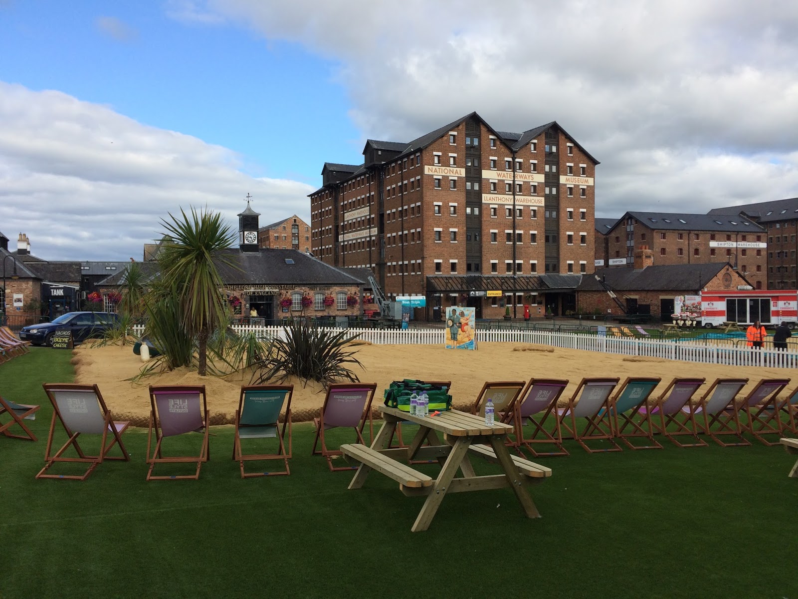
Gloucester Quays is probably the most attractive part of town and there is a good selection of restaurants and bars in converted customs buildings near the River Severn.  Not to mention a Saturday morning market and an artificial beach beside the quays, which intended to save people the long journey to the coast!

The artificial beach on Gloucester Quays

We decided to have breakfast in Bill's Gloucester Quays, which was nothing less than sensational! Purely by coincidence, I had been in the original Bill's in Lewes the week before and I'm quite interested in Bill's story and how this restaurant chain has become so successful - not to mention the fact that their food is amazing!

Breakfast at Bill's in Gloucester Quays
BAM (Best Aussie Mate) was convinced that Bill's is, in fact, an Aussie chain, but a quick search on Google cleared up the confusion, as we learned that there is another chain of Bills, which has also has a story and started in Sydney, Australia.  By all accounts, the food there is also very good and I'm sure some of our Australian readers will be able to confirm this.

Mitcheldean to May Hill (3.3 miles/5.3 kilometres)

We decided to start in the country and walk back to Gloucester, both for the satisfaction of having a sense of destination, but also for the convenience of being able to jump on a train afterward, for the journey back to London.

Getting to Mitcheldean was a bit of an adventure though - unfortunately, the bus times from Gloucester to Mitcheldean have changed recently, but the website I was looking at hadn't been updated, so we missed our bus by about five minutes and ended up catching a taxi to Mitcheldean instead.

Mitcheldean in Gloucestershire
Thirty minutes and £27 later found us on Hawker Hill in Mitcheldean, looking for the Wysis Way, which is the path we followed for most of this walk.  Mitcheldean appealed to me, as Mitchel is another way of saying Michael and, indeed, the main church in the village is called St Michael's.
I don't think we'd walked on the Wysis Way before and it's a handy 55-mile link between the Offa's Dyke path and the Thames Way.

As we left Mitcheldean on a small road which passed the Business Village, we had an interesting debate on the responsibility of governments to provide decent broadband and I was trying to convince BAM that we're living in a first-world economy with third-world Internet connections.

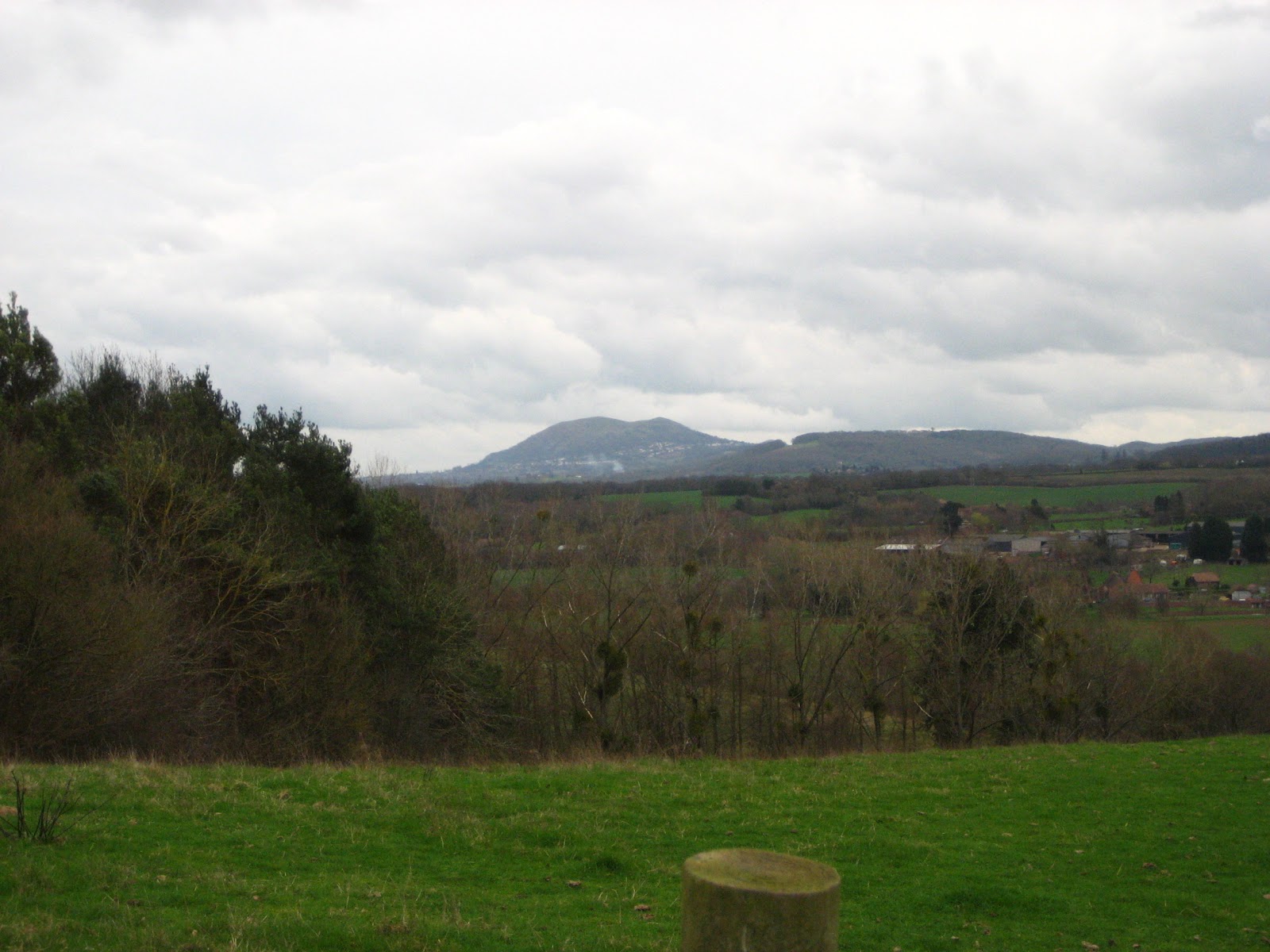
View from May Hill Farm
I'd read recently that the UK's connectivity is worse than Romania's, but actually, researching this further, I've learned that this isn't true and, actually, both the UK and Romania have strong Internet connections - about 16.1 mbps in Romania and 16.3 in UK.  There is an organisation called Akamai that publishes quarterly reports on the State of the Internet - well worth a look, if you're interested.

The highlight of the walk was reaching the top of May Hill, not the biggest hill in the world, at 296 metres, but with fantastic views across to the Wye Valley and the distant hills of Wales to the West, as well as a stunning view of the River Severn, wending its way to the south.  I'd like to return to May Hill on May 1st, as apparently they have Morris dancing on top of the hill every year!

May Hill - view towards Wales

May Hill - old signpost

Trig on the top of May Hill
May Hill to Tibberton (4.8 miles/7.7 kilometres)

From May Hill, it was an easy path down towards May Hill village, then a very quiet path through Newent Woods, where we met a rather rugged man, who was carrying a sawn-off piece of tree.  We stopped to talk to him and he showed us the rings on the bark, which he was going to use to calculate the age of the tree.

There is a rather lovely-looking pub at Glasshouses called The Glasshouse Inn, after which we followed the least well-marked section of the entire walk, through Castle Hill Wood, past a small lake hidden in the depths of the Gloucestershire jungle!

The Glasshouse Inn
After Byford's Farm, I had to face my worst fear again with a field-full of young cows, who seemed rather panicky at the sight of us.  We passed through a total of four fields full of cows on this walk and I think I'm starting to come to terms with the fact that if I don't panic, they are also less likely to panic.  Animals can smell fear and stress and they don't respond well to that, so I kept my breath calm, as we slowly made our way past the various herds of cows we met on the Wysis Way.  Still not my favourite thing though and the thought of cows fills me with dread!

It's hard to write this in September and realise how hot the weather was, just over a month ago but, by the time we got to Tibberton, I was starting to feel a bit dehydrated, so it was lovely to sit in the churchyard at Tibberton Court and have a little rest , about halfway through the walk.
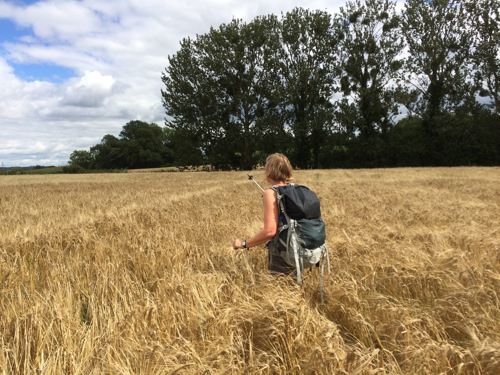
BAM negotiating the fields around Tibberton

Holy Trinity Church at Tibberton
Tibberton to Lassington (3 miles/4.8 kilometres)

I have to say, the people of Tibberton weren't particularly welcoming, especially when we missed the signpost for the Wysis Way in Orchard Rise and got told off by a rather obese lady, who had been enjoying the sunshine in her back garden, until we appeared on a lane between houses, trying to get back onto the path again.

After Tibberton the path disappeared completely into a field of crop and we almost got scratched to death making our way to an eerie cluster of buildings called Bovone, the kind of place that looks like it could feature in an American movie about serial killers!

At Bridge Farm, we crossed the road and joined a disused railway track, which is now part of the Three Choirs Way - a path we walked on before, when we were visiting Worcester back in 2012.  It was an easy path and not too many cows between Bridge Farm and the medieval village of Lassington.

Disused railway line, now part of the Three Choirs Way
Lassington to Gloucester (3.5 miles/5.6 kilometres)

There is nice view of Gloucester and the Severn Valley from the north side of Lassington Hill, then a complicated route downhill through a small wood and out onto the main road at Over.  From Over, we followed local footpaths all the way the Gloucester.

Train near Over

By the time we got to Gloucester, my tongue was stuck to the roof of my mouth, so I was really happy to have a cold beer and some food in the garden of the lovely Fountain Inn just off Westgate Street.

Street Art in Gloucester
Access for Wheelchair Users
Field edge near Taynton

Very little of this walk would be recommended to wheelchair users - but there are plenty of interesting and accessible paths around Gloucester.  I would also recommend a return trip to May Hill from Glasshouses, all of which could be done by using small roads.  

There is a small road that runs from Glasshouses to Tibberton, pretty much parallel with the Wysis Way, but you should only use roads at your own risk and I couldn't really recommend this.  

Image credits:

All images were taken by me - please feel free to reuse them under the Creative commons license:

Attribution (especially to this blog)
Share alike
Non-commercial

Wednesday, March 21, 2012

Worcester - Elgar, Swans and Daffodils

With a population of just over 94,000 people, Worcester is, by far, the biggest 'chester' we've visited during our series of 'Chester' walks.  Home of Lea and Perrins and the birthplace of the British Medical Association, Worcester has faded in and out of history, mostly on the periphery of events (a notable except being the English Civil War) despite its strategic location on the River Severn and its magnificent cathedral.

I must admit, I knew very little about Worcester before we went there, concerning myself more with the pronunciation of the name (it's wuster, right?  Or is it wooster?) than with the city's place in the wider world!  It seems like a pleasant enough place and, although the city is believed to have Roman origins (hence the -cester), this felt less obvious that at some of the other -cesters we've visited, like Wroxeter and Silchester.  I guess the smaller places have kept their more obvious connections to the Romans, whereas cities like Worcester have had many other layers of history added on top. 

Huntlands Farmhouse BnB
Lodging,  victuals and merriment

We decided to stay outside Worcester and walk towards the city, as we enjoy waking up to the sound of birds twittering (as opposed to the constant traffic of London) and it's very fulfilling to walk towards civilisation and the train that will take us back home.  We decided to stay in a wonderful rambling farmhouse with a duck pond called Huntlands Farm, just outside Knightwick in the Malvern Hills District of Worcestershire.  It's not the most obvious place to stay, but I think we're fated to stumble across the most interesting lodgings on these walks and the welcome we received at Huntlands was second-to-none. 

The BnB is provided by Lucy, who redesigned the interior of the main farmhouse building and is a professional upholsterer.  We also met her father, John, who is a charming man and has a wonderful collection of accordions and harmonikas.  We had a very tasty dinner, cooked by Lucy and then an evening of laughter and music - I used to play the accordion years ago, when I was in an accordion band in Ireland.  It was a wonderful feeling to play again and I realise how much I've missed it.  It's inspired me to think about taking up a musical instrument again - it's such a stress-relief and a lovely way to spend an evening!

Huntlands to Knightwick Manor (0.9 miles)
Cows near Knightwick Manor

Rather than walking directly to Knightwick, we decided to take a more circuitous route via Knightwick Manor, so we could avoid walking along the busy A44, which is the road that runs all the way from Oxford to Aberystwyth.  So we turned right, instead of left, at the bottom of Huntlands drive and made as though we were heading south towards Great Malvern.  After a very small settlement called Gaines we followed a local path to Knightwick Manor, a wonderful farm building on top of a small hill near the Suckley Road.

Knightwick Manor to Knightwick (1 mile)

Three Choirs Way signpost
From Knightwick Manor, we turned right onto the Suckley Road, then picked up the Three Choirs Way, a 100-mile long walking route that links the cities that host the Three Choirs Festival - one of the world's oldest classical choral music festivals.  Each year the festival alternates between the cathedrals of Worcester, Gloucester and Hereford and celebrates, amongst others, the music of English composers such as Elgar and Vaughan Williams.  This has definitely been the most musical of our walks so far! 

The Talbot, Knightwick
The symbol of the Three Choirs Way is a treble clef and the words of a local adage 'Blessed is the Eye between Severn and Wye'.  I've been puzzling over the meaning of this adage ever since, but I'm none the wiser, so if anyone knows what it means, please put me out of my misery!

Knightwick itself is very much a typical 'roadside' village and has a very attractive looking pub called The Talbot with an interesting signpost outside, pointing to faraway friends, rather than faraway places!

Knightwick to Ankerdine Hill (0.5 miles)

Daffodils
We don't get to do a lot of climbing on these Chester walks, so Ankerdine Hill was a chance to stretch our calf muscles and enjoy some forest walking as well.  Our conversation had turned to a recent TV documentary about the English Defence League.  BAM (Best Aussie Mate) doesn't have a television, so I was updating her on the themes of the documentary and the how it portrayed the EDL leader in a very positive light. Without addressing that organisation's extreme islamophobia, the documentary seemed to legitimise support of the EDL and justified xenophobia by distracting viewers away from the blatant issues around race.

Ankerdine Hill to Doddenham Hall (1.3 miles)

View of the distant Malverns
Leaving the summit of Ankerdine Hill, we got lost in a conversation about Sakura, the Japanese Cherry blossoms, then we wandered on to a discussion about the incredible optimism of Japanese people, despite last year's terrible earthquake and tsunami and we finished talking about the famous Japanese Shikoku pilgrimage route and how we would both love to do part of this (although the full thing can take sixty days!)

We also slightly lost the Three Choirs Way at this point and wandered on to the much shorter Worcestershire Way, which runs 31 miles from Bewdley to Great Malvern.  We soon realised our mistake and turned off the Worcestershire Way when it came to Easinghope Lane, following the lane downhill to Doddenhall Hall and the Three Choirs Way once more.

Doddenham Hall to Broad Green (1.1 miles)

Hmmm...everywhere but back then!
The stretch from Doddenham Hall to Broad Green was fairly typical of the rest of the day's walk - mostly along the edges of fields, with views of the Malverns off in the distance and the occasional foray on to quiet country lanes.  It was quite a peaceful walk and we didn't come across any other walkers apart from farmers in the distance, tending to their fields. 

Getting out of Doddenham Hall was probably the most complicated part of the whole walk, as the path was partly obstructed and signposts like the one in the picture were particularly open to interpretation!  I sometimes wonder at the value of sign posts like these, as it's plainly obvious that, at any given time, we mainly have four directions to choose from (right, left, back, forward)!

Broad Green to Elgar's Birthplace (2.3 miles)

Broad Green
Broad Green seemed like a fairly sedate place and reminded me of other 'commons' that we've seen on our various walking trips.  The rest of the path to Elgar's birthplace was through pastureland and made very pleasant walking.  I was a bit underwhelmed by the village at Elgar's birthplace.  I think at that point, I'd been hoping for some refreshments and a public toilet.  The birthplace museum building looked really nice and I'm sure it makes a good day trip from Worcester.

As BAM did an artistic re-enactment of Elgar's birth, I thought about his legacy and how Elgar has become a symbol of bombastic patriotism and flag-waving.  By all accounts, nothing could be further from the truth and Elgar was very much an outsider in late-19th century English society. 

Elgar's birthplace museum
He came from a relatively lowly background and languished in obscurity before the success of The Enigma Variations and the Pomp and Circumstance marchesOften considered to be one of the most 'English' of composers, Elgar took his musical inspiration from the Continent.  He was also an outsider because of his Catholic faith.  He loved walking in the countryside, no doubt around some of the fields myself and BAM were walking through. 

Elgar's birthplace to Worcester Cathedral (2.7 miles)

Descent into Worcester
Not long after Elgar's birthplace, we started our descent into the outer suburbs of Worcester.  At this point, the Three Choirs Way passes along the Oldbury Road, past the main campus of the University of Worcester and down the rather steep Hollywell Hill to meet the River Severn. 

The Hive, Worcester
It's a lovely walk along the Severn to reach Worcester Cathedral, past the railway and road bridges and the swan sanctuary.  The cathedral itself is magnificent - with an incredibly imposing exterior and breath-taking interior, it reminded me a little bit of Durham cathedral, which we visited on our Chester-le-Street trip. 

We were equally impressed by The Hive - a gold-plated library building, part of the University of Worcester, which is due to open in July 2012.  It's nice to see some economic growth in these times of doom and gloom!

Access for Wheelchair Users

Worcester Cathedral
As most of the walk was through fields, the only part I'd recommend for Wheelchair users is the 2.7 miles from Elgar's birthplace to Worcester Cathedral.  The first part of this is on a track which seemed fairly accessible.  As you come into Worcester itself, the paths are also accessible.  I wouldn't recommend wheelchairing down Holywell Hill, as it's a bit steep - it would be better to turn left on Henwick Road and then right on Hylton Road, which runs parallel to the River Severn. 

Swan sanctuary on the Severn
Image credits:

All images were taken by me - please feel free to reuse them under the Creative commons license:

Attribution (especially to this blog)
Share alike
Non-commercial